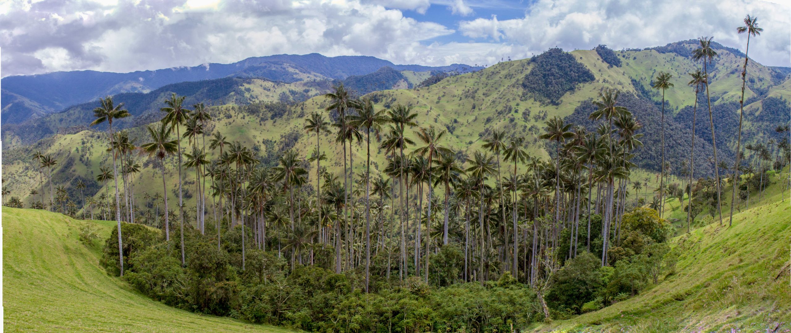
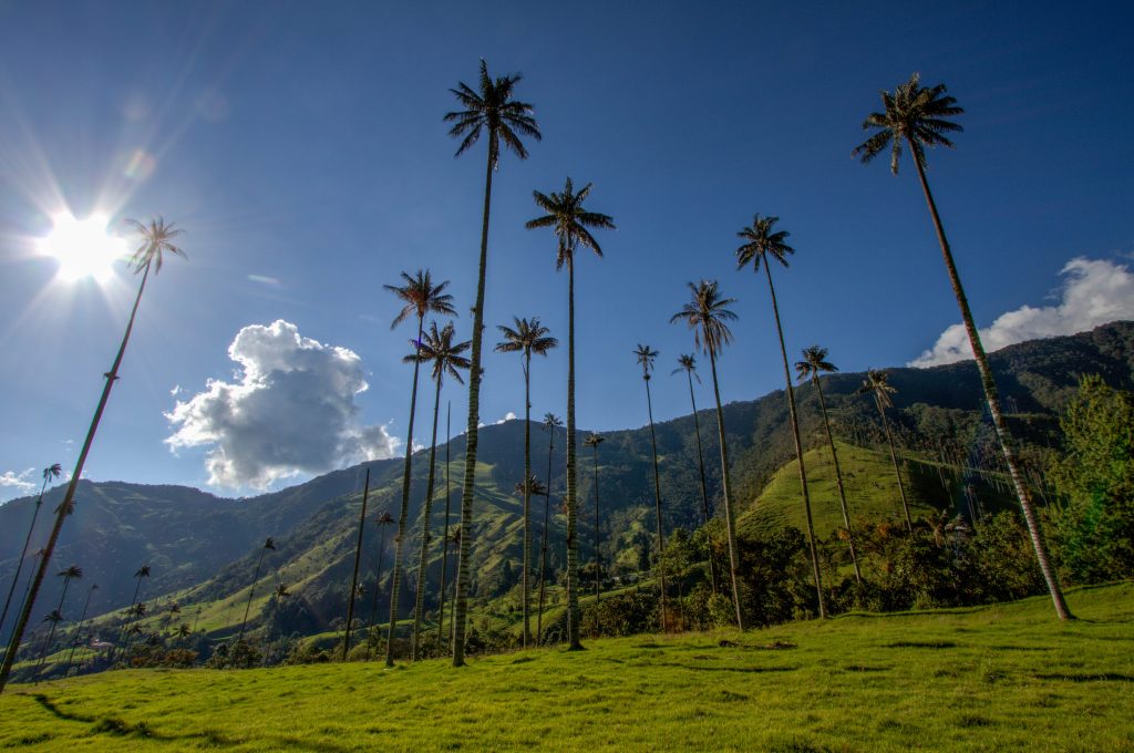
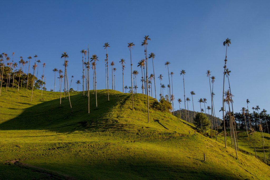
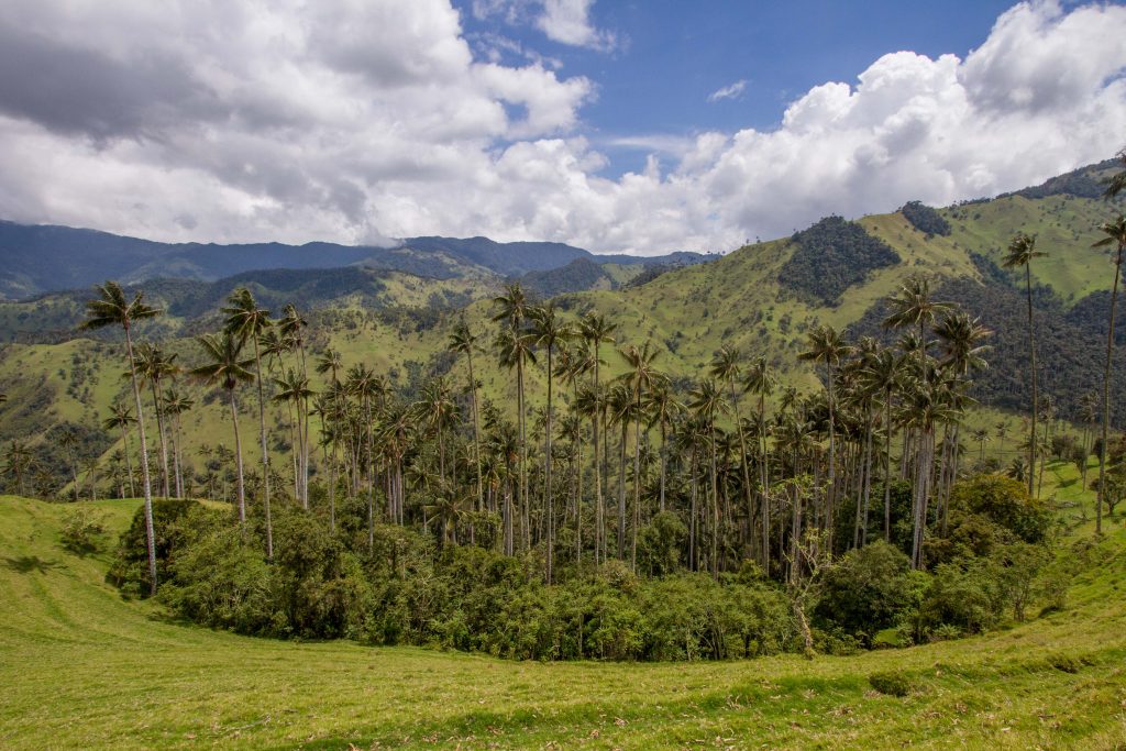
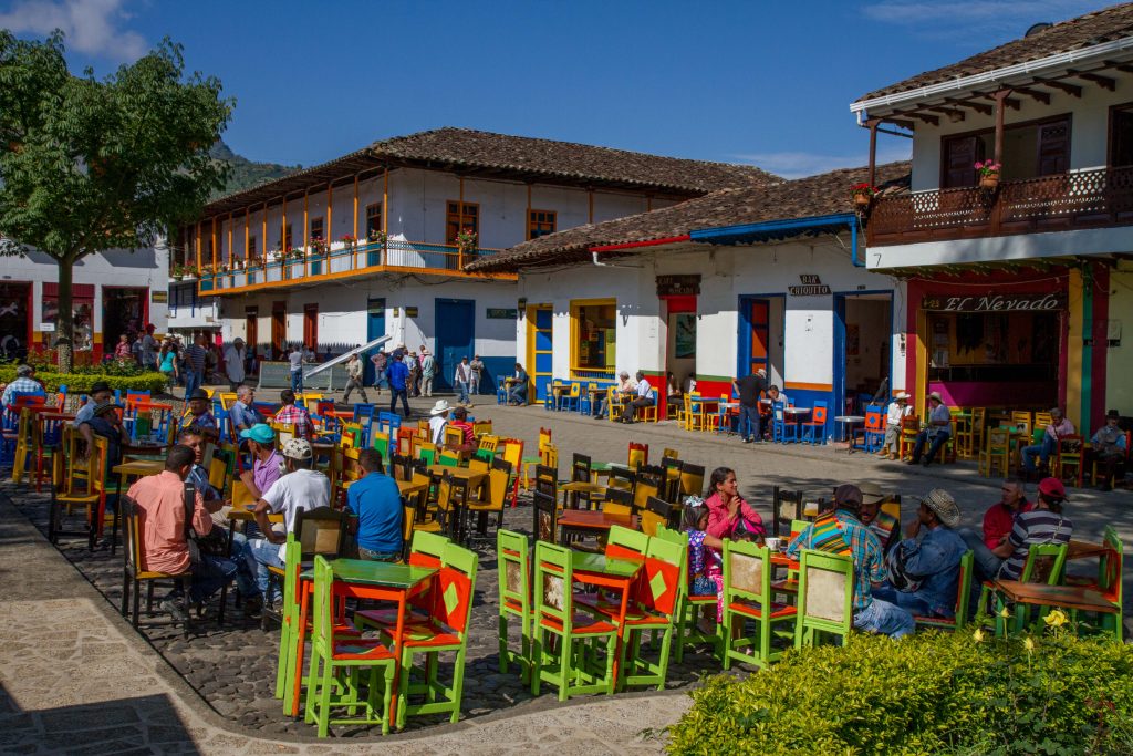
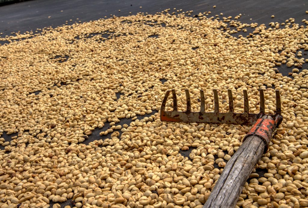
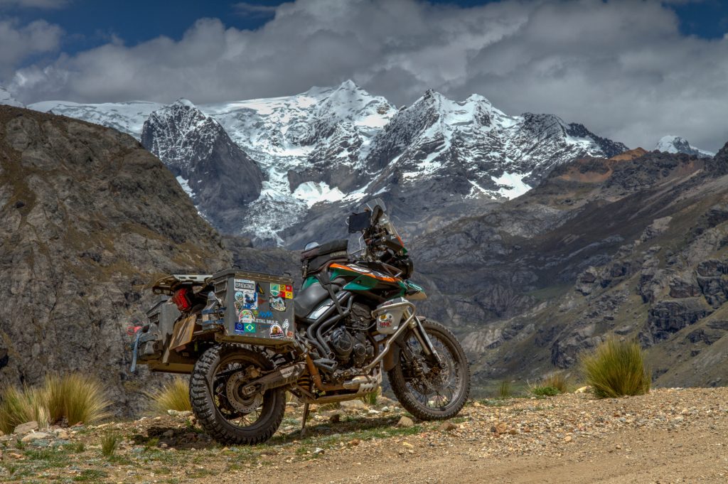
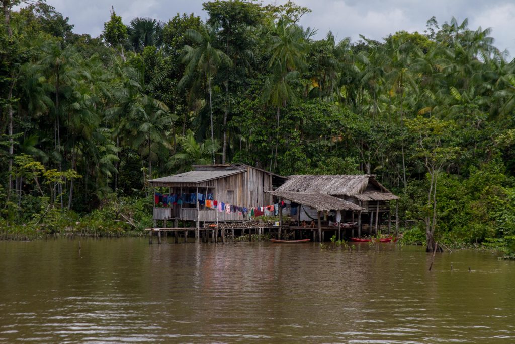
Quindío is a department of Colombia. It is in the western central region of the country, crossed by the Andes mountains. It is famous for the quality of the coffee plantations, colourful architecture and lust green rolling hills. A great area for a Ride.
Set amid gorgeous green mountains 24km northeast of Armenia, this small town survives on coffee production, trout farming and tourists, the last drawn by its quaint streets, typical paisa architecture and its proximity to the spectacular Valle de Cocora. It was founded in 1850, and is one of the oldest towns in Quindío and a great base for visiting Cocora Valley.
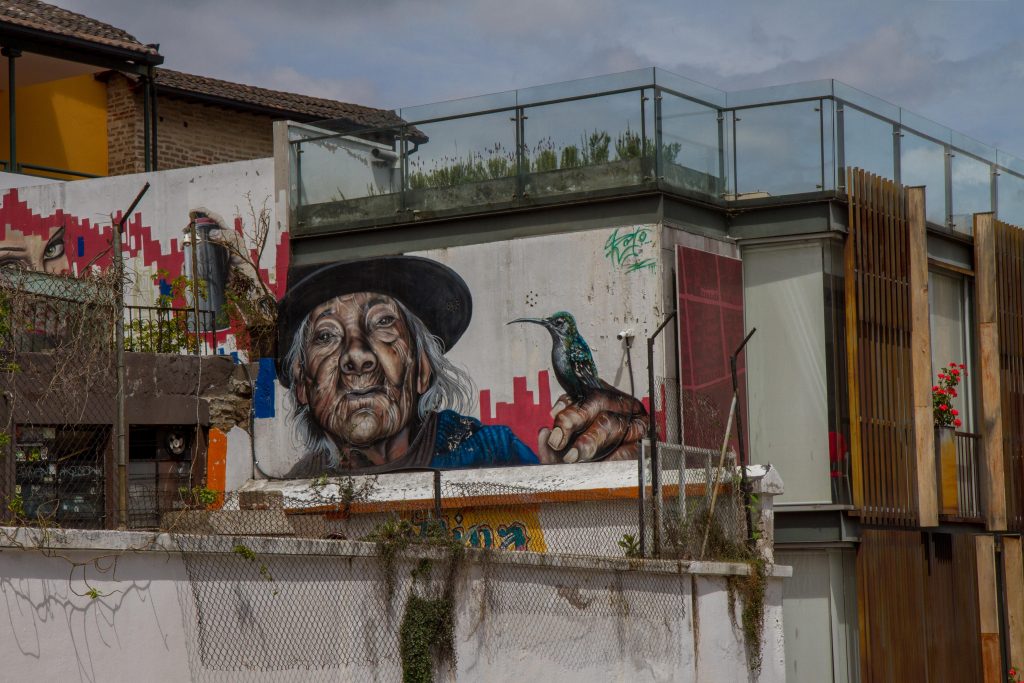
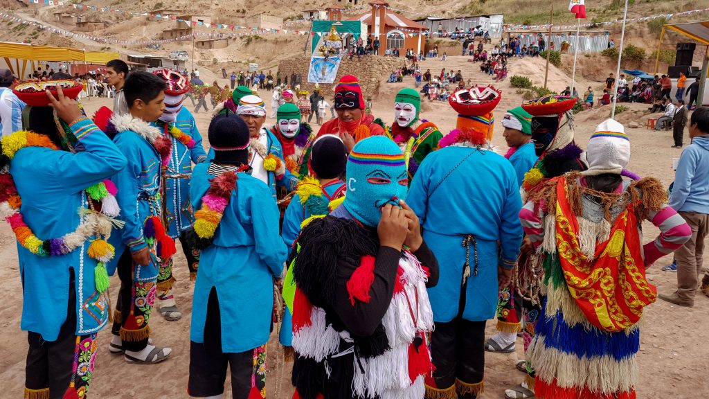
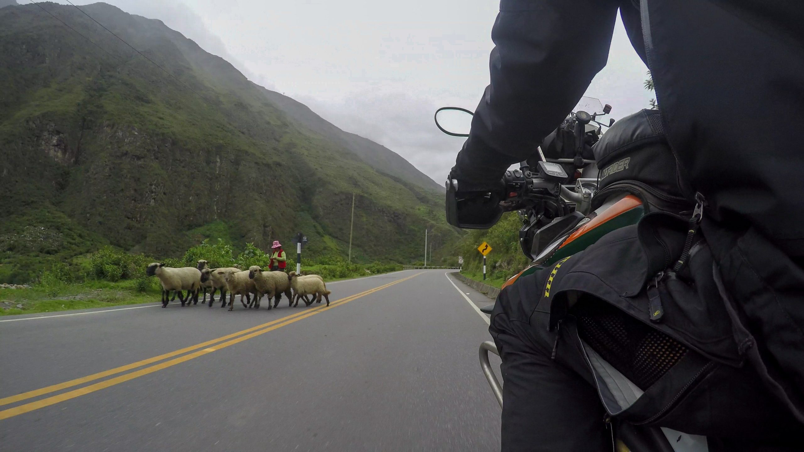
The ‘Willy’ Jeeps you see all around the towns are a great colourfully site… After the wars, the USA exported its huge numbers of excess jeeps to Colombia for military use. Not many were used by the army and they mostly ended up with the people and they made them their own 🙂
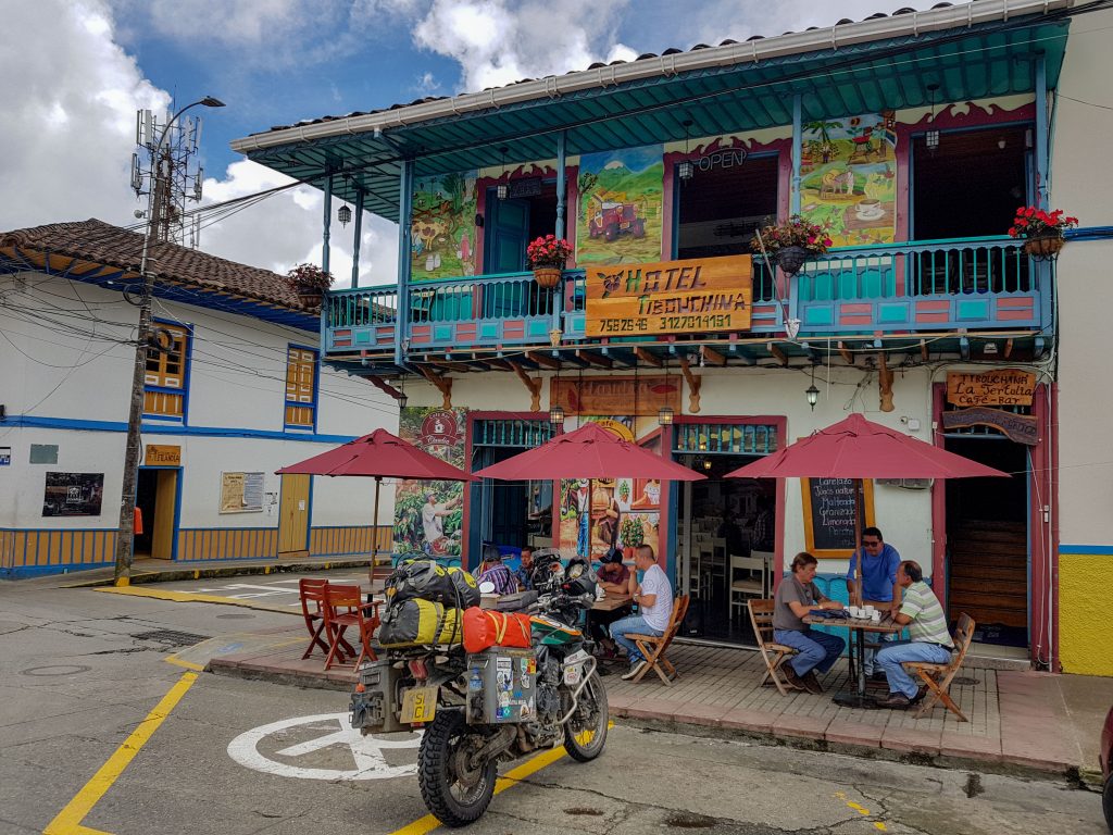
Salento, Colombia
Jardin
Jardín is an Andean town in northwest Colombia, known for its brightly painted houses, colorful floral displays and milk candies. The main plaza, El Libertador Park, features rose gardens, a central fountain and the twin-towered, neo-Gothic Basilica of the Immaculate Conception.
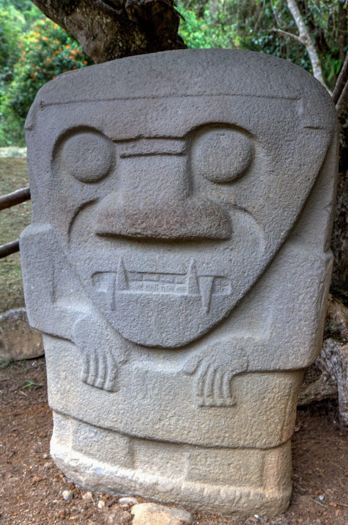
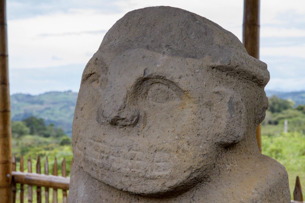
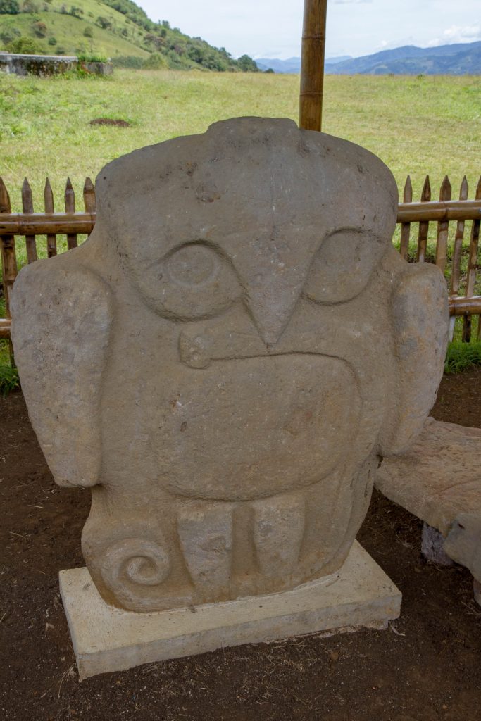
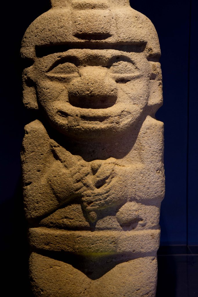
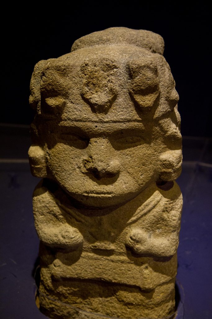
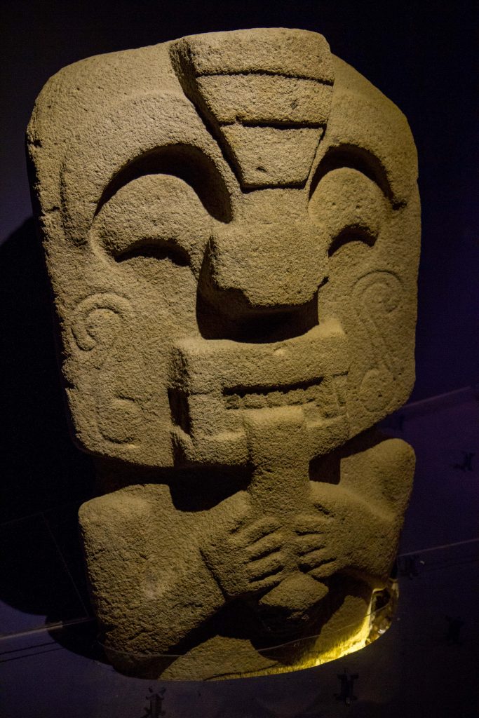
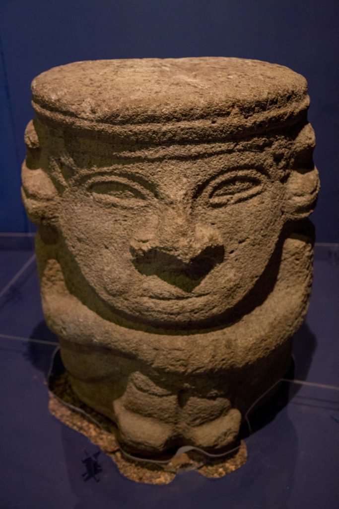
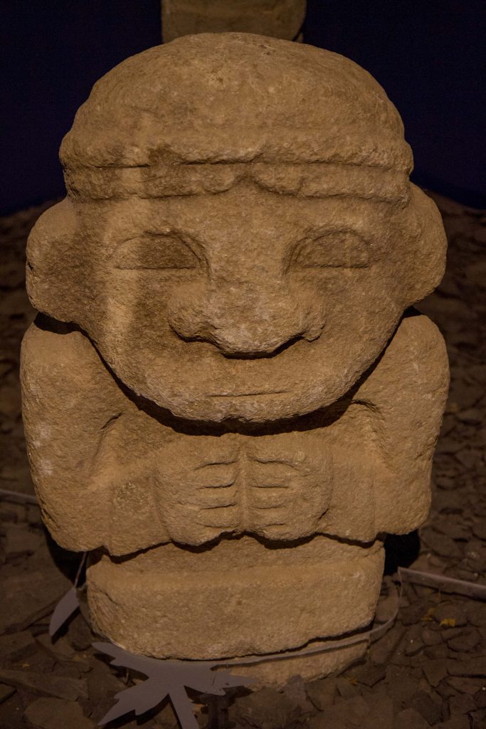
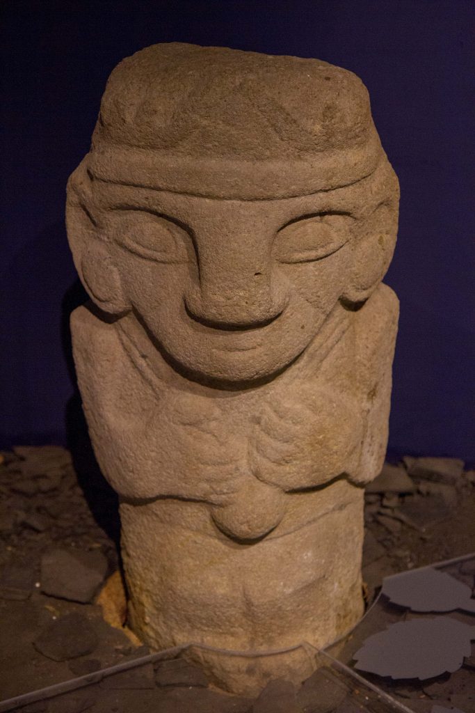
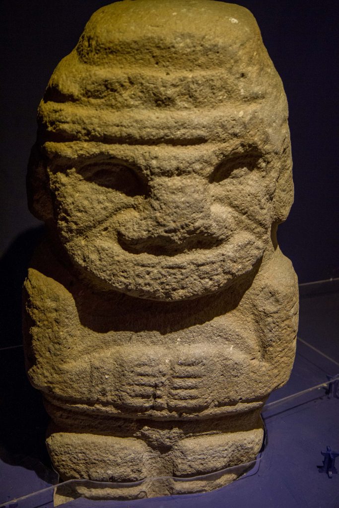
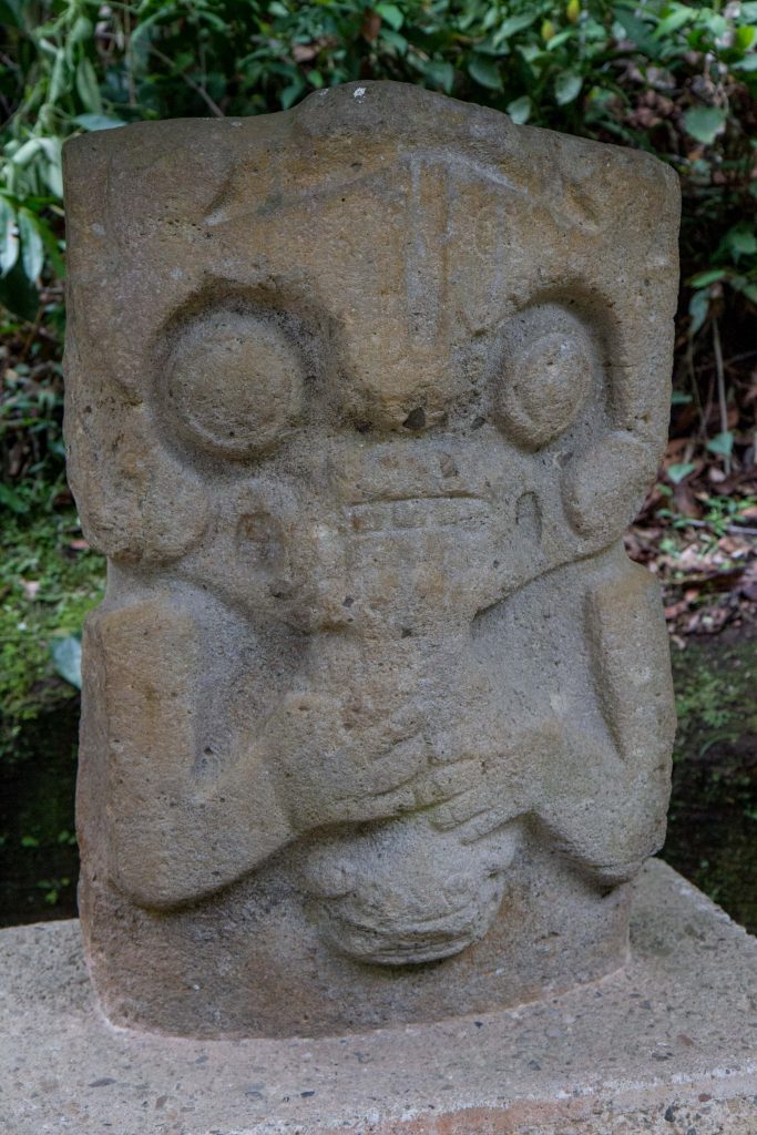
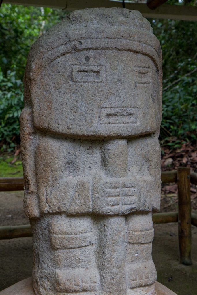
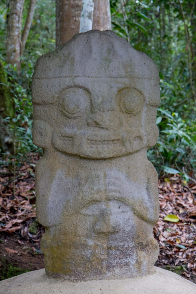
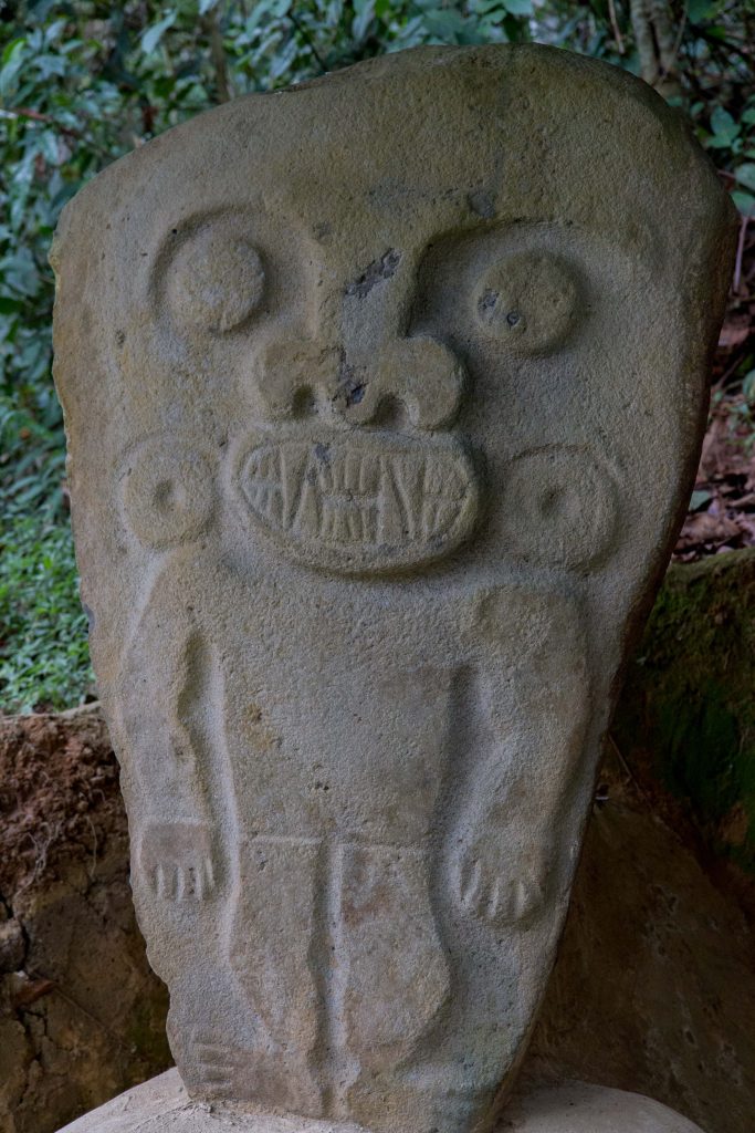
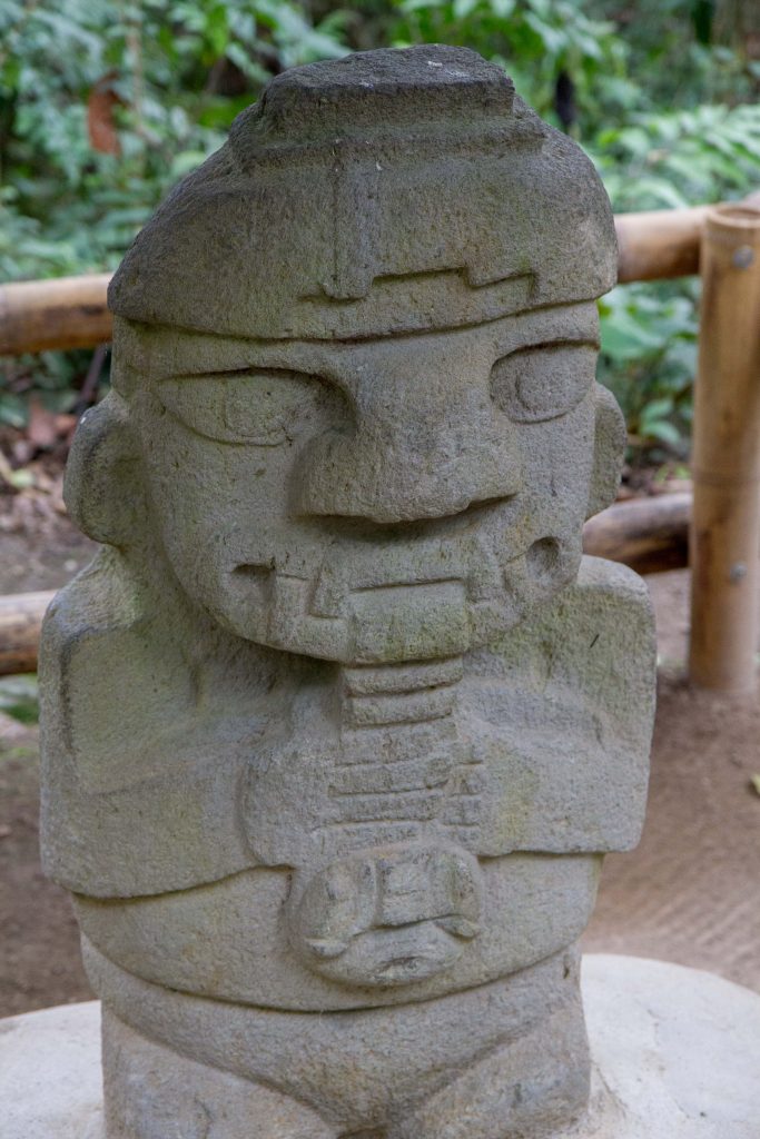
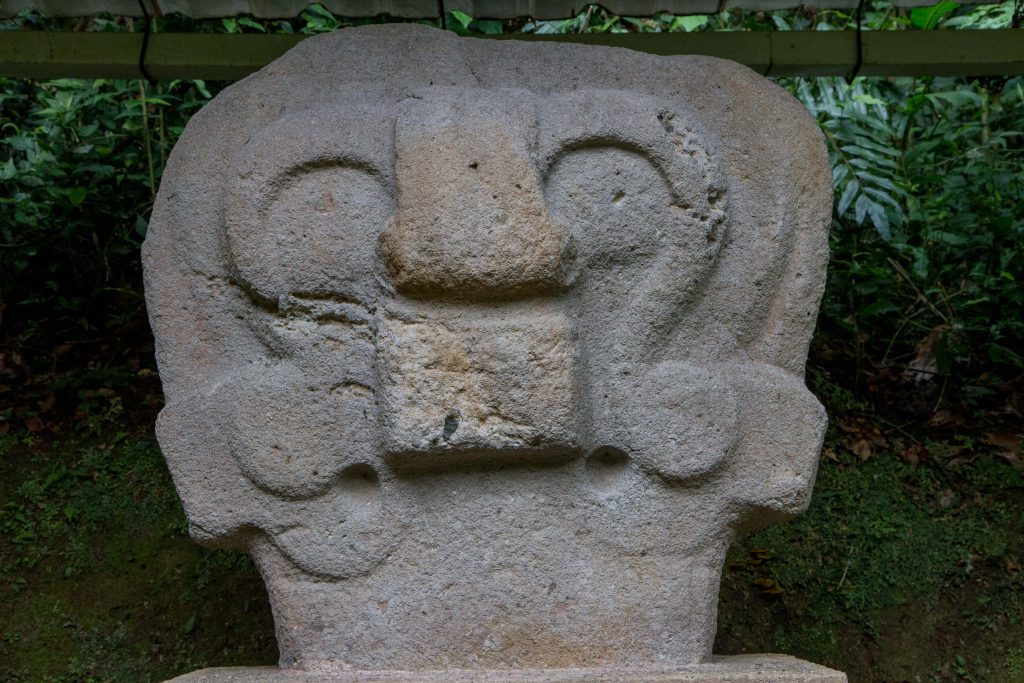
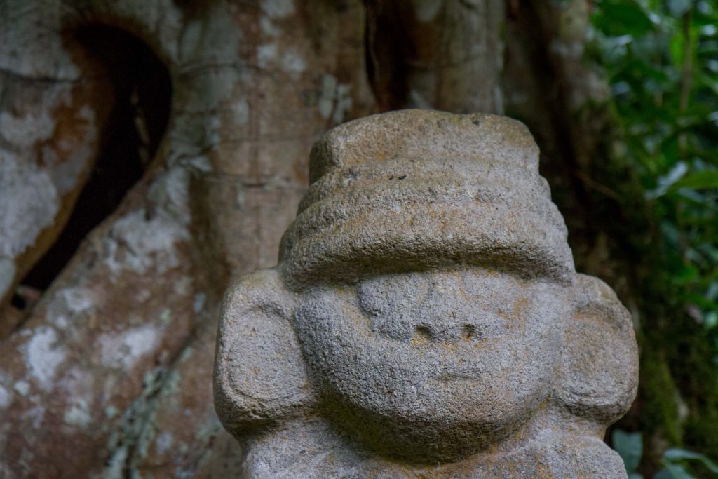
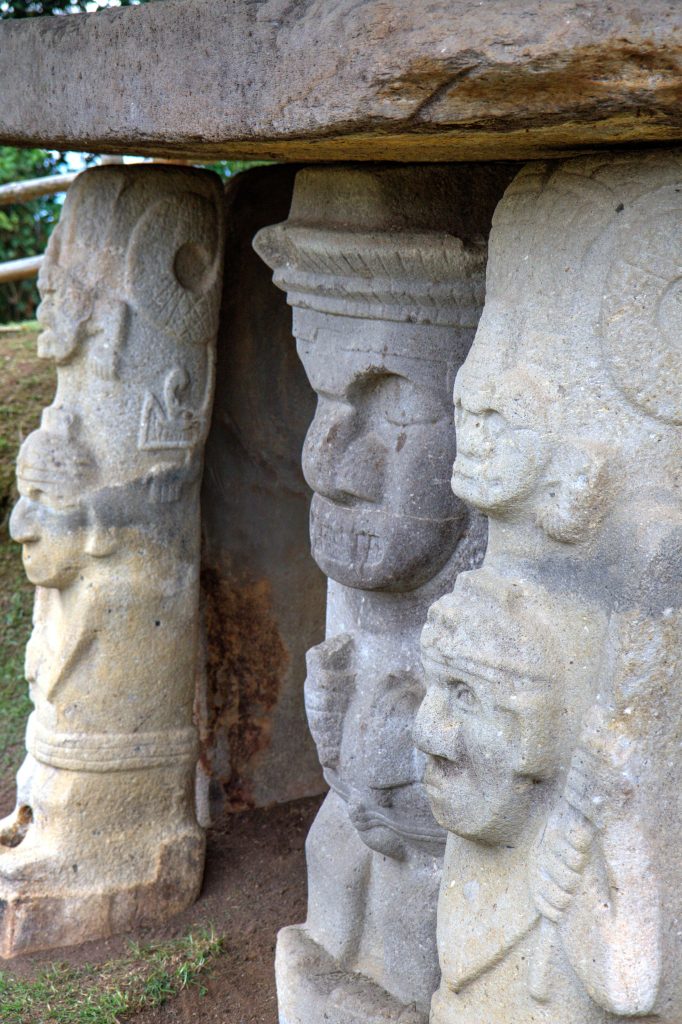
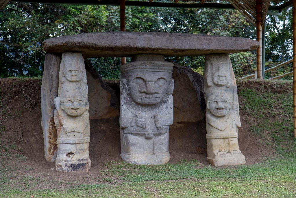
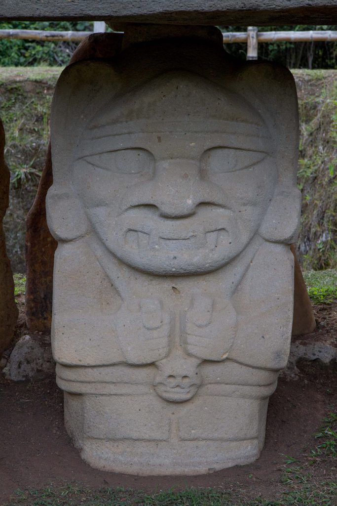
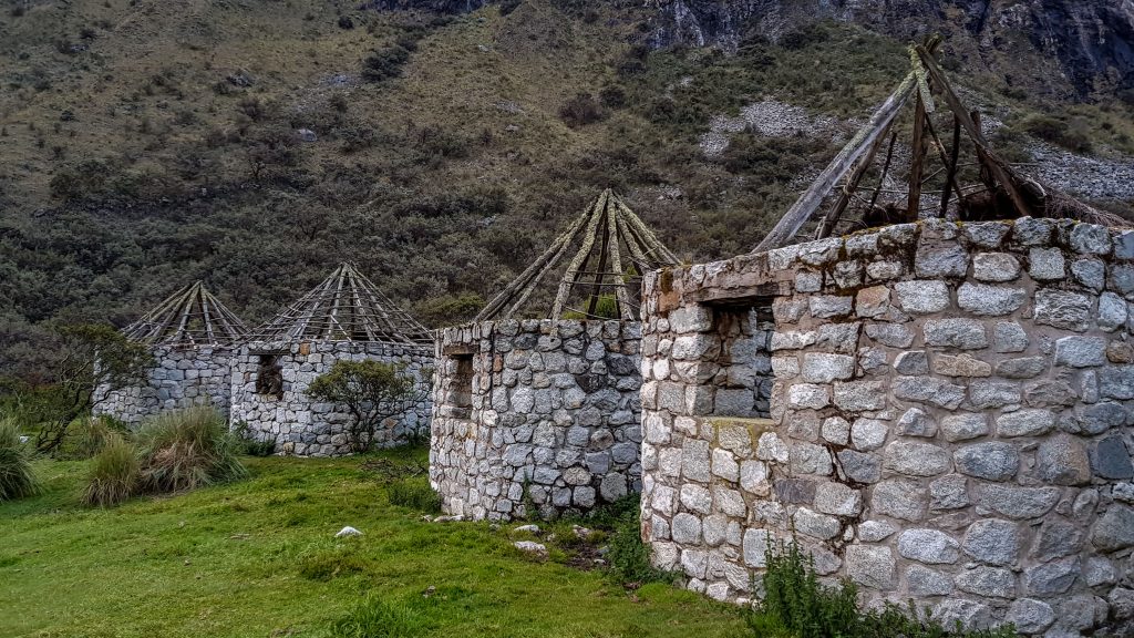
San Agustín is a town in the Andes Mountains of western Colombia. It’s known for its proximity to the San Agustín Archaeological Park, home to numerous pre-Columbian remains spread over several sites. Carved volcanic stone figures and tombs litter the Forest of Statues, amid native trees and flowers. Nearby, the Lavapatas Spring’s rock bed is scored with ceremonial water channels and reptilian shapes.
The San Agustín Archaeological Park is a UNESCO site located in the Colombian southwestern Andes. The park contains the largest collection of religious monuments and megalithic sculptures in Latin America and is considered the world’s largest necropolis.
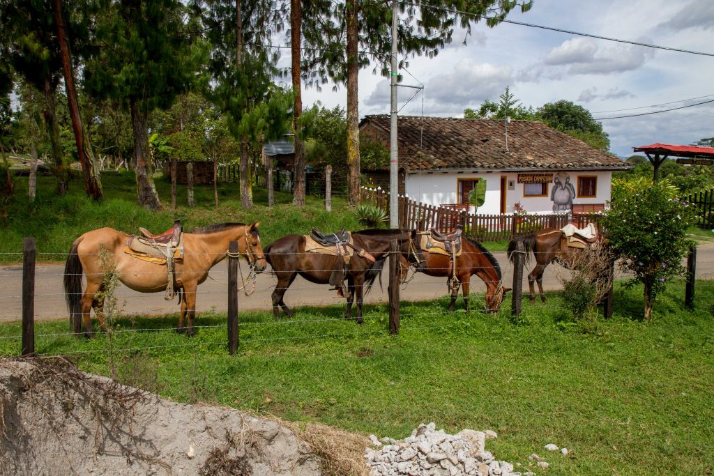
Horse Riding around the Archaeological sites and Coffee Farms
One of the best ways to get around the sites and coffee farms is via horse back. There are many trails available and with the hilly terrain, a horse is perfect for the task. Tours can be arranged that visit coffee plantations as well as the Archaeological sites.
San Agustín, Colombia
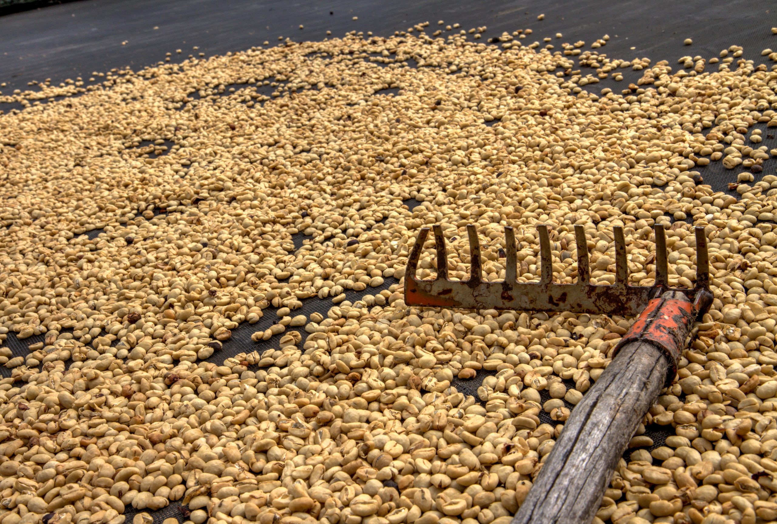
Coffee, Colombia
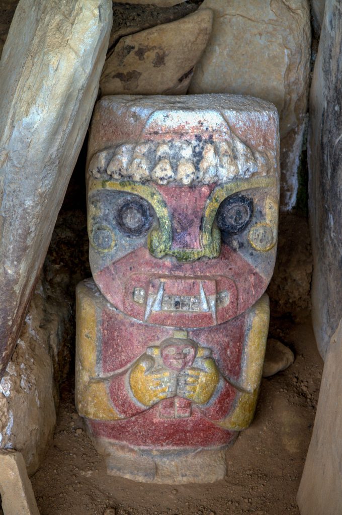
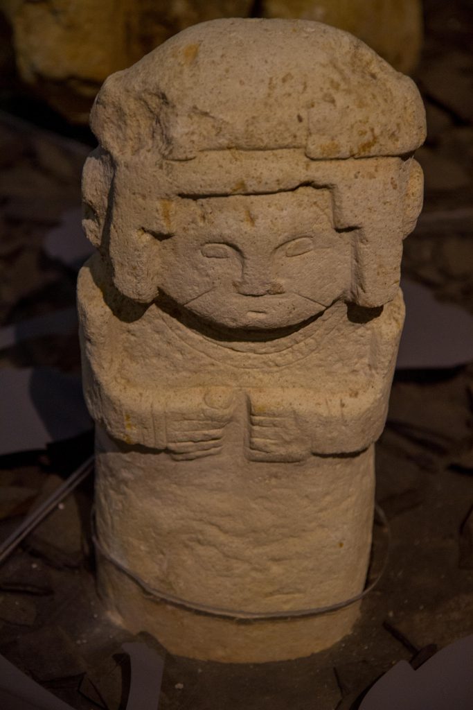
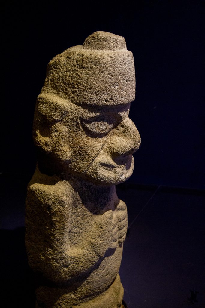
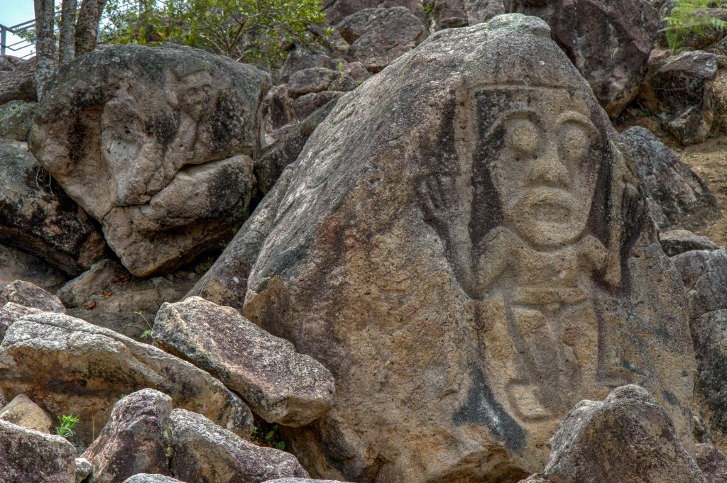
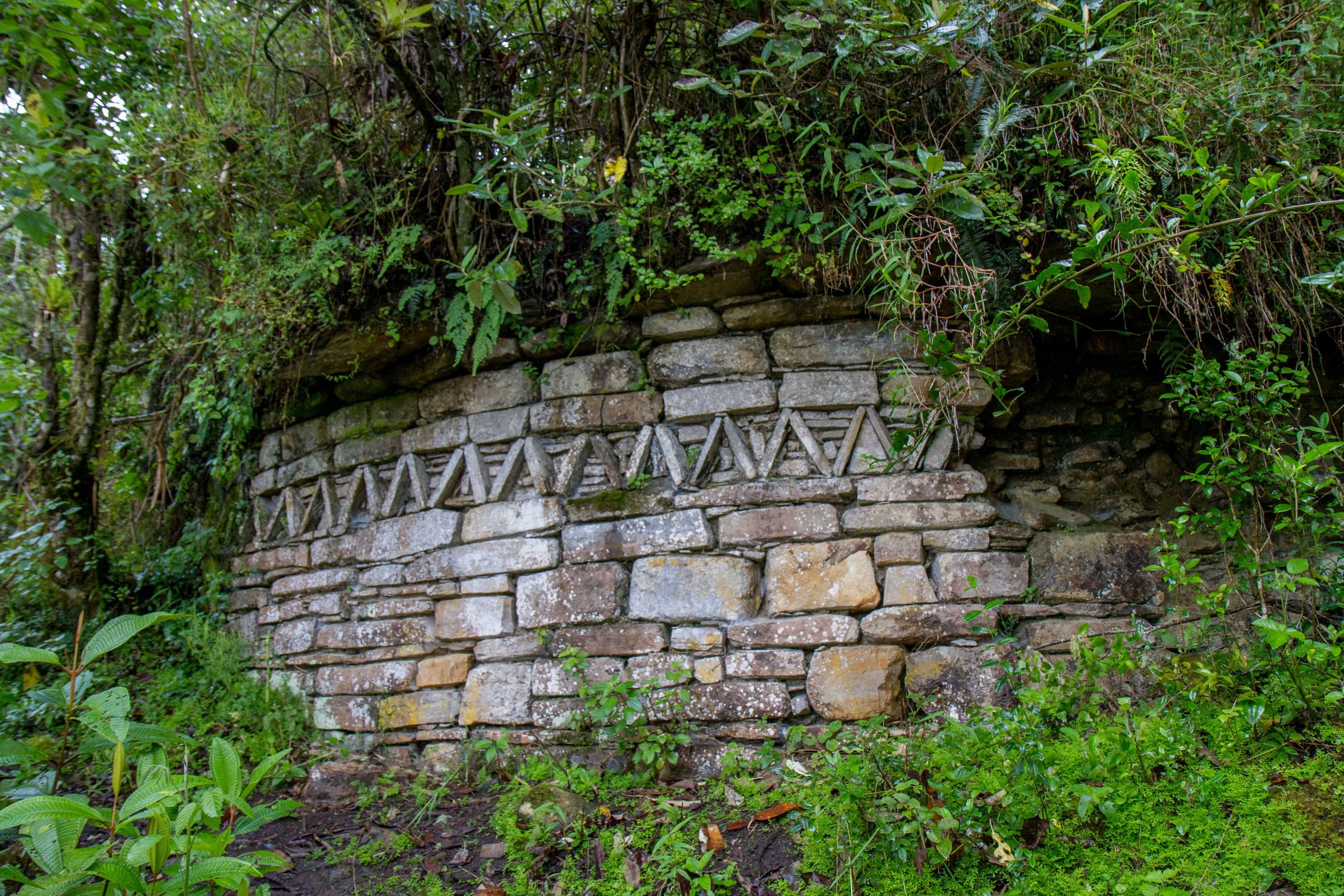
La Chaquira
La Chaquira is located in a valley with historic 1st-10th century carved figures and views of valleys & the river.
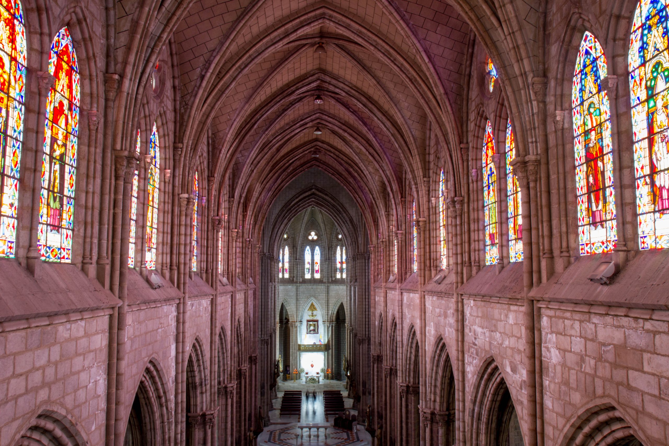
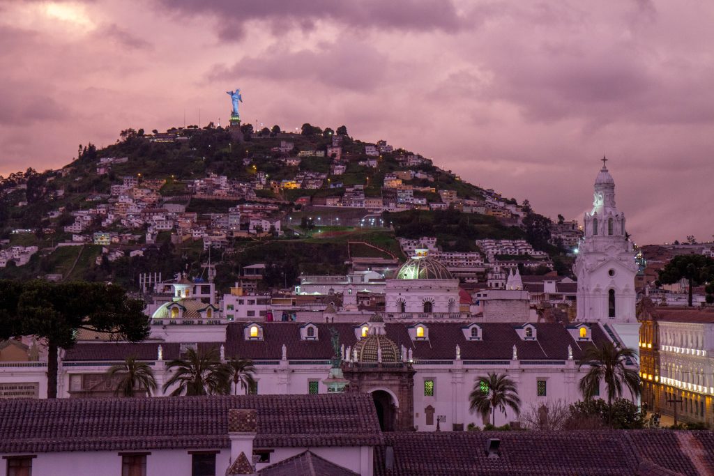
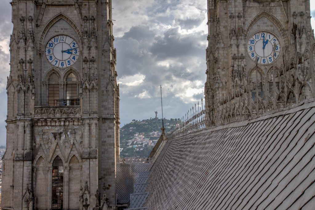
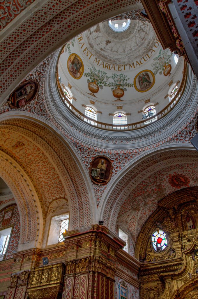
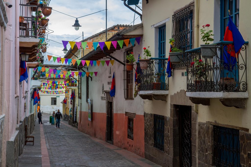
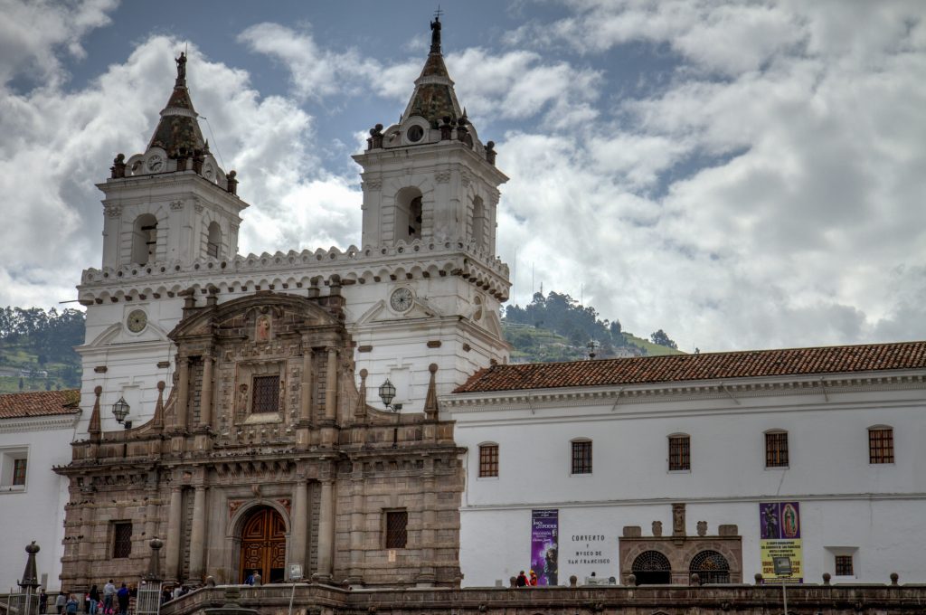
Quito, the capital of Ecuador, was founded in the 16th century on the ruins of an Inca city and stands at an altitude of 2,850 m. Despite the 1917 earthquake, the city has the best-preserved, least altered historic centre in Latin America. The monasteries of San Francisco and Santo Domingo, and the Church and Jesuit College of La Compañía, with their rich interiors, are pure examples of the ‘Baroque school of Quito’, which is a fusion of Spanish, Italian, Moorish, Flemish and indigenous art. (link)
Isolated for centuries in the cloud forests of northern Peru, mellow Chachapoyas appears to be a town on the cusp of wider discovery. For vintage travelers, the ignition of interest will come as no surprise. Straddling the transitional zone between the high Andes and the Amazon Basin, ‘Chacha’ and its surroundings have long felt like a box of hidden treasure waiting to be dug up.
It’s believed that the Incas gave the Chachapoyas culture its name. The word Chachapoyas comes from the Quechua language and means “cloud forest.” Due to their civilization not keeping written records, their culture, beliefs and general lifestyle is still quite a mystery. The Chachapoyas people were known as fierce warriors and incredible architects.
Highlights
The Many Chachapoyas Ruins
With only a few ruins that have been fully excavated, this region is just waiting to be explored.
Chachapoyas, Peru
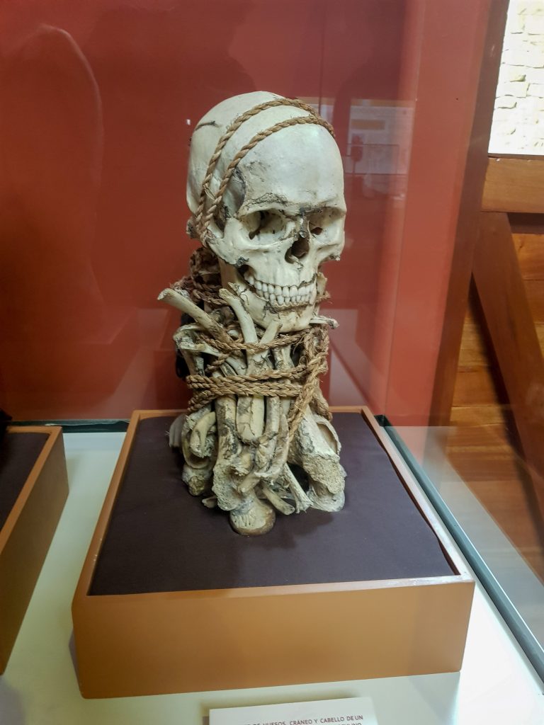
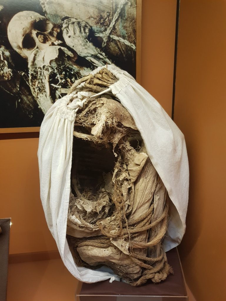
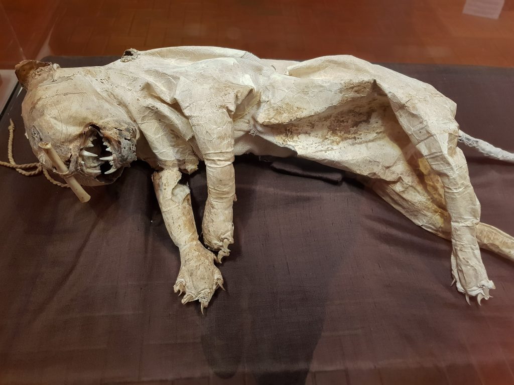
Leymebamba Museum
Opened in the year 2000, the museum covers both the Chachapoya and subsequent Inca cultures.
Among its exhibits are over 200 mummies, and accompanying funerary offerings, recovered in 1997 from the Laguna de los Condores (Condor Lake) site.
The Chachapoya used to bury their dead in a crouched position, inside wooden sarcophagi, then wrap the sarcophagus in cloth and sew a human face on the front.
Despite the humidity of the area, and the activities of huaqueros, hundreds of mummies were discovered, with skin and even hair still intact. (link)
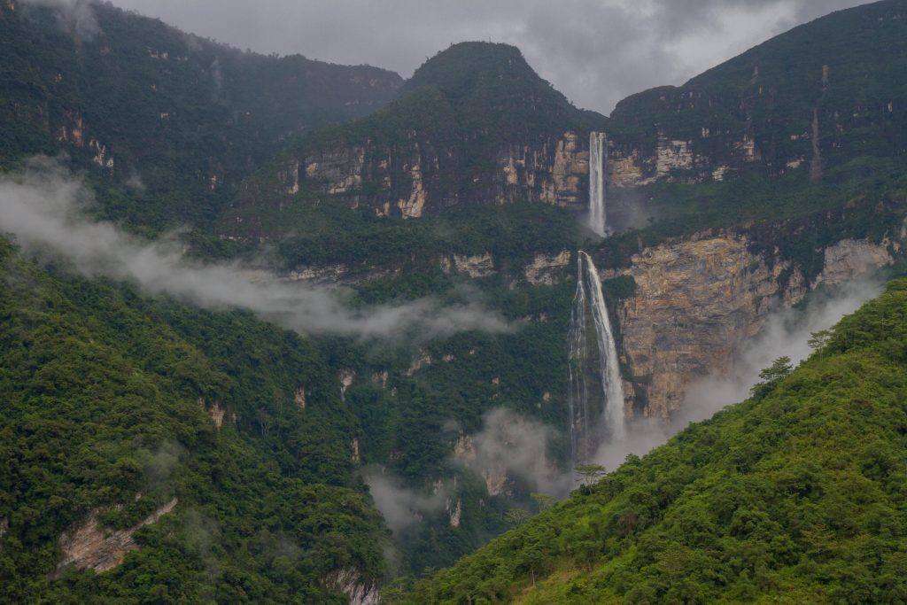
Farmers living in remote hamlets north of Chachapoyas knew that the surrounding cloud forests hid the huge Gocta Waterfall, but local legends prevented villagers from visiting or talking about it, and it did not become known to the outside world until 2005.
Then, a German hydro-engineer named Stefan Ziemendorff saw the Falls, and in 2006, made preliminary measurements – an astounding 771m (2,531ft) in height. The third tallest in the world.
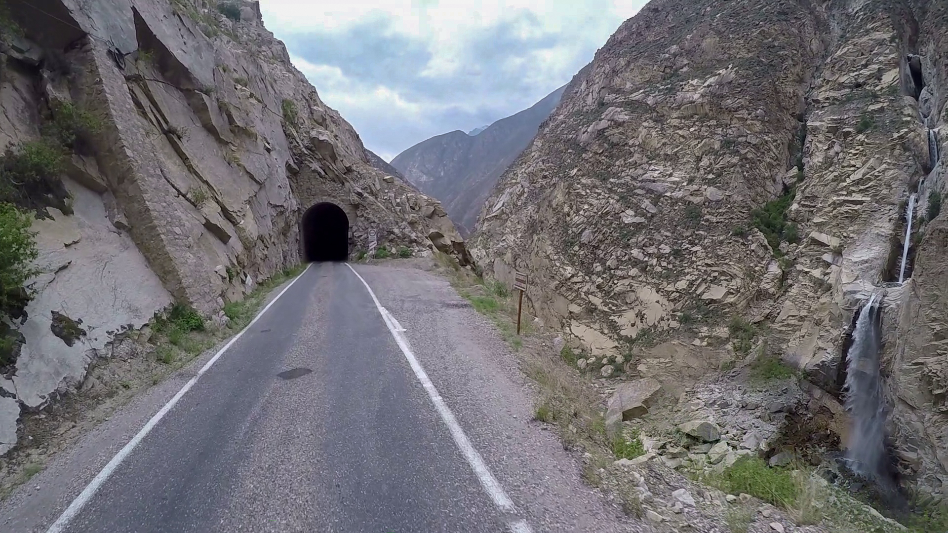
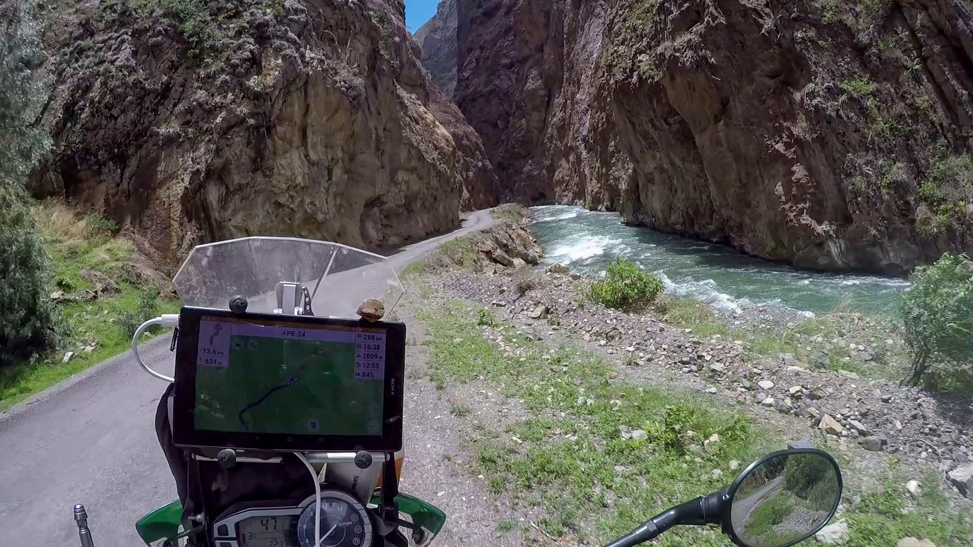
One of the best in Peru but also one of the most dangerous. The narrow high mountain dirt road, totalling a length of 45km, sits between the village of Yuracmarca and the Calipuy National Reservation. The Road is onlyt one lane wide and riders are expected to use the horn to ensure the tunnels are clear before entering. All 50 of them. These tunnels are hand-cut through solid stone.
The road is extreme, with 50 one-lane tunnels. It crosses the infamous Cañón del Pato PE-3N (Duck Canyon), on the Rio Santa (Santa River) at the north end of the Callejón de Huaylas (Corridor of Huaylas) in north-central Peru. This road is very exciting and sometimes very exposed and unsecured driveway in innumerable twists and turns. The total route involves over 50 tunnels, most of which are one lane and rough cut through the mountainside. The road rises from 500m to over 2000m. (link)
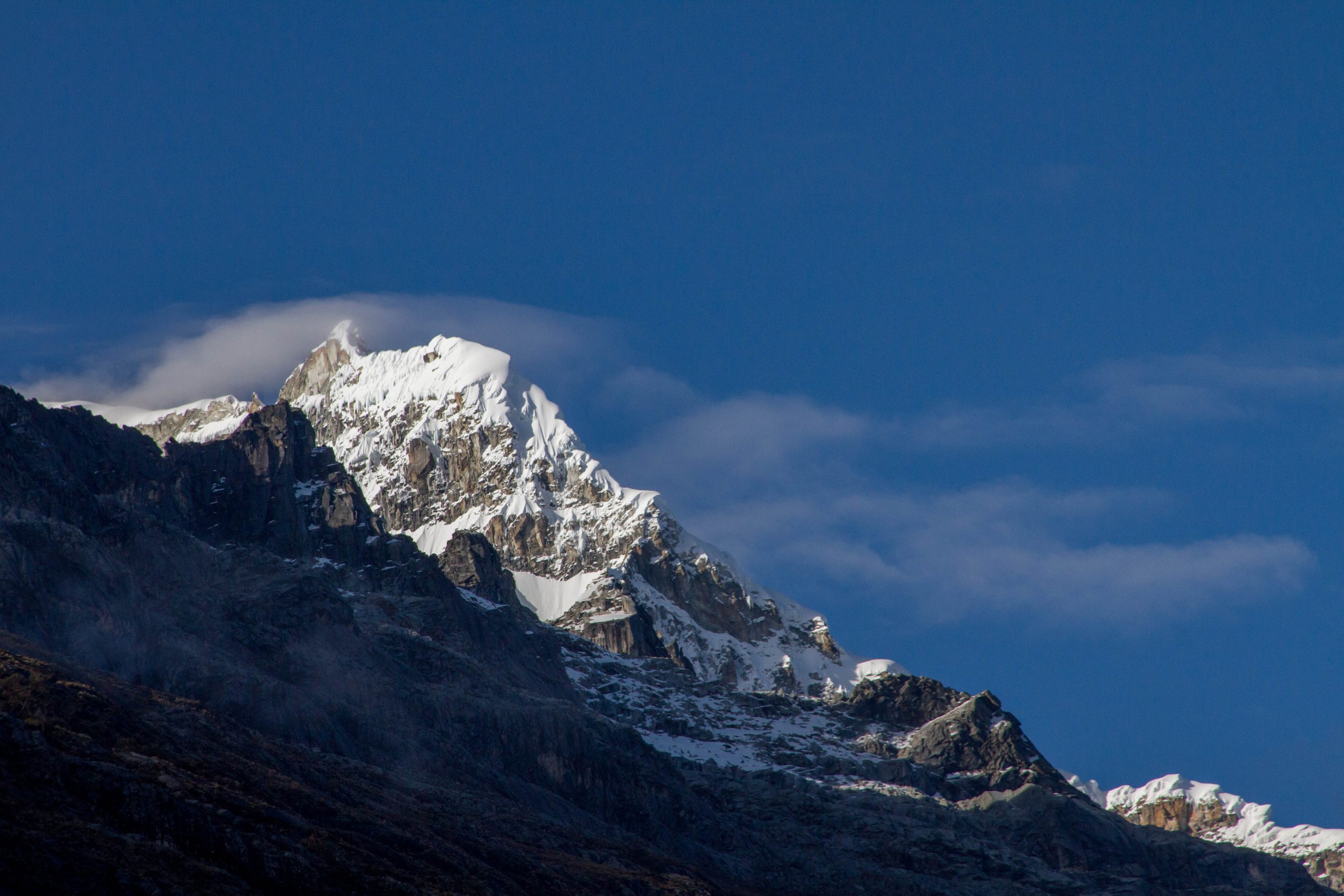
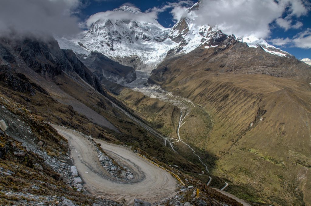
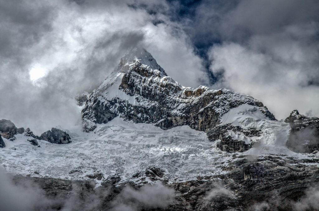
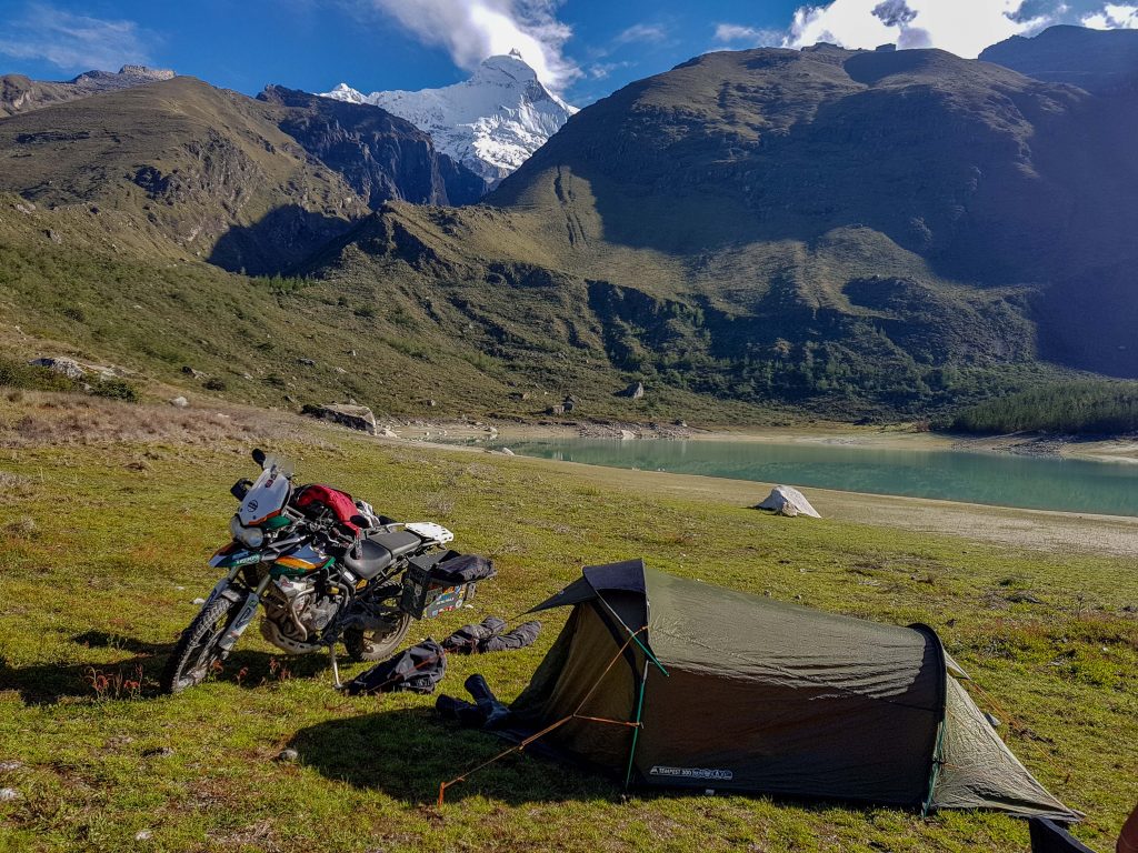
Huascarán National Park is situated in the Cordillera Blanca, the world’s highest tropical mountain range. Named after Mount Huascarán which rises to 6,768 m above sea-level, these lands boast deep ravines watered by numerous torrents, glacial lakes and a variety of vegetation. Making it a site of spectacular beauty.
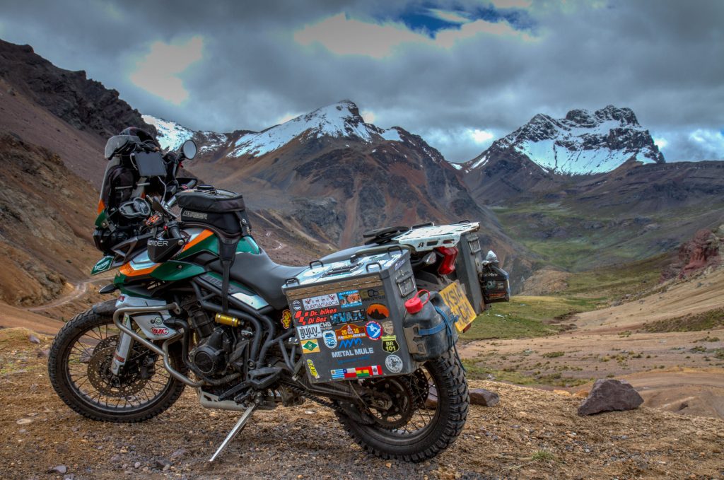
I started the ride from Yungay. The road will be a straight climb until you get to the two blue lakes (near tyhe hike to Laguna 69). The the hairpins being. From there you can loop all the way back around to Yungay.
The Ride through Huascarán National Park
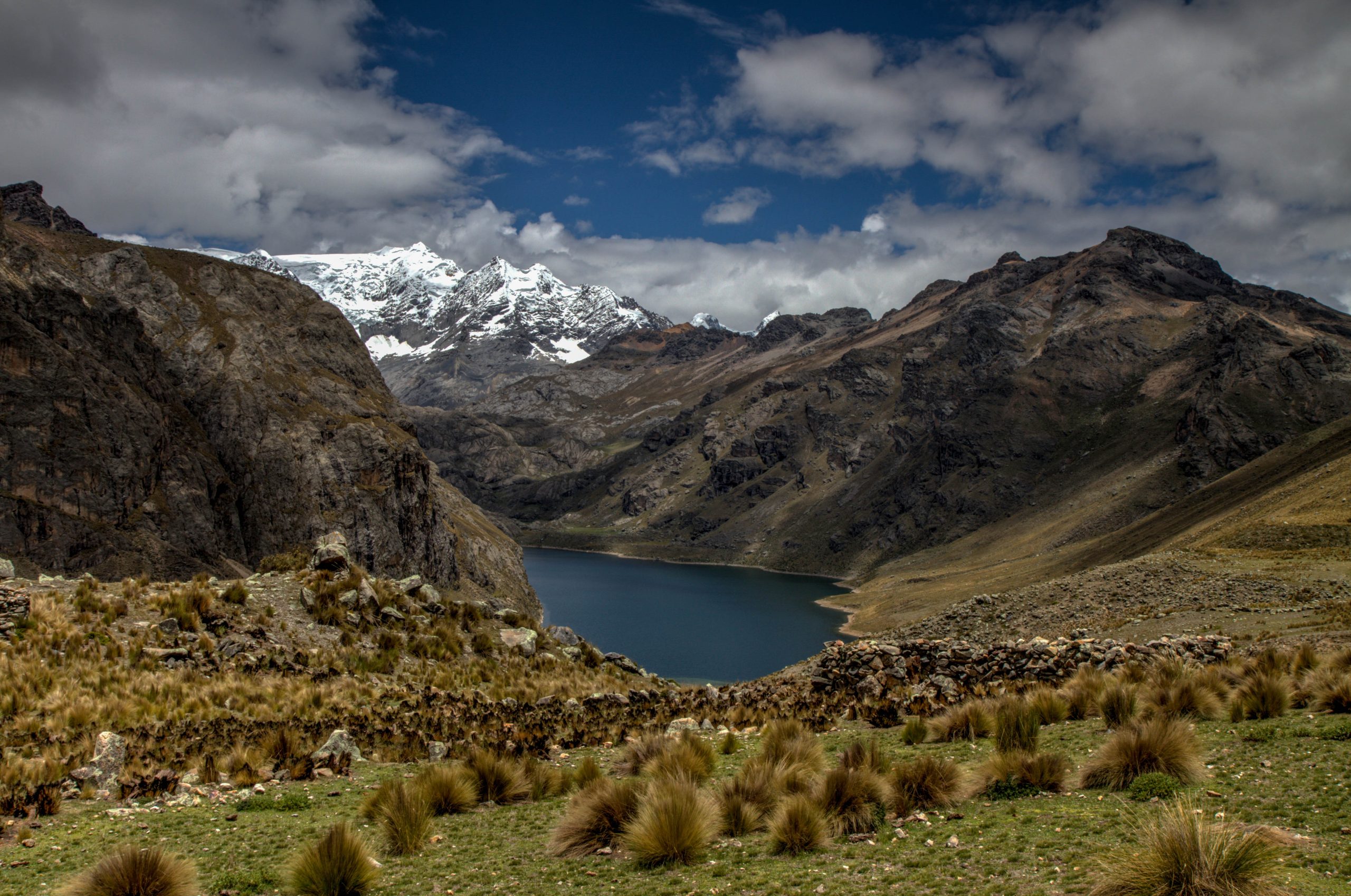
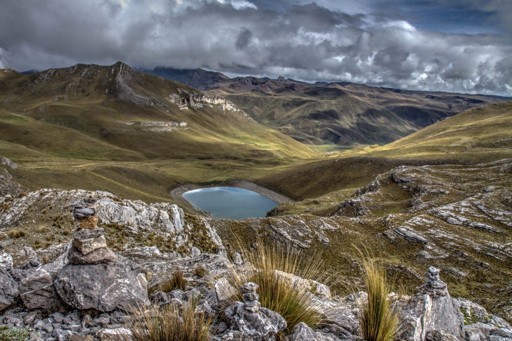
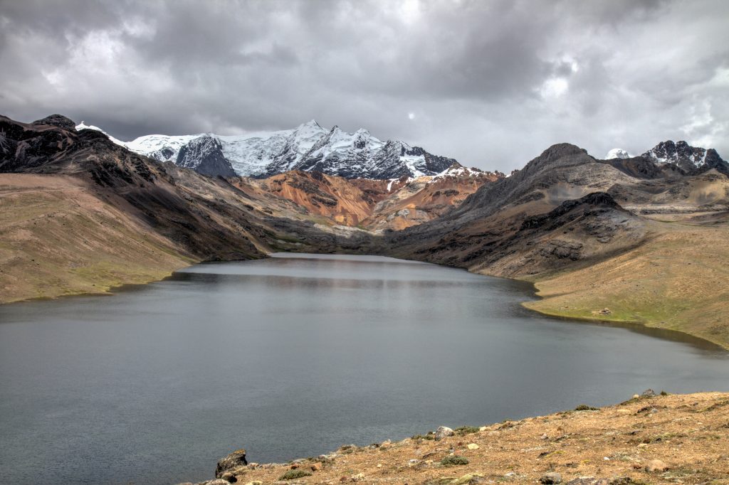
Huascarán National Park
Situated in the aptly named Cordillera Blanca (“White Mountains”), Huascaran National Park protects the heart of the World’s highest tropical mountain range in the central Peruvian Andes. The area of 340,000 hectares covers a diverse mountain landscape from around 2,500m and culminating in 27 snow-capped peaks above 6,000m. It includes the spectacular Nevado Huascaran (Mount Huascaran), Peru’s highest peak at 6,768m, (named after the 16th Century Inca leader Huascar). The snow-covered peaks, the numerous tropical glaciers and glacial lakes, the high plateaus intersected by deep ravines with torrential creeks and the variety of vegetation types form a spectacular landscape of rare beauty.
Huascarán National Park, Peru
Huandoy, Peru
Huascarán National Park, Peru
Huascarán National Park, Peru
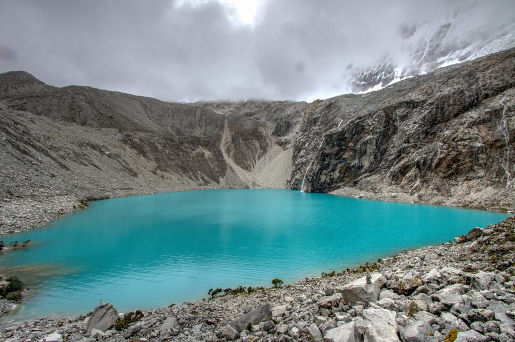
Laguna 69
Lake 69 is a small lake near of the city of Huaraz, in the region of Áncash, Peru. It is one of the more than 400 lakes that form part of the Huascarán National Park, a UNESCO Biosphere Reserve and World Heritage Site.
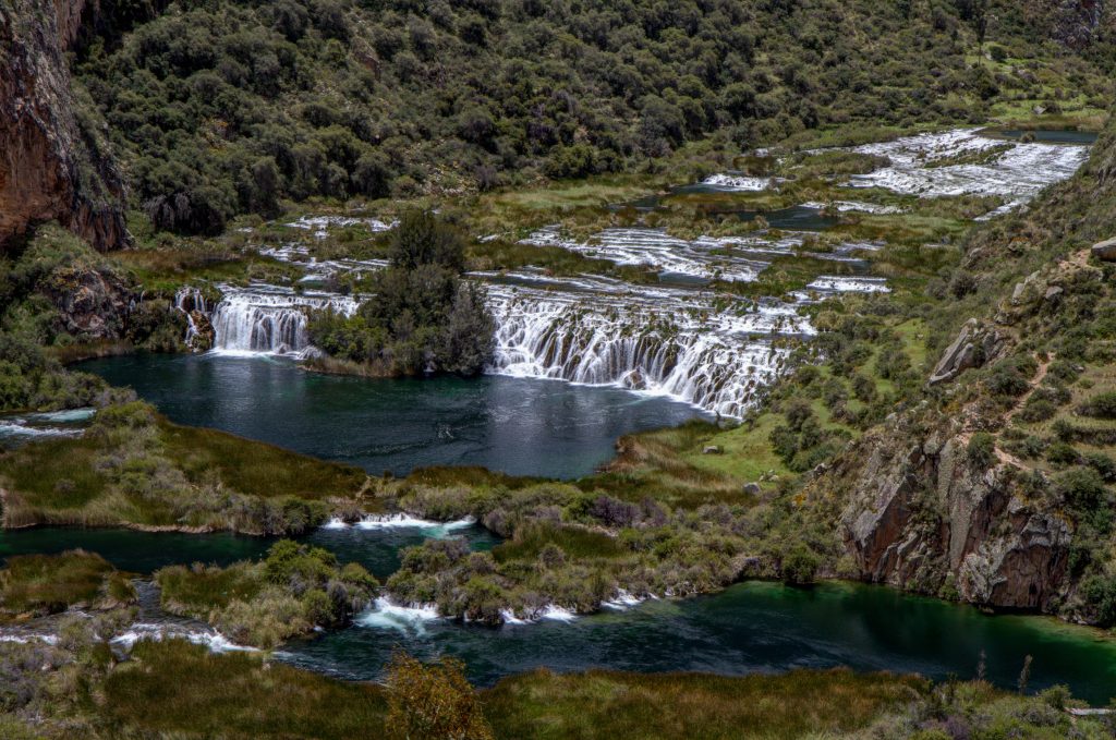
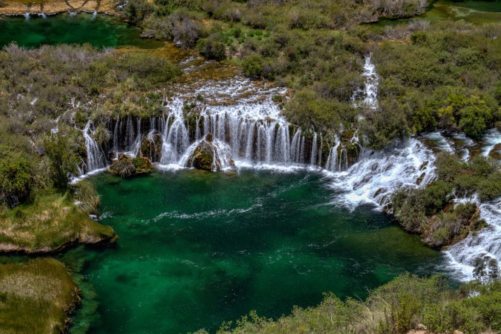
Carr. Canete Yauyos | Huancaya District to San Vicente de Cañete
The ride, when heading to the coast, races the river from the Andes down to the low land coast of Peru. It is a great way to return to Lima from the amazing Reserve Paisajistica Nor Yauyos-Cochas.
Reserve Paisajistica Nor Yauyos-Cochas is an untouched landscape. Even though it is located within the Lima region, it is actually located around 3,000 meters above sea level. The destination itself is characterized by the stunning views that you’ll encounter while exploring the surroundings. Amid lush forest and sweeping pampas, you’ll find lots of small lakes full of diverse birds species and herds of camelids. This is a natural conservation area, and once you get here you will understand why.
Riding through the reserve is a slight challenge with all the road dirt and gravel. But take your time cause you’ll most likely have the place to yourself.
The Ride through Reserva Paisajistica Nor Yauyos-Cochas
Reserva Paisajistica Nor Yauyos-Cochas, Peru
Reserva Paisajistica Nor Yauyos-Cochas, Peru
Reserva Paisajistica Nor Yauyos-Cochas, Peru
Reserva Paisajistica Nor Yauyos-Cochas, Peru
Waterfalls Carhuayno
Between Huancaya and Vilca, the Cañete River forms a multitude of lakes and waterfalls through the forest. The Nor Yauyos-Cochas reserve, ranging from 2,500m to 5,700m in altitude, was created to preserve these magnificent landscapes and its small villages. Its most famous attraction is the Carhuayno Falls.
The Cañete River in this area forms beautiful emerald lagoons where trouts abound. Also ducks, coots and other Andean birds can be seen horses, llamas, cows and livestock. The whole area is dominated by the beauty of the Cañete River which capture the attention of the visitor.
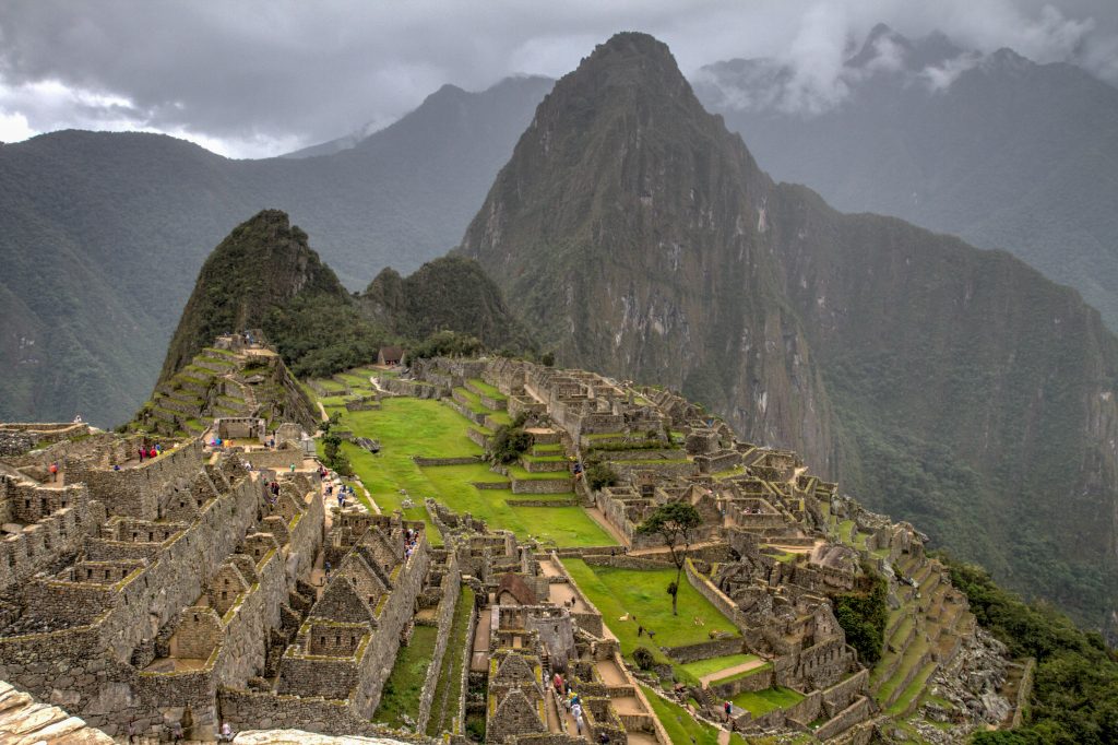
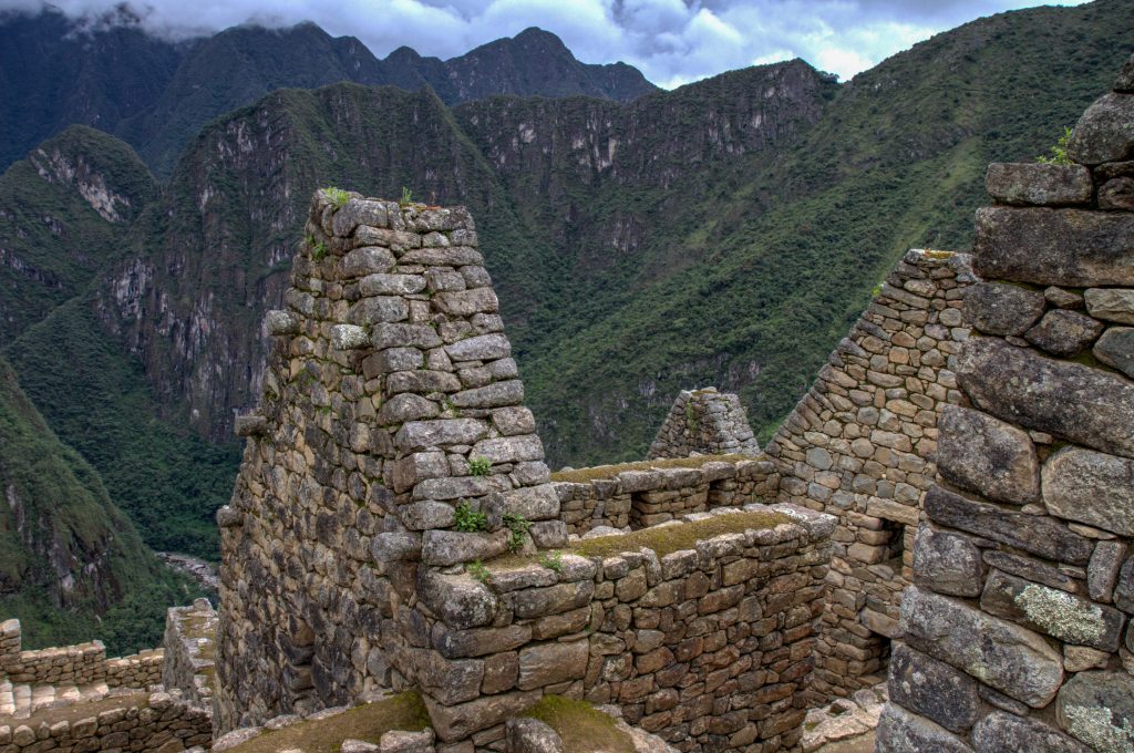
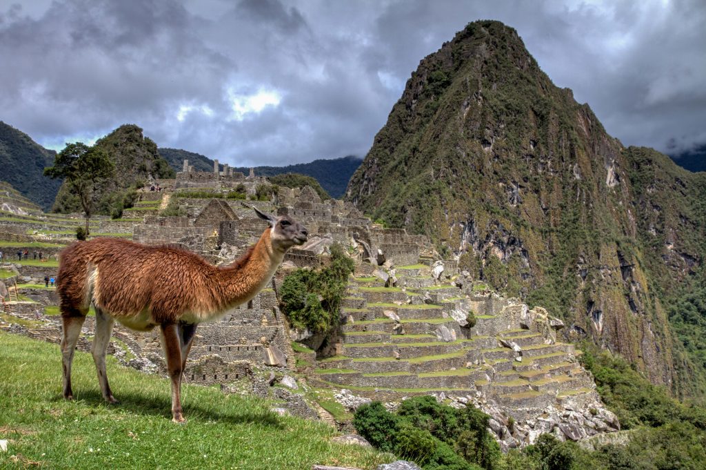
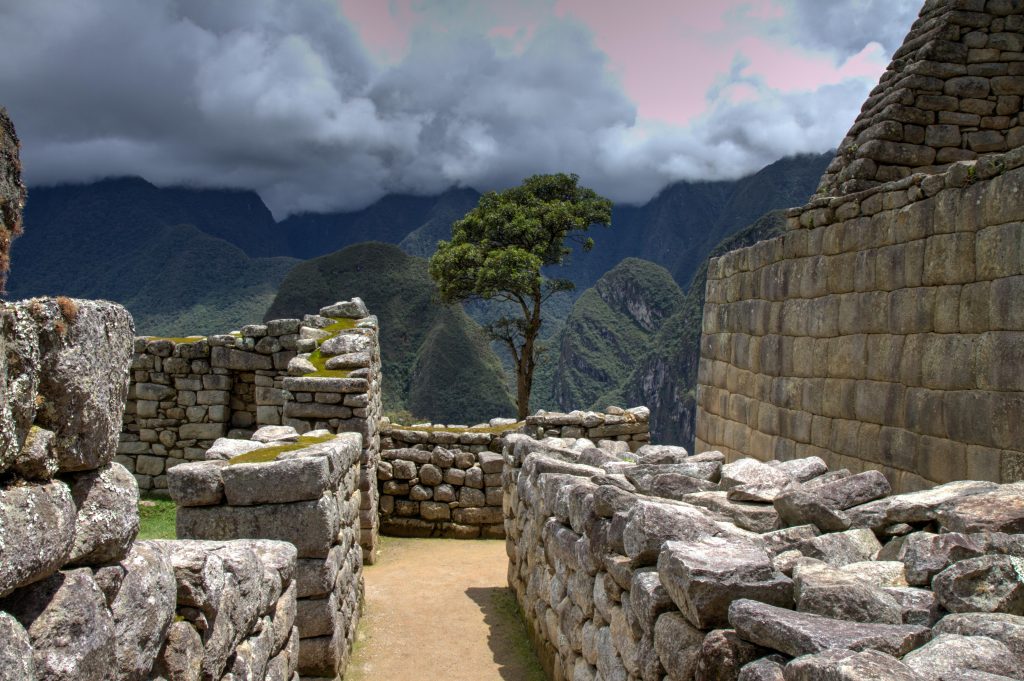
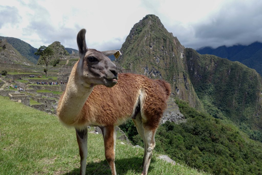
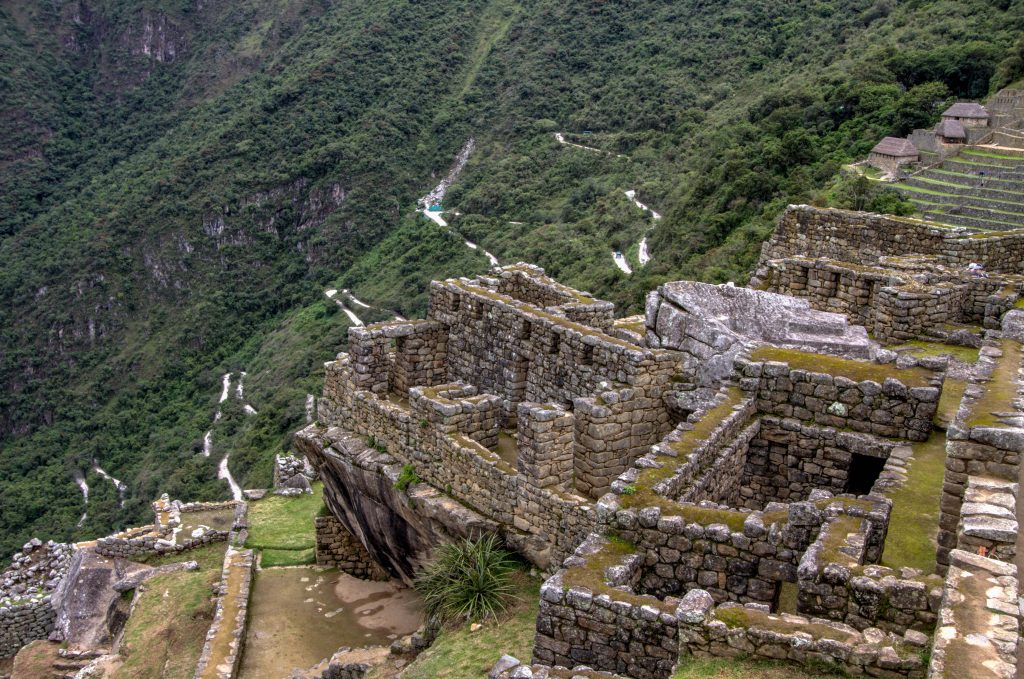
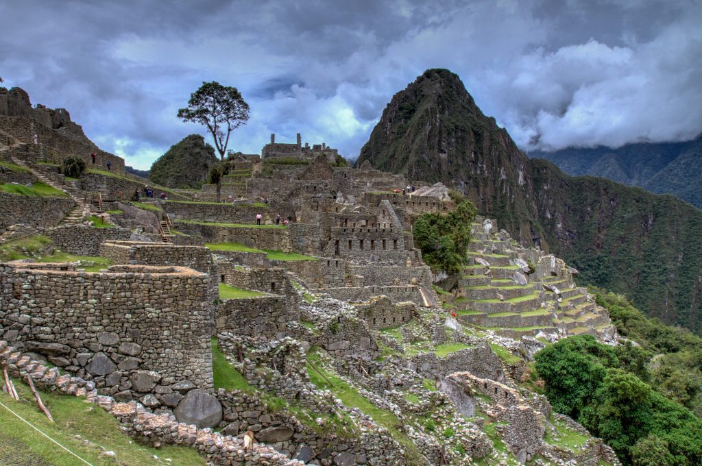
Shrouded by mist and surrounded by lush vegetation and steep escarpments, the sprawling Inca citadel of Machu Picchu lives up to every expectation. In a spectacular location, it’s the most famous archaeological site on the continent, a must for all visitors to Peru. Like the Mona Lisa or the pyramids, it has been seared into our collective consciousness, though nothing can diminish the thrill of being here. This awe-inspiring ancient city was never revealed to the conquering Spaniards and was virtually forgotten until the early part of the 20th century.
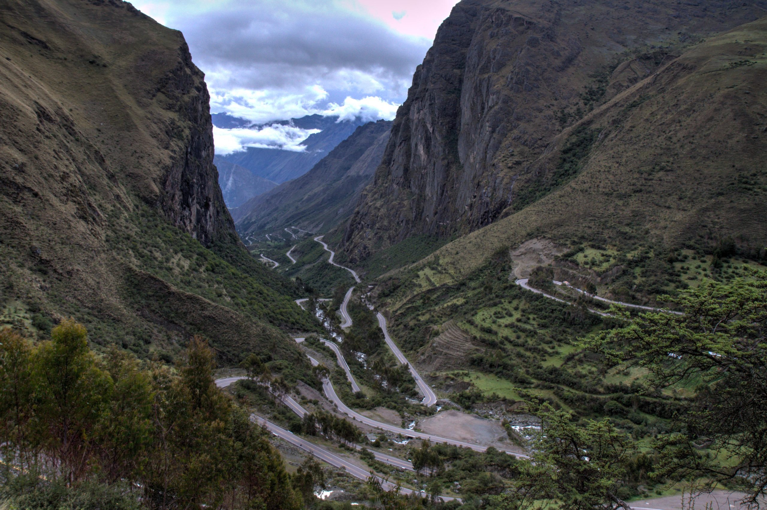
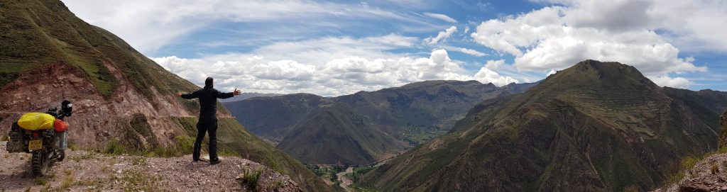
On the ride from Cusco you’ll experience the Sacred Valley, endless mountains passes (some at 4500m) and some great examples of Inca cities from days gone by.
Dominated by two massive Inca ruins, the quaint village of Ollantaytambo, is the best surviving example of Inca city planning, with narrow cobblestone streets that have been continuously inhabited since the 13th century. Because it is half way between Cusco and Machu Picchu, you’ll see alot of buses stopping for a quick break. But with the amazing ruins around, Ollantaytambo is worth at least a night. It’s perfect for wandering the mazy, narrow byways, past stone buildings and babbling irrigation channels, pretending you’ve stepped back in time.
Ollantaytambo, Peru
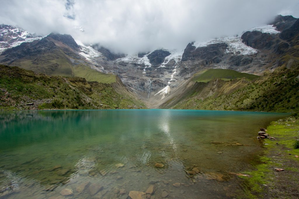
Humantay Lake
After a moderate hike to a 4200m, the gorgeous colours of the lake finally presents itself. With all Inca man-made ruins in the area, it’s great to see some natural sites that are much more tranquil.
Shrouded by mist and surrounded by lush vegetation and steep escarpments, the sprawling Inca citadel of Machu Picchu lives up to every expectation. In a spectacular location, it’s the most famous archaeological site on the continent, a must for all visitors to Peru. Like the Mona Lisa or the pyramids, it has been seared into our collective consciousness, though nothing can diminish the thrill of being here. This awe-inspiring ancient city was never revealed to the conquering Spaniards and was virtually forgotten until the early part of the 20th century.
Machu Picchu, Peru
Machu Picchu, Peru
Machu Picchu, Peru
Machu Picchu, Peru
Best (and cheapest) way to visit Machu Picchu on a Moto
Santa Teresa is one of the closest towns to Machu Picchu. From here you can find a cheaper Hospedaje than other more tourist towns nearby
This Epic Ride takes place on newly created (2011) transcontinental highway that links Peru and Brazil. The section I travelled was from Rio Branco in Brazil to Cusco in Peru. The road provides a fast route from the low lands of the Amazon to the high mountains of the Peruvian Andes. But it is not without controversy. The road is link to many environmental and corruption concerns.
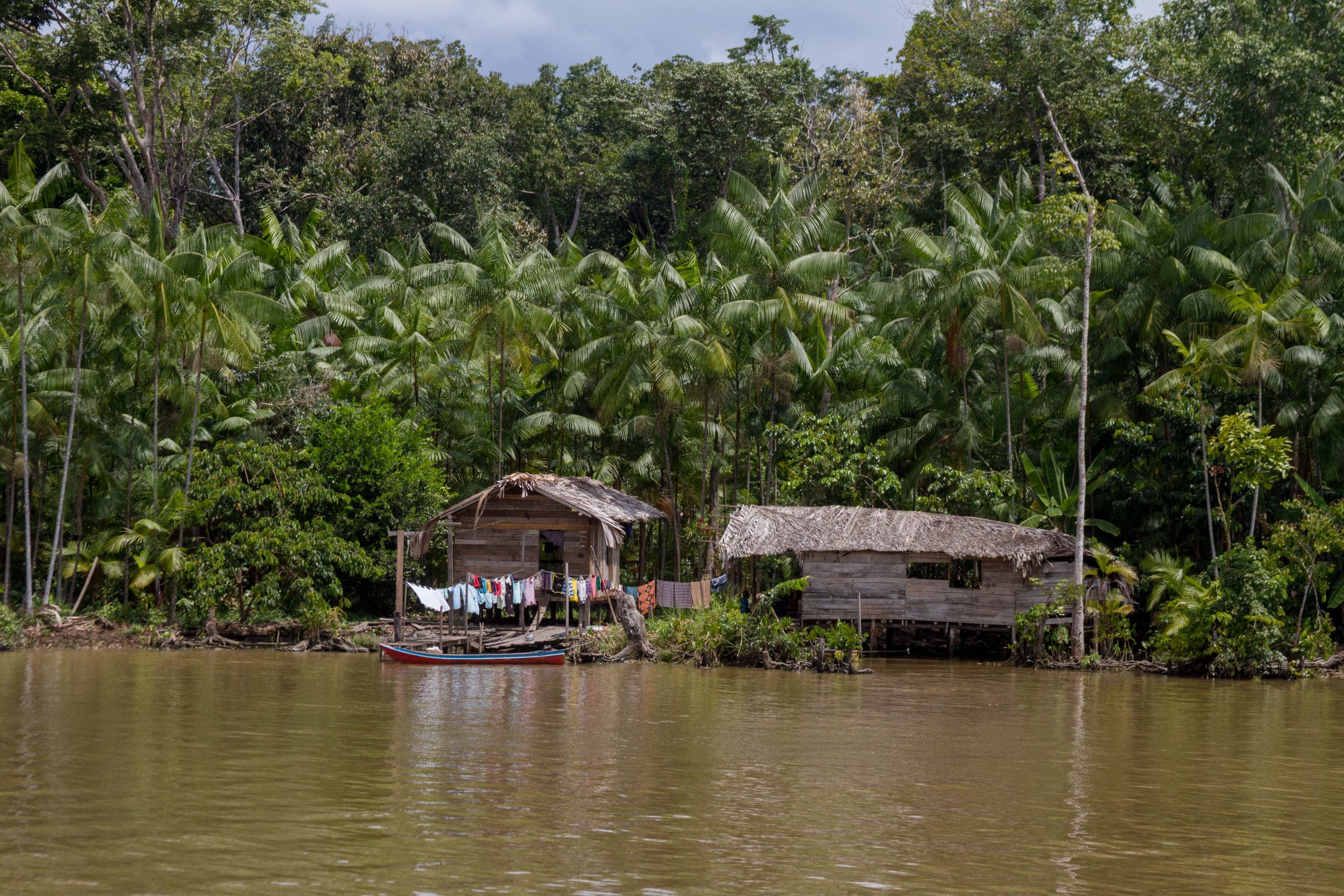
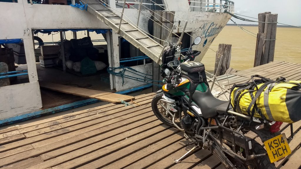
Because I toured this region during the rainy season, this trip had to be done via a boat. The boat ride starts with in Belem and slowly travels river via Santarem, Manaus and then down to Porto Velho towards the Peru Border.
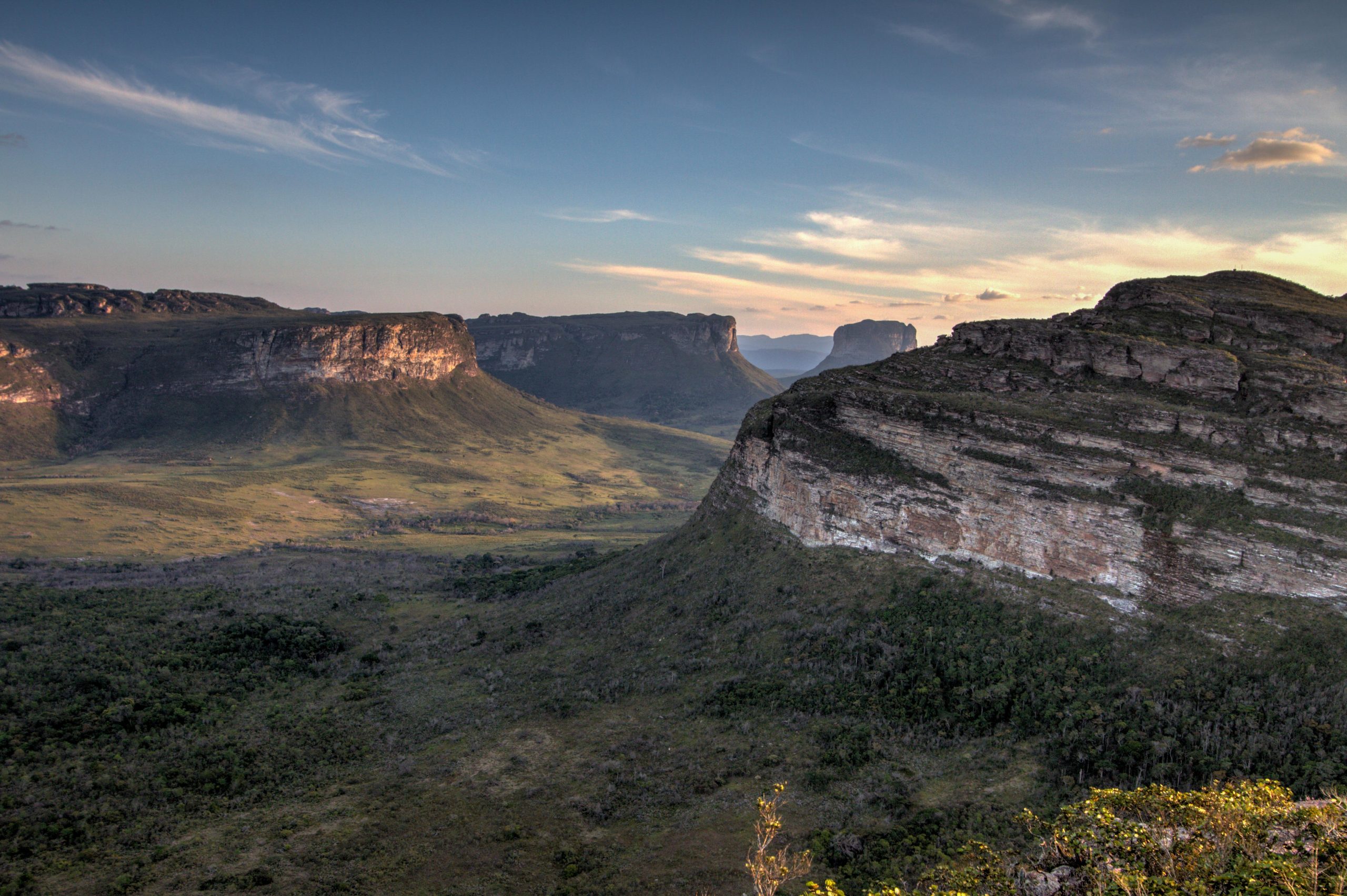
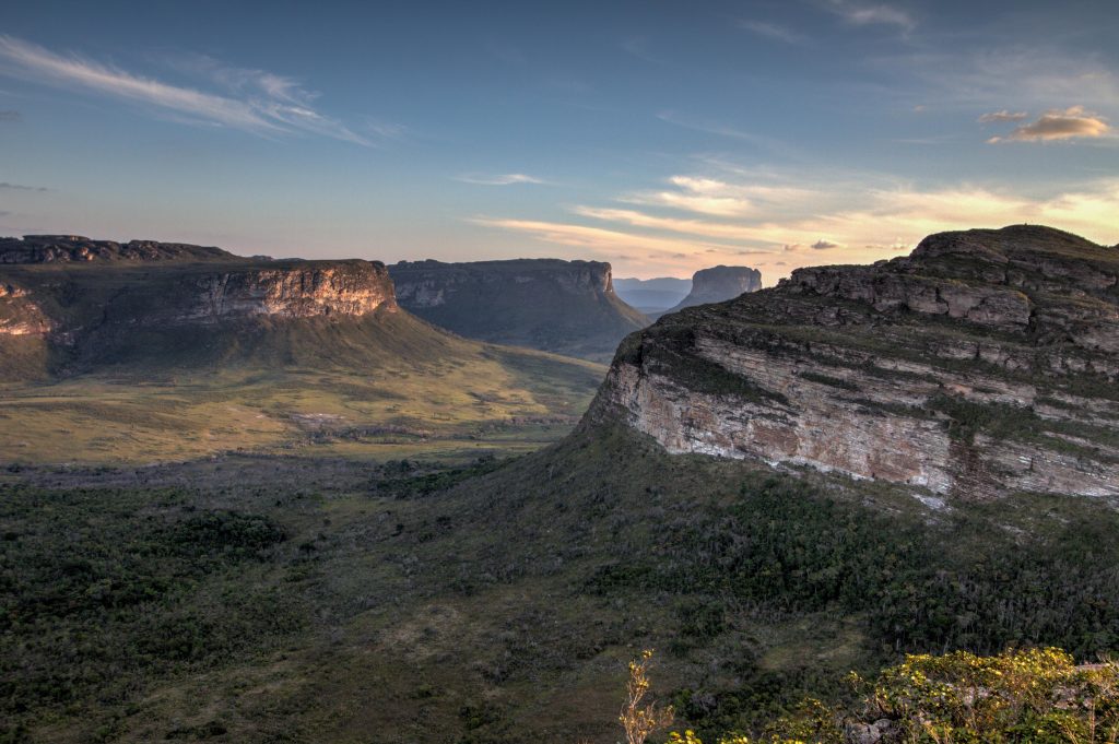
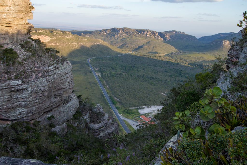
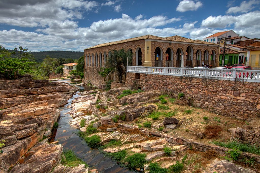
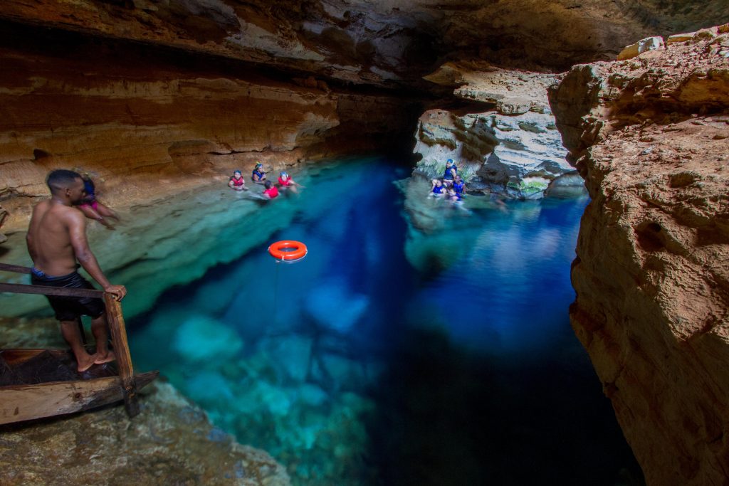
The heart of Bahia is occupied by the huge Chapada Diamantina. Approximately 400 km from Salvador, the Chapada displays a scene of towering rock formations and vast plains covered with typical vegetation from the Cerrado biome. The region was once occupied by treasure hunters. Hence the name, in reference to the exploration of diamonds in the region.
In the Park, one of the main attractions is the Morro do Pai Inácio, with a panoramic view of the entire Chapada.
Chapada Diamantina National Park
Chapada Diamantina National Park
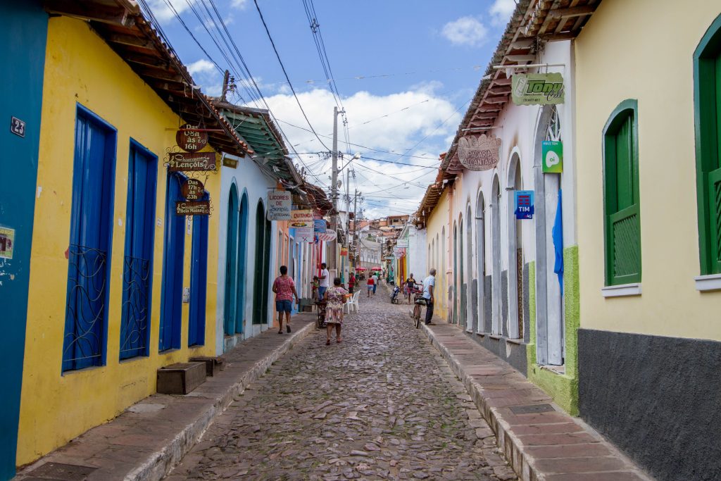
Lencois
Lençóis is the prettiest of the old diamond-mining towns in the Chapada Diamantina, a mountainous wooded oasis in the dusty sertão (backlands of the Northeast). While the town itself has charming cobbled streets, brightly painted 19th-century buildings, and appealing outdoor cafes and restaurants, the surrounding areas are the real attractions. Caves, waterfalls, idyllic rivers and panoramic plateaus set the stage for some fantastic adventures. (link)
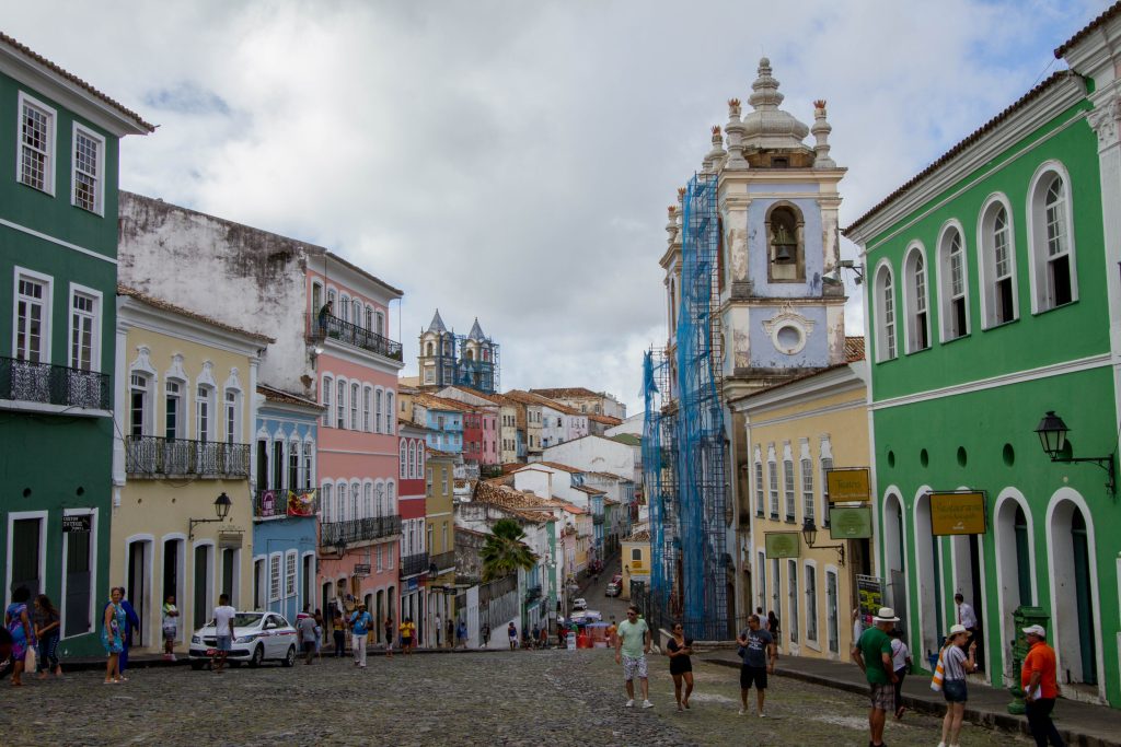
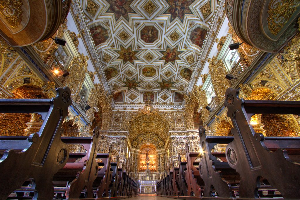
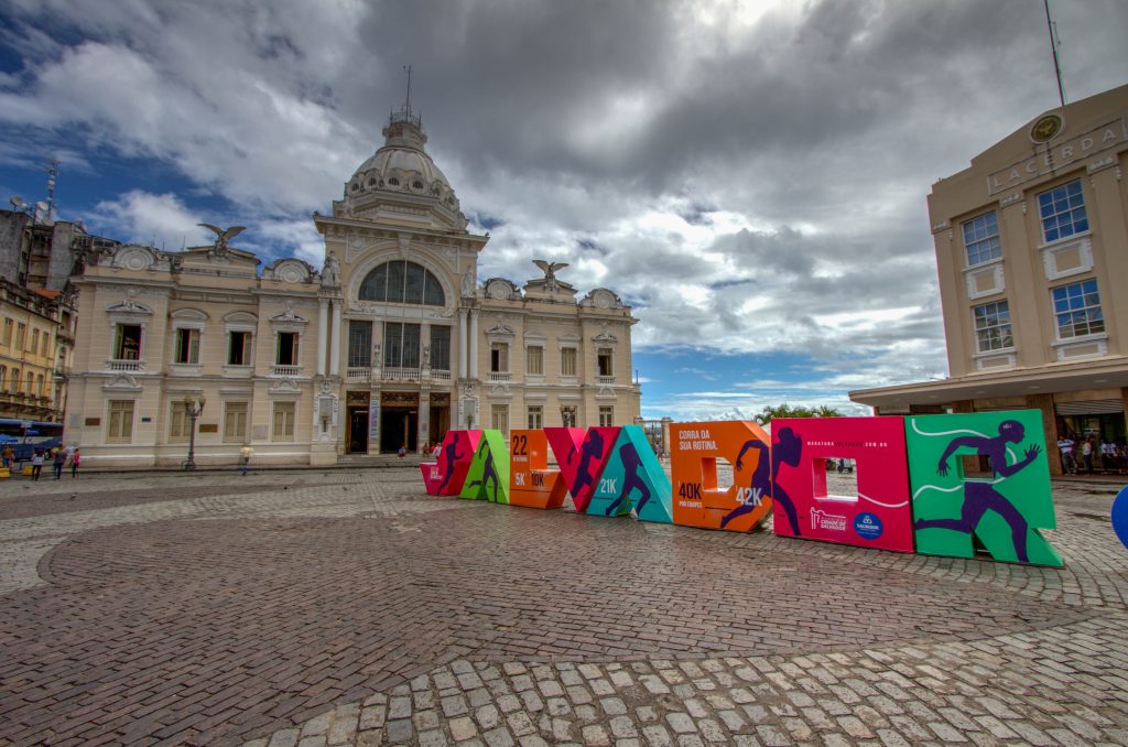
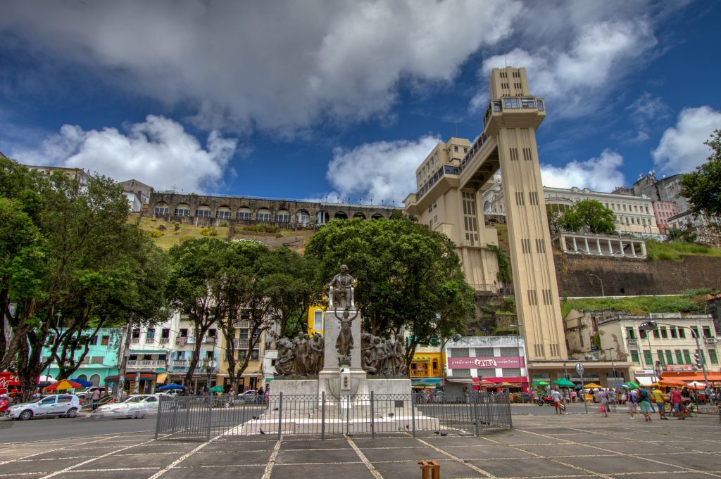
Salvador is the capital of Bahia State, a place well known for its natural beauties, for the kindness of its people and for the strong influence of the African culture.
The moves of capoeira – a martial art that looks like a dance – the smells and flavors of the delicacies, the religious mix and the cultural diversity are samples of the happiness of a people that knows, maybe for it is surrounded by natural beauties, the true meaning of life. The city is also the location of one of the country’s most vibrant and disputed carnival parties. (link)
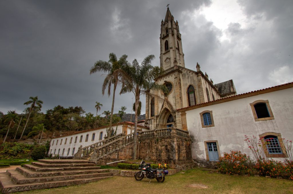
This ride doesn’t have a planned route. Minas Gerais is scattered with many worthy natural sites and colonial towns. Some of the highlights are below.
Highlights
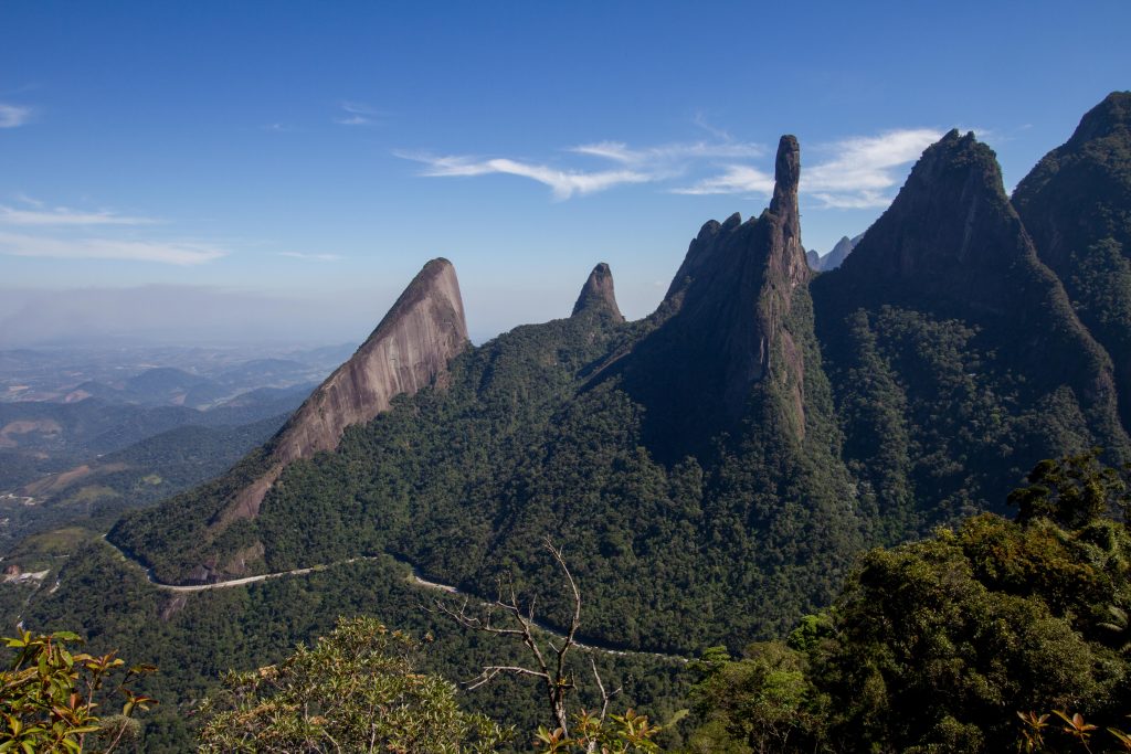
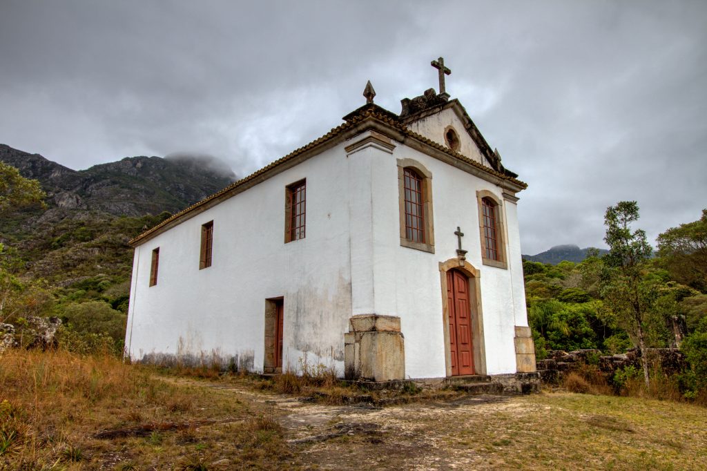
Petrópolis and Teresópolis
Situated in Parque Nacional Serra dos Órgãos, these twin towns are a great base for exploring the park and dramatic mountains, including the iconic Dedo de Deus (God’s Finger) and Agulha do Diabo (Devil’s Needle).
Serra dos Órgãos National Park, Teresópolis, State of Rio de Janeiro, Brazil
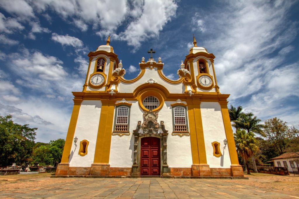
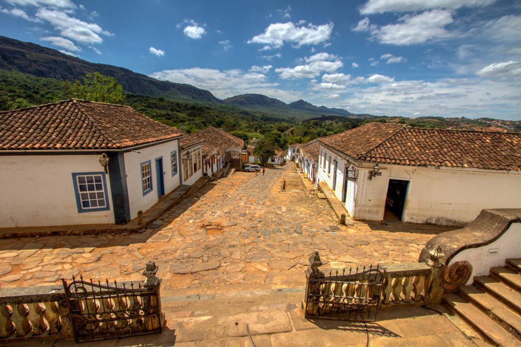
Tiradentes
Located at the foot of the Serra de São José, the city was just a mining camp in the early 18th century. In 1718, it became Vila São José, in honor of the then Portuguese Prince D. José I.
With the proclamation of the Republic, the city was renamed Tiradentes, name of the martyr of the Inconfidência Mineira (an attempt at emancipation from Minas Gerais in 1789), born nearby and who died fighting against the monarchy.
When gold became scarce in the region, the city was forgotten and fell into dispair, it was rediscovered in late 1970. Exceptionally preserved thanks to the decades of long isolation, the Baroque architectural ensemble of Tiradentes gathers jewels like the charming fountain of the São José Fountain, built in 1749 to supply the city with drinking water and which runs until today.
Also standing out in the city is the majestic Church of San Antonio, second in amount of gold in Brasil, with its front built by the artist Antonio Francisco Lisboa, better known as Aleijadinho, and an organ brought from Portugal, in 1788.
Largo das Forras, the central city square, houses the City Hall and numerous handicraft shops, restaurants and inns. It was here, in 1888, that slaves gathered to celebrate the end of slavery.
Tiradentes, State of Minas Gerais, Brazil
Tiradentes, State of Minas Gerais, Brazil
Congonhas
Located in a valley and framed by majestic mountains, Congonhas do Campo, 70 kilometers from Belo Horizonte, bewitches its visitors with the beauty of its rich Baroque heritage.
The earliest records of human occupation dating back to the late 17th century, when the entire region was in a fever of adventurers in search of gold. A large part of the flag of Bartolomeu Bueno populated Vila Real de Queluz (Conselheiro Lafaiete) in 1700, but other members of the expedition followed the trip further and founded other villages such as the Arraial de Congonhas on the banks of the Congonhas River.
The name of the village comes from the plant “congõi” that cover the region’s fields and in tupi means “what supports, what feeds”. It is said that there was much gold in Congonhas that the rocks were the size of potatoes.
So much wealth attracted to the city the great Antonio Francisco Lisboa, Aleijadinho, one of the main artists of Brasil. The passing of Aleijadinho through Congonhas gave Minas Gerais and Brasil one of the most spectacular Baroque treasures: the Basílica Santuário do Bom Jesus de Matosinhos.
The architectural and artistic set of the Basilica is simply breathtaking. This masterpiece of Aleijadinho stands out by its rich carvings and indoor decoration, of 12 large soap stone statues of the Prophets and the six Capelas dos Passos distributed on a hill outside of the temple.
In the chapels, that recreate in a theatrical and educational way the passion of Christ, there are 66 realistic statues carved in cedar and colored masterfully by Mestre Ataíde, a great Brazilian painter and decorator of sacred art.
The sanctuary was declared a world heritage site by Unesco in 1985 and made Congonhas known today as “City of Prophets”.
Congonhas, State of Minas Gerais, Brazil
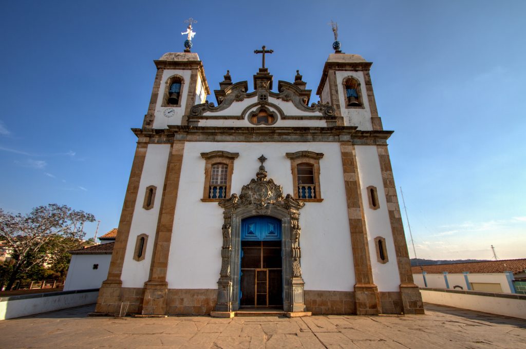
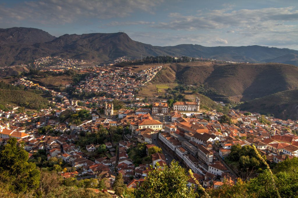
Ouro Preto
The city of Ouro Preto, in Minas Gerais, is well known for its colonial architecture. It was the first Brazilian city to be considered a world heritage site by Unesco in 1980, and is home to a magnificent Baroque architectural ensemble, one of the best preserved in the world.
The history of the city begins at the end of the 17th century, when an anonymous adventurer encountered curious dark stones (dark gold with a layer of palladium) and initiated one of the biggest gold races of humanity.
The territory that today make up Minas Gerais began to be occupied quickly and various camps sprang up. In 1652, they were grouped under the name of Vila Rica – today, Ouro Preto.
Tons of gold were sent to Portugal in the 18th century, and what remained in the region produced Baroque wonders that enchant those who visit the city.
In the historic centre, alleys and streets you will find rich fountains, townhouses, chapels and churches of the 17th and 18th centuries.
Ouro Preto, State of Minas Gerais, Brazil
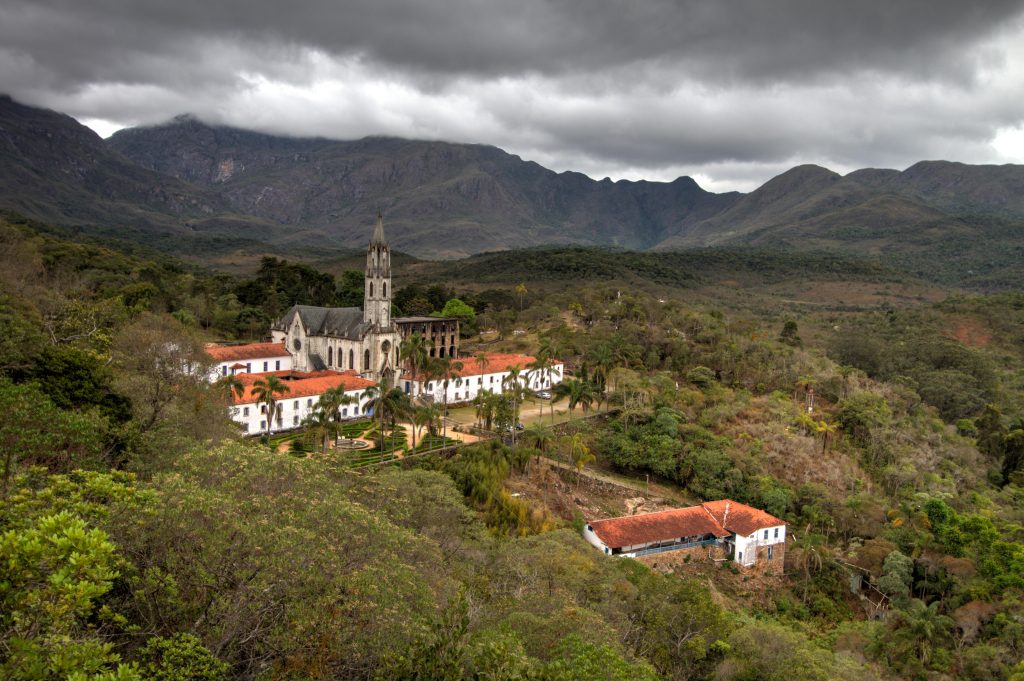
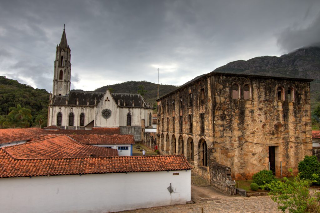
Sanctuary Caraça
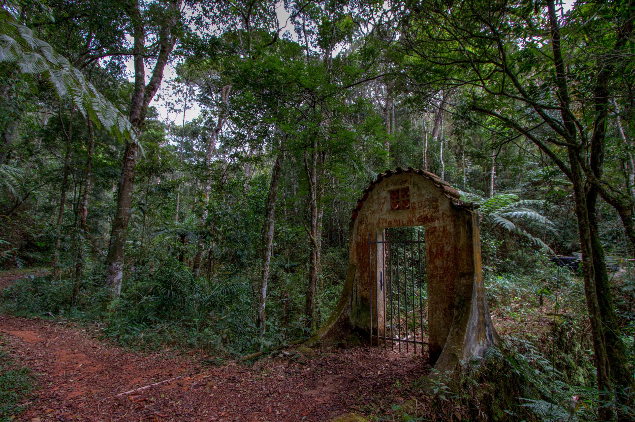
The name of the Caraça (big face) mountains and nature reserve derives from the colonisers’ perception that the range’s profile resembled a human face. A chapel was built here around 1774, dedicated to Our Lady the Mother of Men, as well as a house to shelter missionaries, on the initiative of a certain Brother Lourenço from the Lamego bishopric. Some historians hold that he was really José Policarpo de Azevedo, one of the figures involved in the attempt to assassinate King José I (1768), who had taken refuge in Brazil to escape capital punishment. The original features of the house and chapel are known from an old drawing apparently used as a model for the Seminary of Mariana. When he died in 1819, the founder left all his property to the prince regent, requesting that a teaching institution be established at the site. The resulting college was founded in 1820 by two Lazarist priests designated by King João VI. In 1883, a building in the neo-Gothic style replaced the original chapel; elements from the latter are nevertheless still identifiable, such as the floor flagstones and some religious images, as well as the altars painted and gilded by master Ataíde, who also painted the canvases embellishing the church, among them the famous depiction of the Last Supper. One of the college’s wings was destroyed by a fire in 1968, which also affected the library. In the 1980s, the complex was subject to a thorough and ambitious restoration. (link)
Maned Wolf Experience
One of the highlights of this place happens under the night sky on the steps of the neo-Gothic monastery. If you’re lucky, you may witness the beauty of the maned wolf up close and personal. These are rare creatures to see in the wild, making for a surreal and unforgettable experience.
The unique relationship between the residents of the Santuário do Caraça monastery and the area’s native maned wolves began in the early 1980s. Monks started to notice that an apparently large and strong animal was habitually raiding the church’s trashcans by tipping them over and dragging out the contents for clandestine midnight feasts. (link)
Sanctuary Caraça, State of Minas Gerais, Brazil
Sanctuary Caraça, State of Minas Gerais, Brazil
Sanctuary Caraça, State of Minas Gerais, Brazil
Sanctuary Caraça, State of Minas Gerais, Brazil
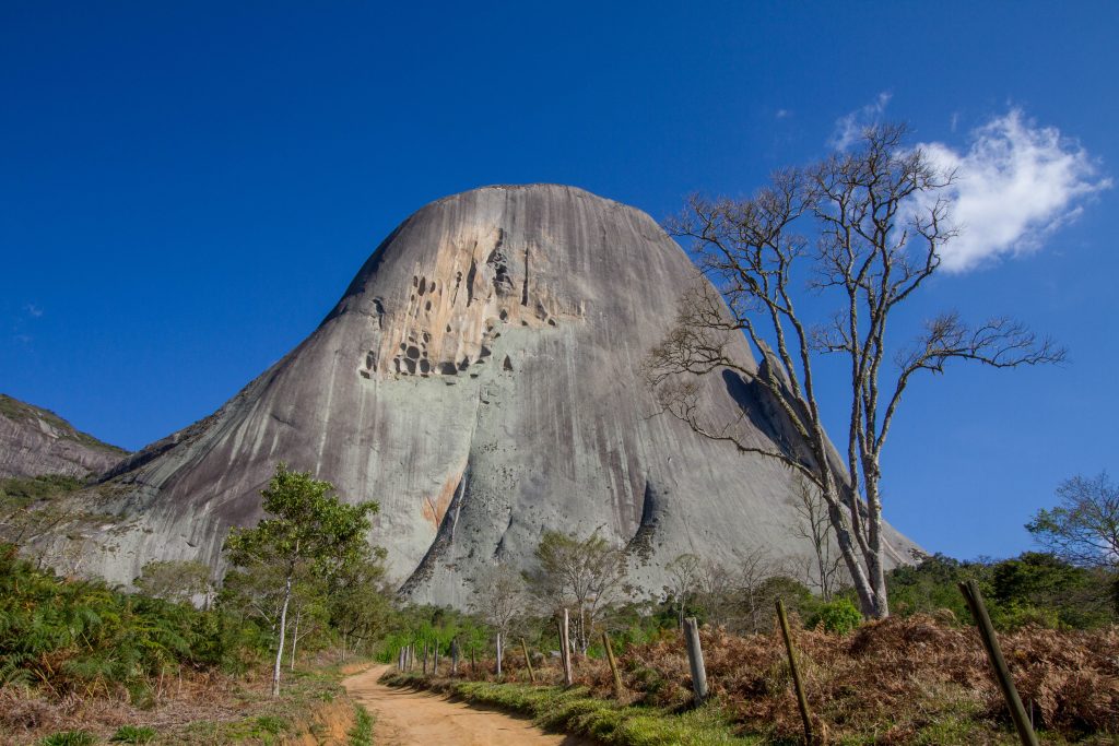
Pedra Azul
While not located in Minas Gerais, instead located in Espírito Santo state. The ‘Blue Rock’ is a granite rock formation reaching a height of 1,822 metres (5,978 ft). Temperatures range from about 7.3 to 27.8 °C (45.1 to 82.0 °F). It is rated the 3rd best climate in the world (from the UN). Altitude ranges from 1,250 metres (4,100 ft) at the visitor center to 1,909 metres (6,263 ft) at the peak of Pedra das Flores, the highest point. The park covers parts of the municipalities of Domingos Martins and Vargem Alta. These towns are built by Pomeranian immigrants, who came from a region that is now part of Germany and Poland. This population often finds itself in difficult-to-access areas, and many still speak East Pomeranian, though today it is thought to be extinct in their homeland. Domingos Martins still has many characteristically Germanic architecture and cuisine.
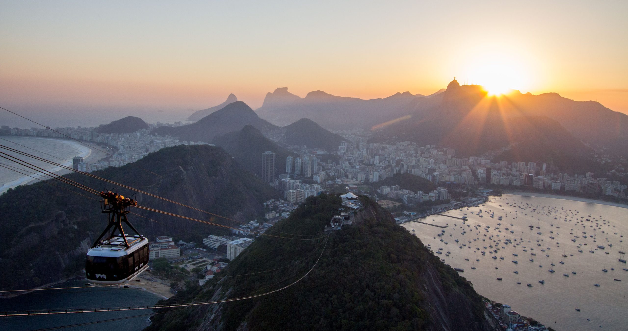
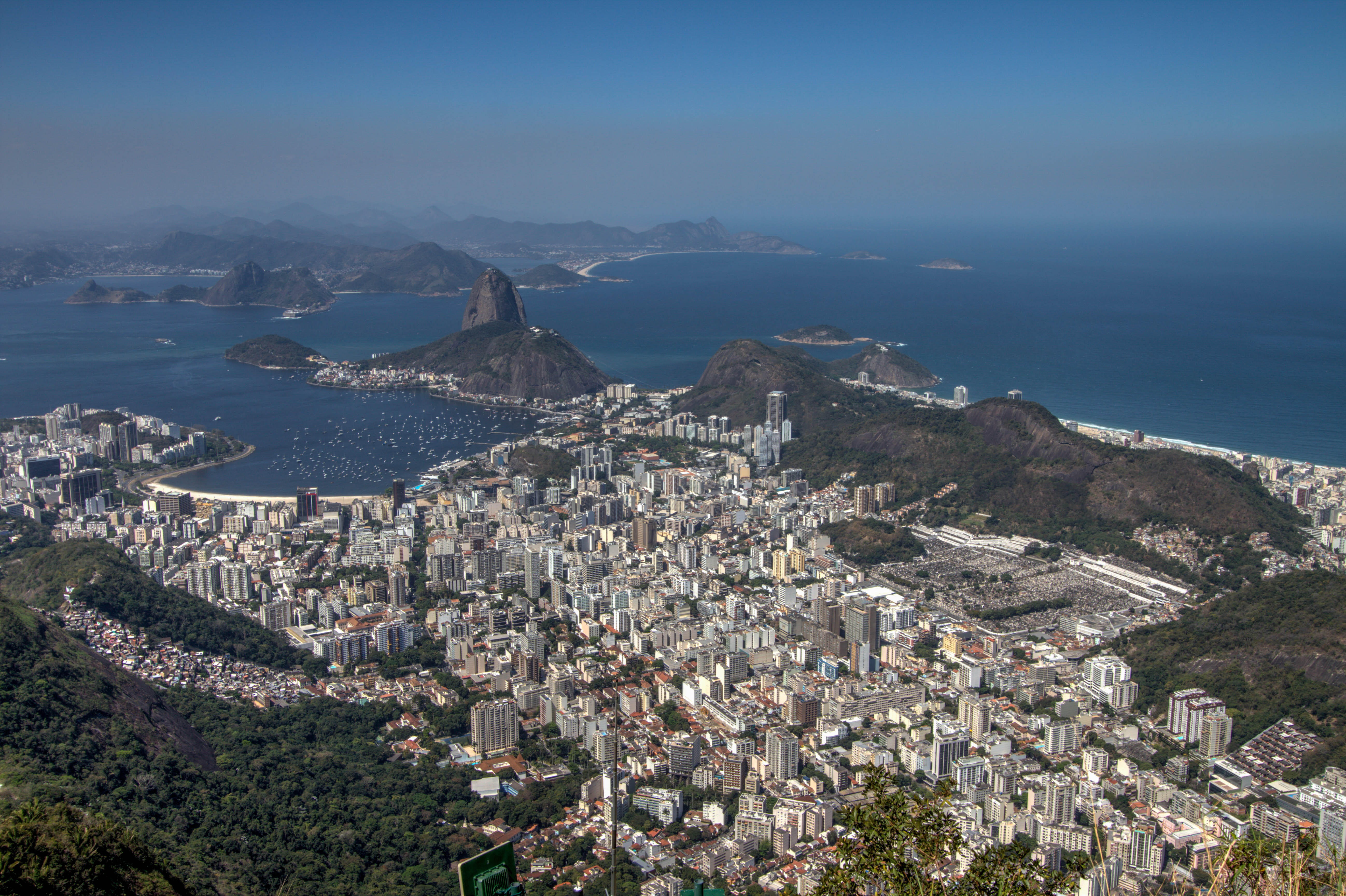
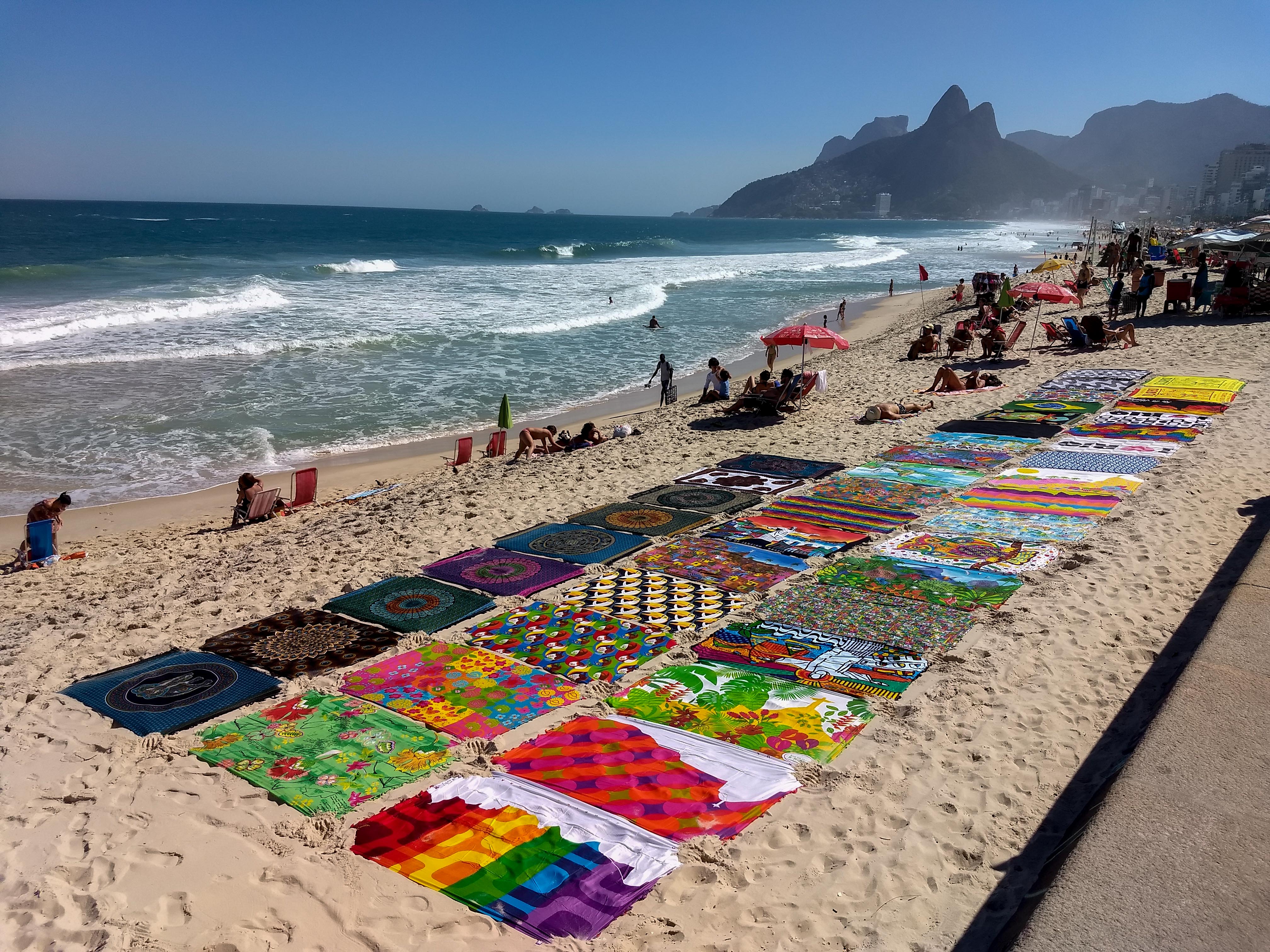
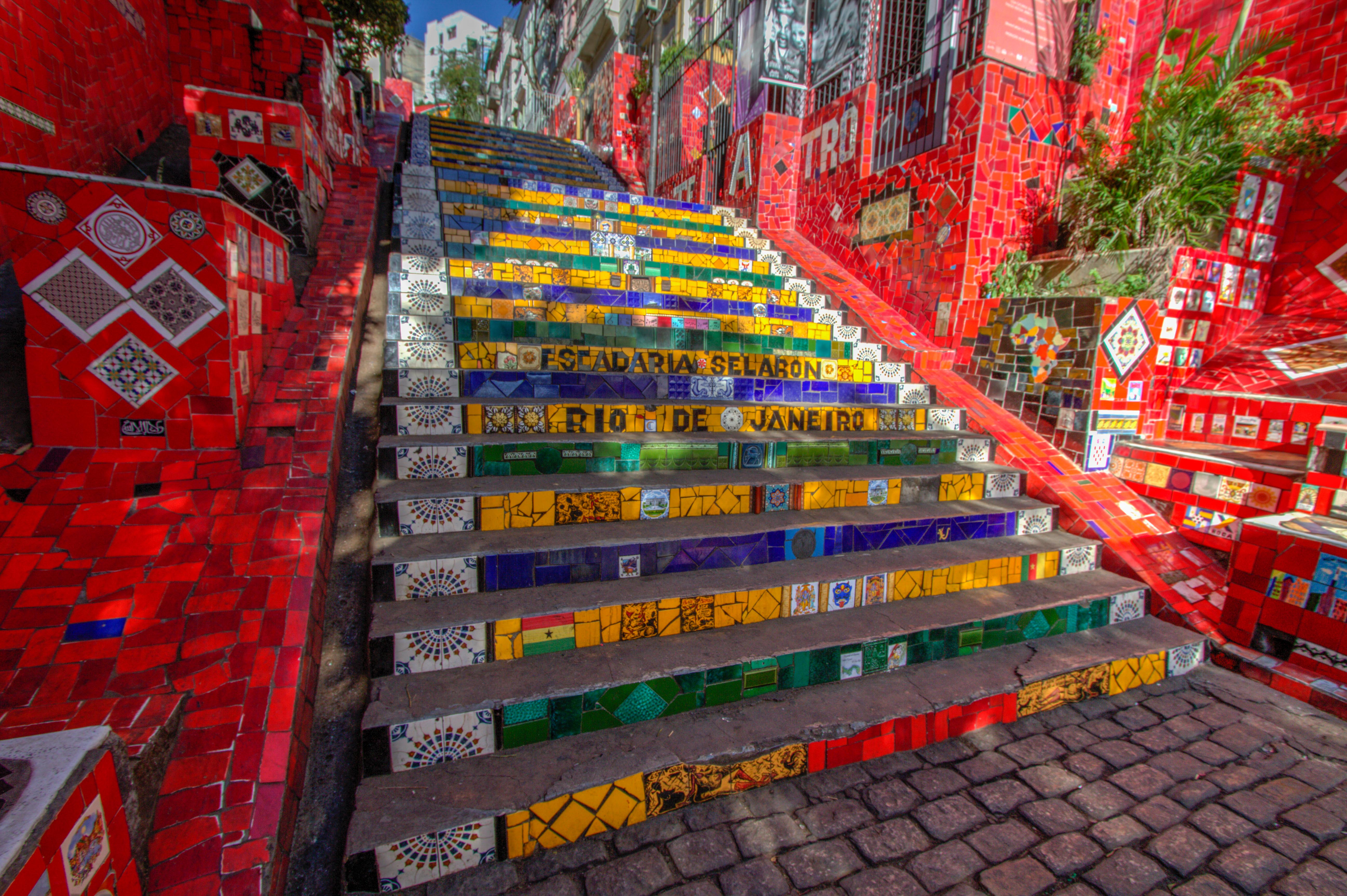
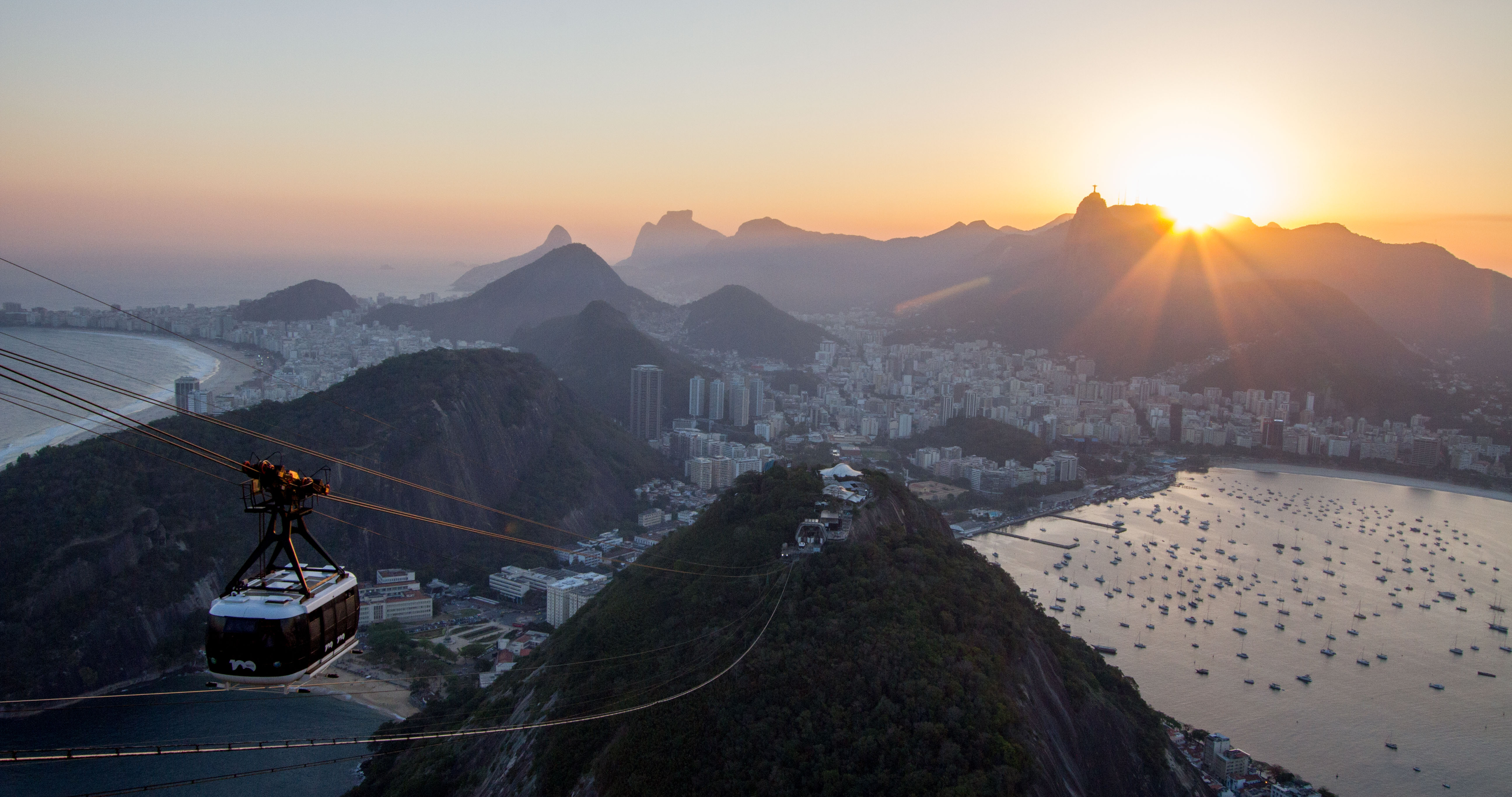
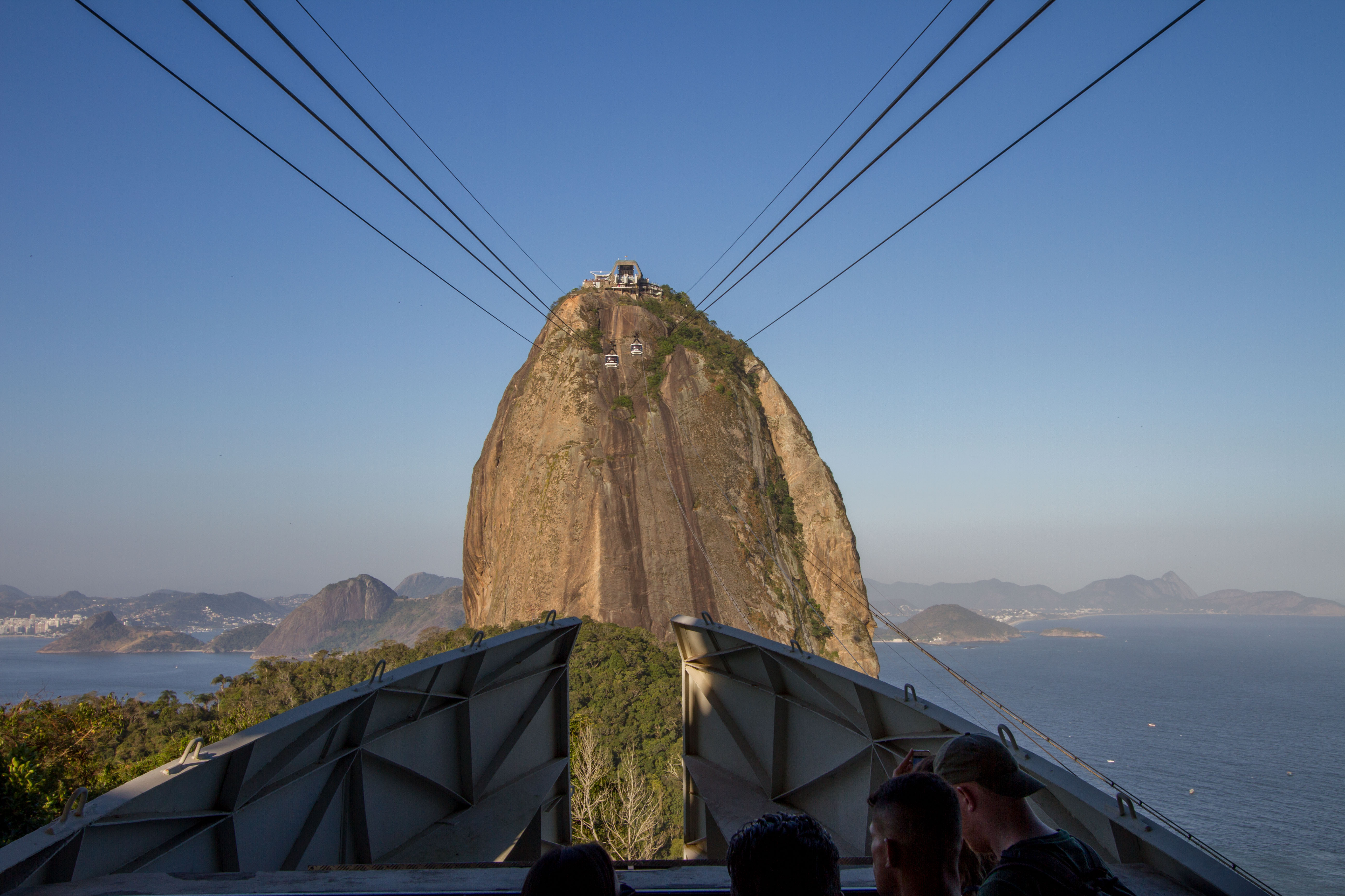
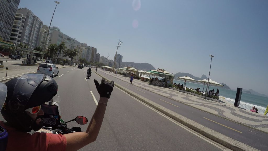
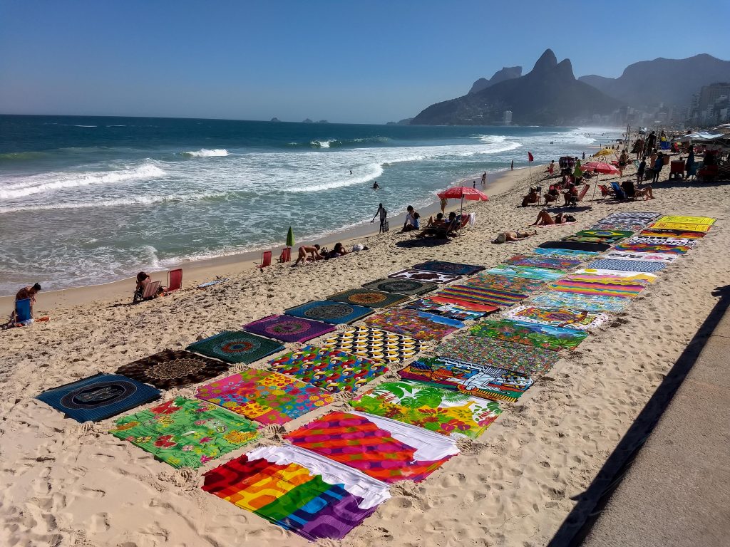
…and the rumours are true, the powers of Rio will seduce even the most cynical of travelers with its charms. For starters, Mother Nature halts the march of the city at every turn, from the rainforest that creeps up its rolling hills to the huge lagoa (lagoon) surrounded by the continent’s most expensive real estate and, of course, the most beguiling stretches of urban beach on the planet – Ipanema, Copacabana, Arpoador and Leblon.
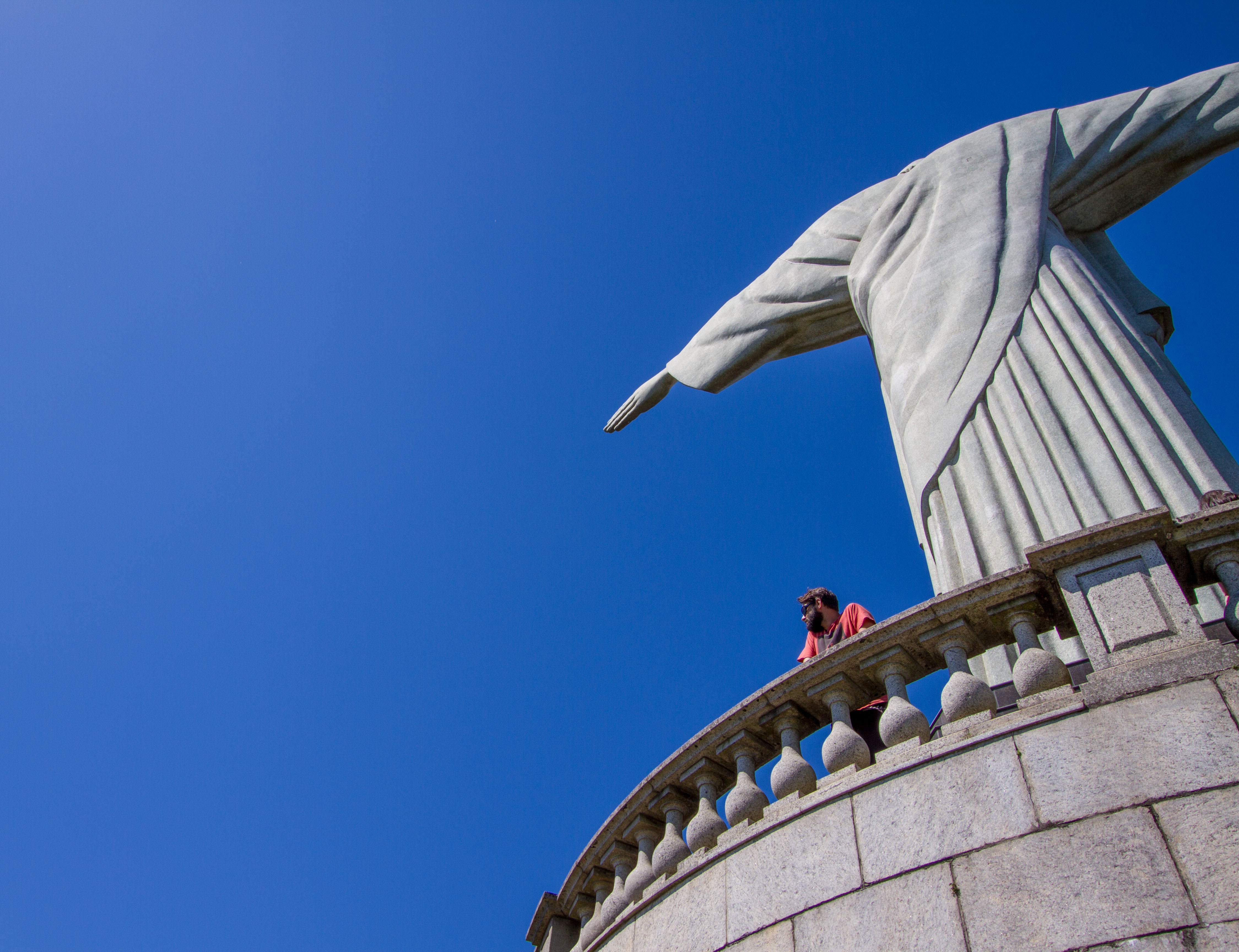
Whether it is the statue of Christ perched atop Corcovado mountain or the Sugarloaf cable car, the hoards kite-surfing off Barra beach or dancing to samba on the smooth slopes of Pedra do Sal rock, this is a city and landscape turned playground, where life isn’t taken too seriously and the twists and turns of the daily political and economic soap opera has ingrained a rueful cheeriness and creativity in its people.
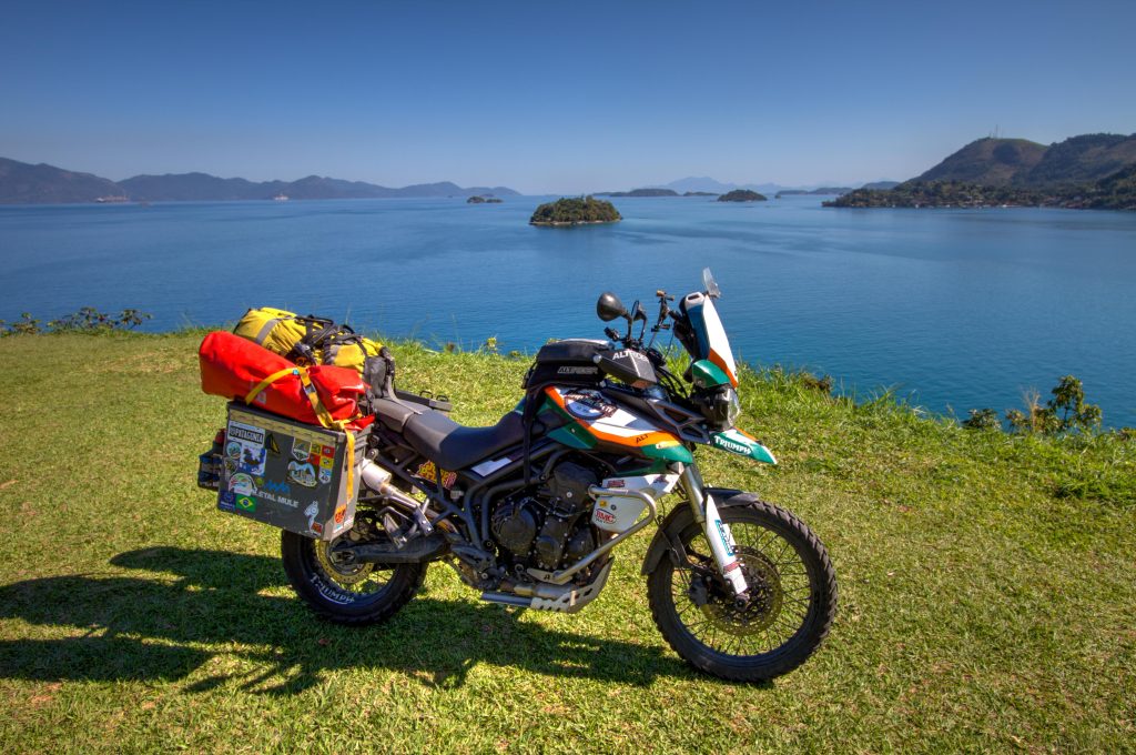
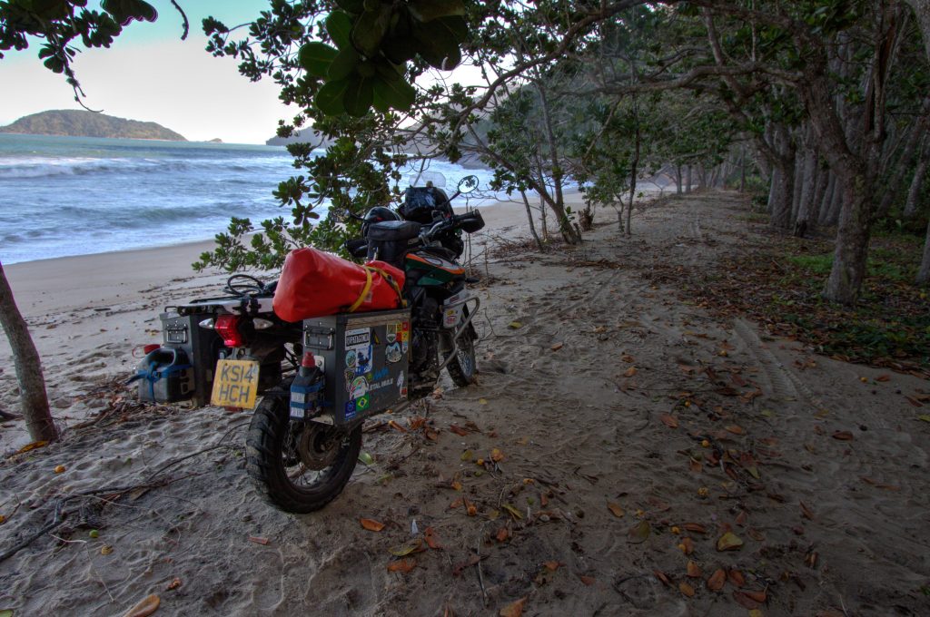
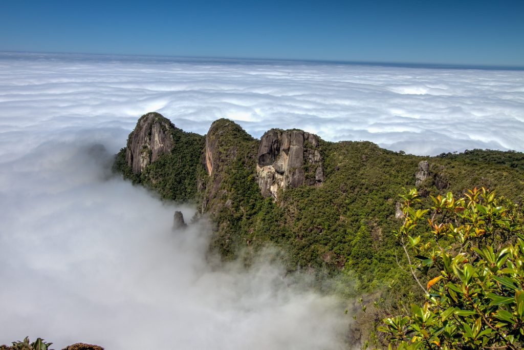
The BR-101 runs along the jagged coast line of Brazil. This area is called Brazil’s Costa Verde. Characterized by the Serra do Mar escarpment reaching Atlantic Ocean. This creates a mountainous landscape very near the coast. It is considered the greatest extension of Atlantic Forest biome reaching the ocean anywhere in the world
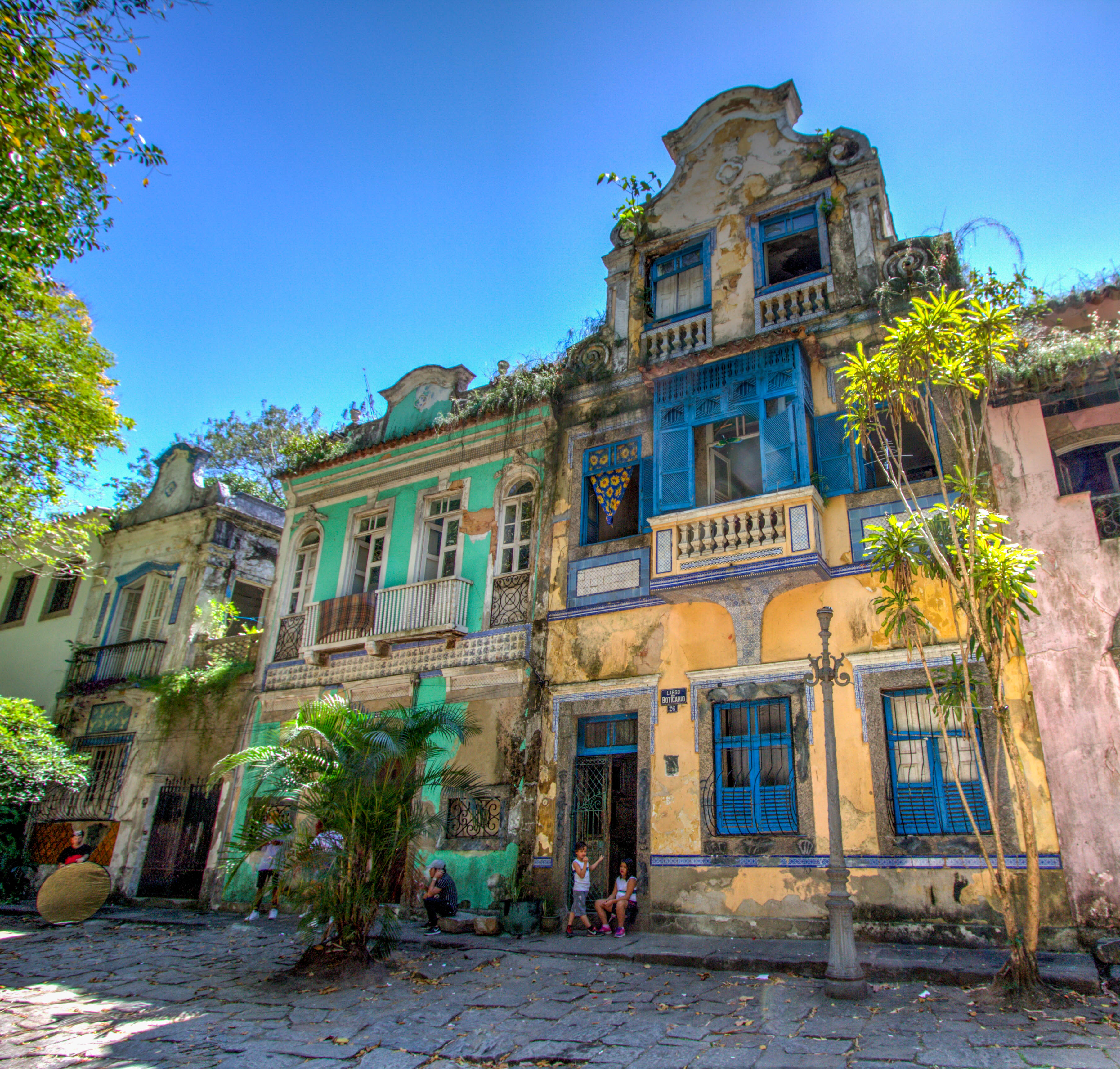
State of Rio de Janeiro, Brazil
State of Rio de Janeiro, Brazil
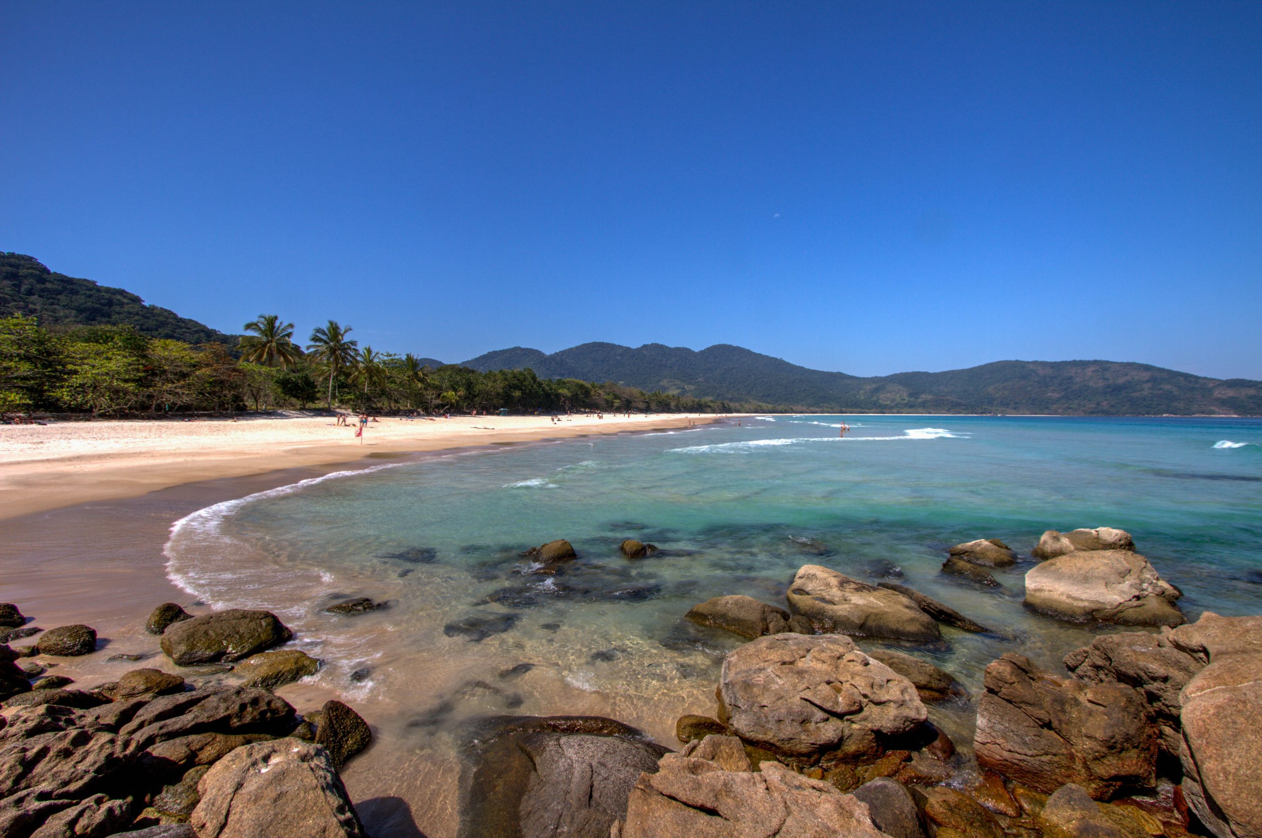
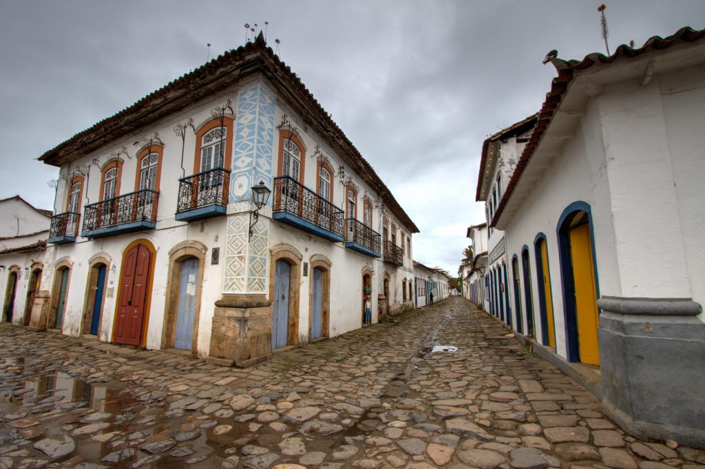
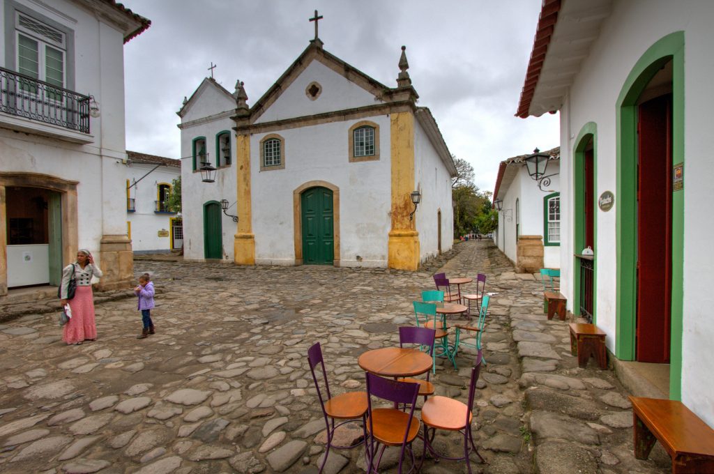
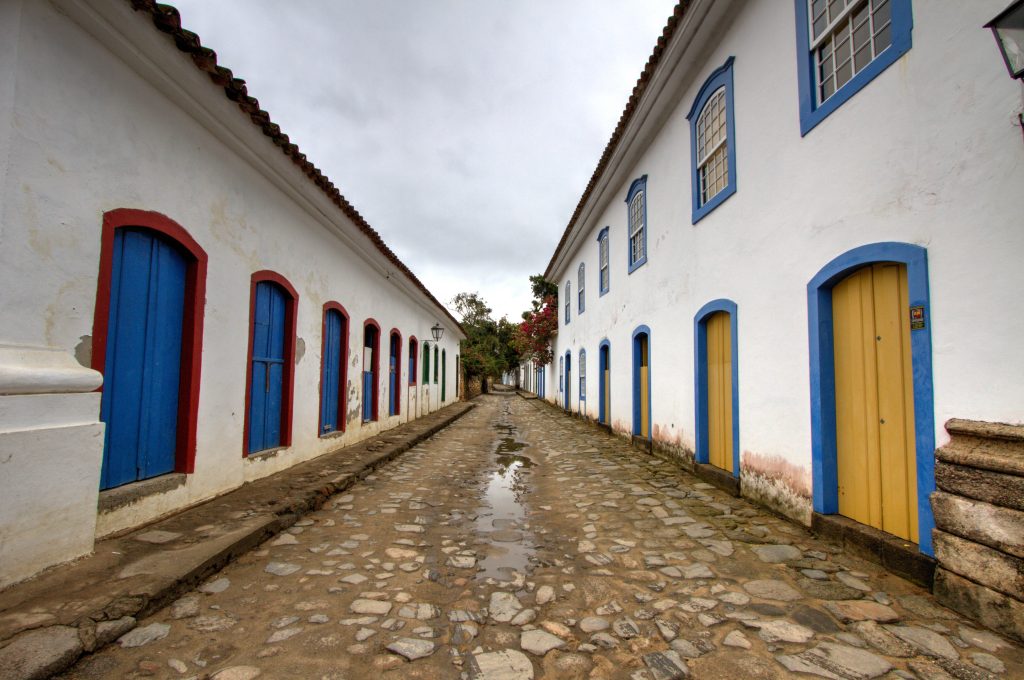
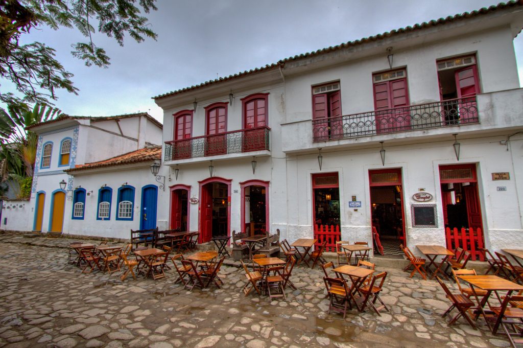
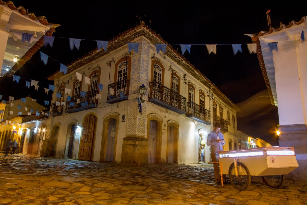
Paraty
Paraty is a charming little town that was once a thriving gold port. With its Portuguese colonial architecture, Paraty is known for the cobblestone-paved streets. No cars or trucks are allowed in this part of town, only foot traffic or bicycles.
Paraty has been able to maintain many of its historic buildings. Much of the architecture of the city has not changed for 250 years or more.
Paraty, State of Rio de Janeiro, Brazil
Paraty, State of Rio de Janeiro, Brazil
Paraty, State of Rio de Janeiro, Brazil
Paraty, State of Rio de Janeiro, Brazil
Paraty, State of Rio de Janeiro, Brazil
Paraty, State of Rio de Janeiro, Brazil
Estrada Real (RJ-165) from Paraty to Stone Macela
The Estrada Real winds from the coast town of Paraty to the breathtaking sceneries of mountainous regions around Cunha. You still can see parts of the old mule pathways used to transport Gold and other heavy loads in caravans down to the harbour city.
Pedra da Macela (1840m) is one of the highest peaks on Serra da Bocaina. This mountain is localized near of the border of Rio de Janeiro and São Paulo States and can be reached by a 2km steep walk.
It is a bit of a ride off the main road (BR-101), but it worth it for the stunning views.
Where this ride ends….. and the rumours are true, the powers of Rio will seduce even the most cynical of travelers with its charms. For starters, Mother Nature halts the march of the city at every turn, from the rainforest that creeps up its rolling hills to the huge lagoa (lagoon) surrounded by the continent’s most expensive real estate and, of course, the most beguiling stretches of urban beach on the planet – Ipanema, Copacabana, Arpoador and Leblon.
Whether it is the statue of Christ perched atop Corcovado mountain or the Sugarloaf cable car, the hoards kite-surfing off Barra beach or dancing to samba on the smooth slopes of Pedra do Sal rock, this is a city and landscape turned playground, where life isn’t taken too seriously and the twists and turns of the daily political and economic soap opera has ingrained a rueful cheeriness and creativity in its people.
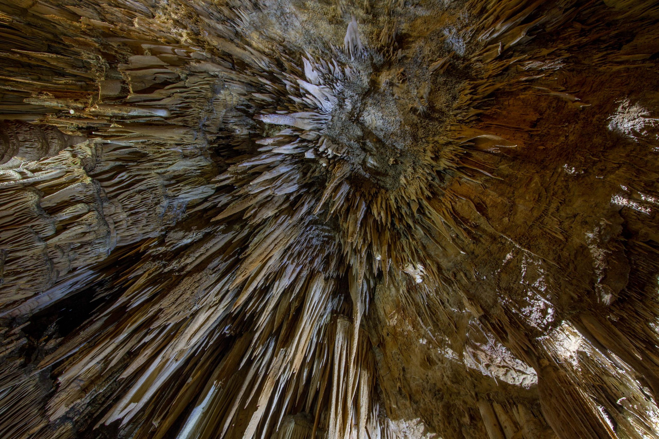
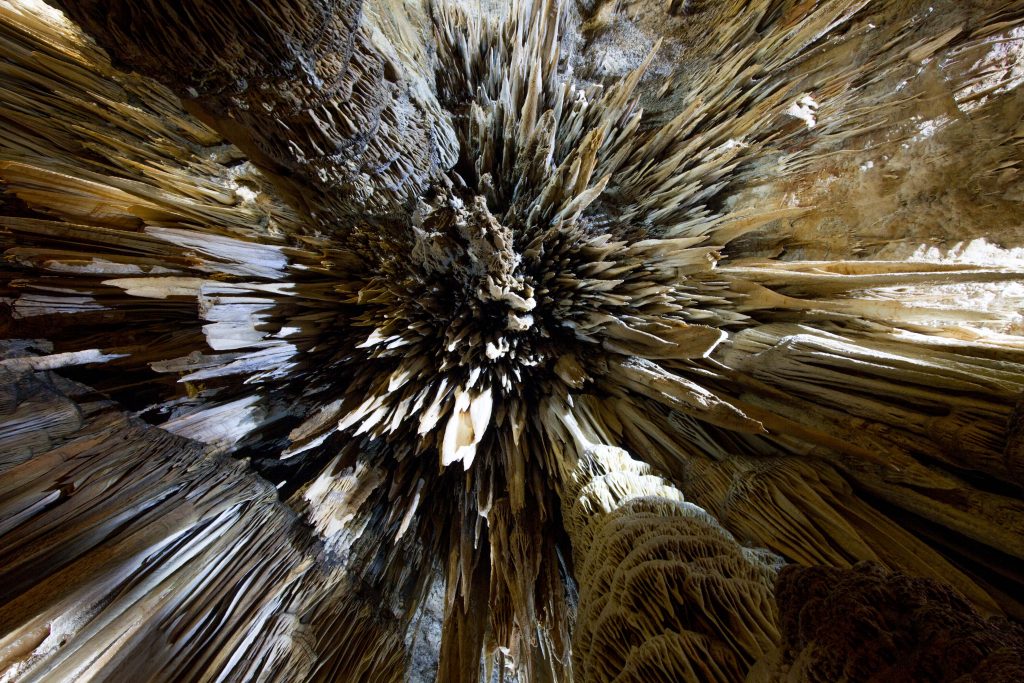
Of the 6.237 meters of the cave whose entrance measures approximately 40 meters high, 3.200 meters have already been surveyed, of which only 700 meters are free for tourists. It measures 152 deep from one side of the cave to the other. All this area has a sound system and lighting, walkways, stairs and handrails for safety measures.
LEGEND
Once discovered the cave was then named Caverna da Tapagem, meaning “mysterious place”. Some legends were responsible for the appearance of the most popular pseudonym Devil’s Cave around 1964, for the Indians who inhabited the vicinity of the cave believed that if they were hit by drops of water from the ceiling, they would be then transformed into stone. To them, the strange geological formations which called their attention were in fact people and other animals that had been petrified by the constant dripping in the cave. Those who later inhabited the site, also believed that the noises heard at the entrance of the cave were groans of lost souls who had been punished by the devil.
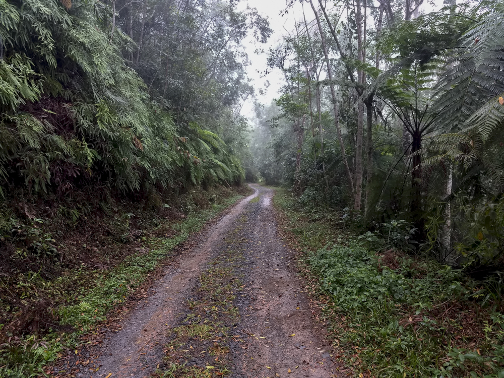
This Epic Ride is in the Brazilian state of Paraná. The road was an old tropeiros (Drovers) route towards the state coast to the cities further inland. The road goes through the most pristine stretch of Atlantic Forest of Brazil , marked by the tropical forest and the beautiful streams that are born in the Serra do Mar . It was declared by UNESCO as an Atlantic Forest Biosphere Reserve in 1993.
As of 2017, mostly asphalt. Some sections are old cobble-brick.
When is the best time to Ride?
Anytime. It’s sunny Brazil 🙂
Highlights
The Road
If you avoid the weekends, you’ll mostly have the road to yourself. The road isn’t very long but there are alot of little restaurants and viewpoints to easily take up half a day.
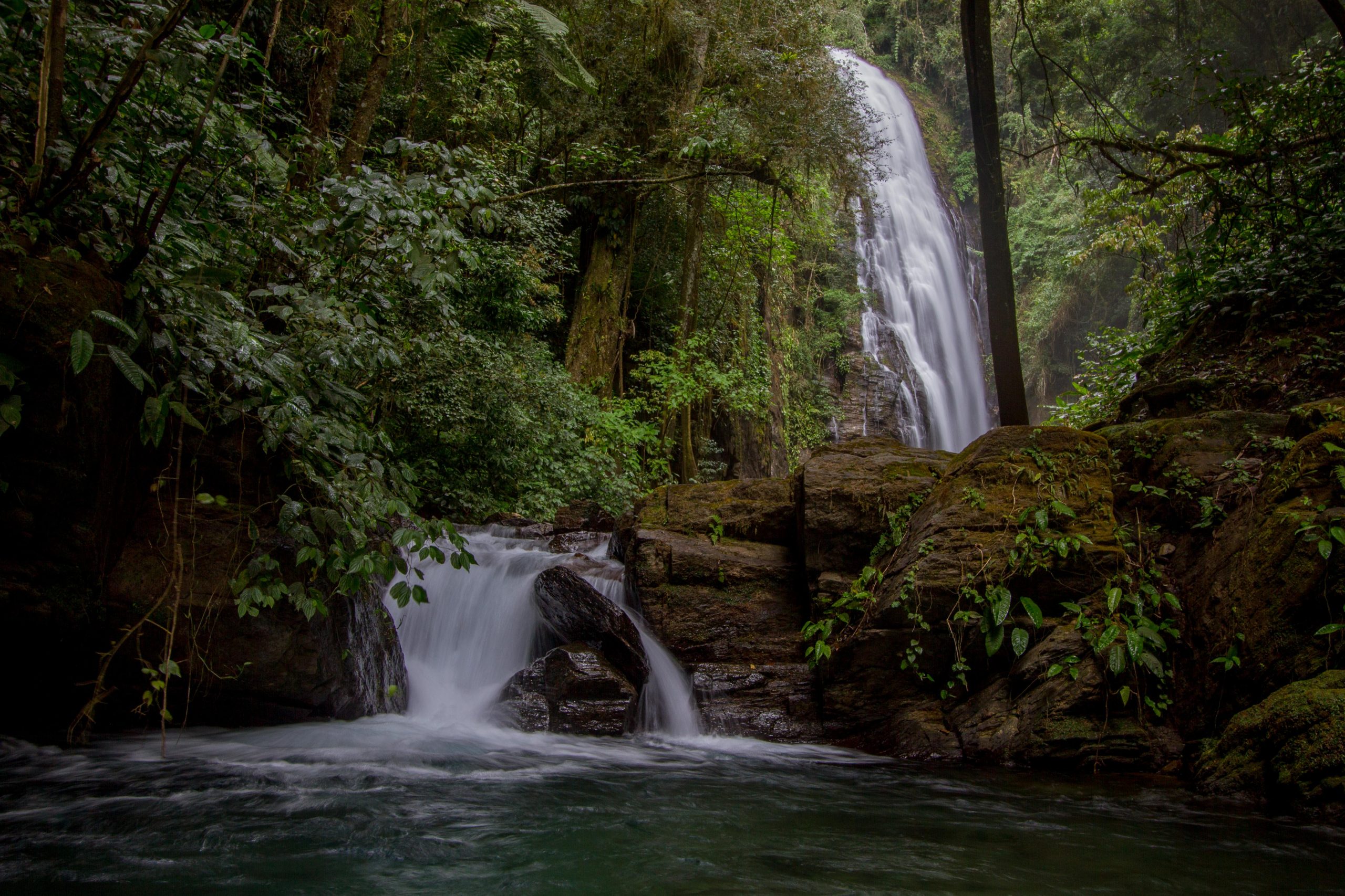
Waterfalls
With mountains and forests this dense there are a lot of waterfalls to explore. All the waterfalls around here were amazingly peaceful. You’ll have the place to yourself.
Graciosa Road, Paraná, Brazil
Why is it an ‘Epic Ride’
Maybe not an ‘Epic’ ride, but its a quick ride of the main road, it has alot of history, great views and isn’t very busy traffic wise.
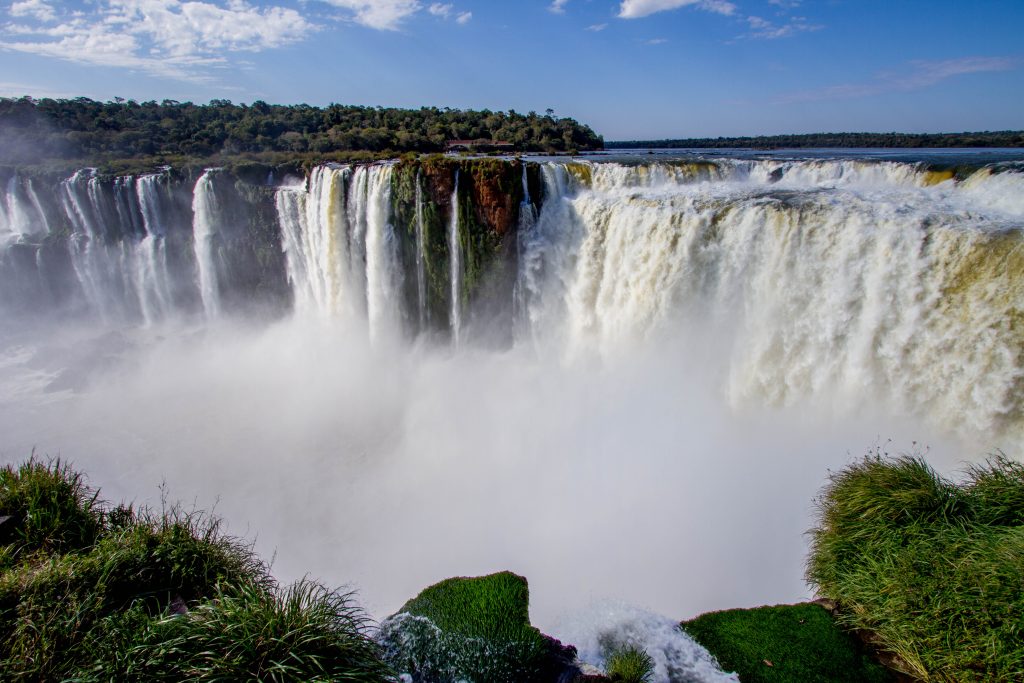
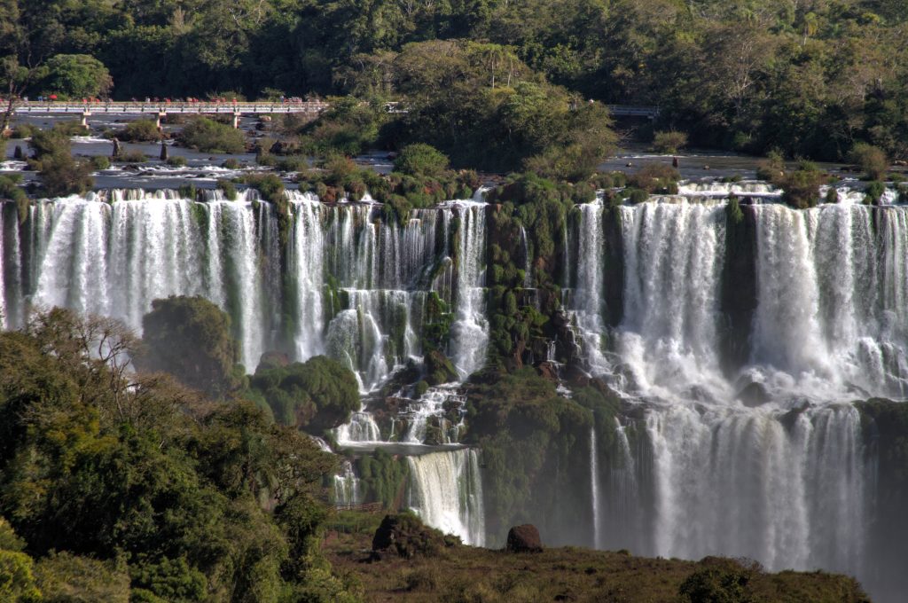
Iguazú Falls are waterfalls of the Iguazu River on the border of Argentina and Brazil. Together, they make up the largest waterfall system in the world……. and they are truly breathtaking. The falls divide the river into the upper and lower Iguazu. The Iguazu River rises near the city of Curitiba and even though most of its course flows through Brazil, most of the falls are on the Argentine side.
The falls form the boundary / border area between Argentina and Brazil. Access to the falls is possible from both countries and it is definitely worth visiting from both sides as the prospective from each country is totally different and unique. Also the border crossing located near the falls between these two countries is less restrictive becuase of the sheer number of tourists visiting both sides of this amazing place.
Argentinian Side
The Argentinean side boasts more structured walkways than the Brazil side. You walk along the top of the falls instead of having a front view of the water ‘wall’. The changes through when you get to Devils throat, the prime attraction on the Argentinian side. Here you will see a panoramic view of section further up the river than the Brazilian side. This view point is Mirador Garganta del Diablo.
Iguazu Falls
Brazilian Side
This side is much easier to access, is better organised and has better landscape views of the ginormous falls.