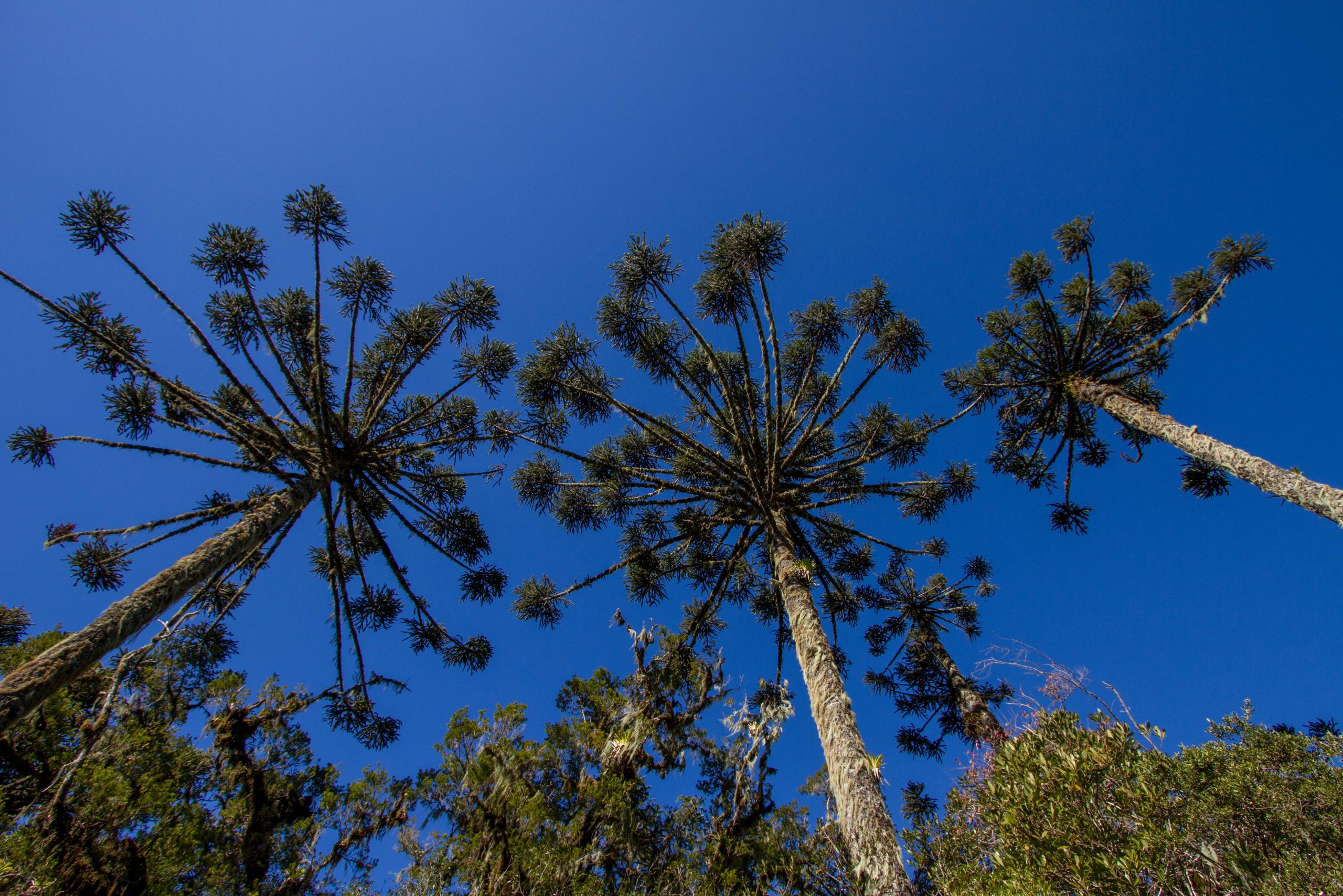
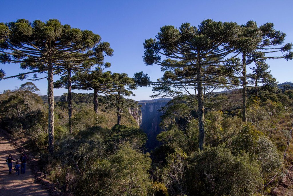
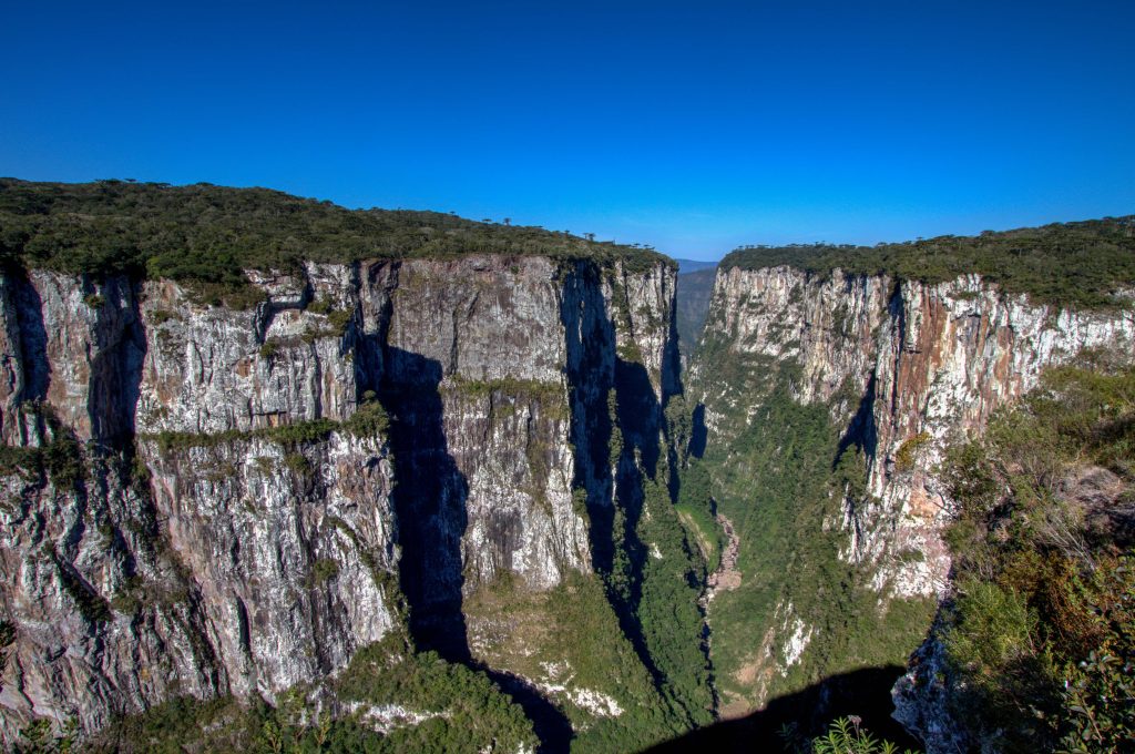
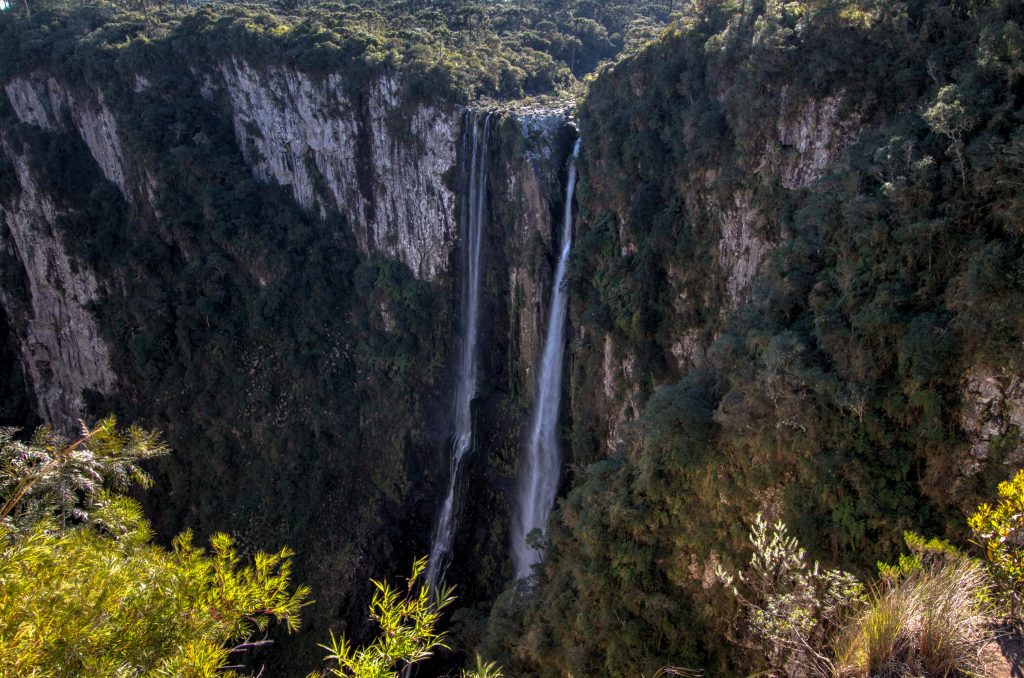
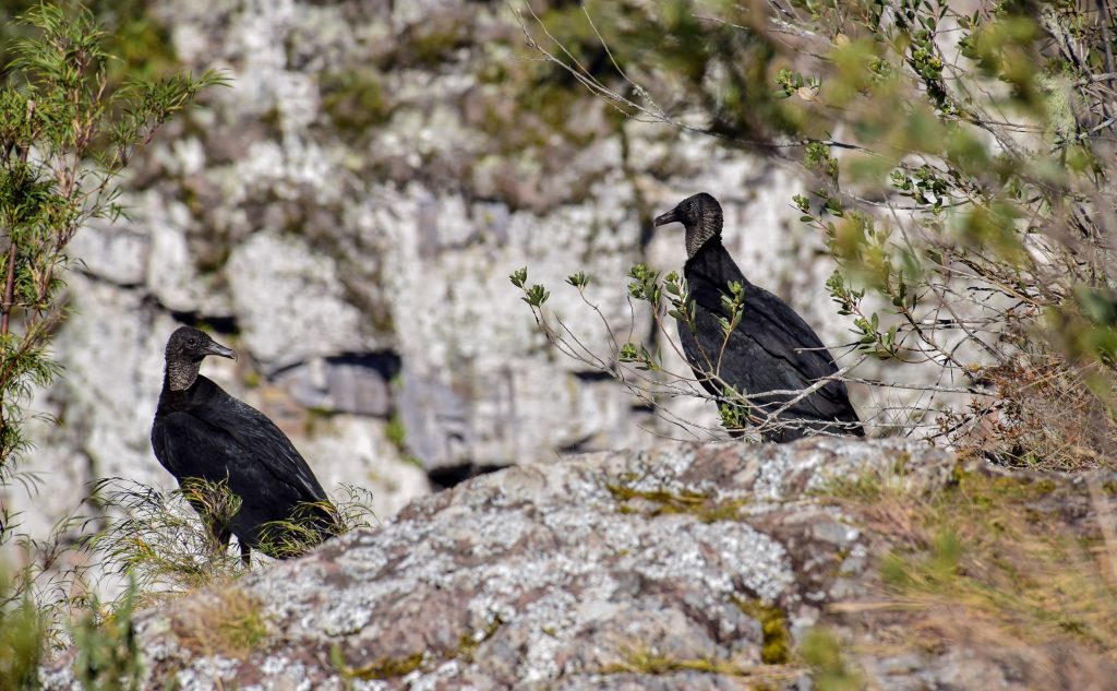
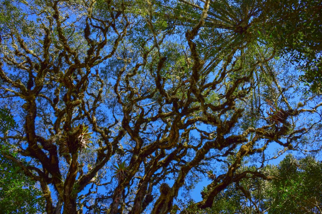
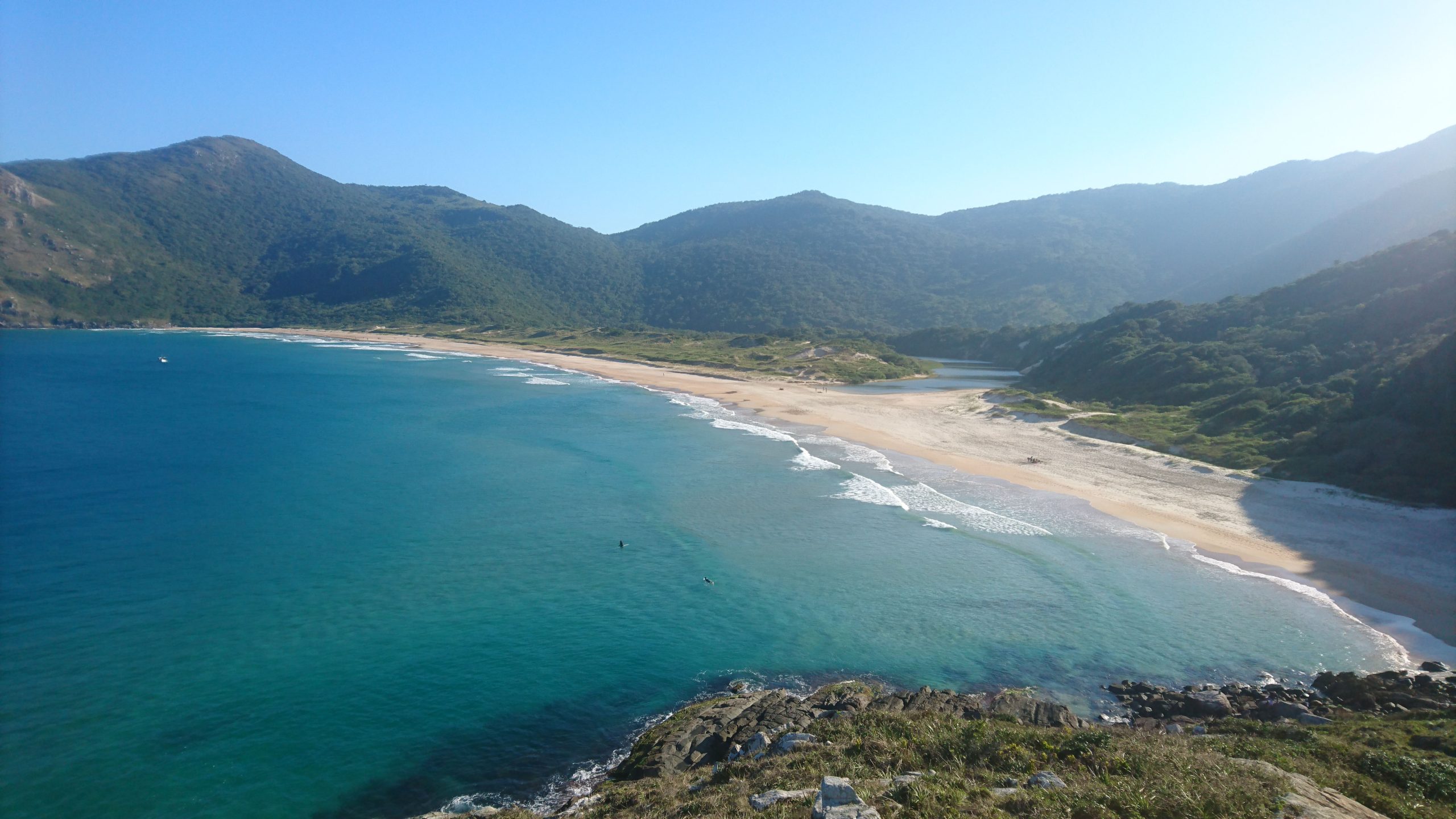
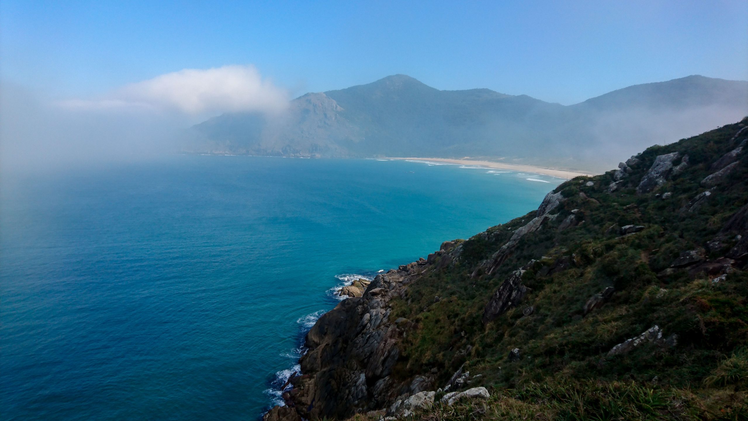
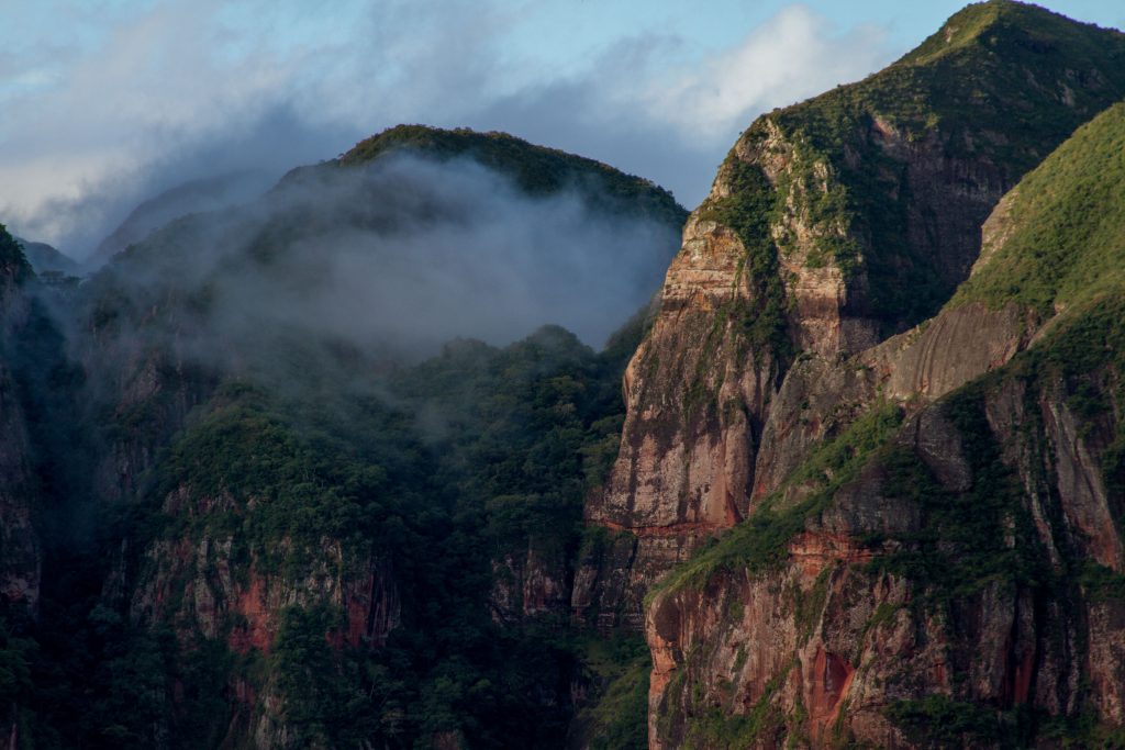
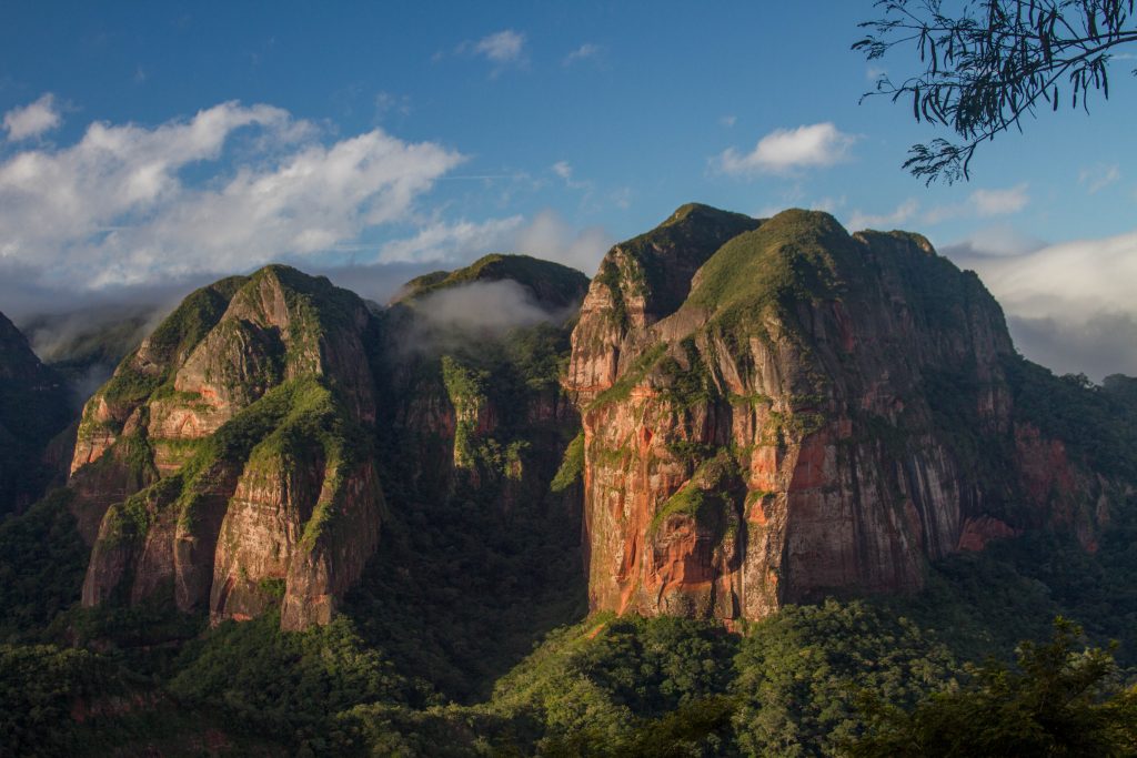
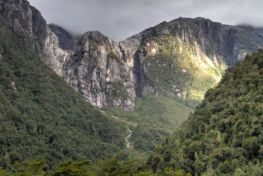
With stunning, breathtaking scenery the area is full of complex canyons, valleys and forests. 800m high vertical walls are surrounded by lush green tropical & subtropical forests. The park is well signed with heaps of trekking routes and viewpoints.
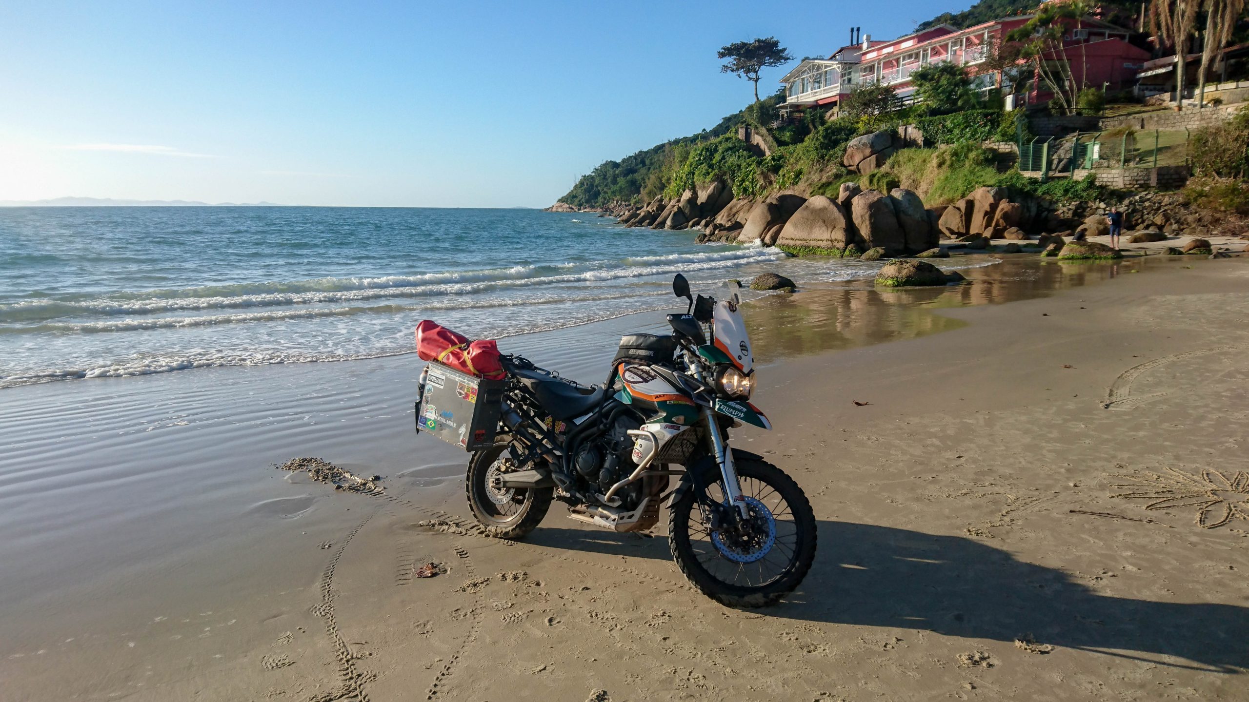
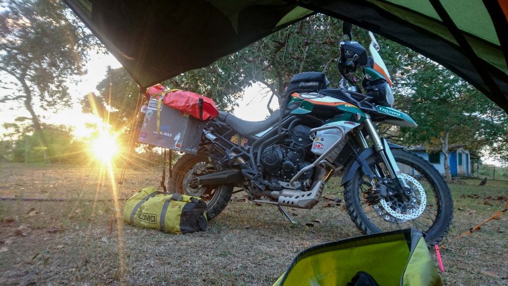
This Epic Ride takes place on the island of Santa Catarina in the Brazilian state with the same name. The island is about 54km long and is connected to the mainland via a few massive bridges.
Florianópolis city sits on the mainland side of the island which makes for a great mix of island and city life.
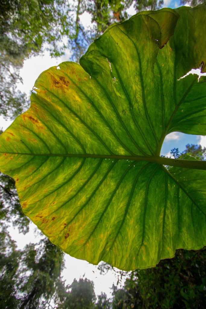
Portuguese for “beautiful”, bonito is a gem hidden far from any major city and in Amazon basin. This place boasts some of the world ‘best’ eco-tourism in South America. When entering this small and relaxed town, it is not exactly clear what amazing natural sites exist all around this unassuming area.
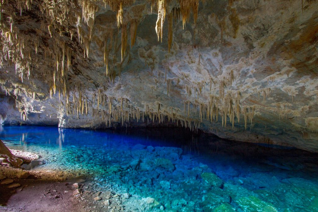
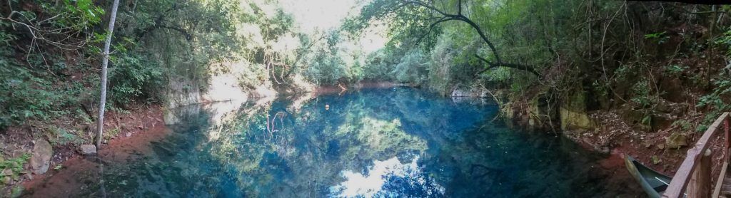
Between the months of September and February the waters of Gruta do Lago Azul take on an intense blue color. The site is protected and only open to scientists. Fossil bones have been found of large mammals that inhabited the region for more than 12,000 years. Including giant sloths, armadillos and sabre-toothed tigers.
Gruta do Lago Azul, Mato Grosso do Sul, Brazil
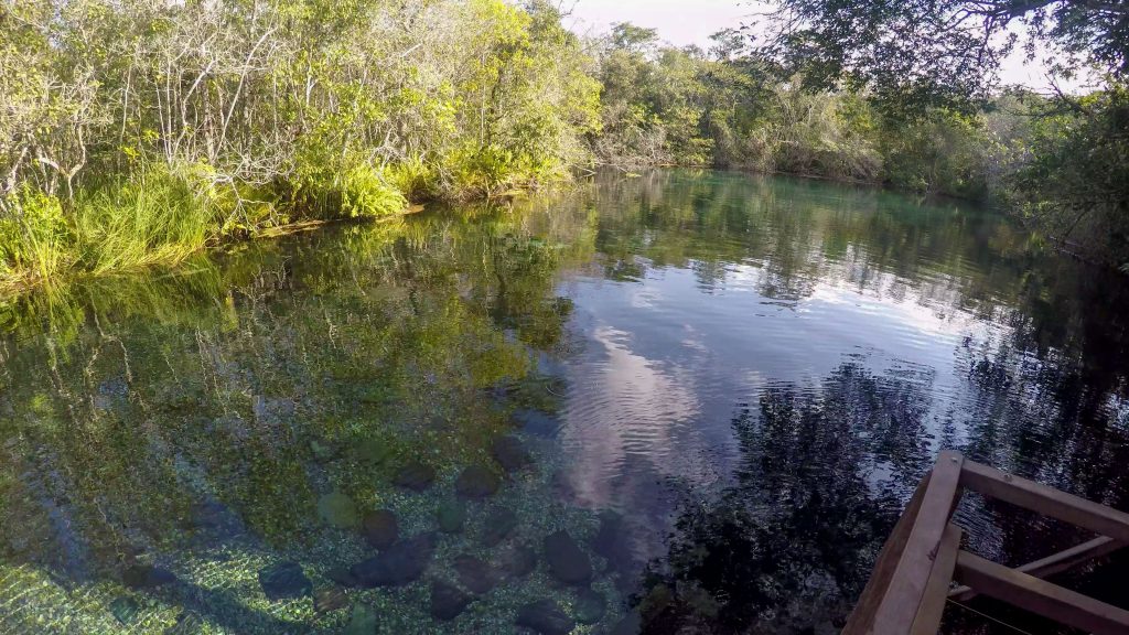
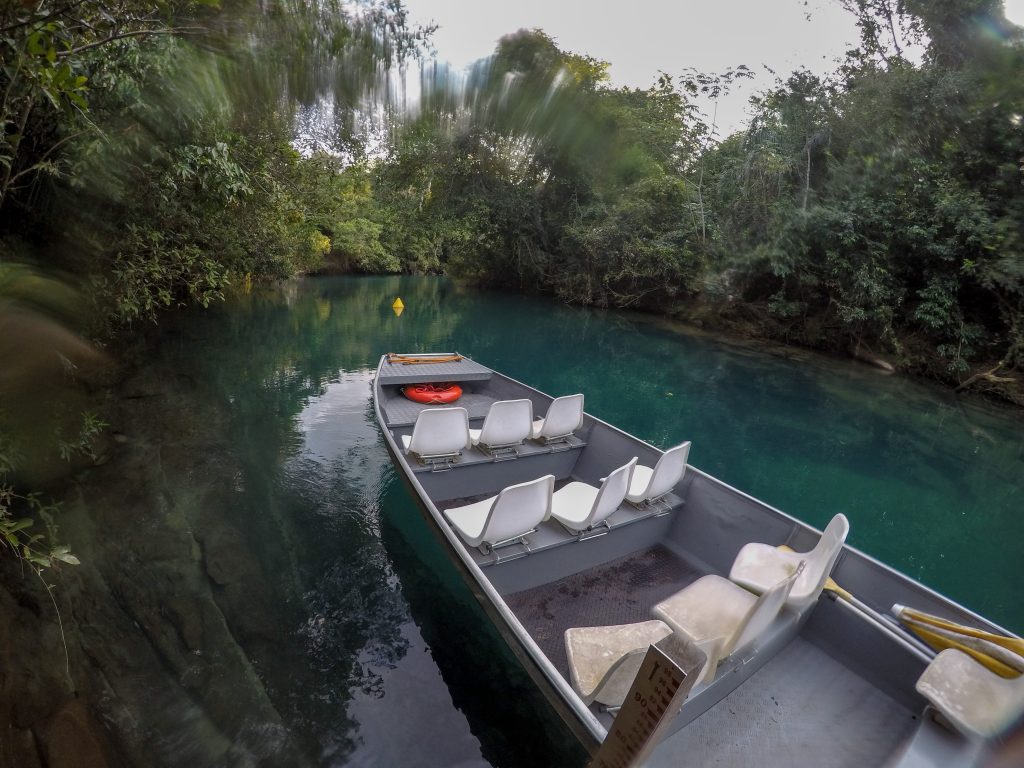
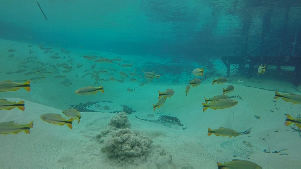
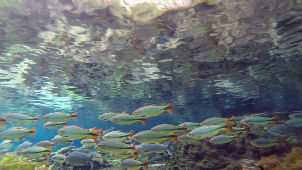
Rio da Prata
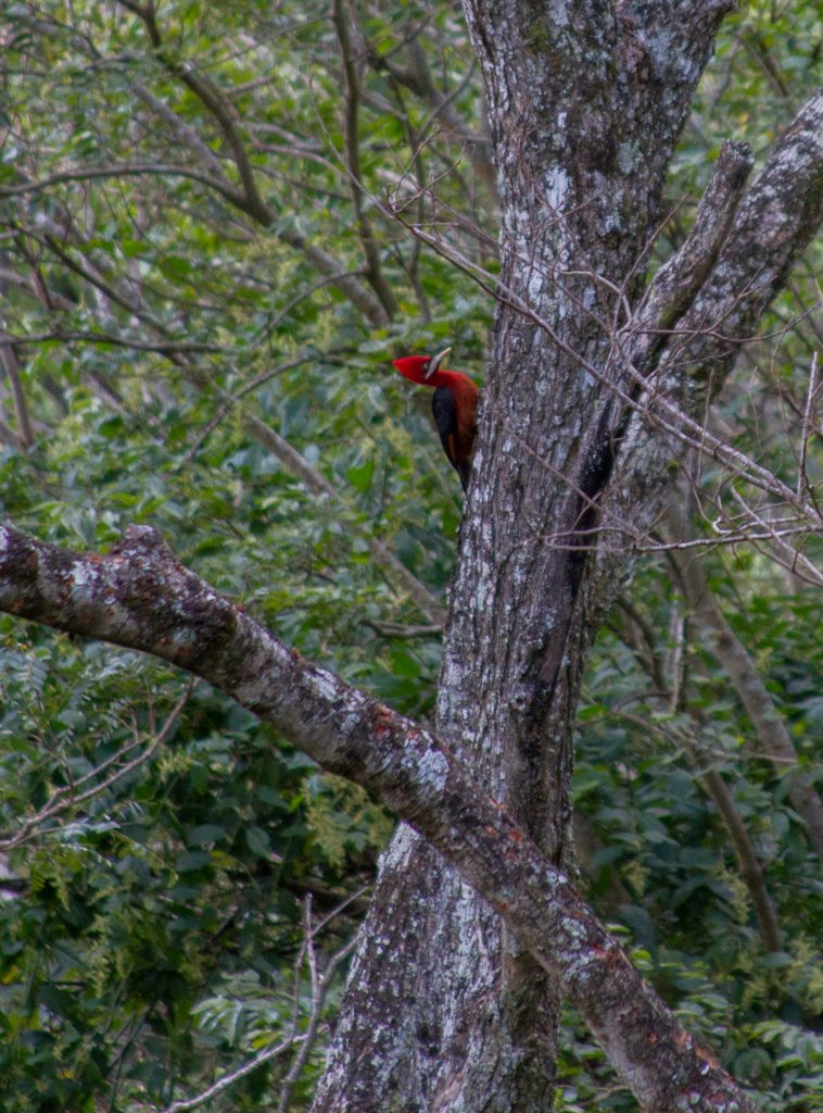
Snorkeling in crystal clear waters! The tour down Rio da Prata follows strict sustainability guidelines, meaning the tour groups are small. Gently float down the river whilst enjoying the many fish below and the colorful birds and monkeys in the tree above.
Rio da Prata , Mato Grosso do Sul, Brazil
Bonito, Mato Grosso do Sul, Brazil
Bonito, State of Mato Grosso do Sul, Brazil
Bonito, State of Mato Grosso do Sul, Brazil
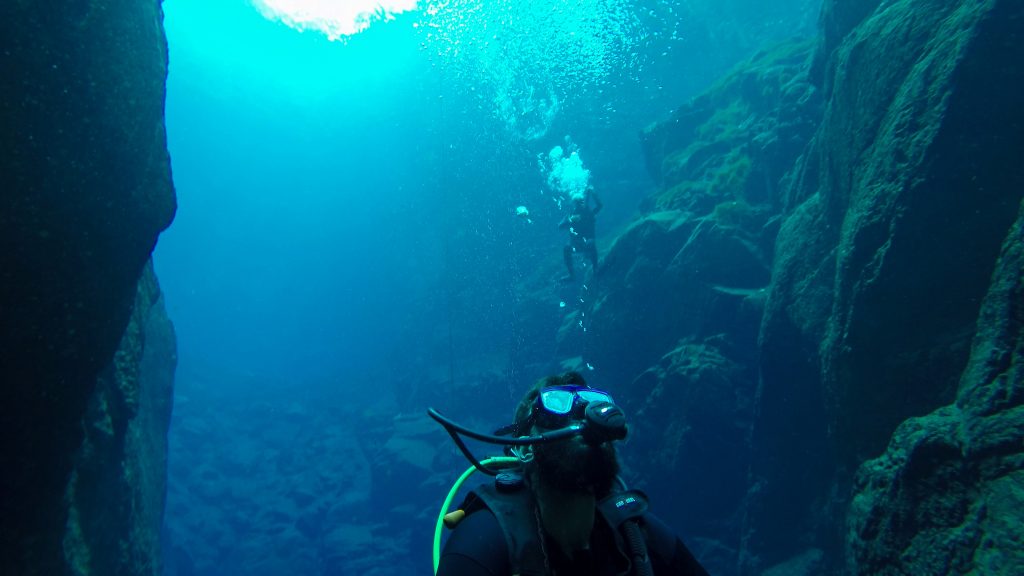
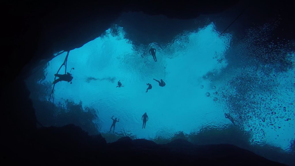
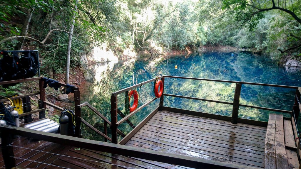
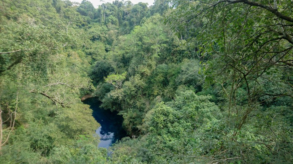
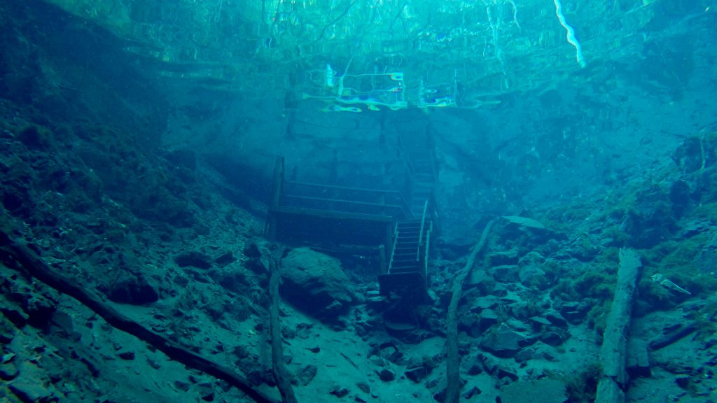
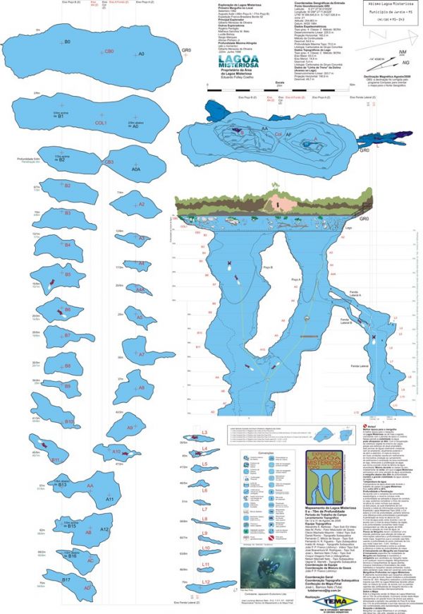
Mysterious Lake (Lagoa Misteriosa)
Lagoa Misteriosa, which translates as “Mysterious Lagoon”, is a lake at the bottom of a sinkhole, a type of geological formation common in limestone regions. This lake of transparent waters impresses visitors for its incredible depth. It is considered one of the deepest submerged caves in Brazil, with more than 220 meters of water column (maximum depth reached by professional cave diver Gilberto Menezes de Oliveira, in 1998), which explains why is called mysterious. Lagoa Misteriosa is a phreatic cave, that is, was formed by the flow of underground water that dissolved the limestone in its passage. These types of caves usually are flooded and do not have fragile mineral deposits, such as speleothems. The first dive at Lagoa Misteriosa was done in September 1992 by Augusto Auler, member of a French-Brazilian Expedition that came to Bonito on the same year. In 2008, a team of specialized divers mapped the cave until the depth of 70 meters. The Mysterious Lagoon was the first cave in Brazil to have a “Speleology Management Plan”, a document that comprehends the environmental diagnosis of the area and the guidelines for its conservation, approved by CECAV – the National Center for Research and Conservation of Caves in 2010.
Lagoa Misteriosa, which translates as “Mysterious Lagoon”, is a lake at the bottom of a sinkhole, a type of geological formation common in limestone regions. This lake of transparent waters impresses visitors for its incredible depth. It is considered one of the deepest submerged caves in Brazil, with more than 220 meters of water column (maximum depth reached by professional cave diver Gilberto Menezes de Oliveira, in 1998), which explains why is called mysterious. Lagoa Misteriosa is a phreatic cave, that is, was formed by the flow of underground water that dissolved the limestone in its passage. These types of caves usually are flooded and do not have fragile mineral deposits, such as speleothems. The first dive at Lagoa Misteriosa was done in September 1992 by Augusto Auler, member of a French-Brazilian Expedition that came to Bonito on the same year. In 2008, a team of specialized divers mapped the cave until the depth of 70 meters. The Mysterious Lagoon was the first cave in Brazil to have a “Speleology Management Plan”, a document that comprehends the environmental diagnosis of the area and the guidelines for its conservation, approved by CECAV – the National Center for Research and Conservation of Caves in 2010.
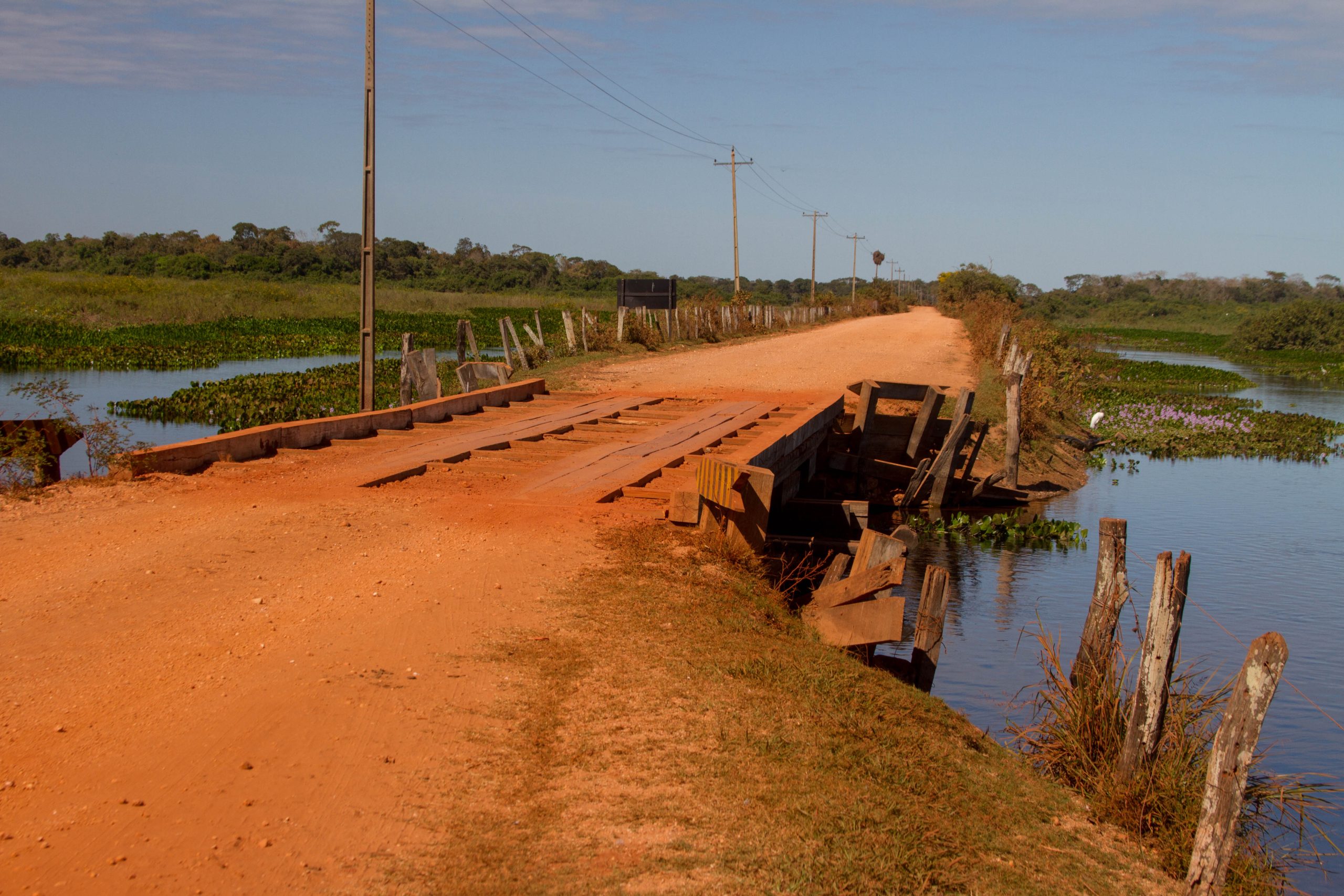
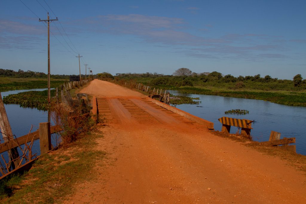
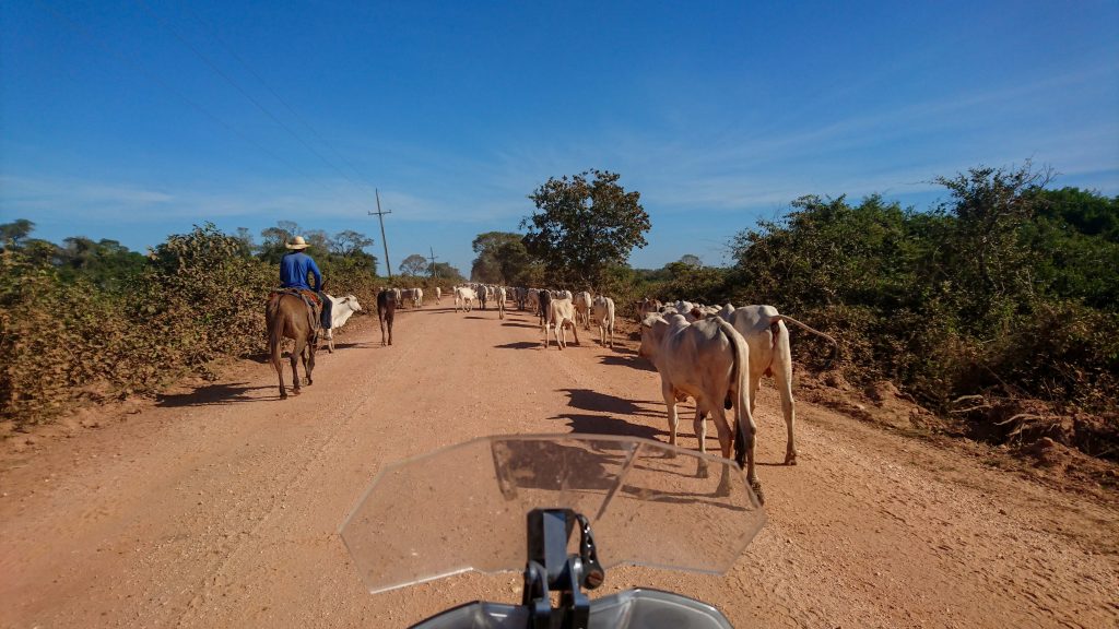
This Epic Ride is all dirt road and goes nowhere… well not exactly, the road is a link between the city of Poconé and the place of Porto Jofre. It’s 147 km long and crosses no less than 122 wooden bridges.
It was suppose to cut through the pantanal, but it was stopped half way because of either constant flooding or environmental reasons.
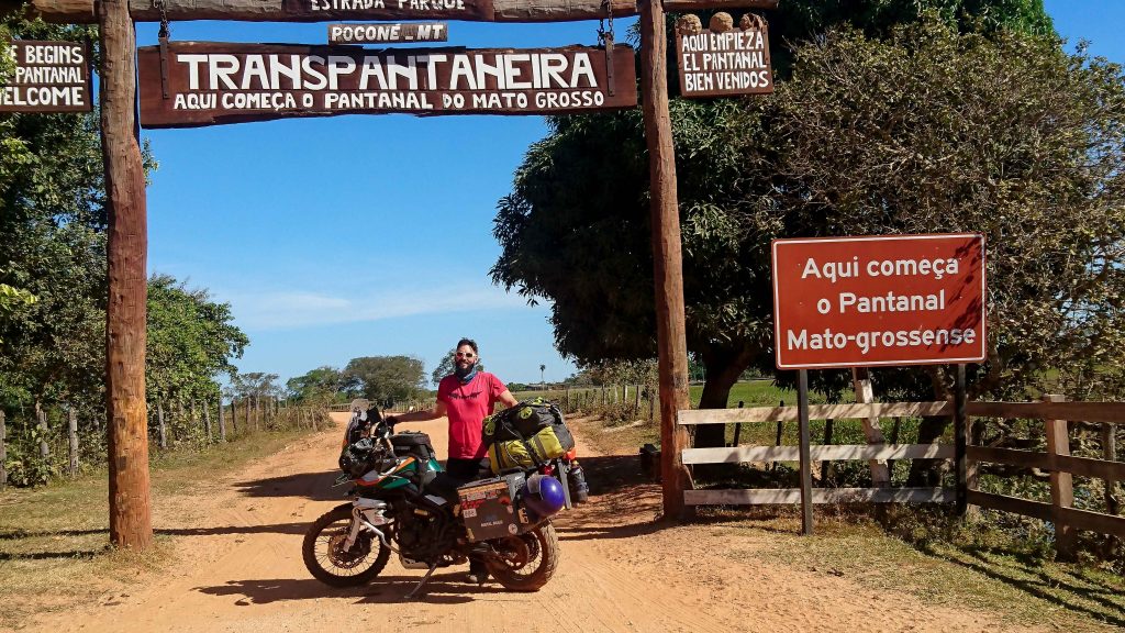
While it looks like the beginning of the Transpantaeria, this gate is actually a few kms into the 147km long dusty road. Most likely this is gate is used to close the road when it floods.
The Entrance gate is a great place to stop, get a photo and recharge before the long challenge ahead.
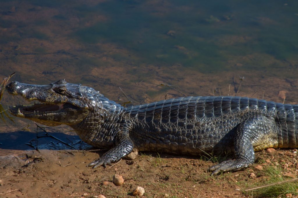
Whilst travelling along the transpantaneira, look over one of the many bridges your sure to find a number of caimans kicking back in the sun.
These guys are now protected and there are apparently over 10 million in the pantanal. crazy.
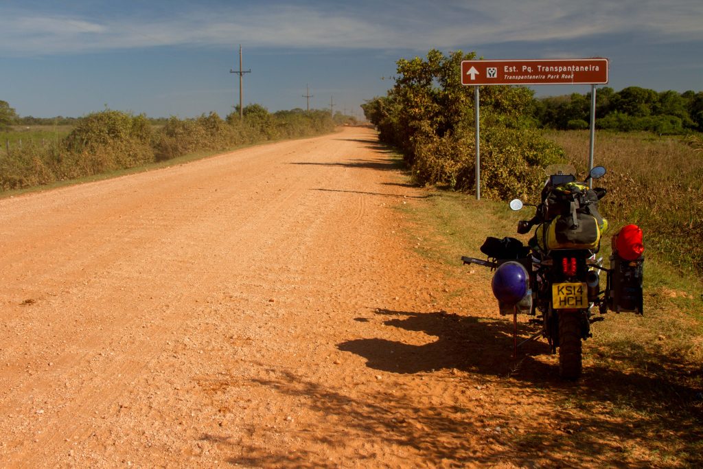
Transpantaneira, Pantanal, Brazil
Transpantaneira, Pantanal, Brazil
Transpantaneira, Pantanal, Brazil
Transpantaneira, Pantanal, Brazil
Transpantaneira, Pantanal, Brazil
Transpantaneira, Pantanal, Brazil
Transpantaneira, Pantanal, Brazil
Transpantaneira, Pantanal, Brazil
Why is it an ‘Epic Ride’
The transpantaneira boosts a lot of records. It has the most bridges for its length in the world. It is a dead end, so it has limited traffic. It goes through the biggest wetlands in the world.
It’s not prefect though, you will only be able to ride it in outside of the wet season… and in summer is it crazy hot.
There are many highlights around Samaipata, these are my favorites.
Samaipata town
Samaipata is a small town with numerous colonial buildings and narrow cobbled streets. It is a good mix of locals, expats and global tourists. Though it is not as touristy as the Bolivian sites in the highlands. It is strategically located near several tourist attractions such as El Fuerte de Samaipata, the Amboro National Park, El Codo de los Andes, Cuevas waterfalls, vineyards, rapids and lagoons. The local economy is mainly dedicated to tourism, agriculture (including its many vineyards) and crafts. Local farmers produce organic vegetables such as tomatoes, artichokes, lettuces and green beans. The region is also famous for its production of fruits such as peaches, grapes, plums, chirimoyas, guapurus, strawberries and figs. There is also a significant production of wines, singani, honey, marmalades, cold cuts, herbal infusions, lavender, art pieces and artisan crafts.
Amboro National Park
Amboro National Park is a nature reserve with over 912 species of birds, over 177 mammalian species including puma, ocelot, and the rare spectacled bear. Covering an area of 4,425 km² (1,709 sq mi), it is protected from human settlements, hunting, mining and deforestation, though problems with all these still exist within the park. The Carrasco National Park is placed adjacent to Amboró, and together the two form a larger conservation unit.
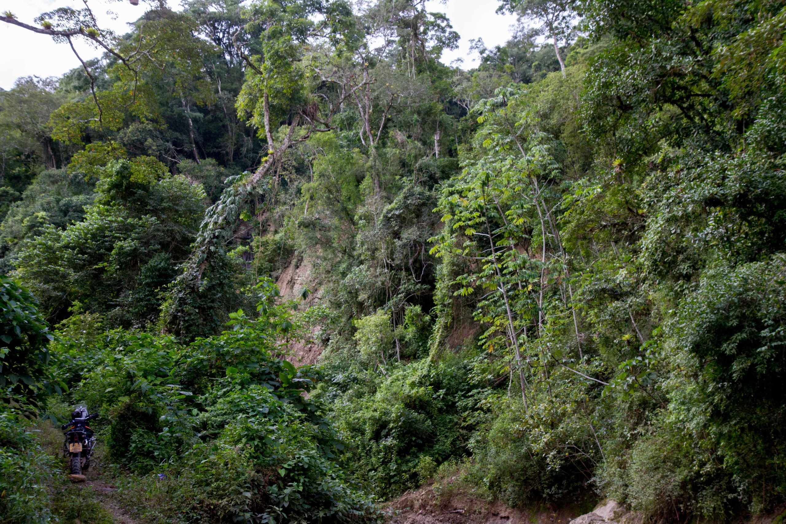
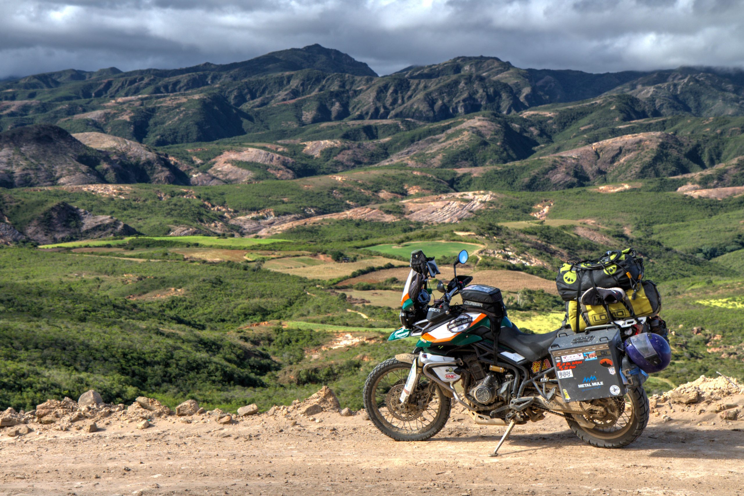
This Epic Ride is between the High and Low lands of Bolivia. Remote dirt roads, rolling lush green valleys, soaring condors and friendly villages dominate the route.
As of 2018, loose hard packed gravel. Because it is a mountainous road, it may become impassable during heavy rain. Some river crossing.
When is the best time to Ride?
All year, though avoid after heavy rain
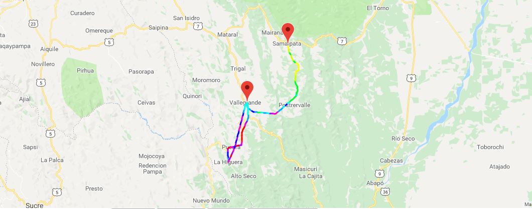
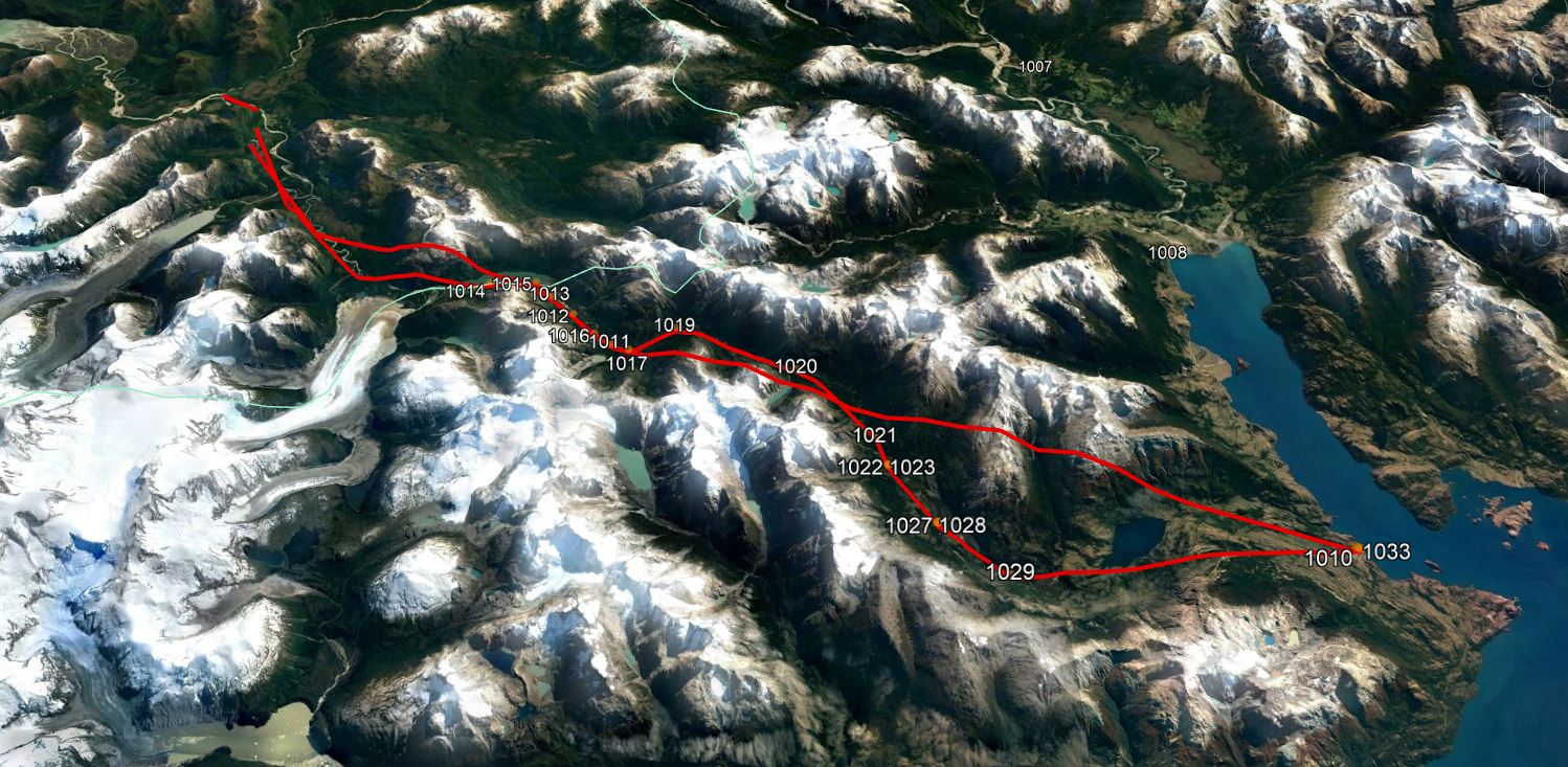
GPS Tracking Map
My tracking from Vallegrande to Samaipata (via La Higuera) . Tracking files can be downloaded here. (GPX/KML)
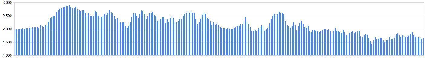
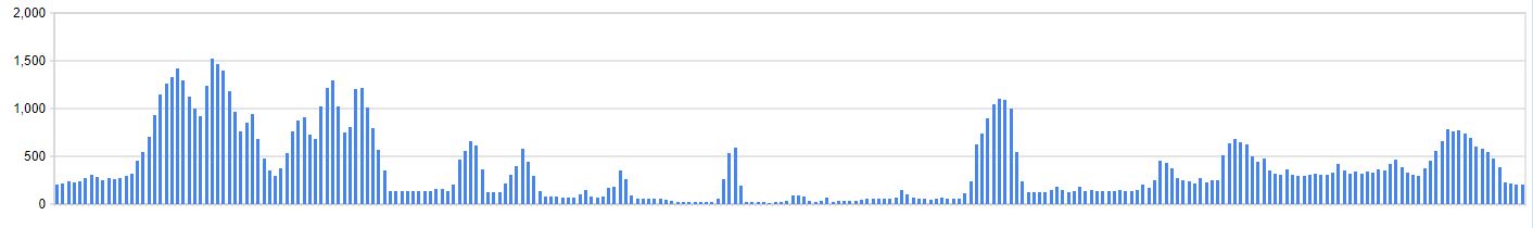
Elevation Profile
Highlights
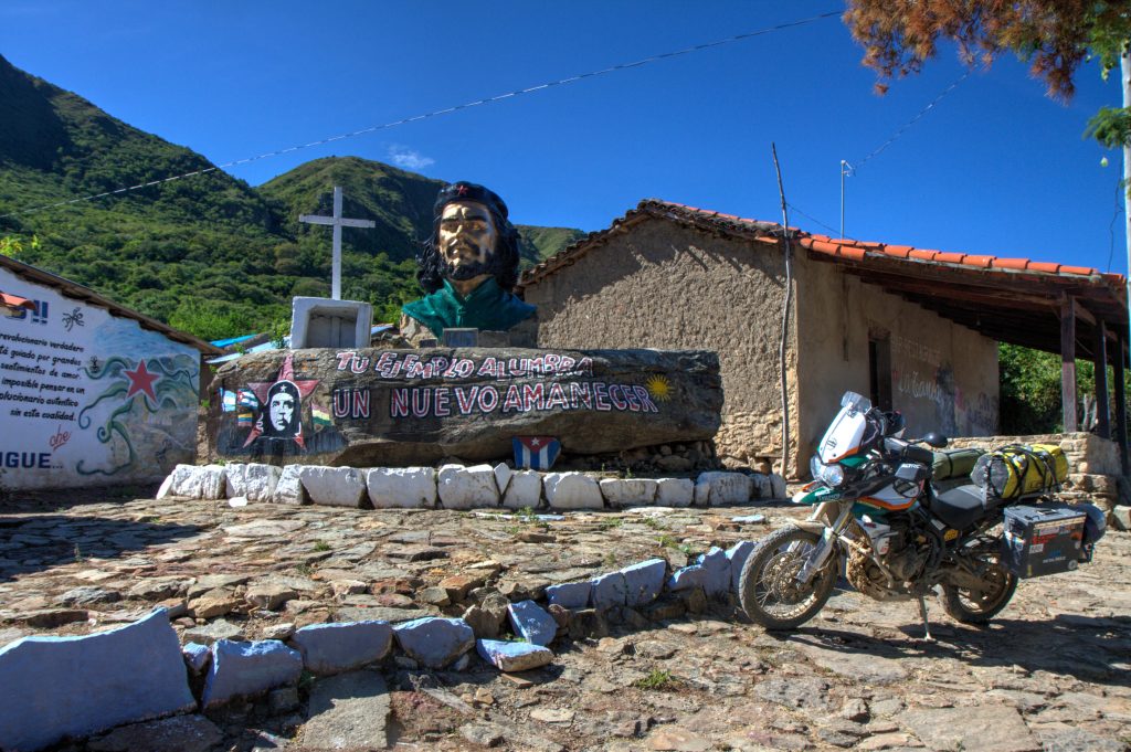
La Higuera
La Higuera lies at an elevation of 1950m, with a population of around 100 people. The village became famous in October 8, 1967 when Che Guevara was captured by the CIA-assisted Bolivian Army in the nearby ravine Quebrada del Churo, ending his campaign to create a continental revolution in South America. Che Guevara was held in the schoolhouse, where he was killed the next day. The body was then brought to Vallegrande, where it was placed on display and afterwards secretly buried under an airstrip.
The village is tiny and consists of only a school, main square and now two hostels. The whole village has several statues and monuments to Che.
La Higuera, Bolivia
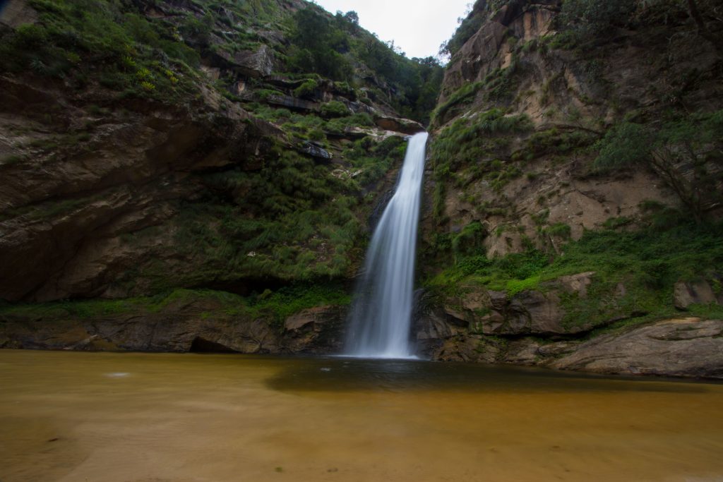
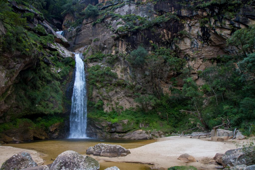
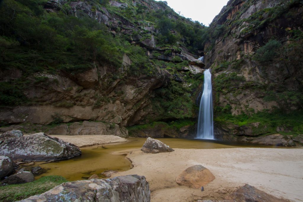
La Pajcha
La Pajcha is a lovely waterfall just off the road to Samaipata. It’s definitely worth a stop for a break after tackling the crazy roads.
Even if you’re staying in Samipata, it is only a 1hr 30min drive. Based on the time of year, you should have the place to yourself.
The highlight is a sandy beach (amazing site in land locked Bolivia)
Make sure you climb to the top of the waterfall. there is small goat track from the entrance on the left
La Pajcha, Bolivia
Here is a TimeLapse of the waterfall
Samaipata
Samaipata is place you’ll quickly fall for. It’s a small town in valley that has a great climate and a good mix or locals and expats. Check this separate post.
Why is it an ‘Epic Ride’
Let’s start with an overview. Like most places outside the cities in Bolivia, this route is remote and the roads are dirt and gravel. You won’t see many other vehicles on the road. This area was my favorite in Bolivia as the climate is mild and the rolling green valleys provide some stunning backdrops as you ride. The scenery is stunning. However, based on the weather, your visibility could be limited to white cloud meters in front of you or lust green valleys as far as you can see. This ride is also part of the “Ruta del Che” (Che Guevara Trail). check out my vBlog of the Route below.
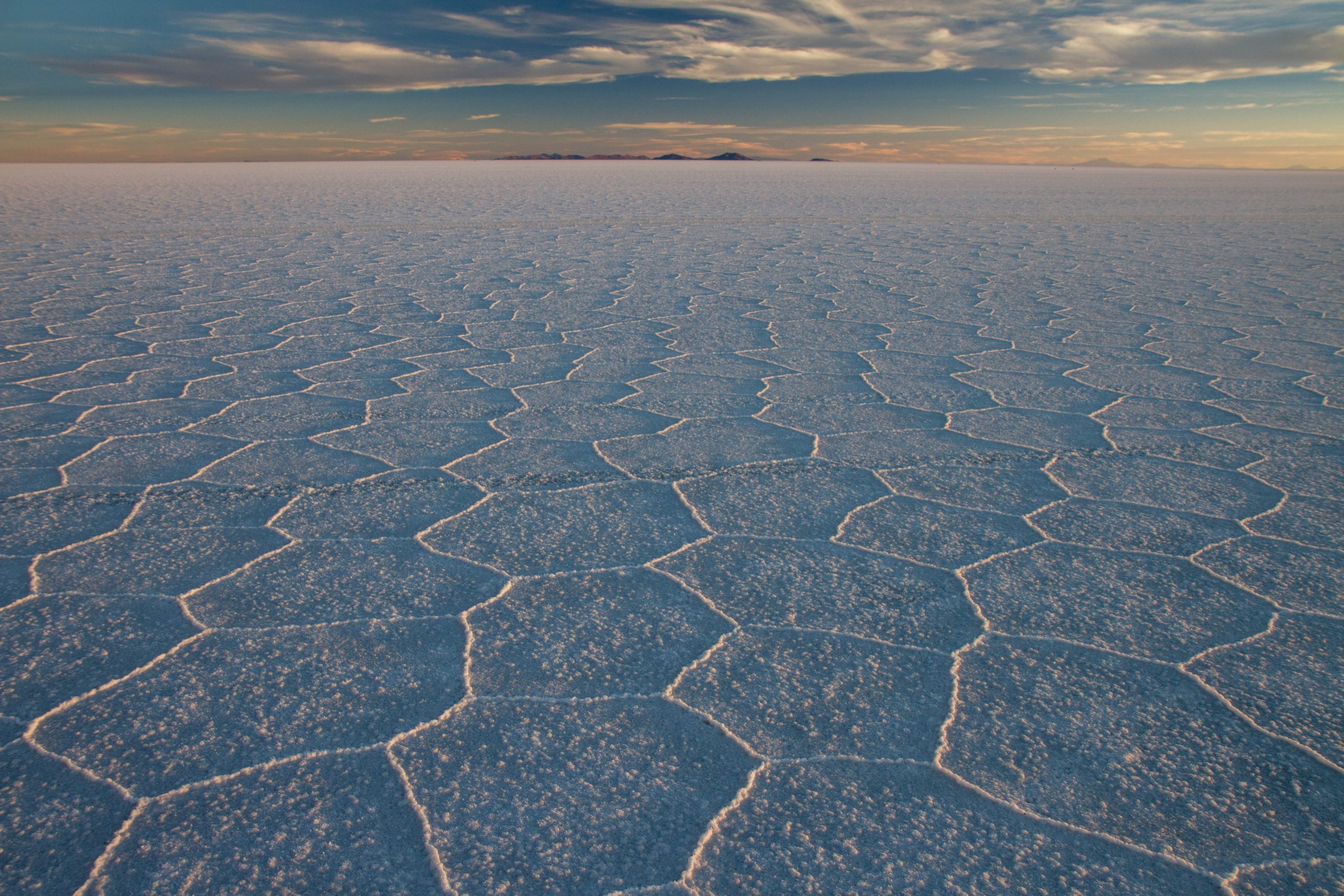
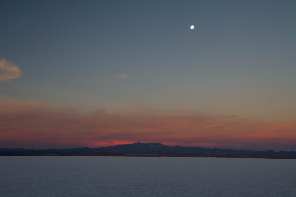
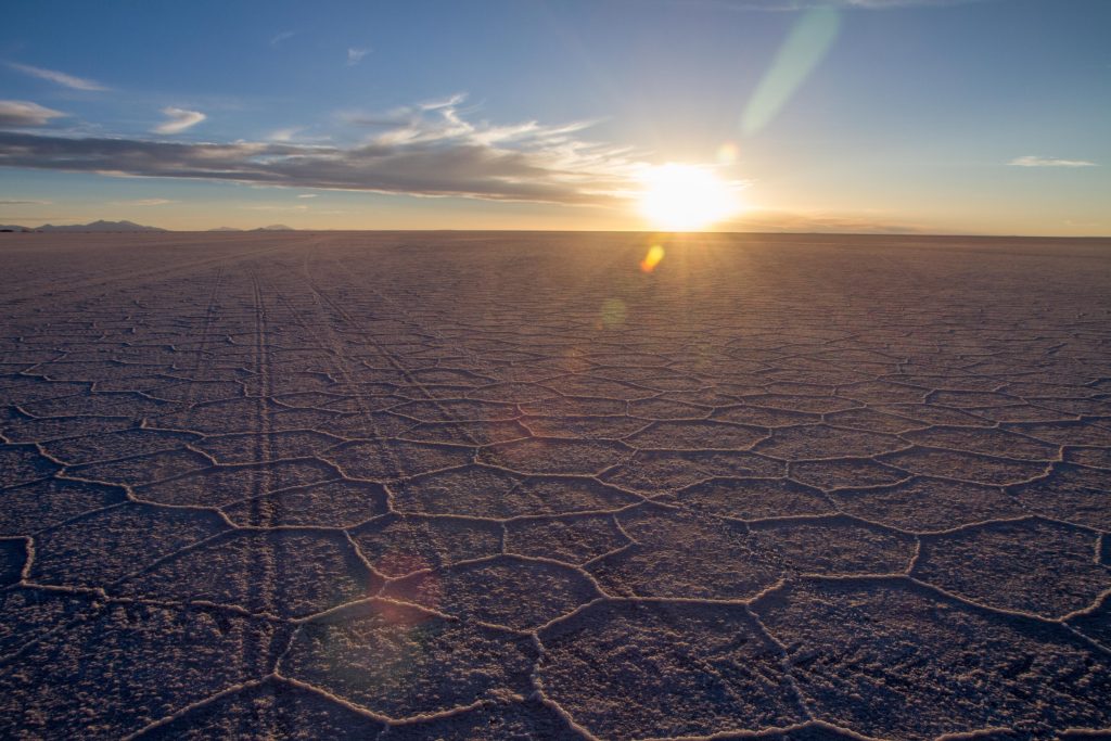
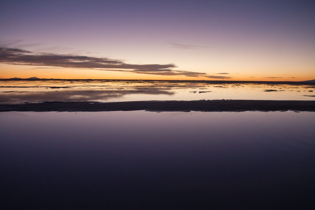
Uyuni Salt Flats (Salar de Uyuni) is the world’s largest salt flat, at 10,582 square kilometers (4,086 sq mi). It is in the Daniel Campos Province in Potosí in southwest Bolivia, near the crest of the Andes and is at an elevation of 3,656 meters (11,995 ft) above sea level.
The Salar was formed as a result of transformations between several prehistoric lakes. It is covered by a few meters of salt crust, which has an extraordinary flatness with the average elevation variations within one meter over the entire area of the Salar. The crust serves as a source of salt and covers a pool of brine, which is exceptionally rich in lithium. It contains 50% to 70% of the world’s known lithium reserves. The large area, clear skies, and exceptional flatness of the surface make the Salar an ideal object for calibrating the altimeters of Earth observation satellites. Following rain, a thin layer of dead calm water transforms the flat into the world’s largest mirror, 129 kilometres (80 miles) across.
The Salar serves as the major transport route across the Bolivian Altiplano and is a major breeding ground for several species of flamingos.
Its truly one of the most amazing places in South America.
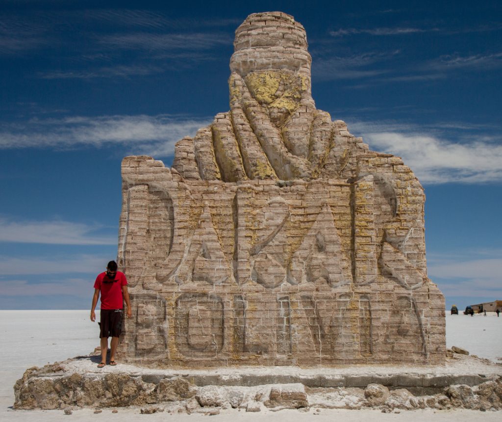
The Dakar Monument was created in 2014 to celebrate the arrival of the famous rally to the Salar. It has since been a massive draw card for tourists that visit the Salar every year.
Uyuni Salt Flats, BoliviaPlaza de las Banderas Uyuni, Bolivia
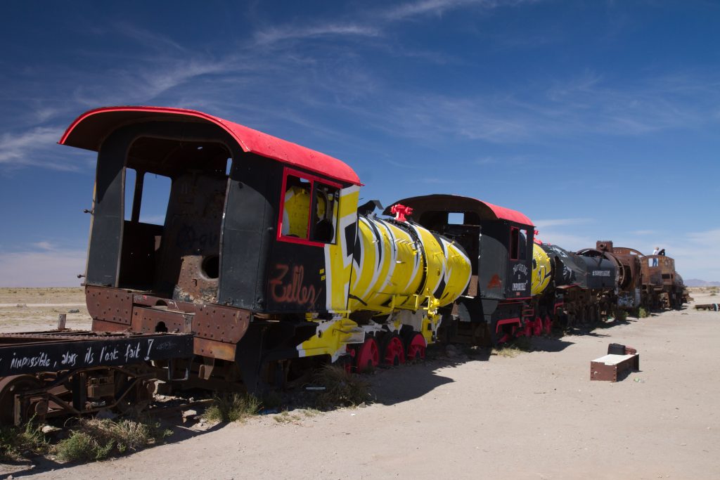
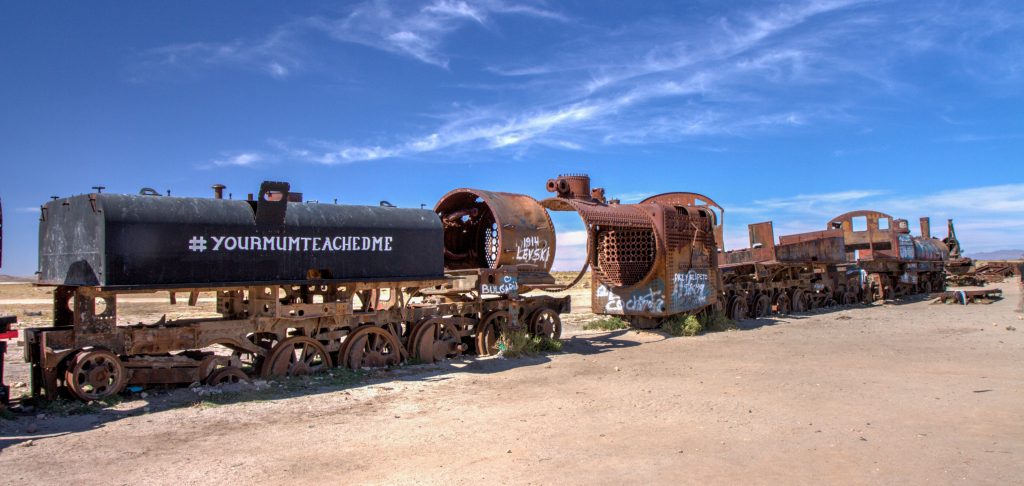
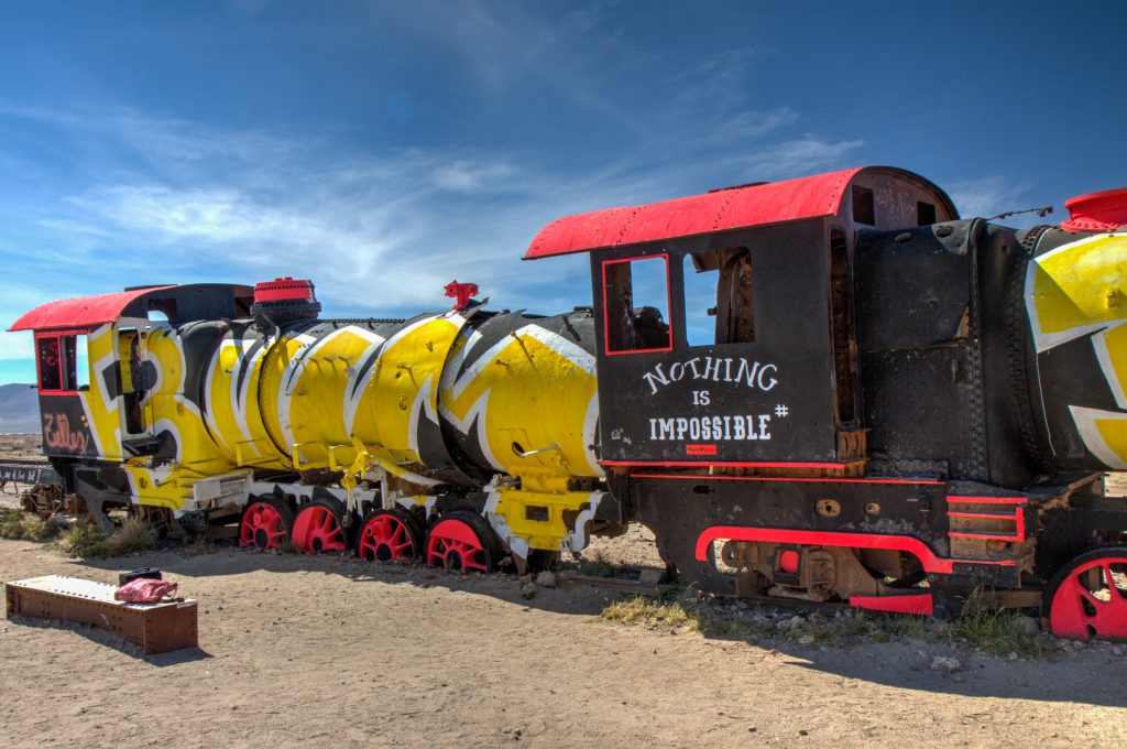
Train Cemetery
It’s steel vs salt in this unique grave yard of old trains, some dating back to the early 20th century and mostly from Britain.
Train Cemetery, Uyuni, Bolivia
Train Cemetery, Uyuni, Bolivia
Train Cemetery, Uyuni, Bolivia
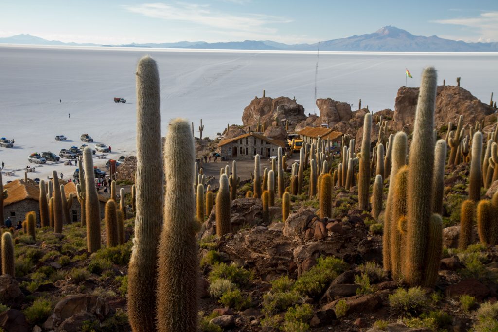
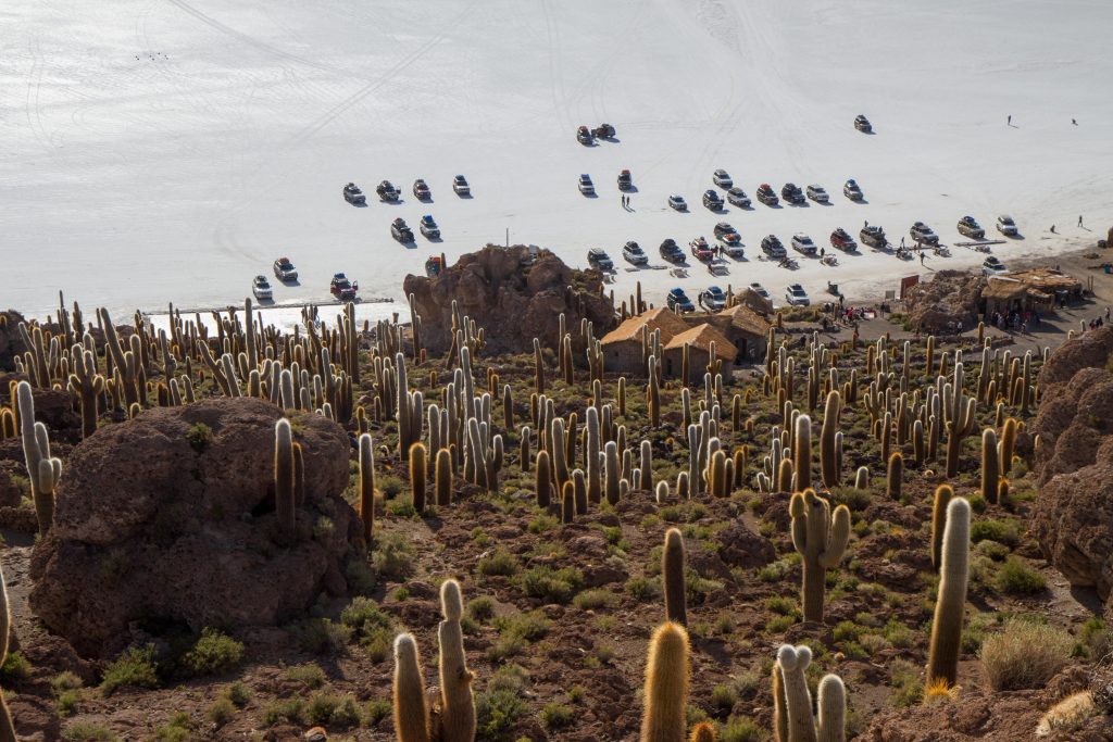
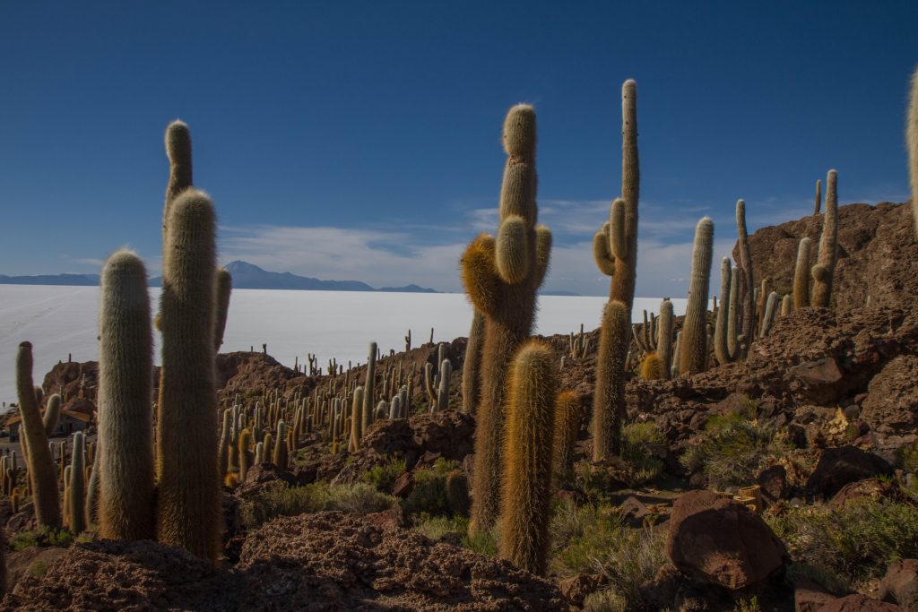
Incahuasi Island
This island sit in the middle of the Salar, and if that is not amazing enough it is also covered in giant cacti.
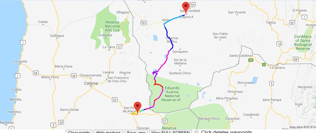
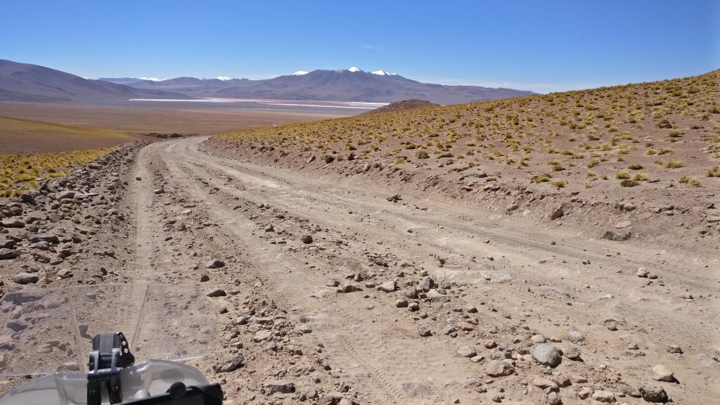
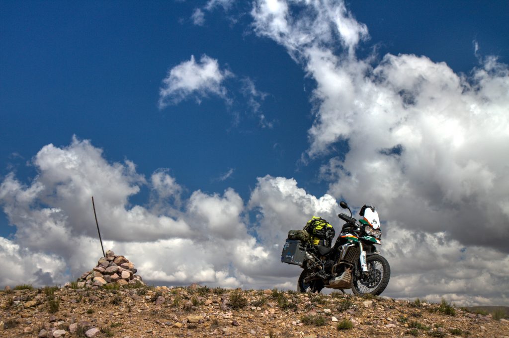
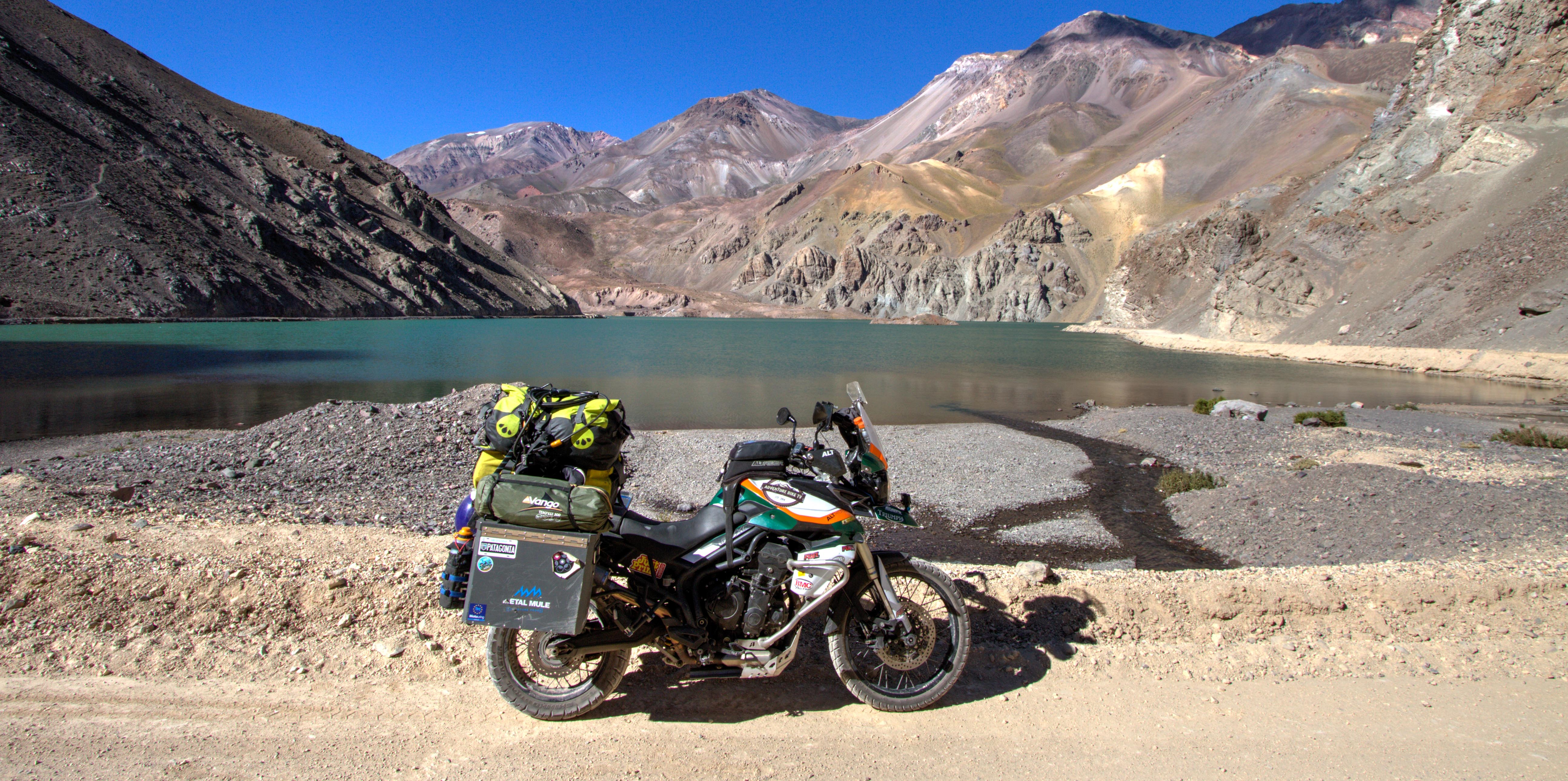
This ride starts in either Bolivia or Chile. This Pass, as the name suggests, travels via numerous Lagoons. Sounds ok right? Well it is and SO MUCH more.
As of 2018, loose hard packed gravel and some sand.
Laguna Blanca, Bolivia
When is the best time to Ride?
November to March. Even during these months it will be chilly (especially at night)
GPS Tracking Map
My tracking from Chile to Bolivia via the Laguna Pass. Tracking files can be downloaded here. (GPX/KML)
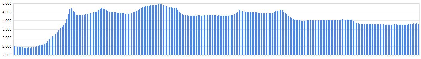
Elevation Profile
The Ride
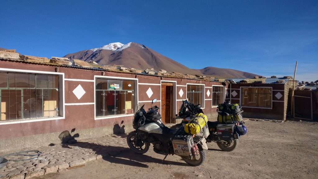
Let’s start with an overview. This area is the most isolated in Bolivia, maybe the world. As you can see above, the elevation profile for this ride is high. Very high. Planning is required for this route.
Weather
This route is only be passable in summer months. Of course there are variables in weather, so check before attempting this route as it takes a few days to complete.
Fuel
The distance on this ride is approx. 350km. From San Perdo de Atacama to the first fuel station in Bolivia. Fill up in San Perdo and bring a secondary fuel can that allows you to be able to make this distance plus have enough spare in case of emergency. (Whilst the route is very remote and isolated, the are alot of 4wd vehicles running tourists back and forward from San Pedro de Atacama to the Salt Flats of Uyuni. )
Why is it an ‘Epic Ride’
The scenery is stunning. The roads are difficult and will test your riding skills. The altitude is high, you’ll be out of breath. But once you make it back to civilization, you’ll be smiling ear to ear.
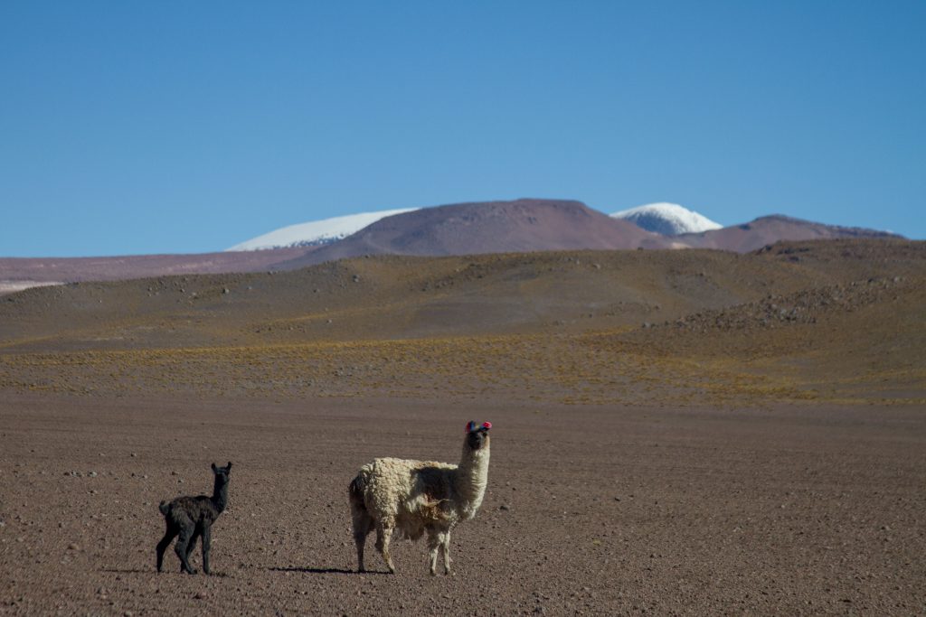
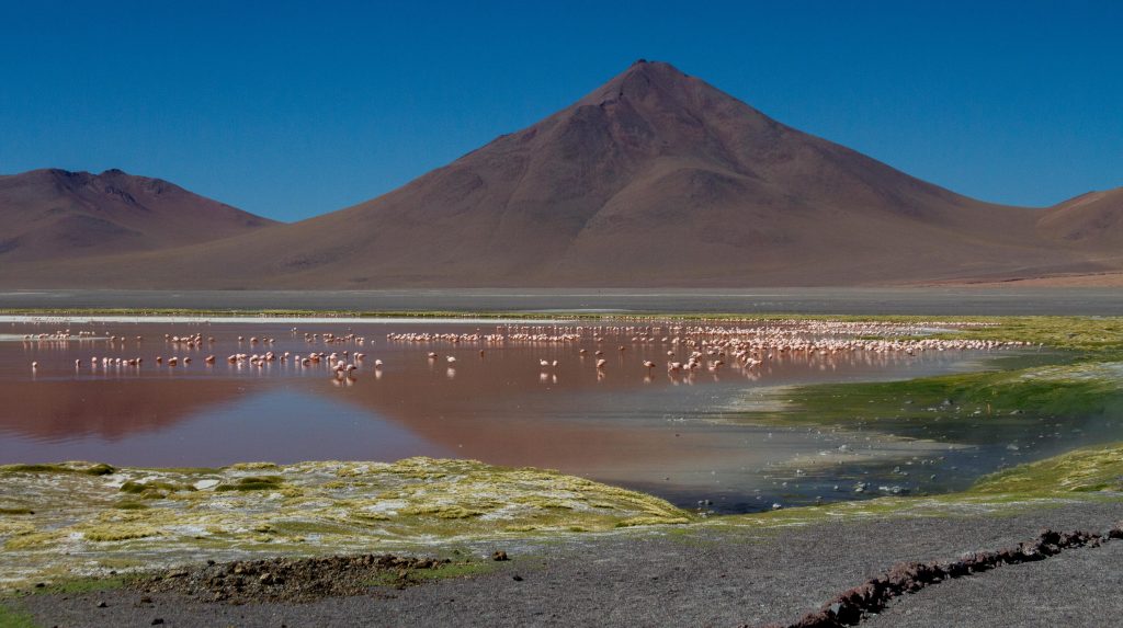
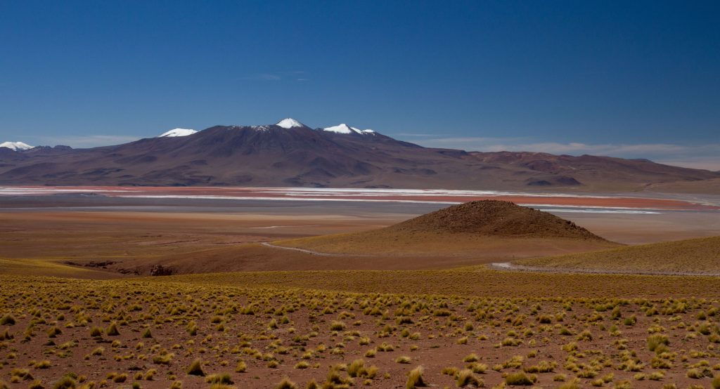
Reserva Nacional de Fauna Andina Eduardo Avaroa, Bolivia
Laguna Colorada, Bolivia
Reserva Nacional de Fauna Andina Eduardo Avaroa, Bolivia
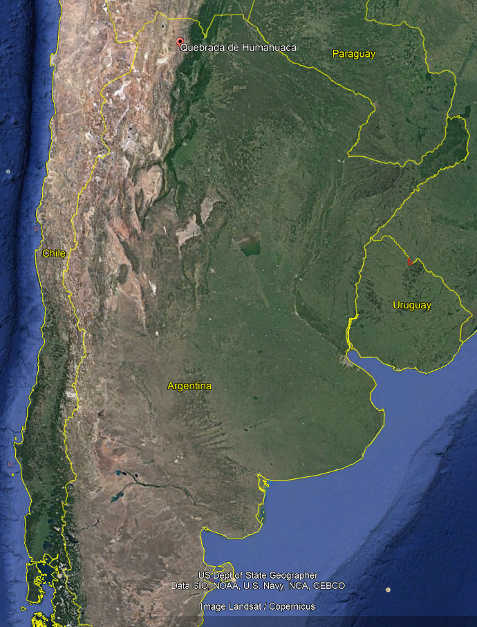
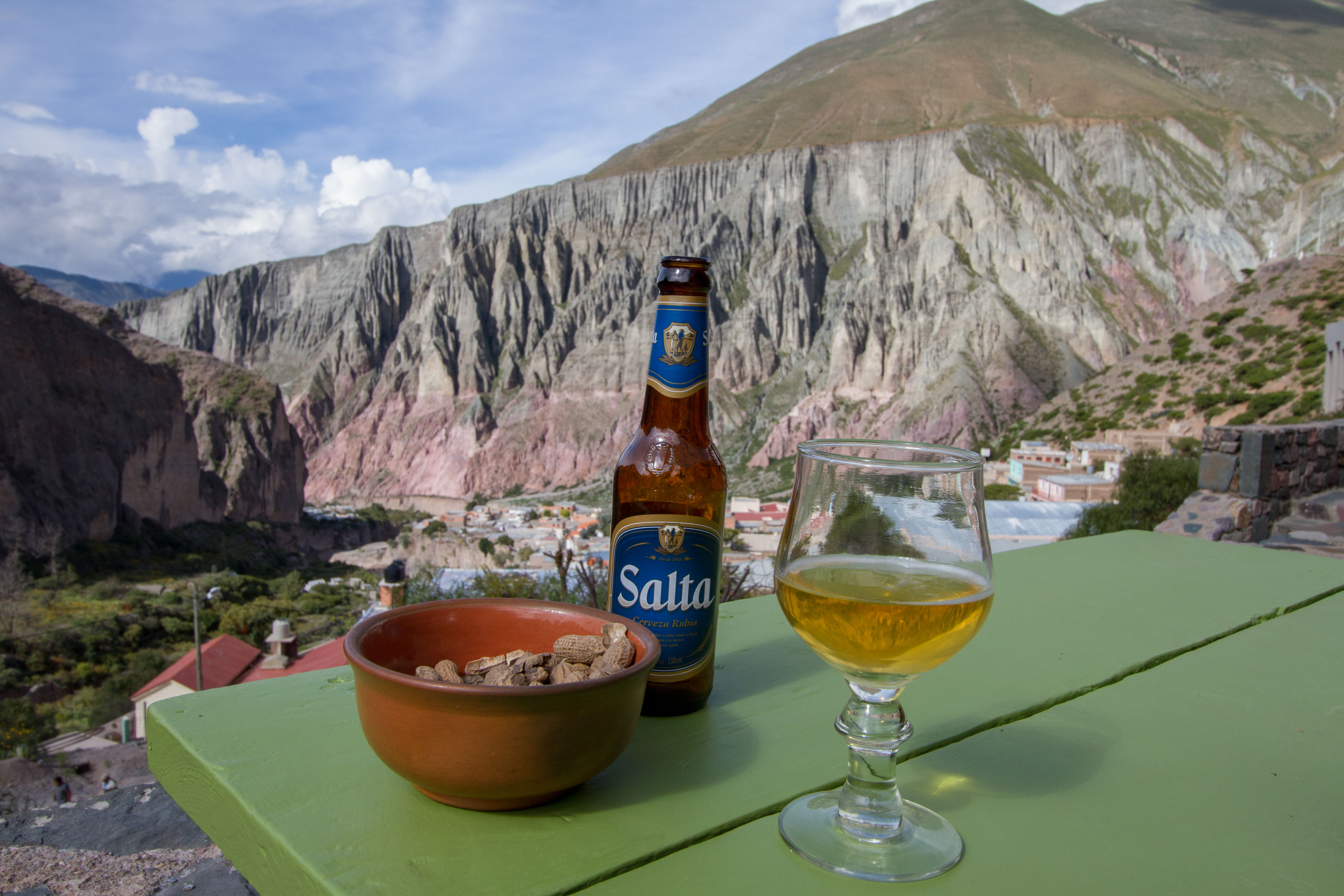
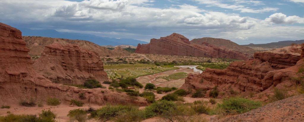
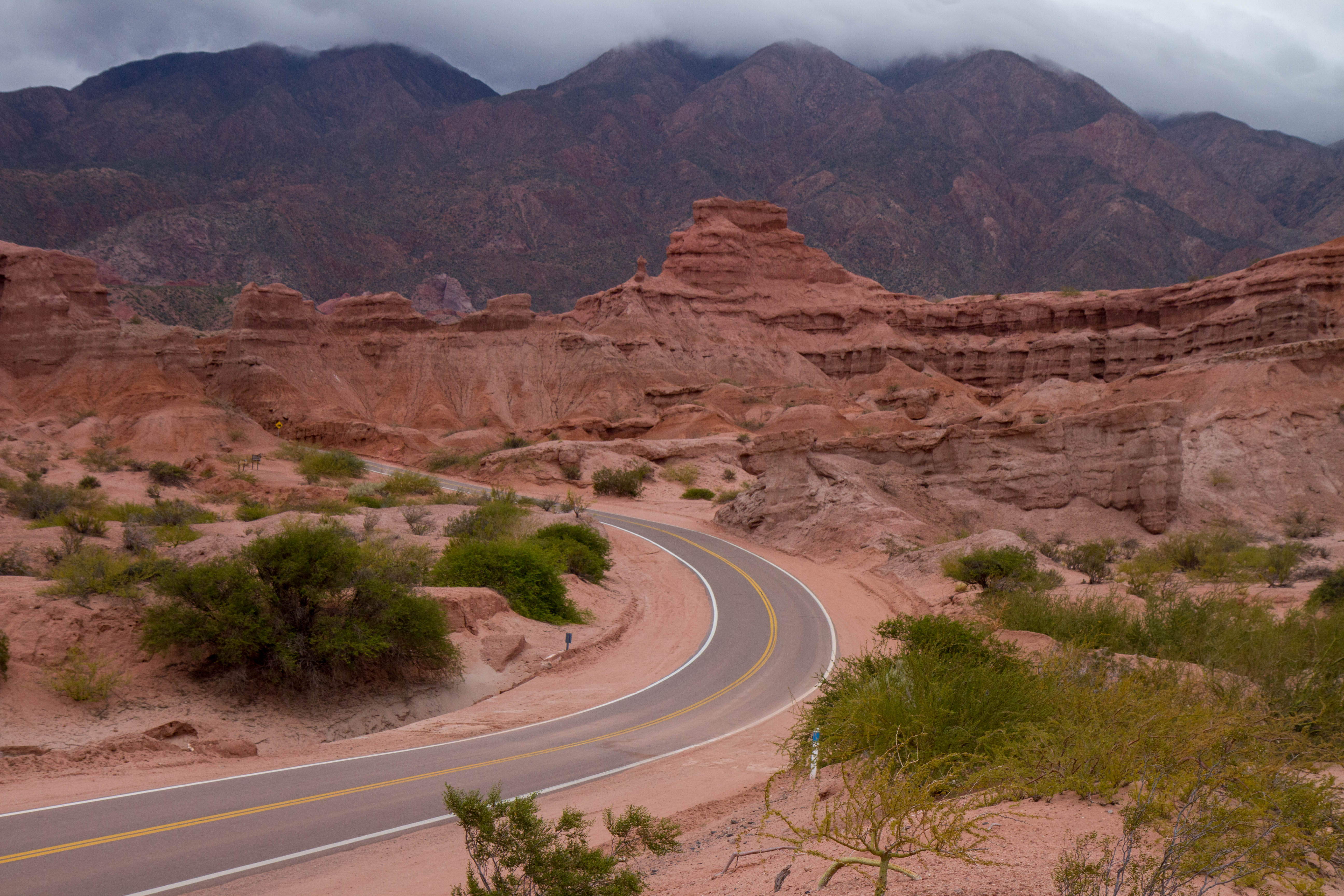
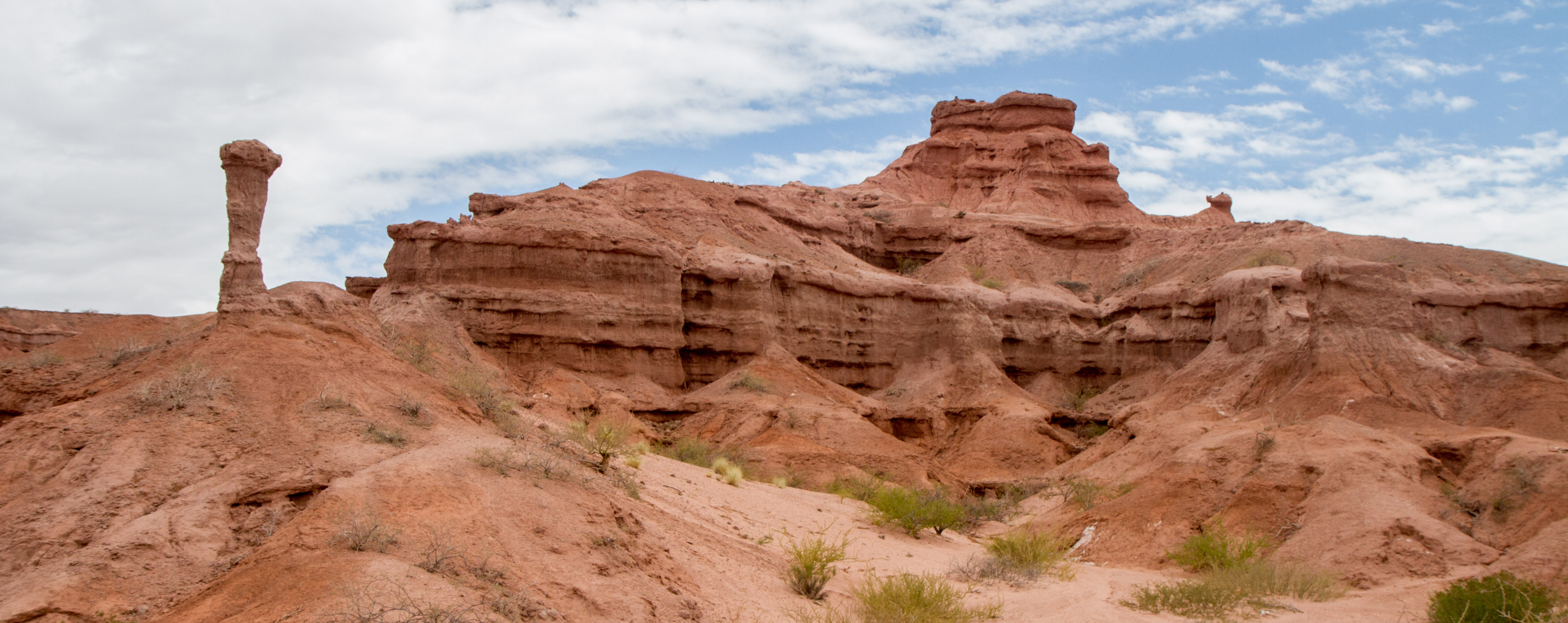
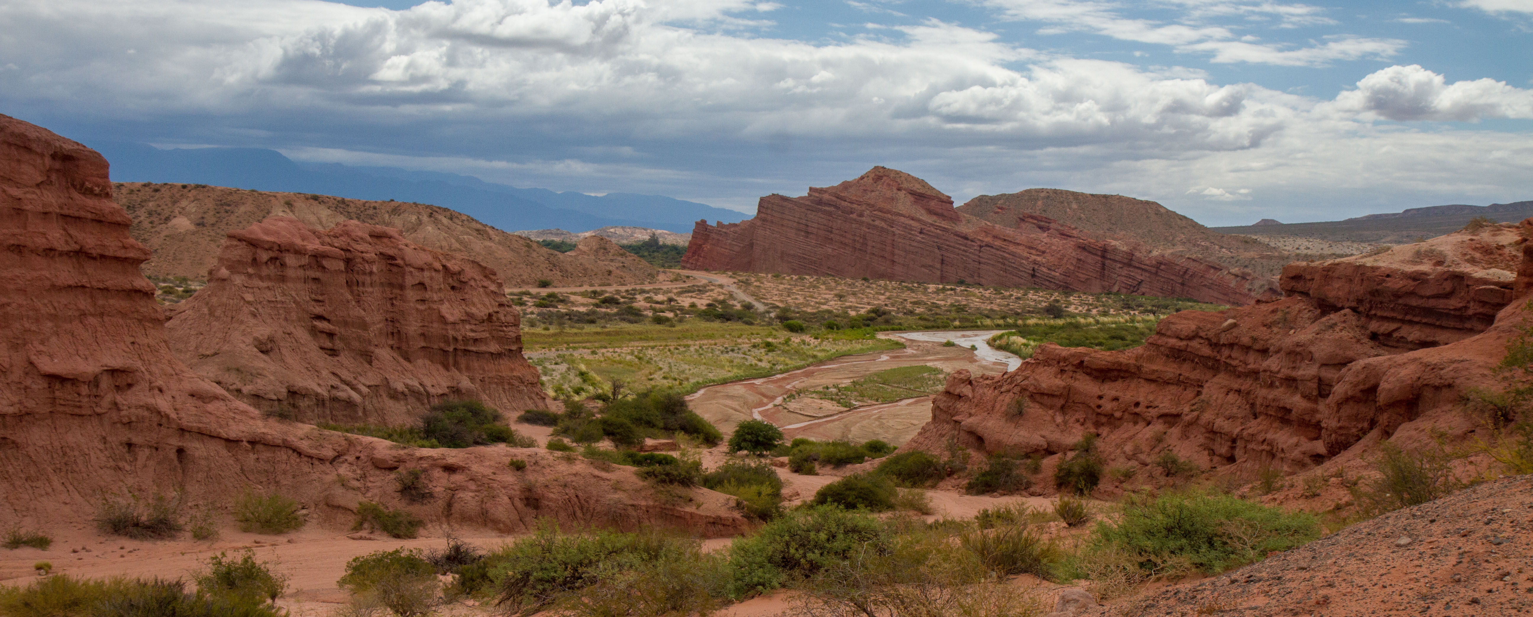
Quebrada de Humahuaca (Humahuaca Valley), is located in the Jujuy province of Argentina. It is narrow mountain valley that contains many villages in which are the oldest settlements in Argentina. The valley runs north to south and can be easily accessed when travelling to/from Bolivia or Chile.
There are many highlights along the valley, these are my favorites (Some are just outside the valley)
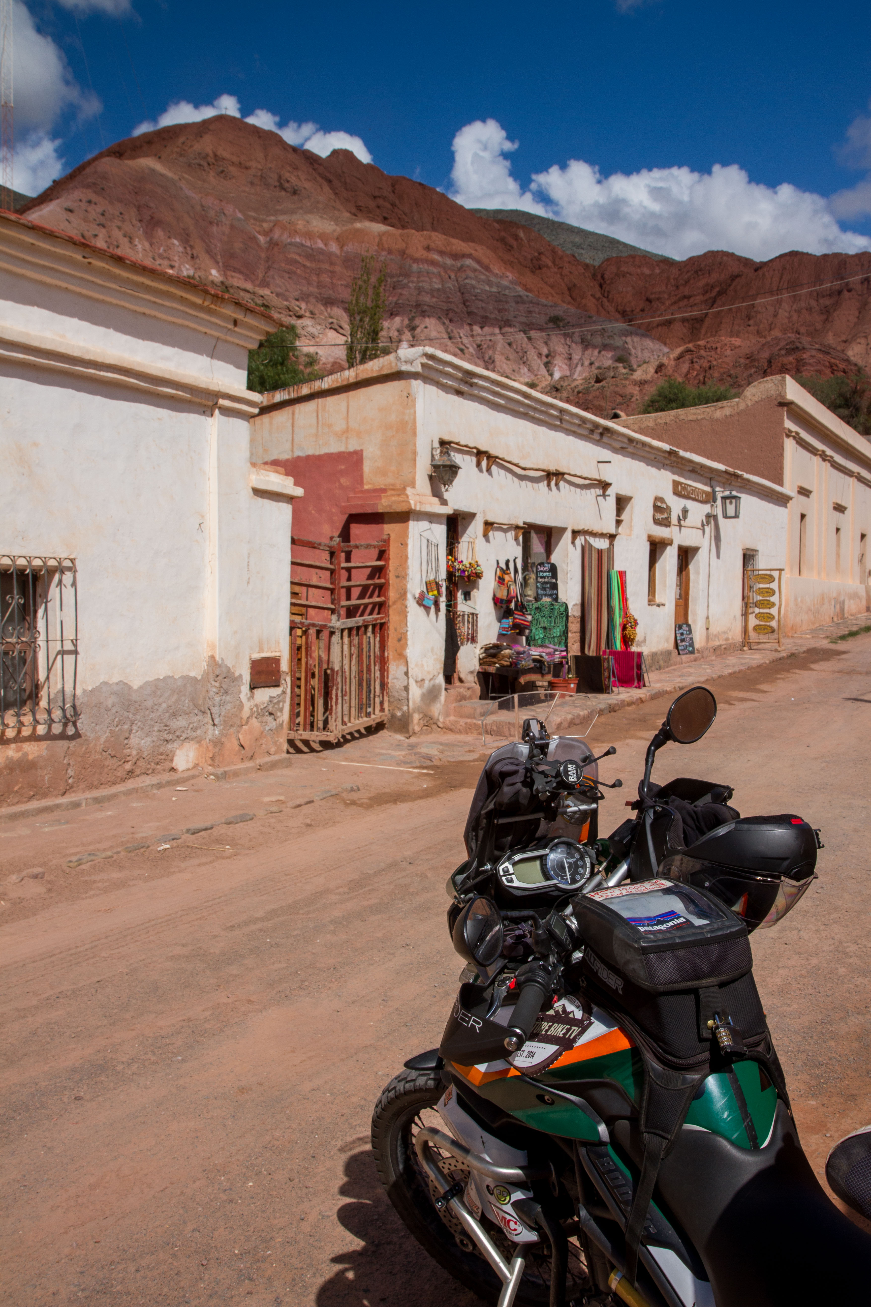
Purmamarca
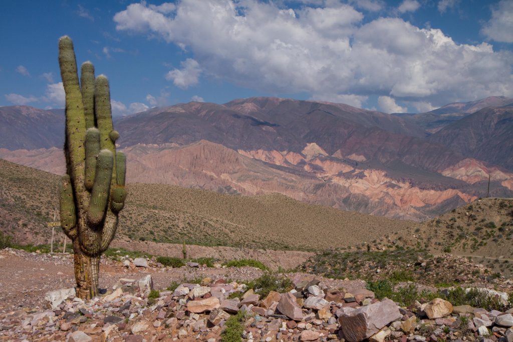
Purmamarca actually is located off the main road in the valley. It is on the road towards Attacama desert in chile via the amazing Paso de Jama. This makes it a great stop on the way to and from Chile. The town is very small and was the most ‘touristy’ town in the area. Best for a day trip, check out the main square which is full of markets stalls. Another site is the Cerro de los Siete Colores (The hill of seven colours). It has a unique color range that is the product of a complex geological history including marine sediments, lake and river movements elevated with the movement of the tectonic plates.
Purmamarca, Jujuy, Argentina
Tilcara
I found Tilcara to be the best place to stay as it has alot of hostel options and great restaurants (more than the other towns). Traces of human habitation in the area date back more than 10,000 years, making it one of the oldest continuously inhabited settlements of Argentina. There is also an amazing day hike to ‘Devils Throat’, that has great views of the area, waterfalls, and a water aqua-duct.
Jujuy, Argentina
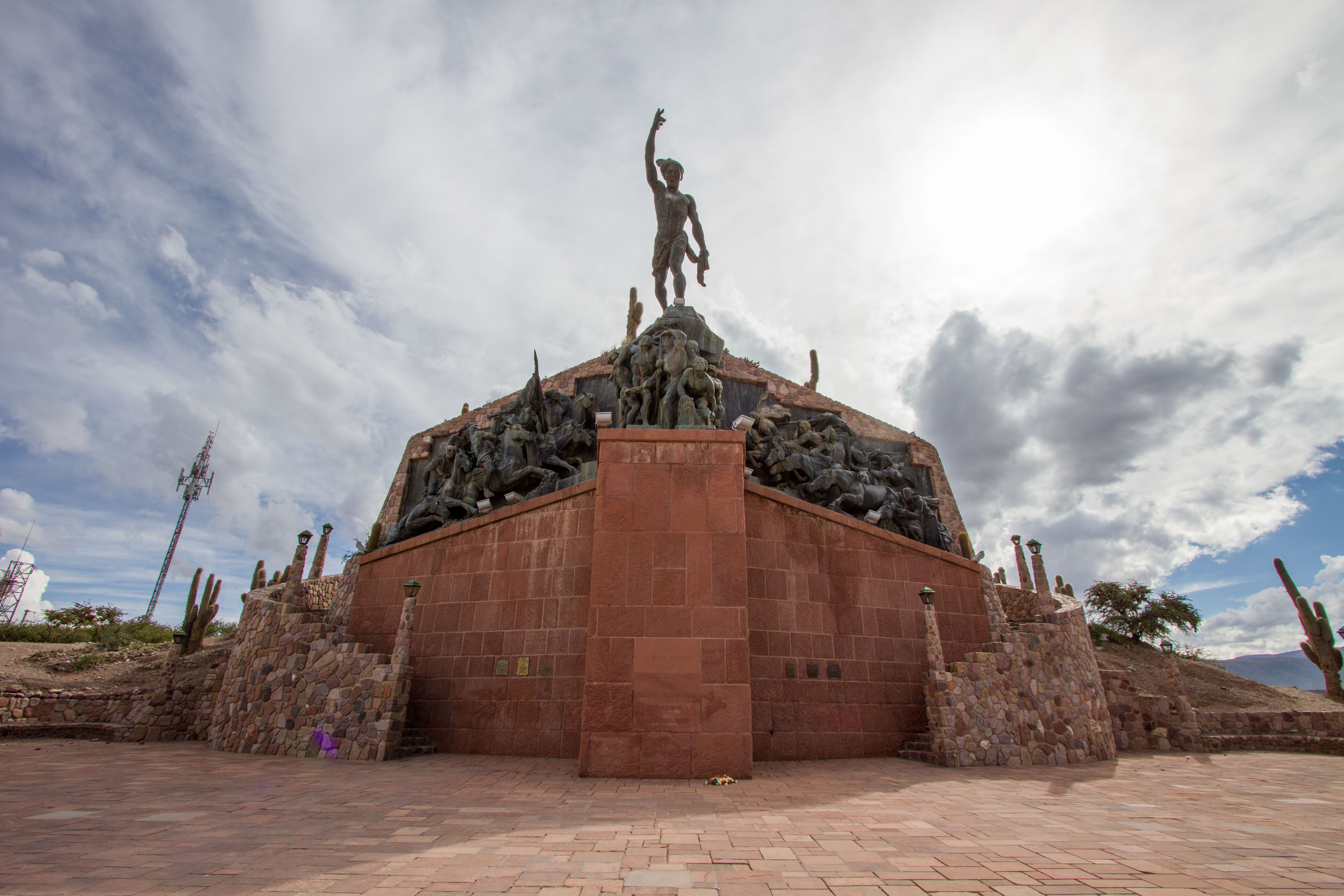
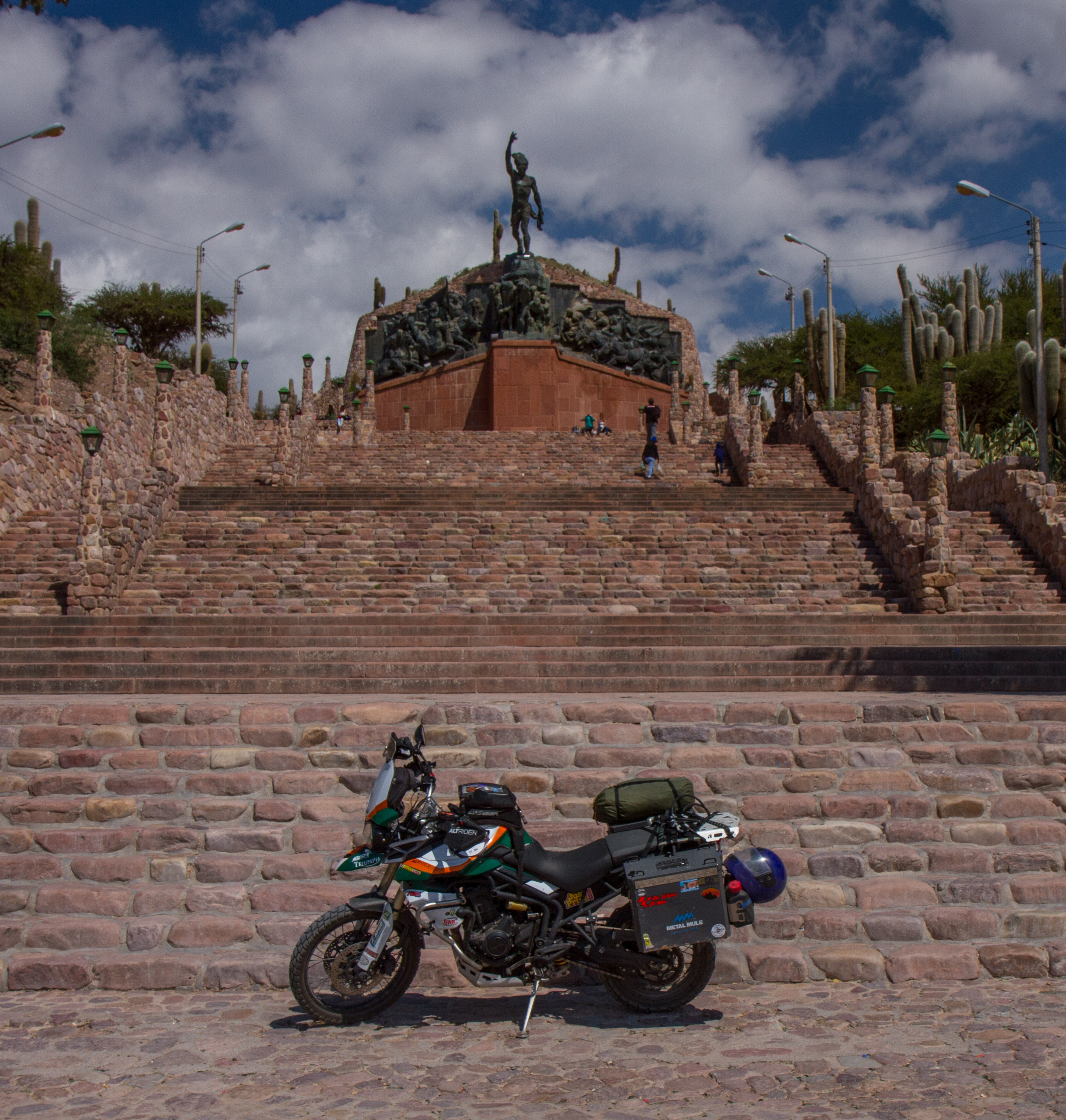
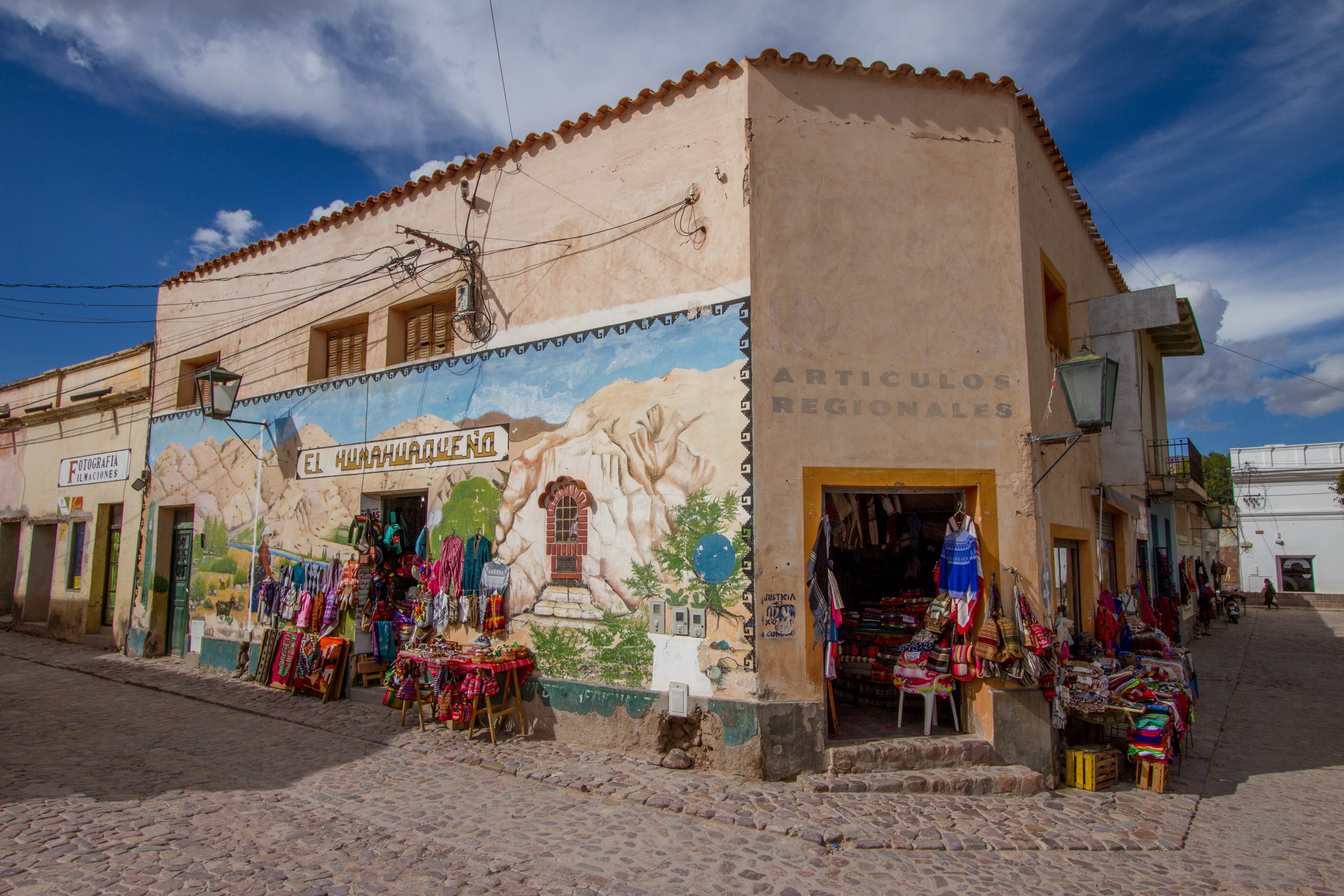
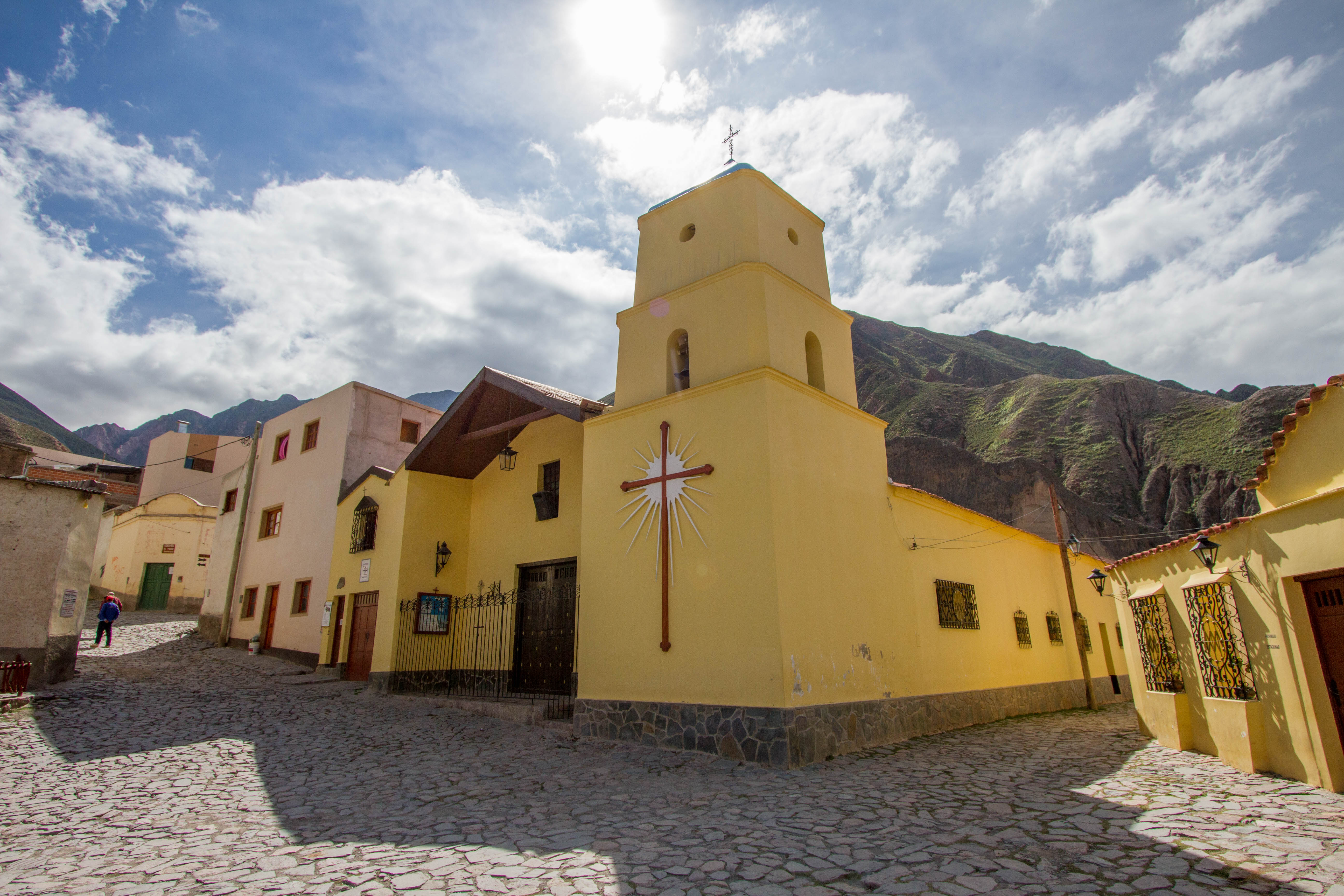
Humahuaca
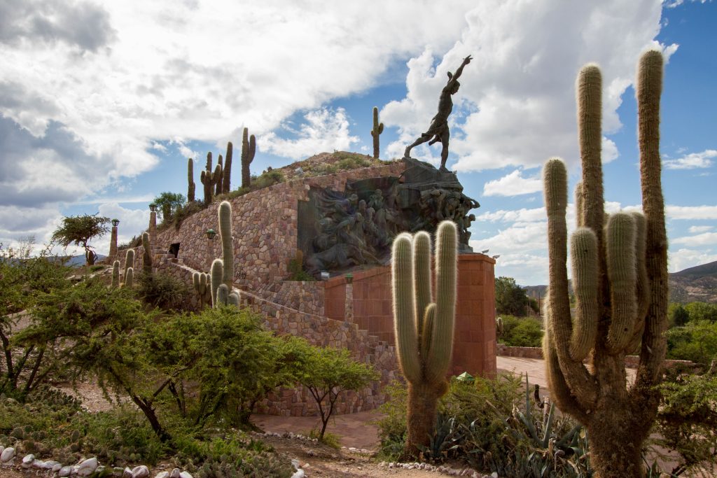
Humahuaca is widely known for its location at the Quebrada de Humahuaca, a long valley east of the central Andean Altiplano. It is the main town in the valley, located north of Tilcara and Purmamarca. The centre of the town has a lovely square which leads up some amazing stairs to a monument to the heroes of the Independence. (Monumento a los Héroes de la Independencia)
Humahuaca, Jujuy, Argentina
Humahuaca, Jujuy, Argentina
Humahuaca, Jujuy, Argentina
Humahuaca, Jujuy, Argentina
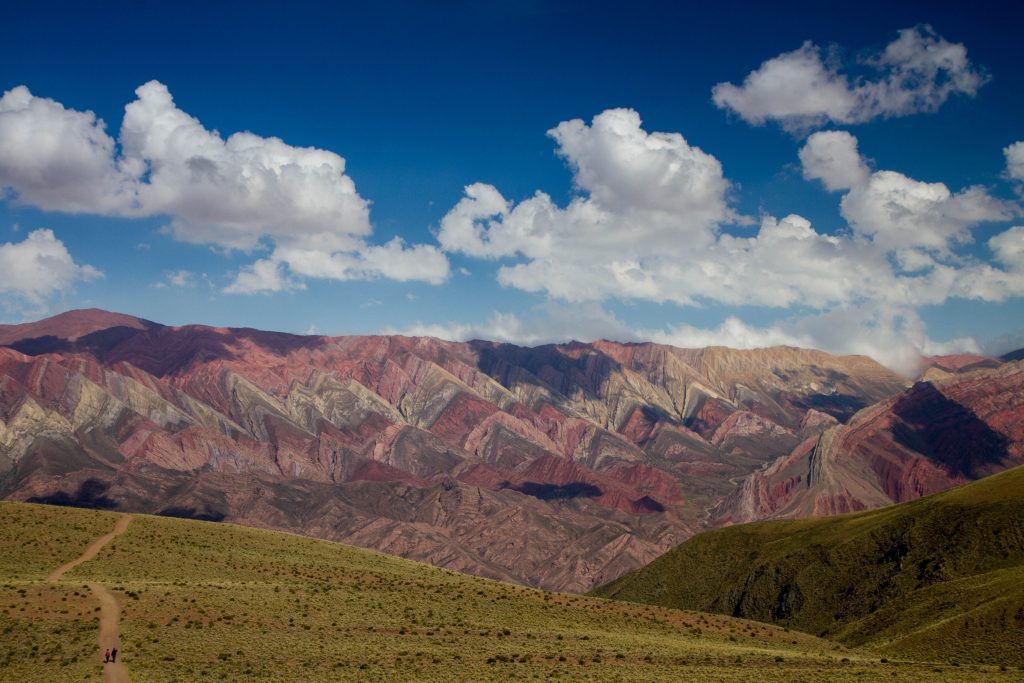
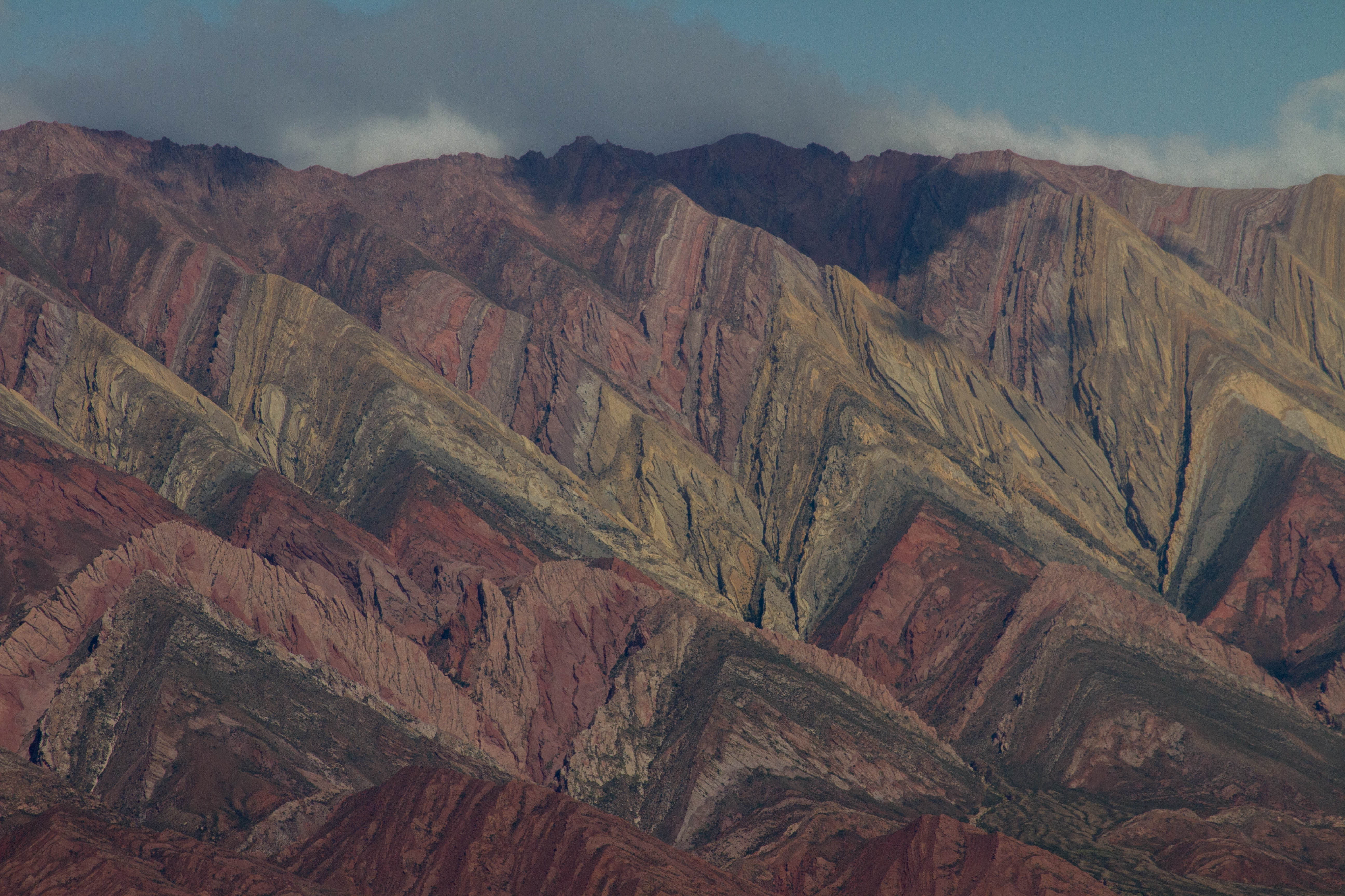
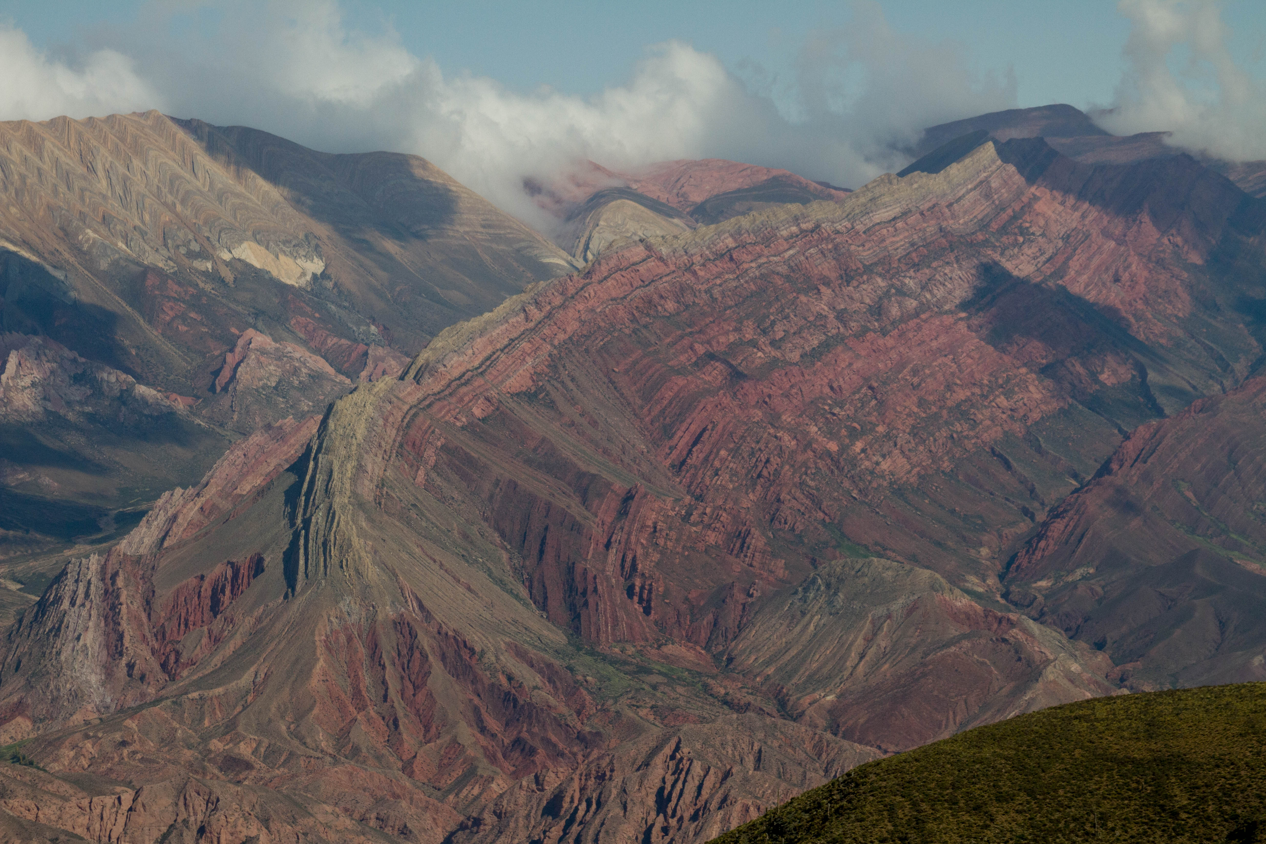
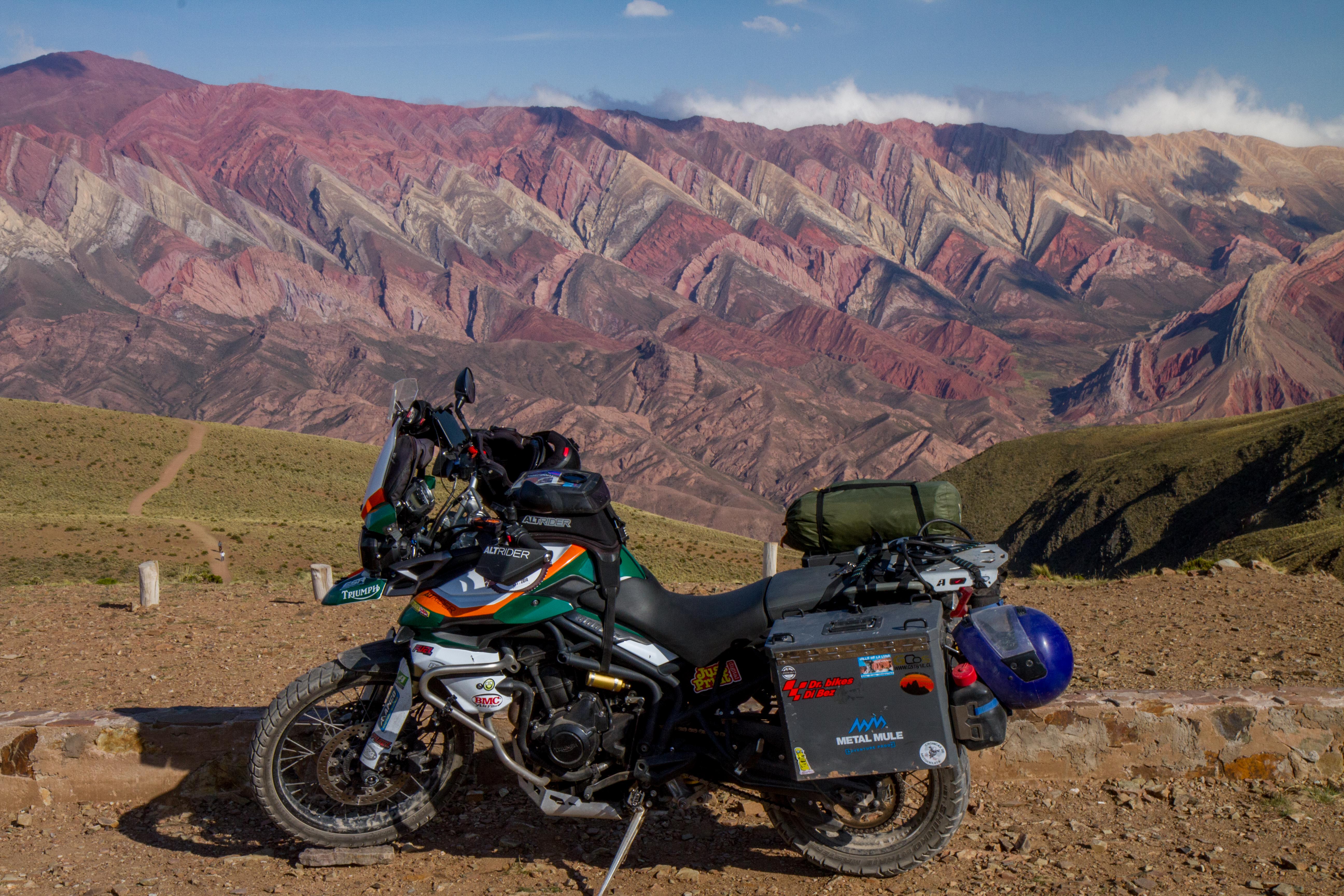
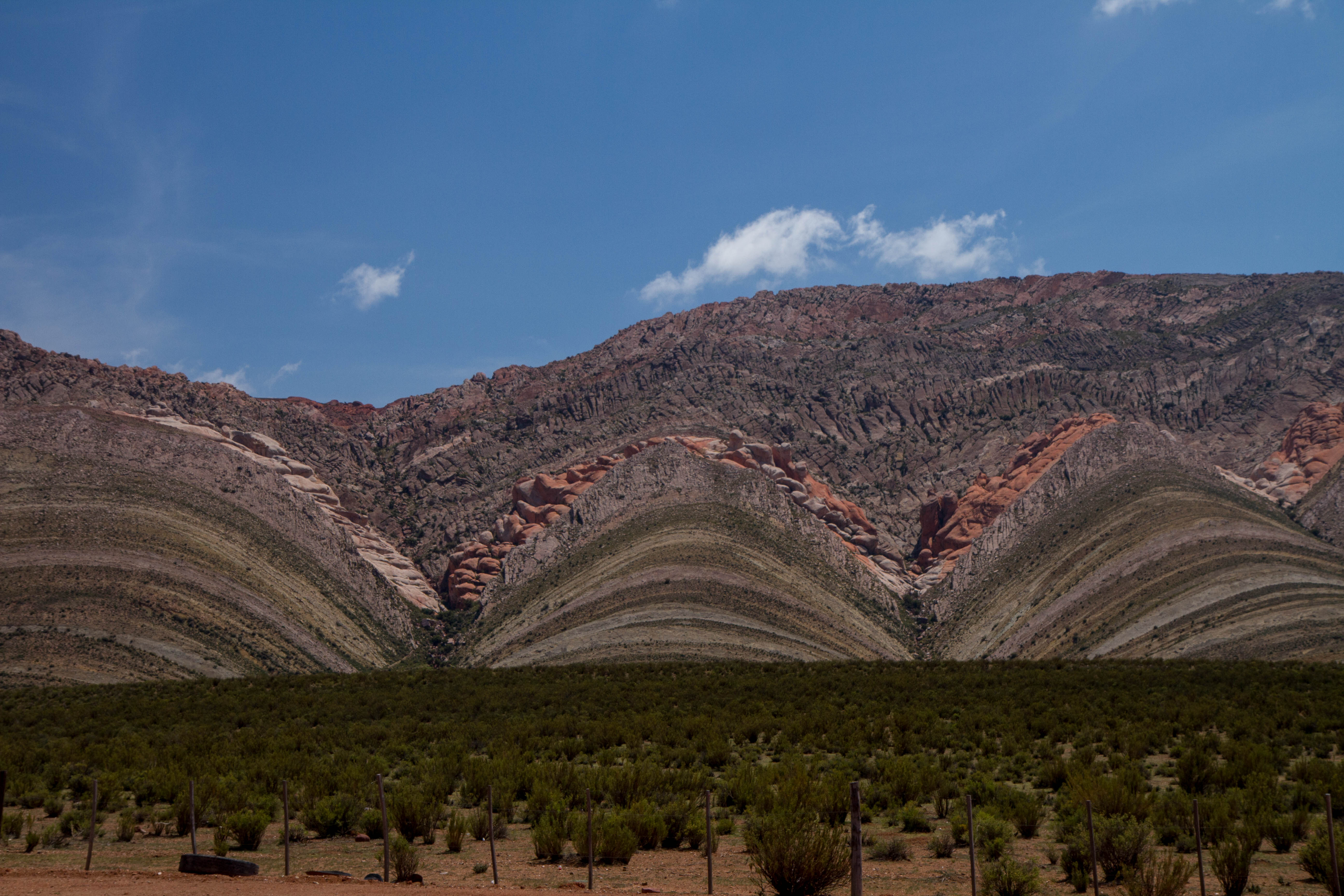
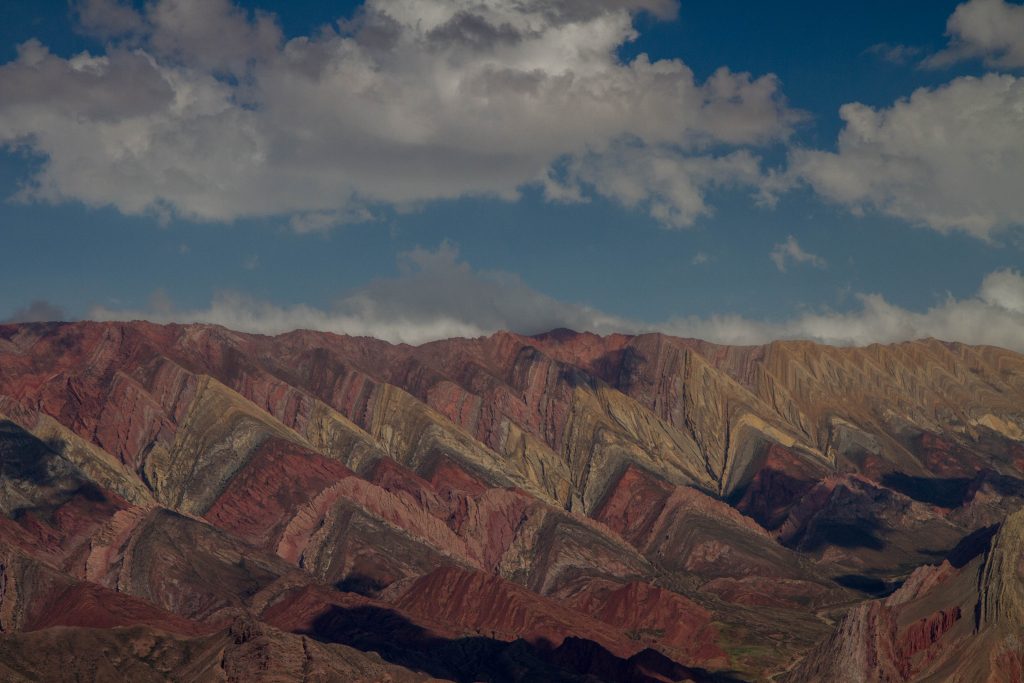
Serranía de Hornocal
The Serranía de Hornocal are a range of mountains located 25 kilometers from the city of Humahuaca in the Argentine province of Jujuy. Exposed in the range is the limestone formation called Yacoraite that extends from Salta, Argentina, through the Argentine Quebrada de Humahuaca and then through the Bolivian Altiplano to Peru. When you finally reach the colored mountains, you’ll be at 4761 meters above sea level.
Cerro de los 14 colores, Jujuy, Argentina
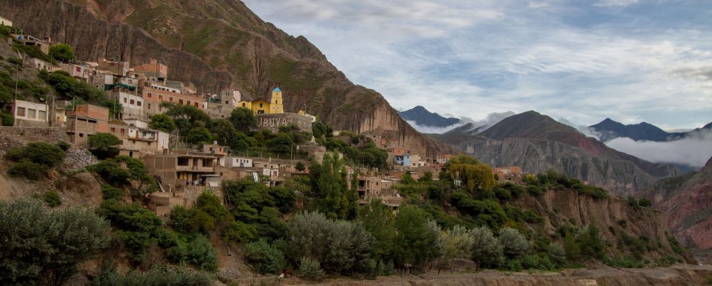
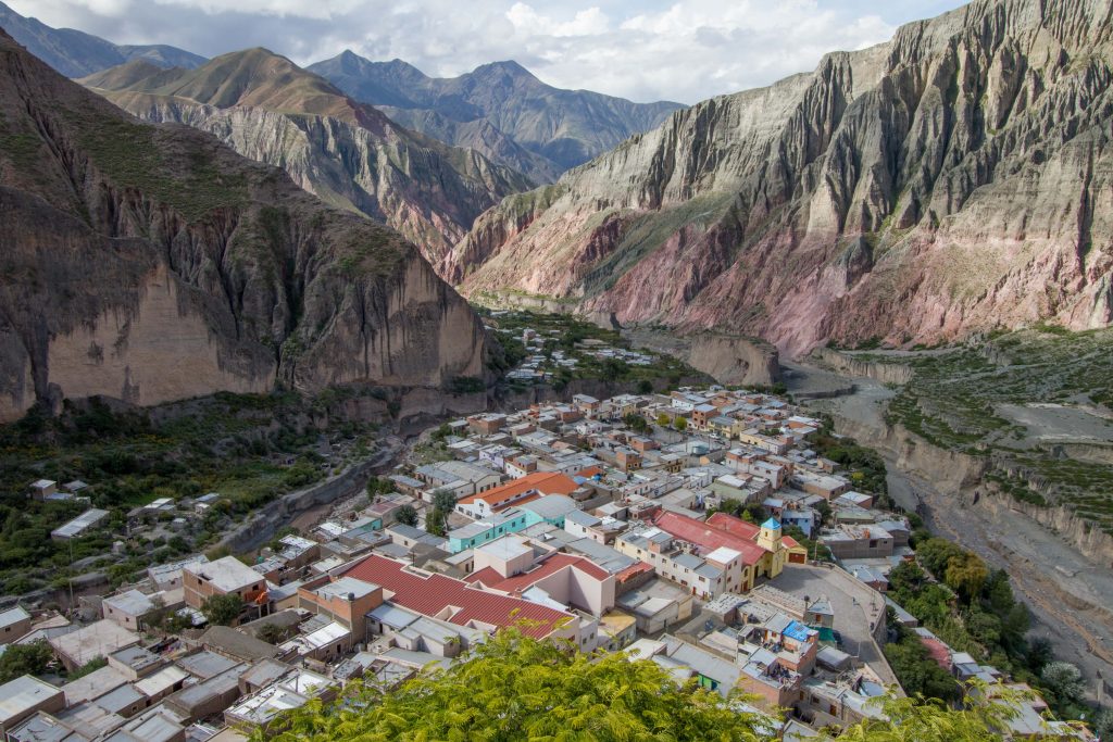
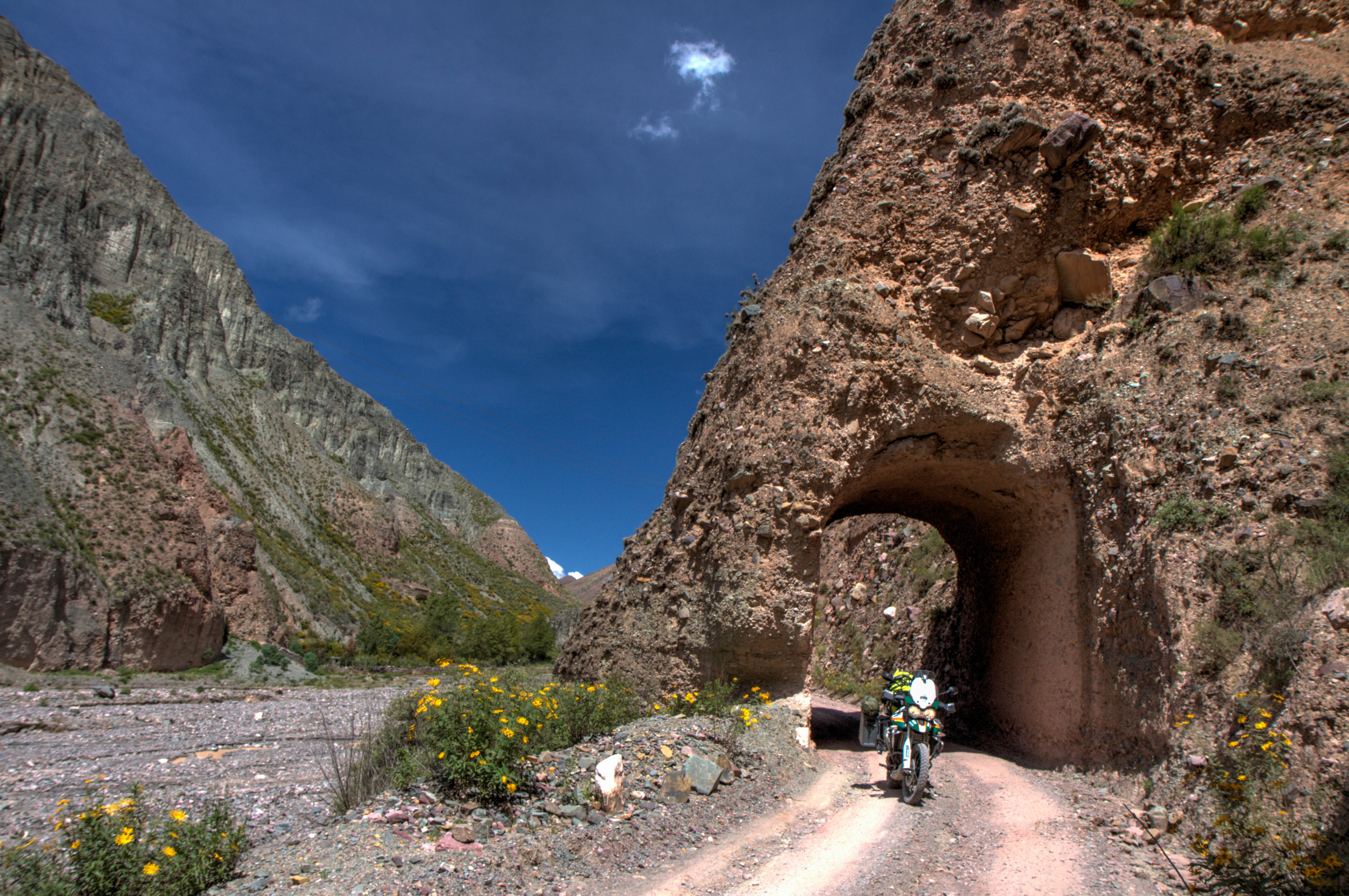
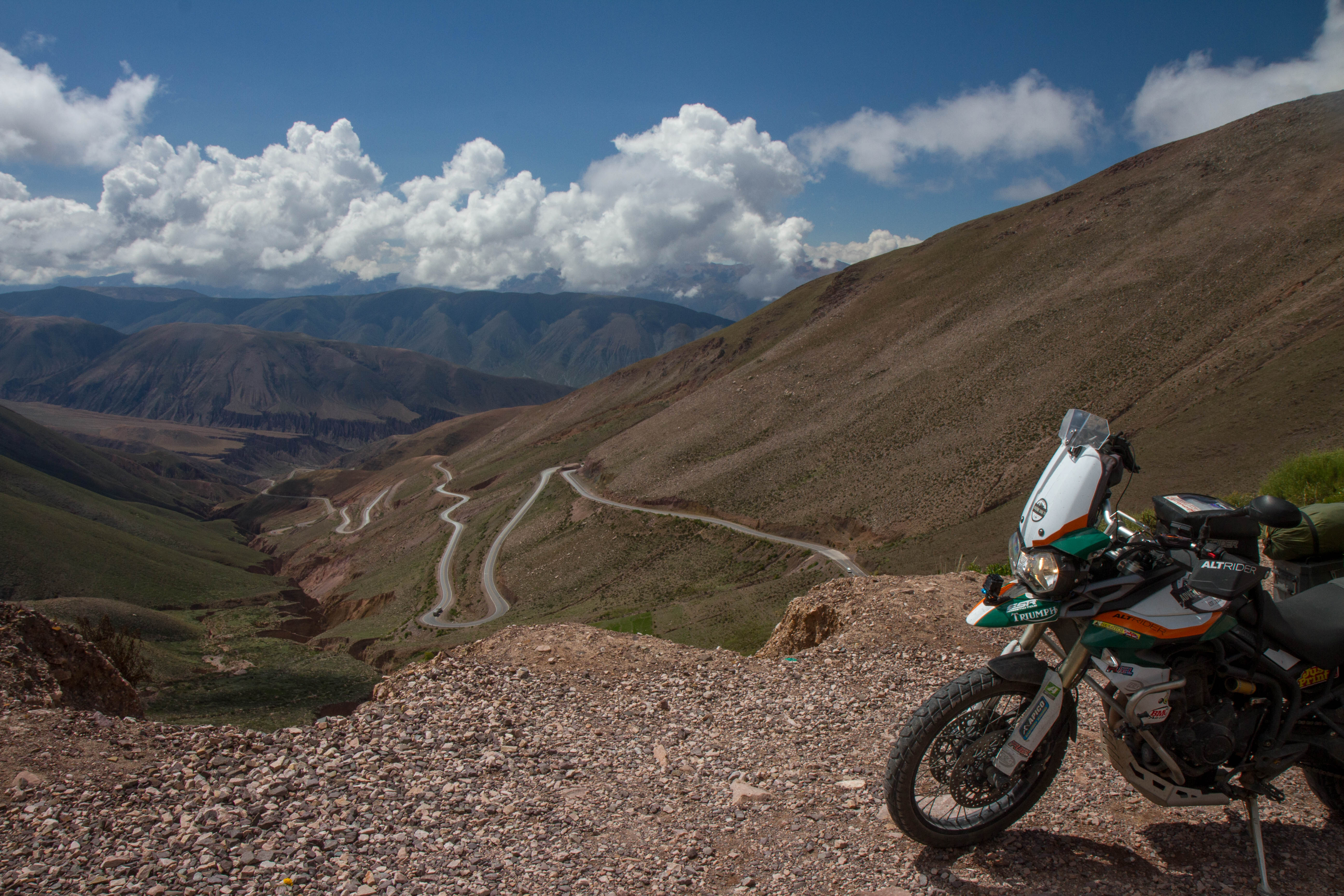
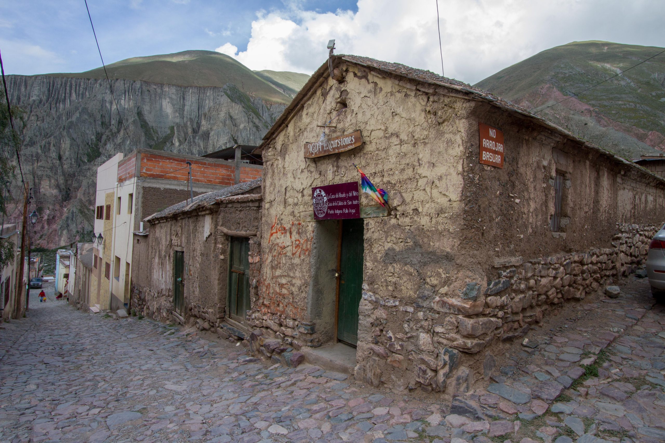
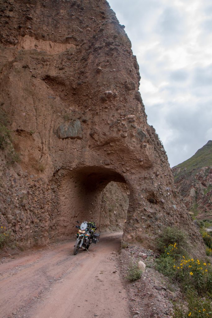
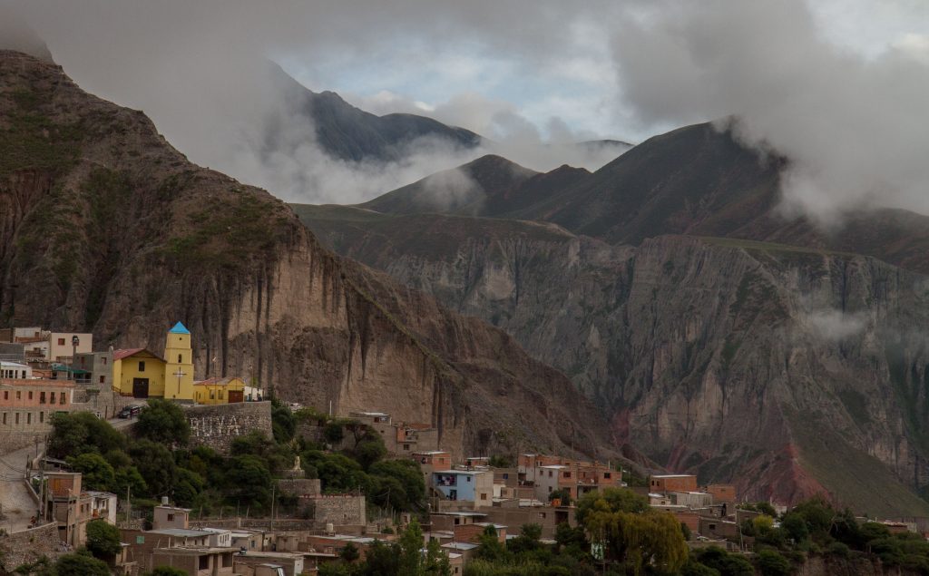
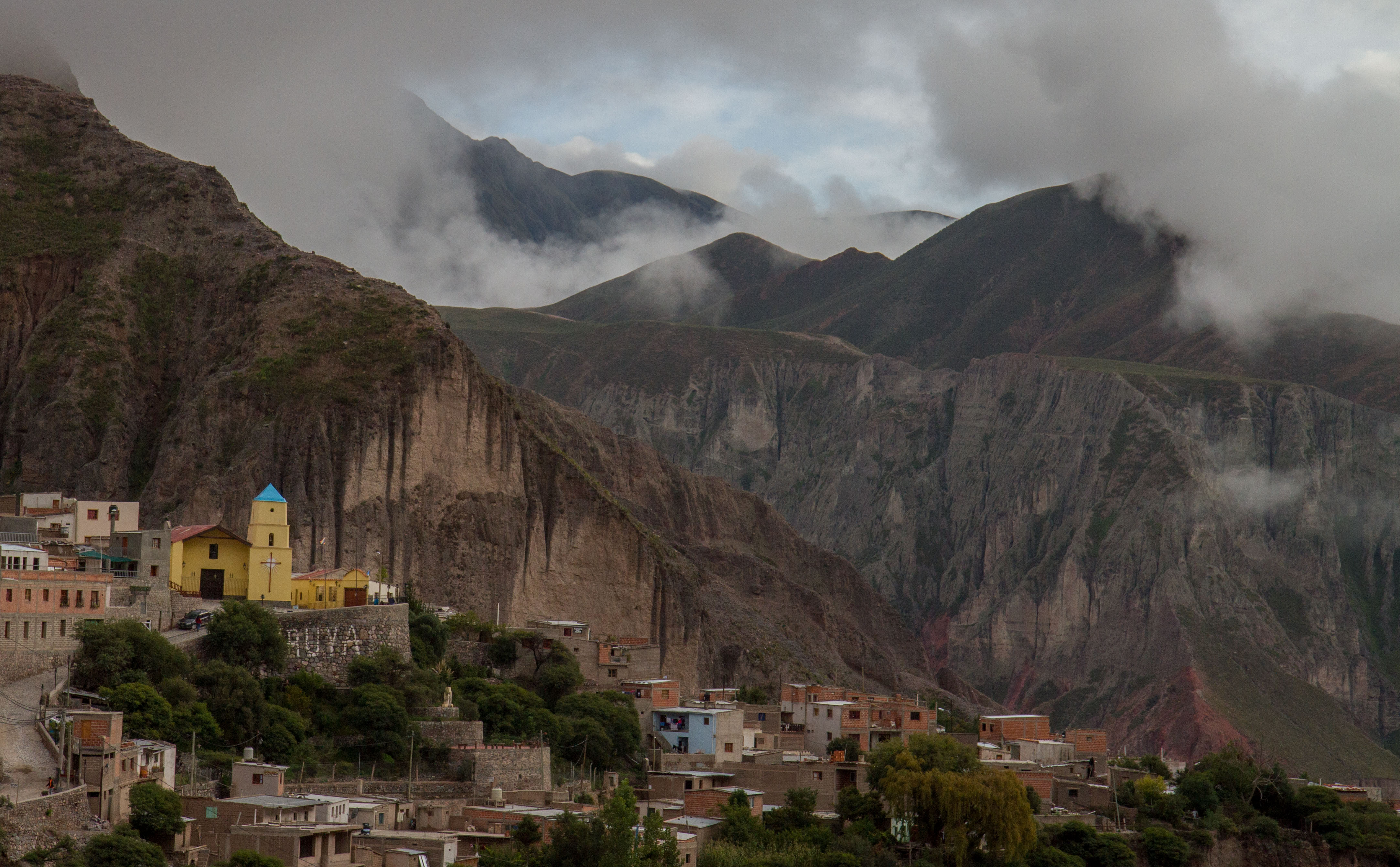
Iruya
Iruya is small mountain town located in the Salta region of North West Argentina. The town is accessed by a gravel road from Quebrada de Humahuaca (Humahuaca Valley). So technically it is outside the Quebrada de Humahuaca, but it was my favorite place in Argentina, because of its remoteness. I have a dedicated post on Iruya
Iruya is small mountain town located in the Salta region of North West Argentina. The town is accessed by a gravel road from Quebrada de Humahuaca (Humahuaca Valley). The road climbs to 4000m before descending to 2600m where Iruya is located.
You’ll see the entrance tunnel to the town once you start to ride along the Iruya River. This ride is stunning, with dramatic landscape and twisty bends.
Iruya, Salta Province, Argentina
Once in the town, the hightlights are the church (built in 1609), the friendly people and many condors you can see from the ‘Mirador de los condor’
Iruya, Salta Province, ArgentinaIruya, Salta Province, Argentina
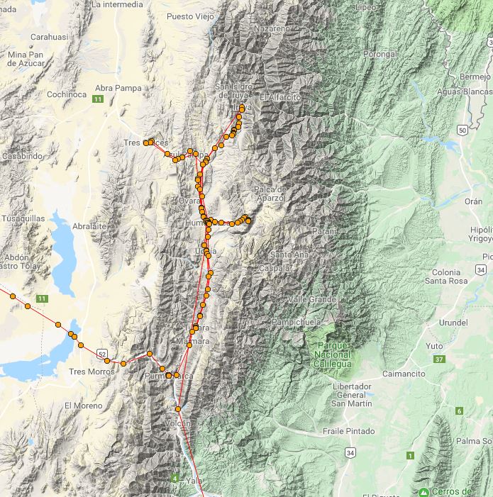
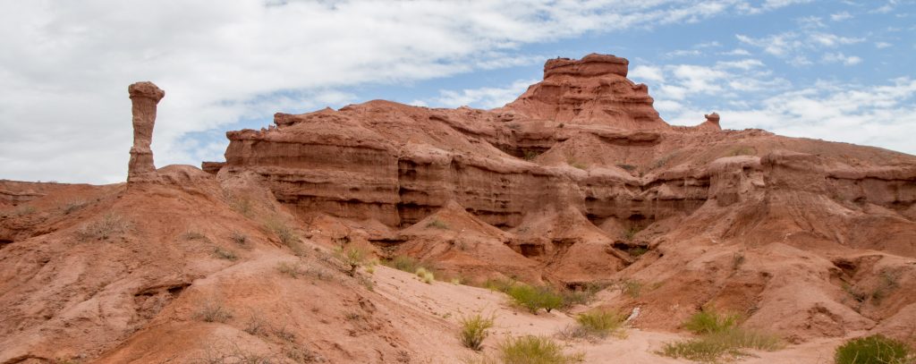
This ride starts in Salta, in the northwest Argentina. Shortly after leaving the city, you’ll find yourself in a remarkable jungle which only last an hour before you’re transported into a landscape of red rocks similar to Utah in the USA.
The road is superb, as of 2017 is new and has very little traffic.
My tracking from Salta to Quebrada de Humahuaca. Tracking files can be downloaded here. (GPX/KML)
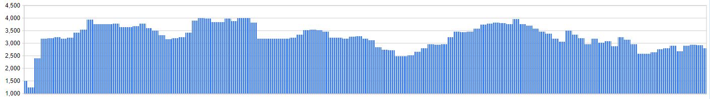
Elevation Profile
Highlights
Stunning Landscapes
From lush rich green forests to landscapes straight out of the roadrunner cartoon, the landscapes here do not disappoint. Once you arrive to the valley (Quebrada de Humahuaca) you’ll find amazing coloured mounatins and great village indigenous villages. Check out my post on Quebrada de Humahuaca.
Quebrada de las conchas, Salta Province, Argentina
Quebrada de las conchas, Salta Province, Argentina
Iruya
Iruya is a small mountain outside the Quebrada de Humahuaca, but is well worth the ride. You can check out this separate post on Iruya.
Iruya, Salta Province, Argentina
Time Lapse Video of the Road to Iruya
Serranía de Hornocal
The Serranía de Hornocal are a range of mountains located 25 kilometers from the city of Humahuaca in the Argentine province of Jujuy. Exposed in the range is the limestone formation called Yacoraite that extends from Salta, Argentina, through the Argentine Quebrada de Humahuaca and then through the Bolivian Altiplano to Peru.
The ride to serranis de hornocal is all dirt with some amazing dramatic scenery. When you finally reach the coloured mountains, you’ll be at 4761 meters above sea level.
Cerro de los 14 colores, Jujuy, Argentina
Time Lapse Video of Serranía de Hornocal
Why is it a ‘Best Ride’
This part of Argentina was easily my favorite. It’s full of earthy landscapes, rich culture, good roads and colorful little towns. The weather is mild, even though you are sometimes at 4000m above sea level. Also from here, your options for onward rides are endless. I decided to head west towards Argentina’s own salt flats and then over the Andes into Chile.
Time Lapse Video of a section from Salta to Quebrada de Humahuaca
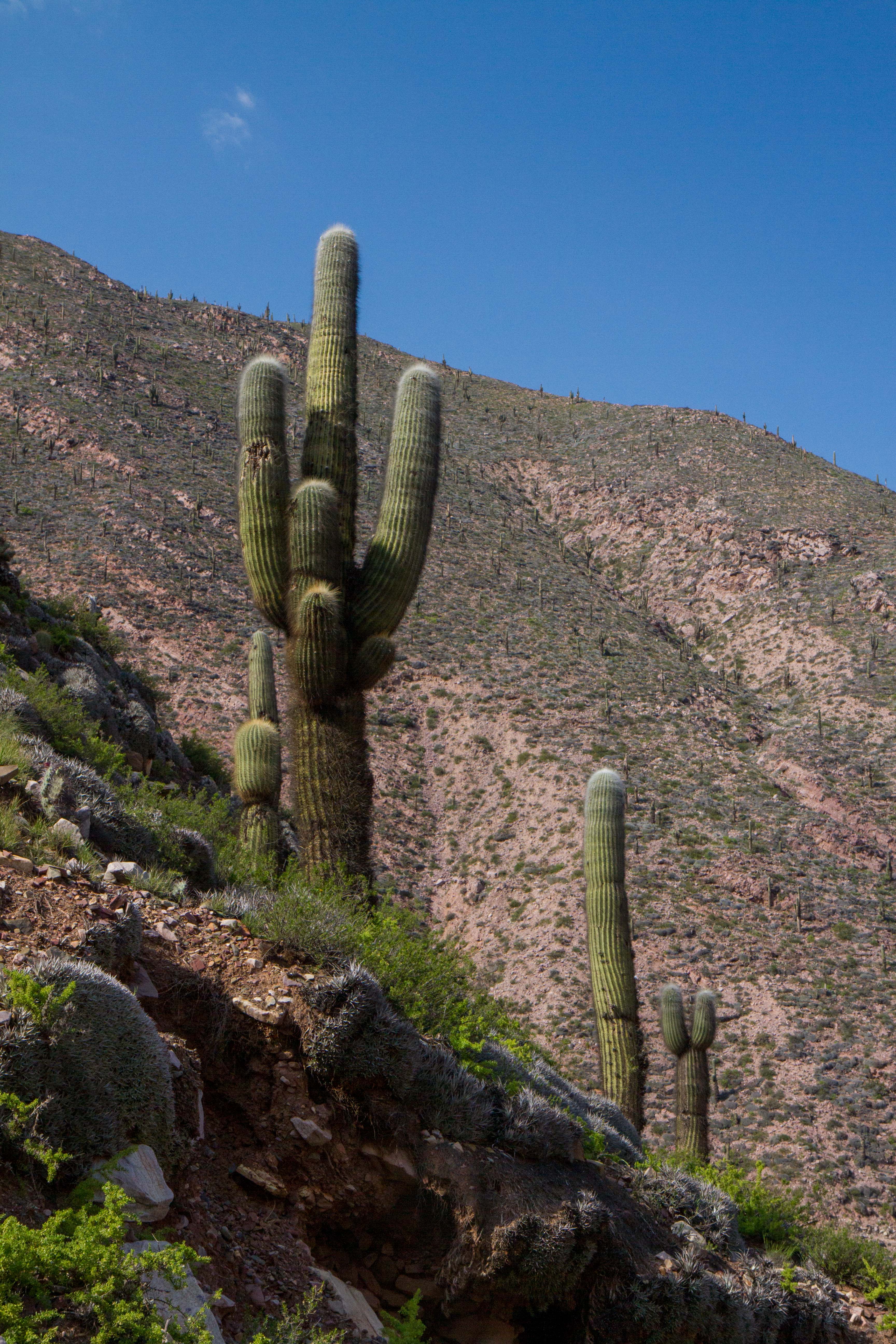
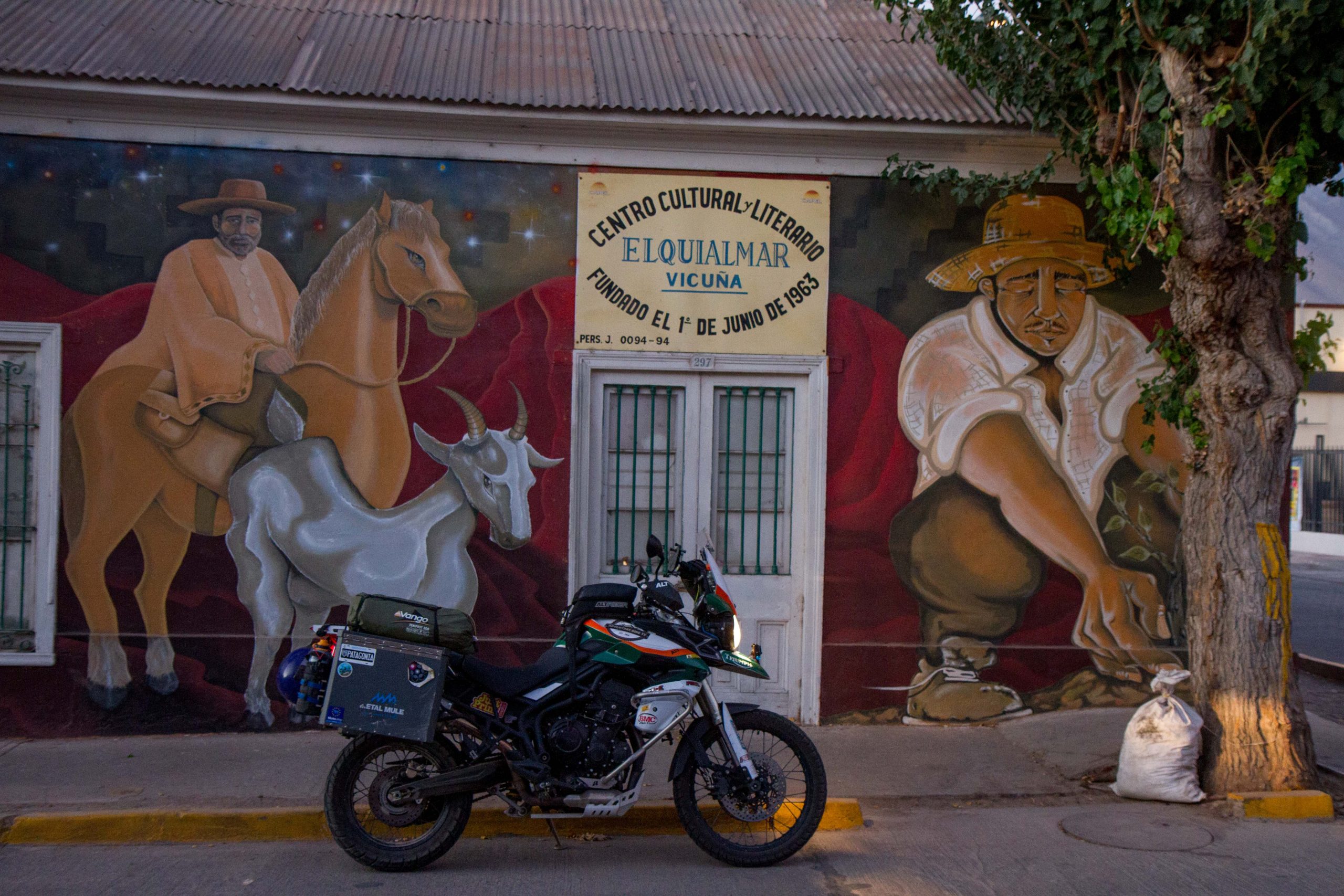
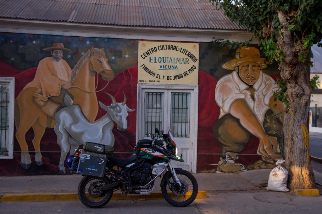
Elqui Valley is almost hidden away in an area that isn’t on the international tourist trail. Most people will travel up the coast near La Serena (Where the beaches in Chile slowly start becoming warm enough to swim it), but if they venture towards the Andes they will be rewarded by one of Chile’s most important valleys. This is Elqui Valley, famous for pisco-producing and stargazing.
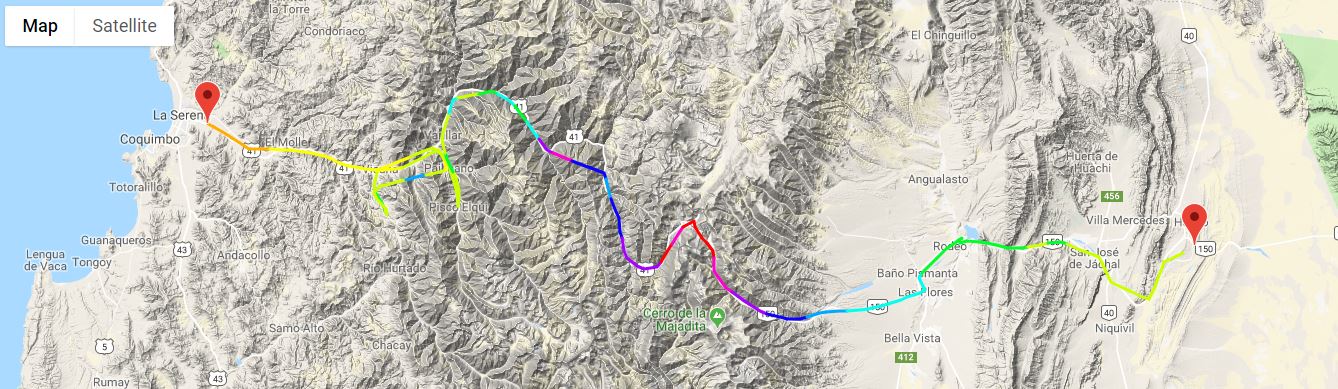
Agua Negra Pass is a border crossing between Chile and Argentina. At over 4700m it is one of the highest passes between the countries in the world and is only passable outside the winter months.
The road is gravel from the Chile side and brand new asphalt on the Argentina side. (A proposed tunnel has been started from the Argentina side to allow easier access to the Chilean port town of La Serena.
The road from Chile is a gradually climb from the beautiful Elqui Valley region. This should not cause any issue with altitude sickness if you climb at a normal pace. The Argentina side is similar however because the road is asphalt you will be able to climb faster, therefore take your time.
My tracking from La Serena (Chile) over the Agua Negra Pass to Argentina. (GPX / KML files)
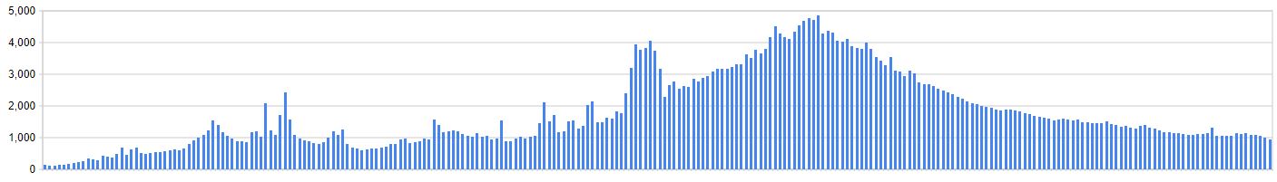
Elevation Profile
Highlights
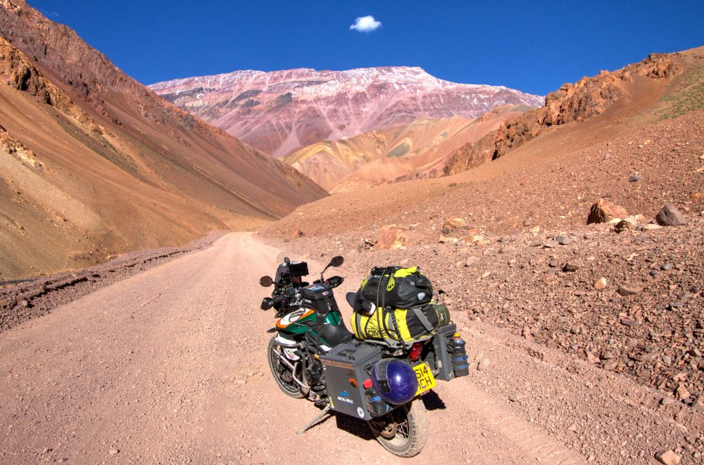
Stunning Landscapes
The pass has some stunning landscapes and is relatively quiet in regards to traffic. It is also very cold at the top of the pass (even in summer it was 0 degrees)
Paso Agua Negra, Chile
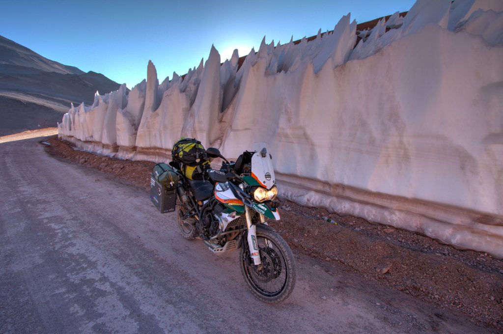
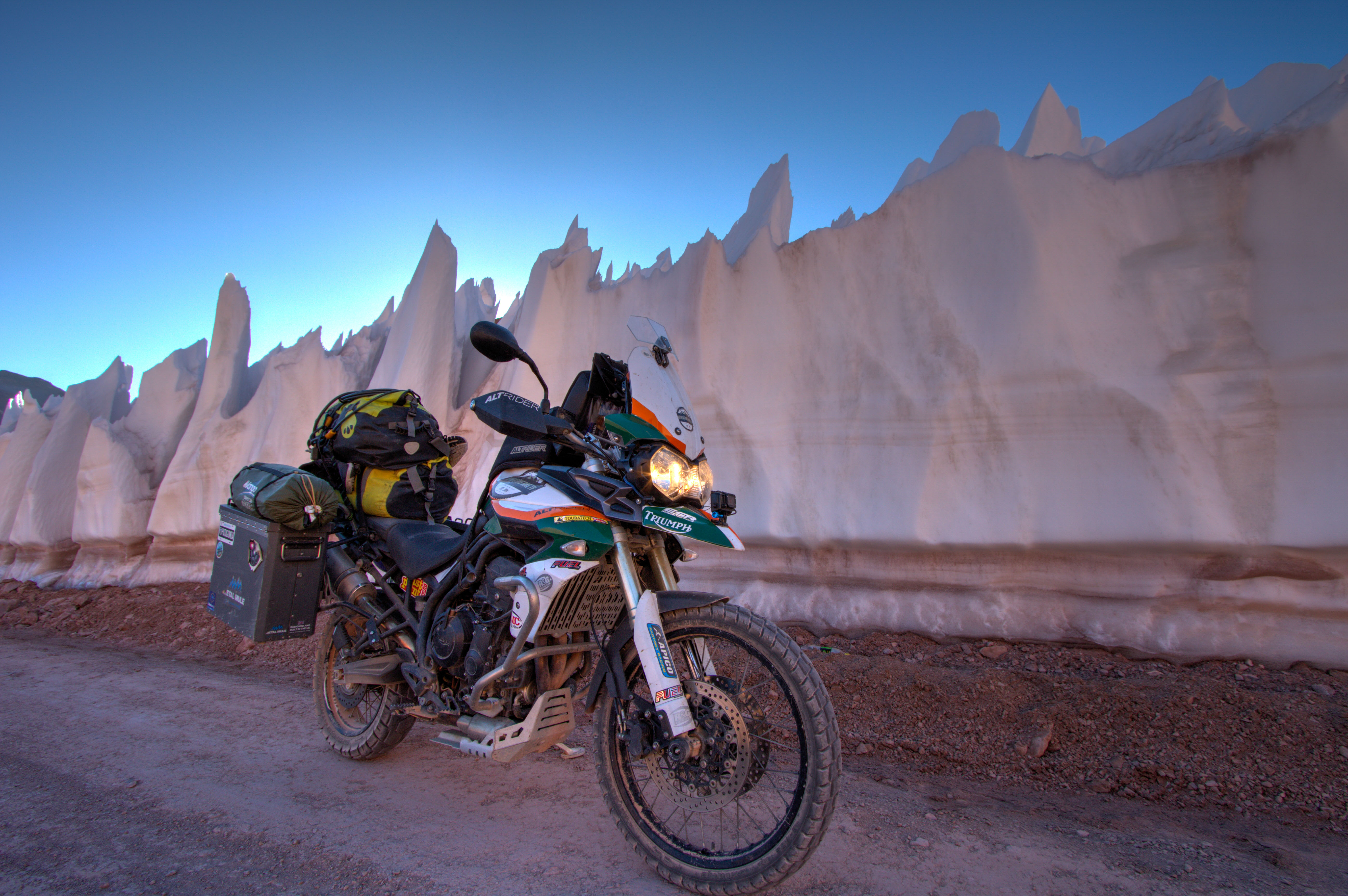
Glaciers
Just before you reach the top, on the Chile side, you will experience riding/driving through a glacier. I’m not sure how is cut but the glacier is split to allow the road to pass through it. awesome stuff.
Paso Agua Negra, Chile
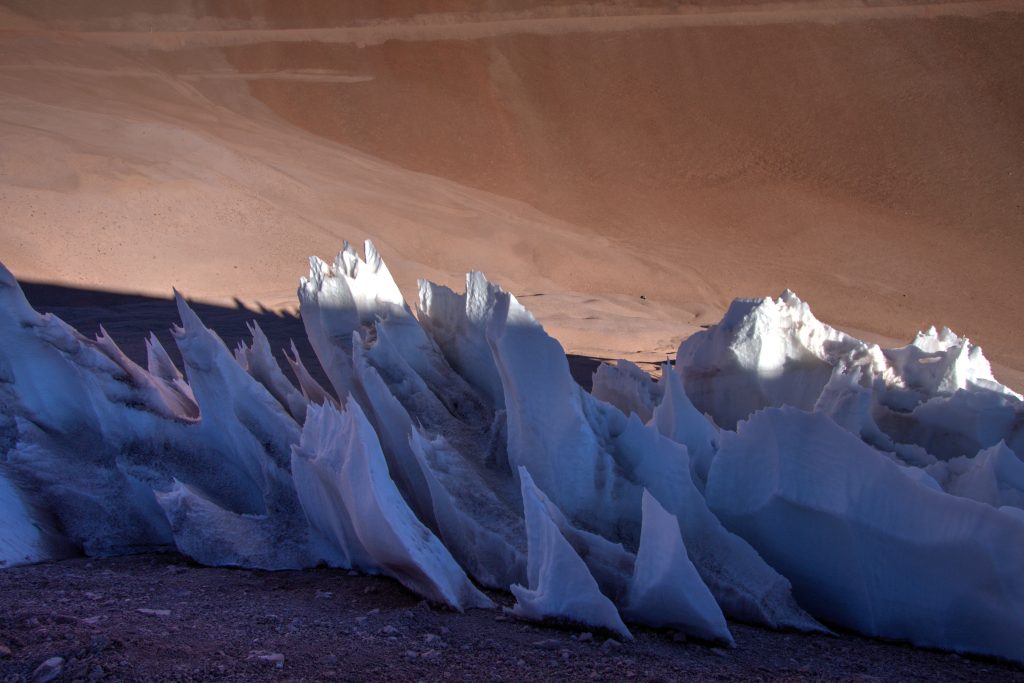
Penitentes
Penitentes are snow formations found at high altitudes. They take the form of elongated, thin blades of hardened snow or ice, closely spaced and pointing towards the general direction of the sun. You can find these amazing formations at the top of the pass. For a stunning drone view of these formations check out this video
Paso Agua Negra, Chile
Why is it a ‘Best Ride’
Well, apart from the snow formations, riding through glaciers and the stunning landscapes. The ride is also very challenging, only passable in summer and with temperatures ranging from 30 degrees to Zero. Want to see the whole trip in a time lapse? Check out the video below.
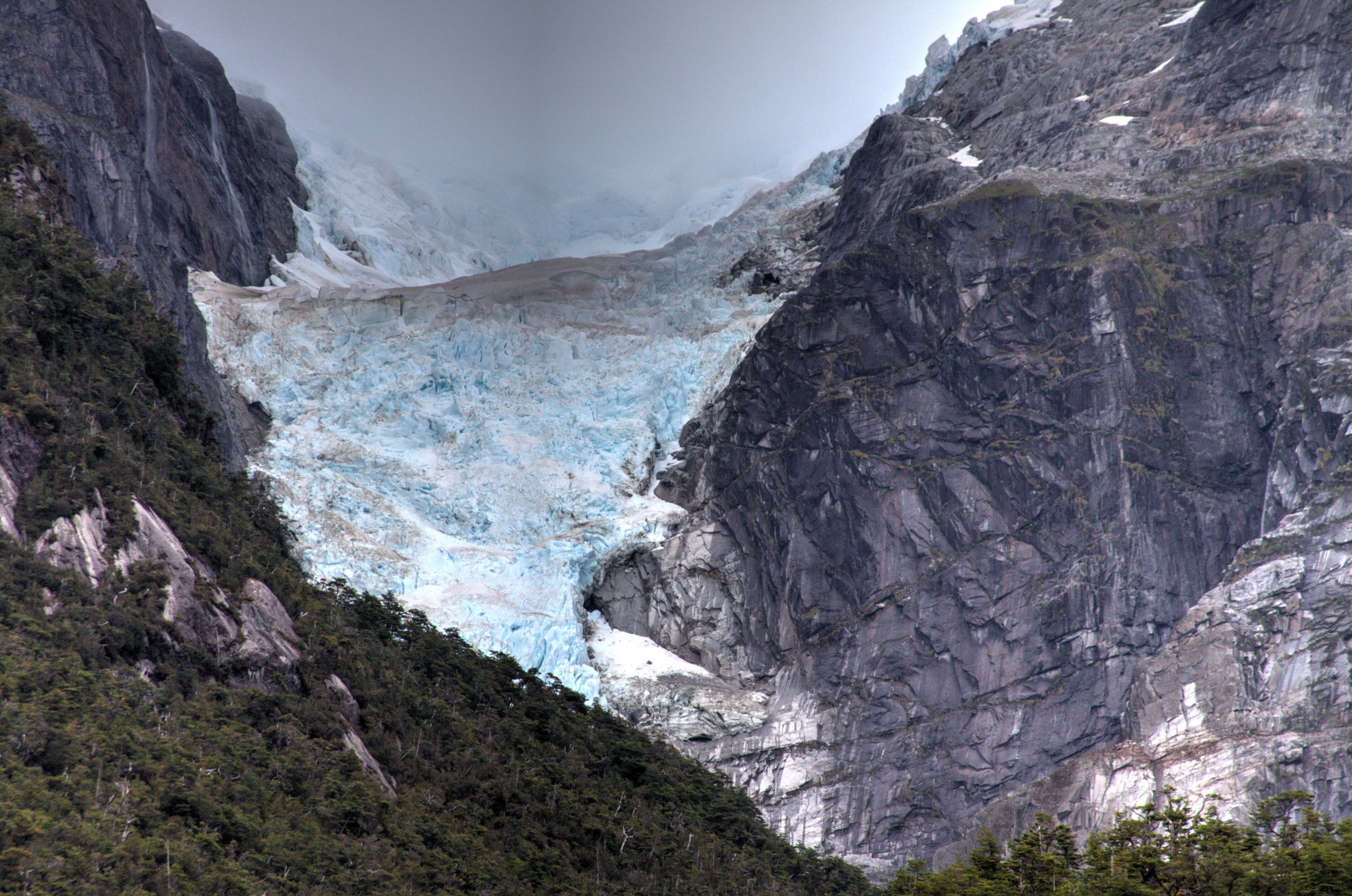
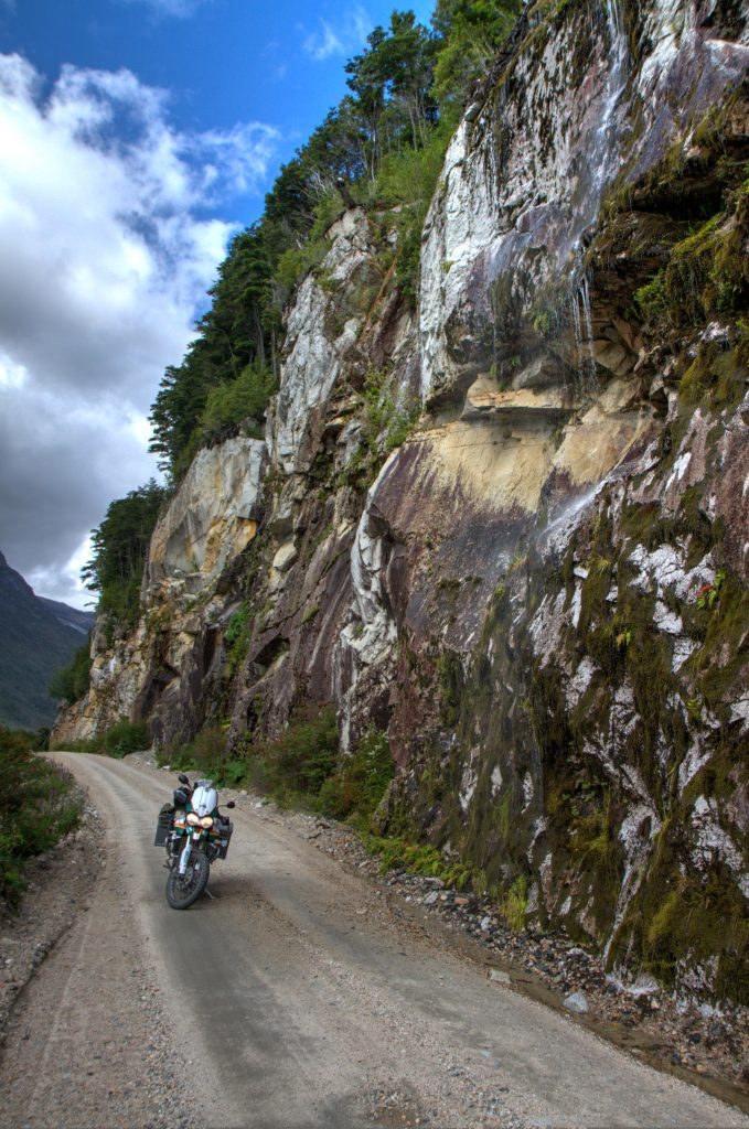
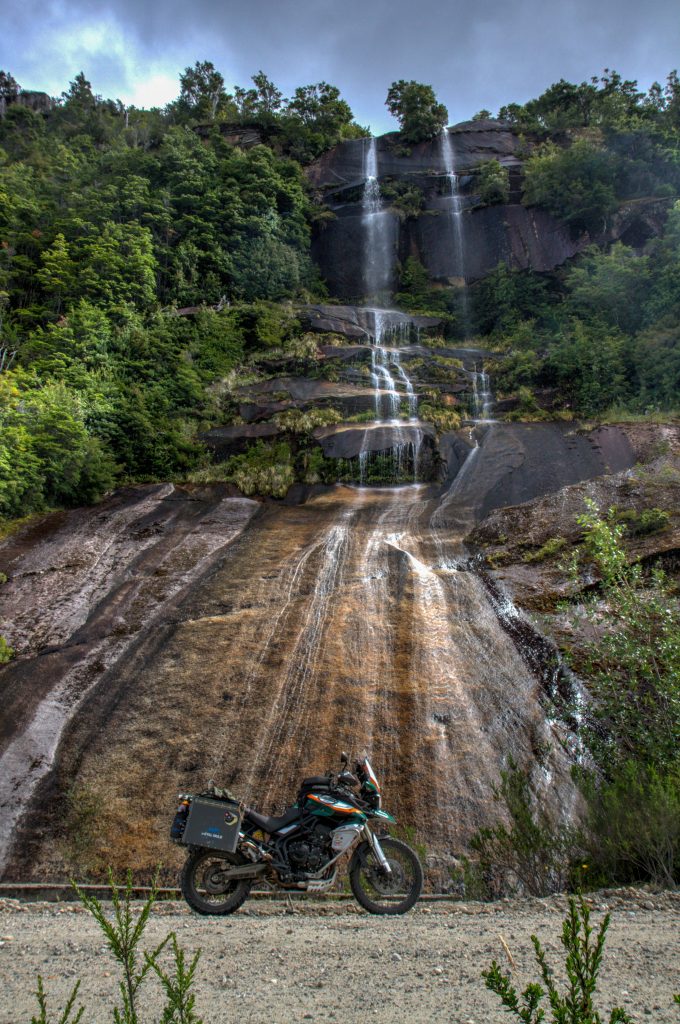
Ruta X-728 is a dead-end road that starts from Puerto Rio Tranquilo to the Glacier Exploradores. It is a spectacular road that winds through lakes, cliff walls and is surrounded by Glaciers and mountains.
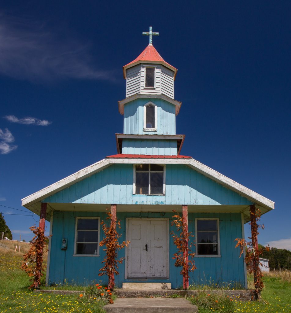
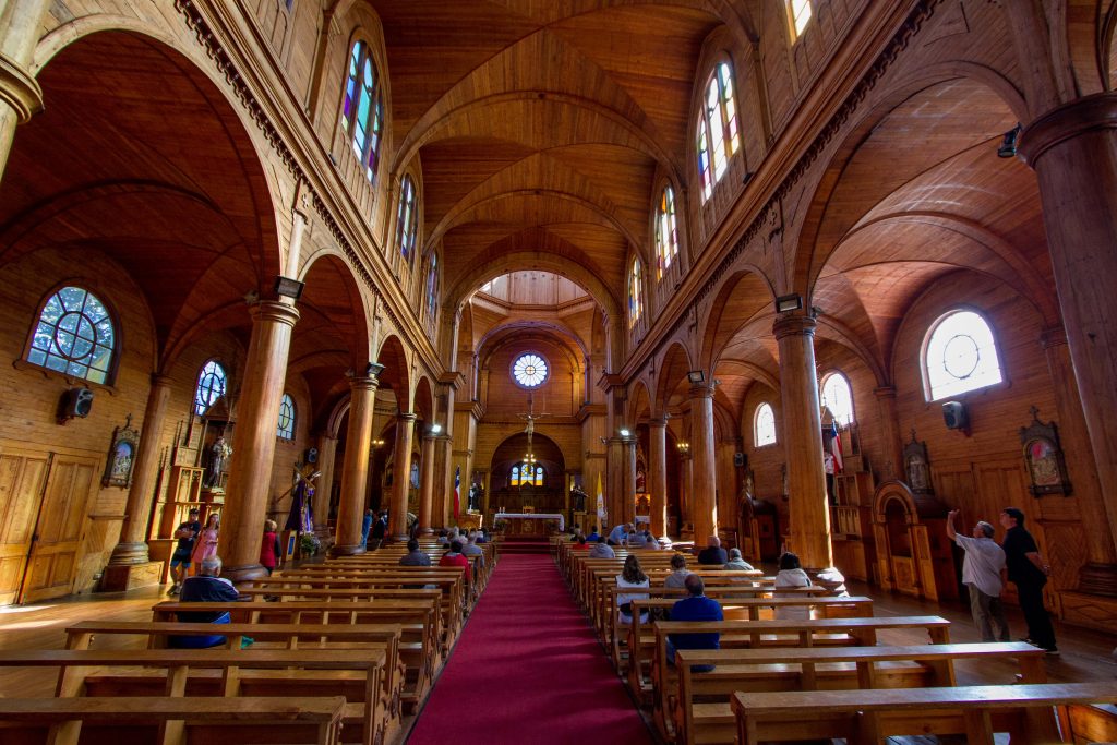
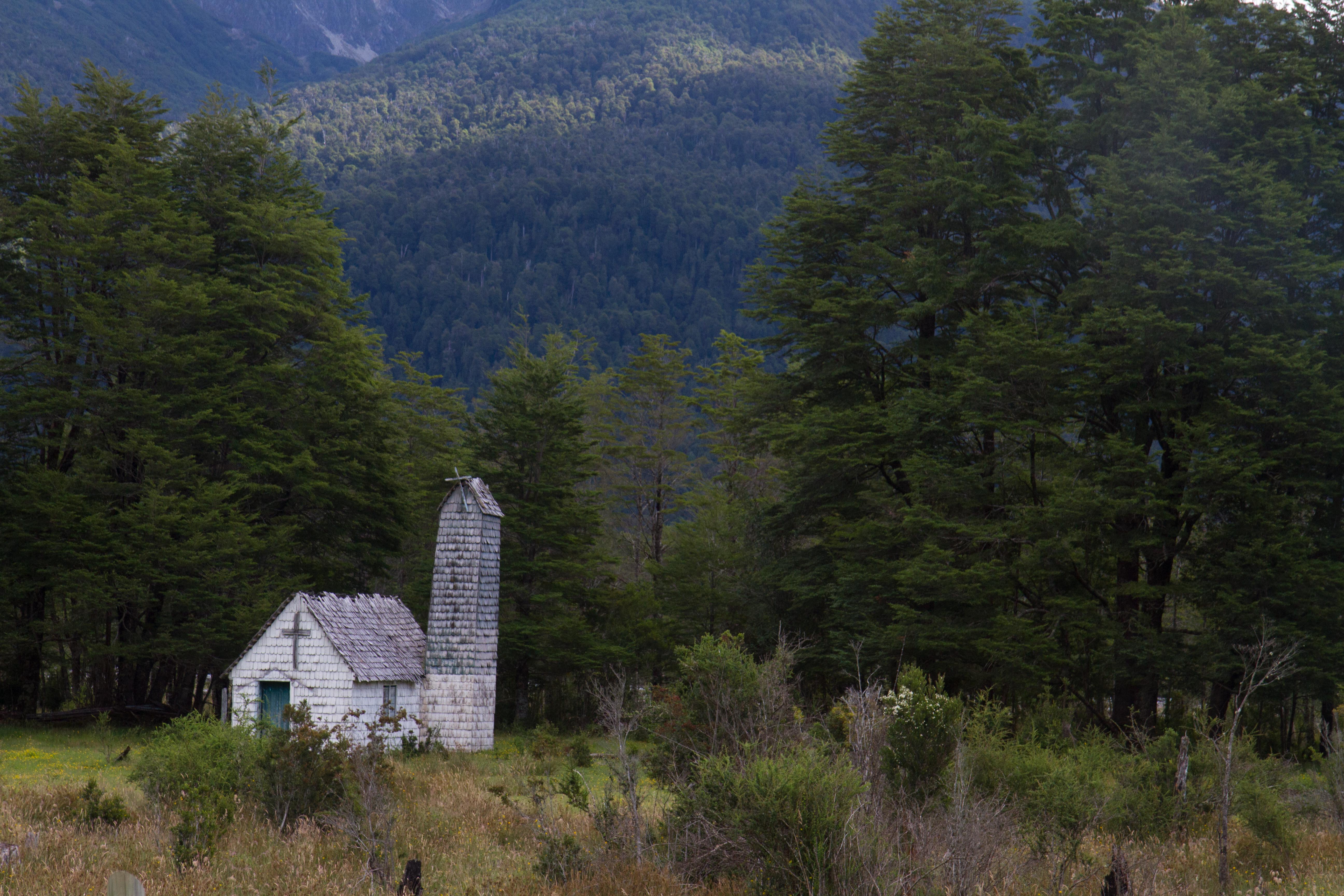
The wooden churches of Chiloe and a UNESCO World Heritage Site and are a unique architectural phenomenon in the Americas. Unlike classical Spanish colonial architecture, the churches of Chiloé are made entirely in native timber with extensive use of wood shingles. The churches were built from materials to resist the Chiloé Archipelago’s humid and rainy oceanic climate.
Wooden Churches of Chiloé, Chile
Wooden Churches of Chiloé, Chile
Wooden Churches of Chiloé, Chile
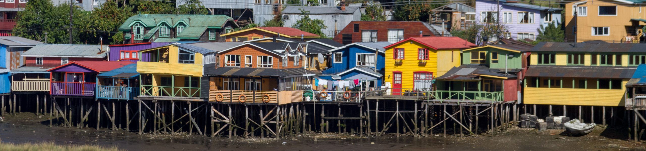
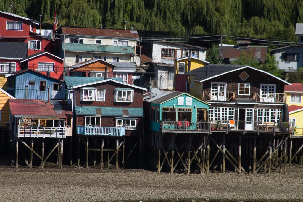
Castro, Chile
Castro is famous for its palafitos, traditional wooden stilt houses which were common in many places in Chiloé. Some of them are preserved in the town district Gamboa in the west of the town in a bay called Fiordo de Castro.
Castro, Chile
Castro, Chile
Sunsets
Sunset Explosion over the beaches in Chiloe Island
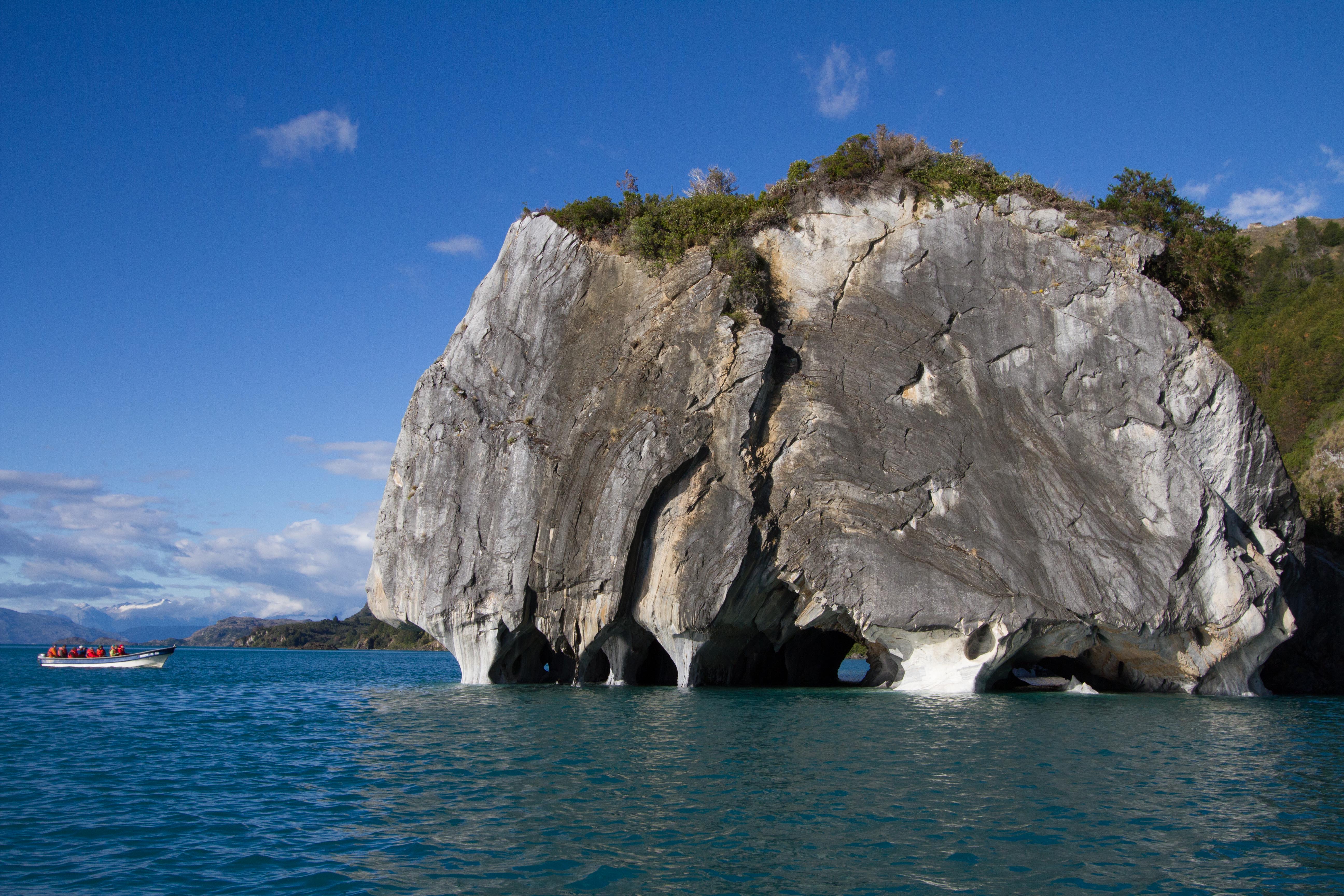
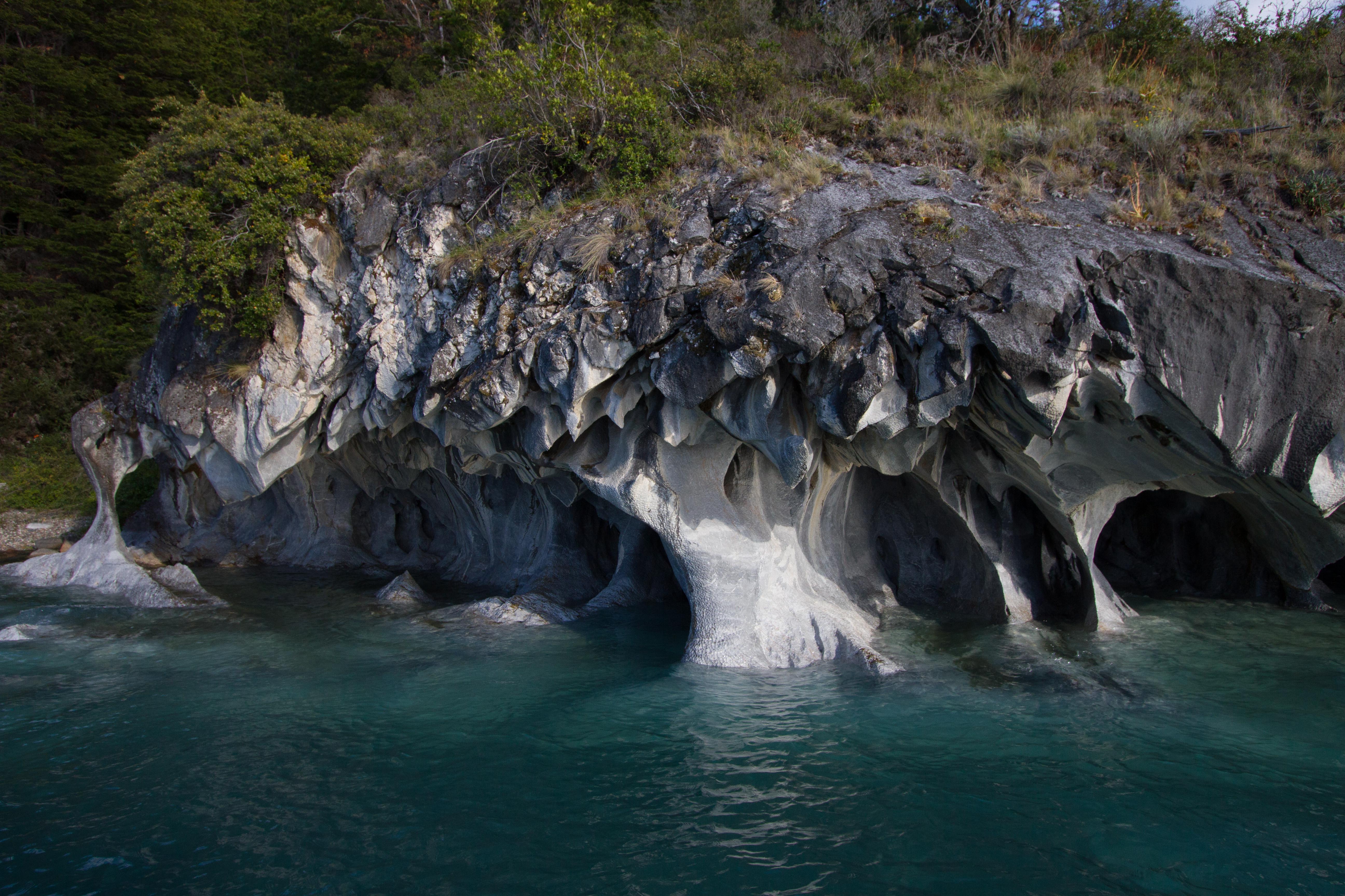
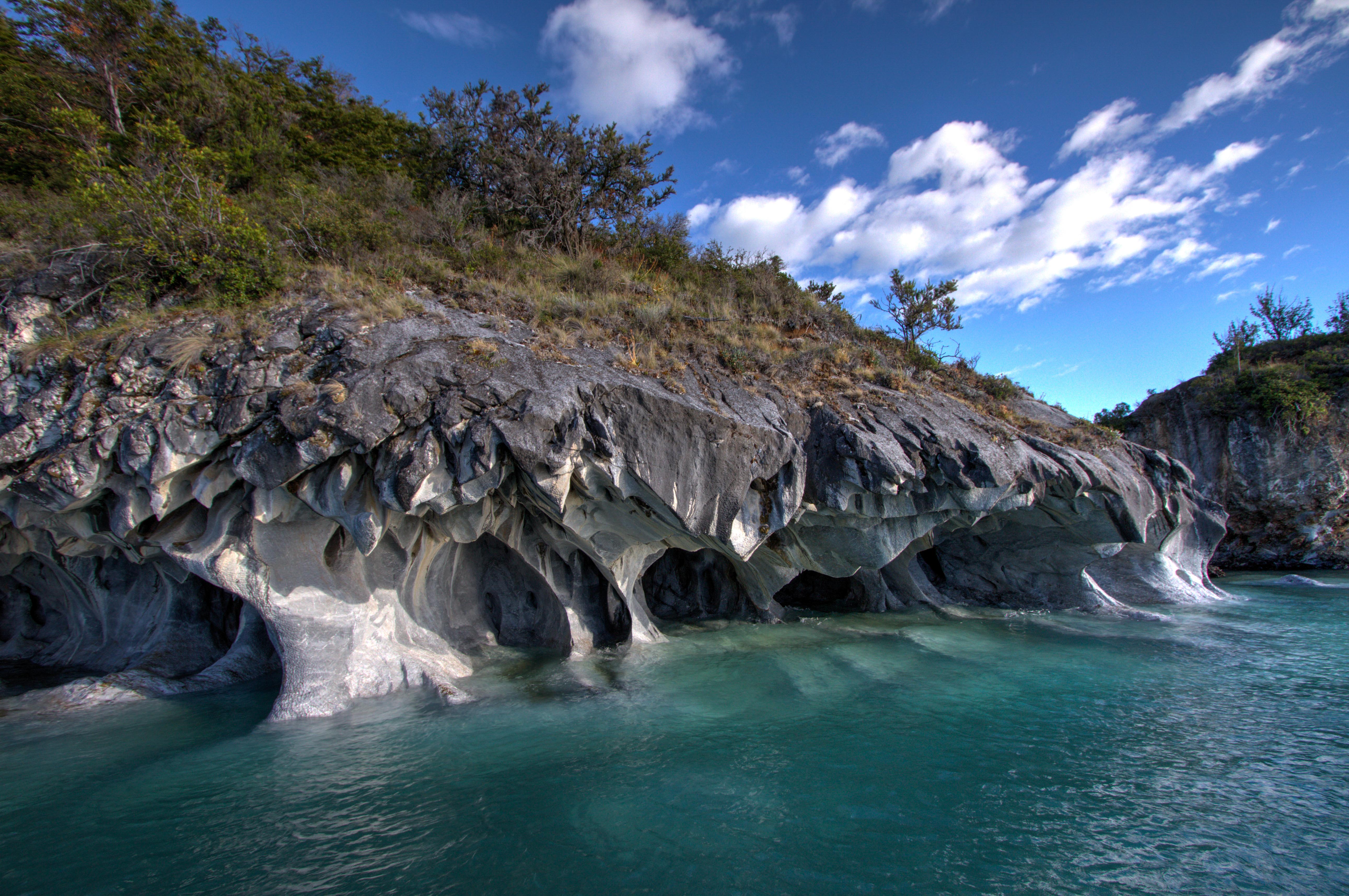
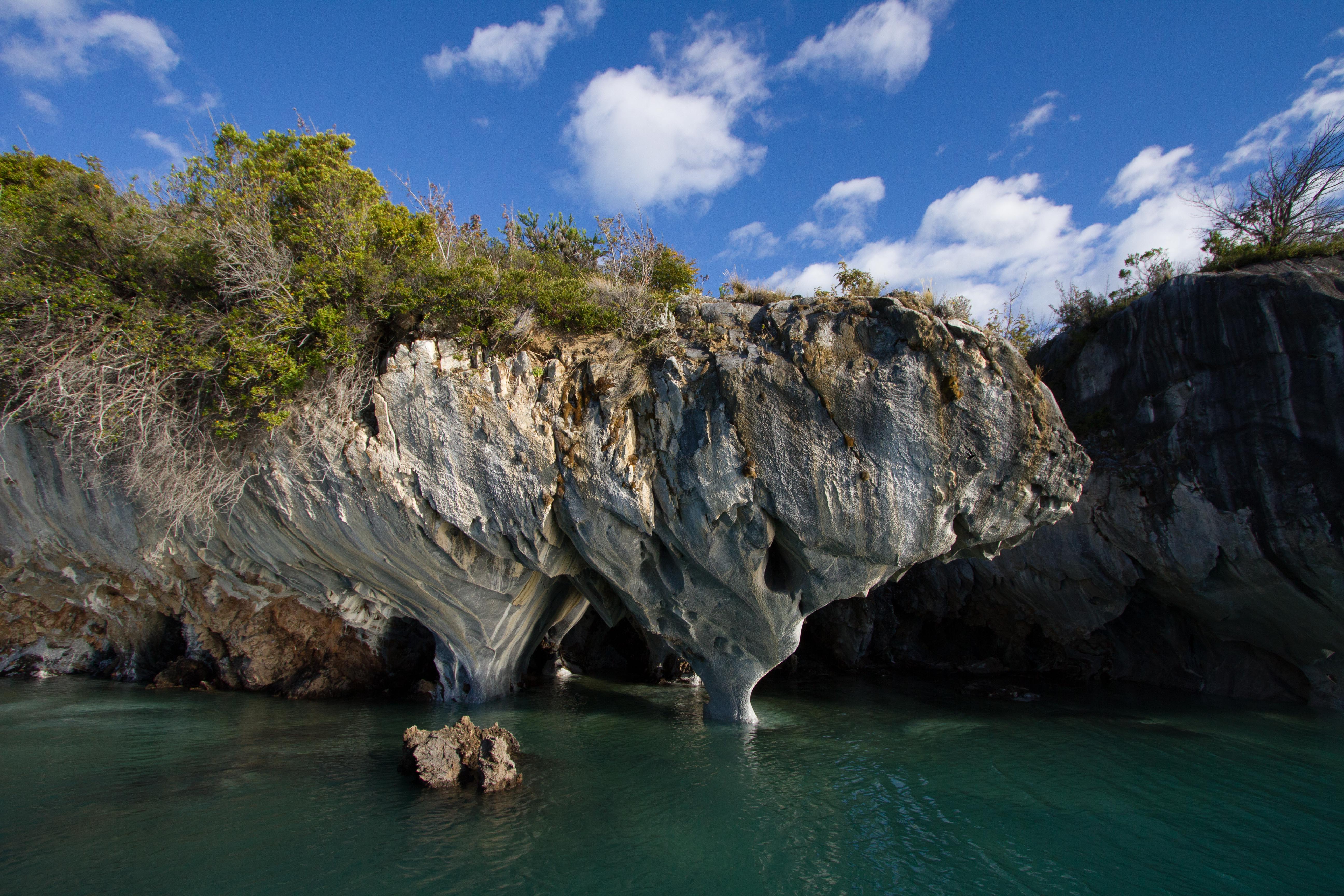
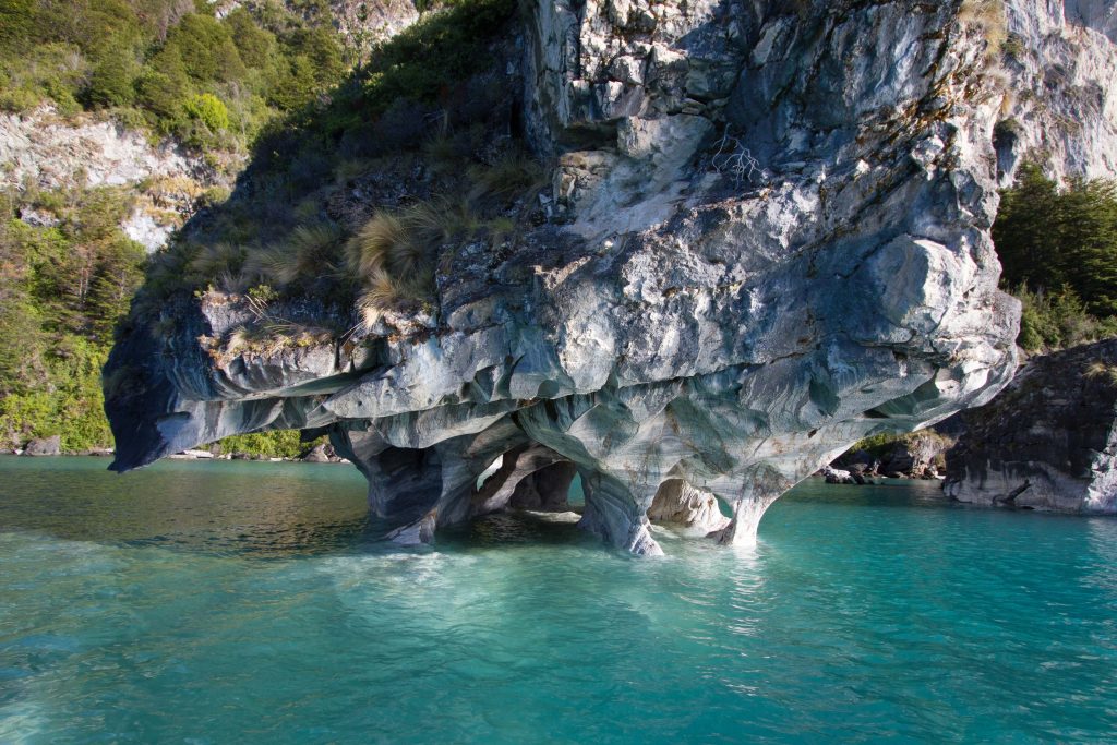
The Marble Caves (Cuevas de Mármol) are located on a peninsula of solid marble. Lake General Carrera sits at the base… 6000 yrs of the lakes waves have formed this unique cave…. add the blue glacier water from the lake and you’ll find a very surreal mix of cathedral caves with ice blue reflections.
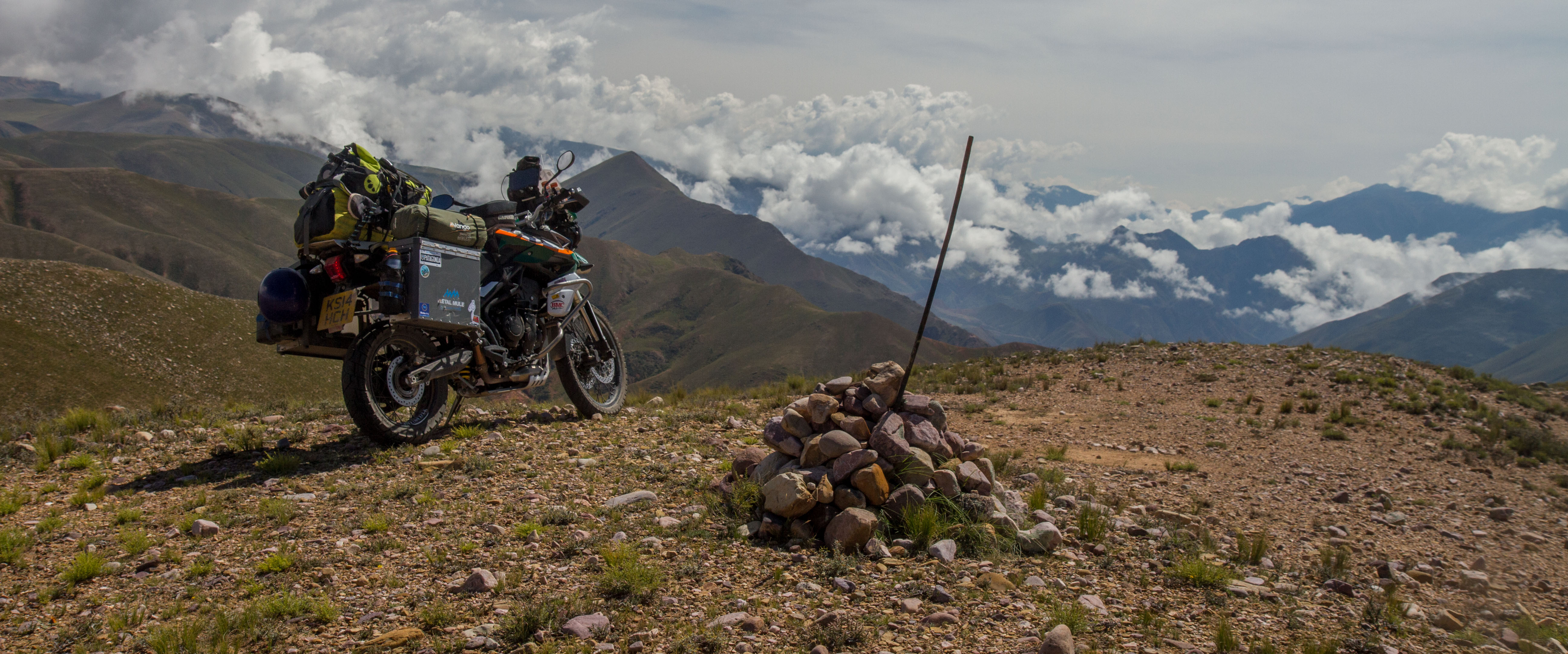
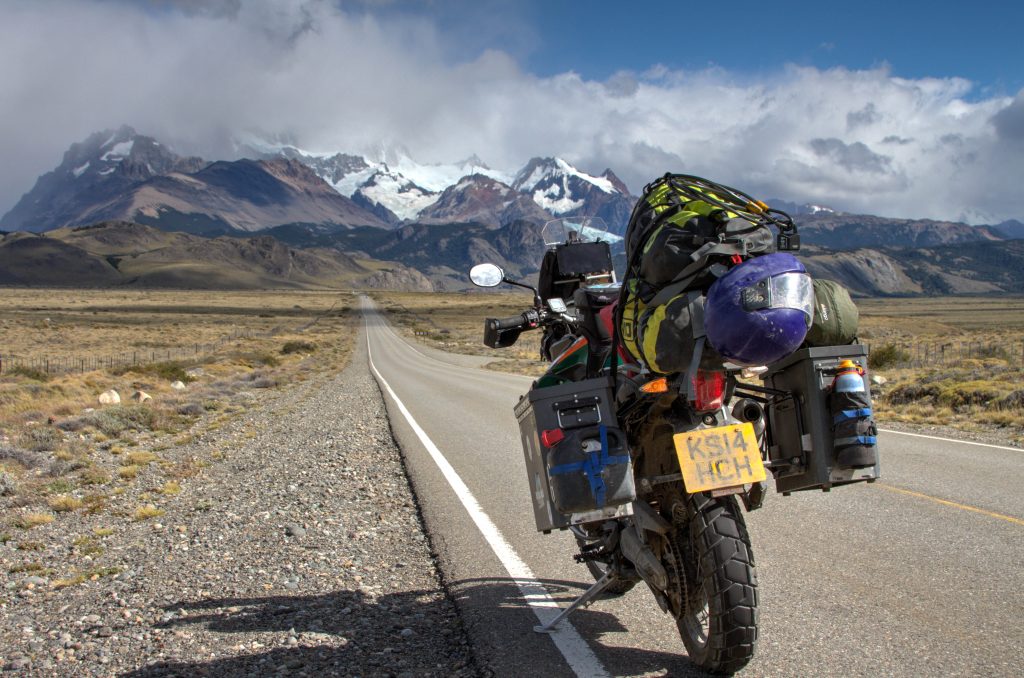
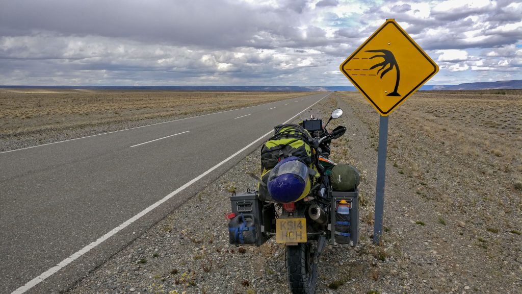
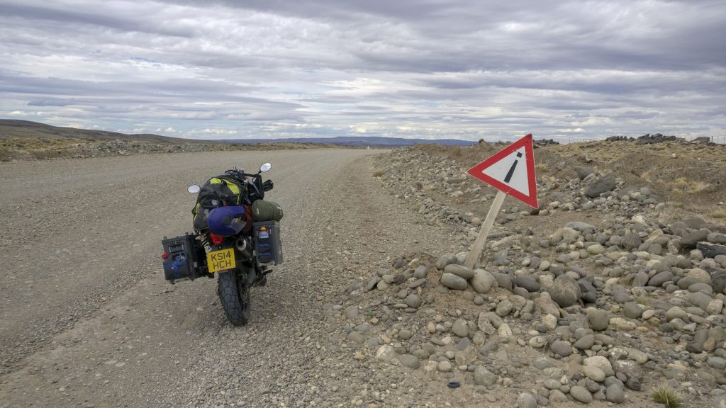
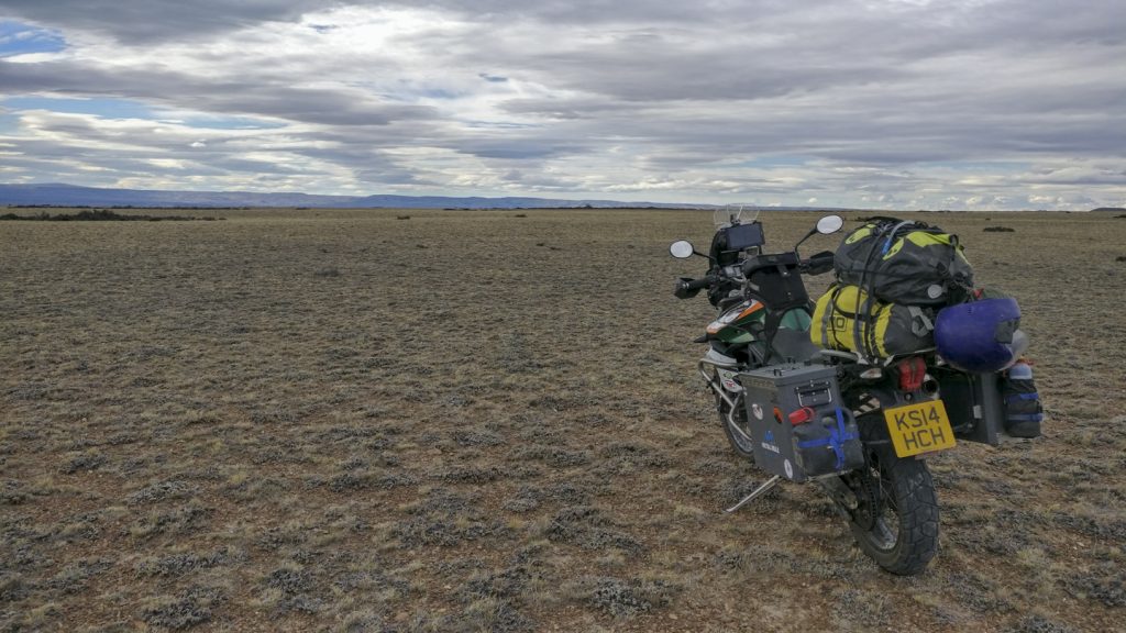
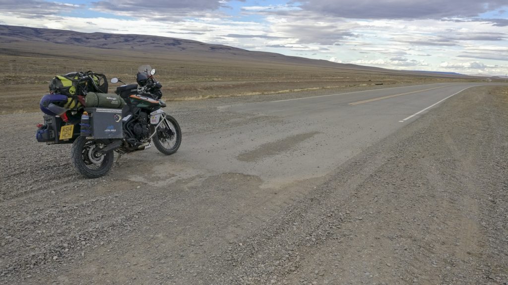
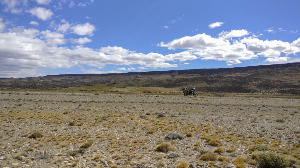
This Epic Ride is from Bajo Caracoles towards El Chalten. It’s long, boring, windy and flat. But when you finally arrive back near the Andes at El Chalten, you’ll be glad you took the challenge.
This section is of Ruta 40 is from Bajo Caracoles to Tres Lagos, Santa Cruz Province, Argentina
Type of Road
As of 2018, loose hard packed gravel. Because it is a mountainous road, it may become impassable during heavy rain. Some river crossing.
When is the best time to Ride?
Anytime outside Winter
Santa Cruz Province, Argentina
Ruta 40, Argentina
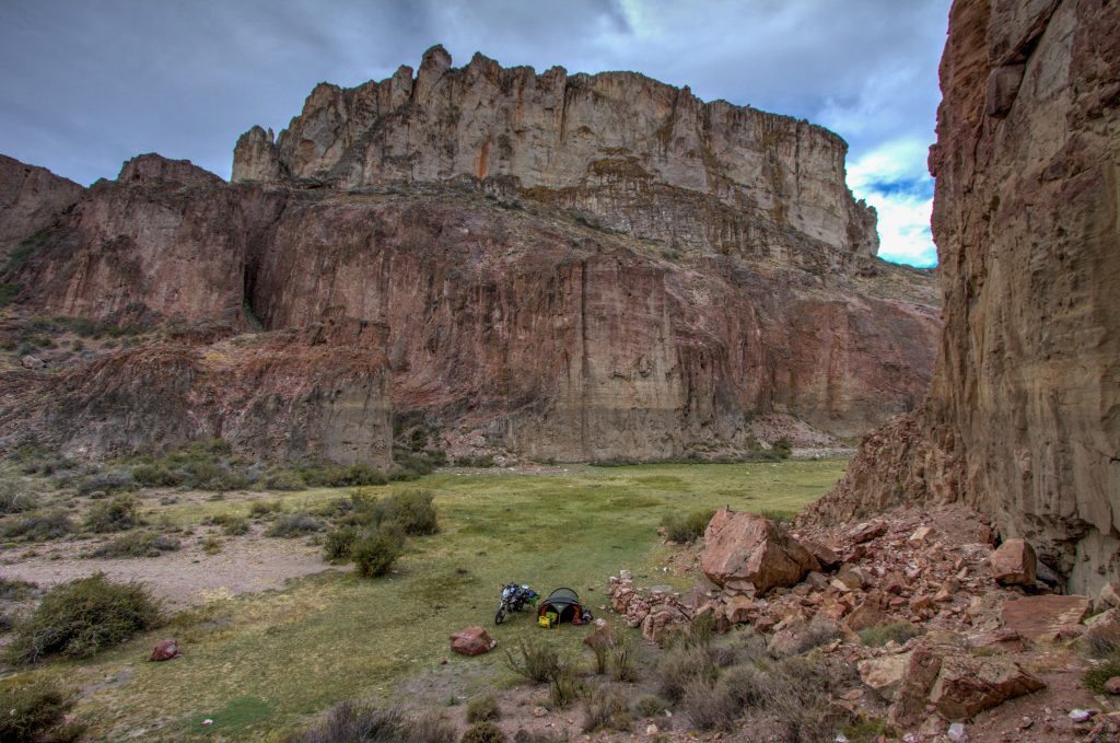
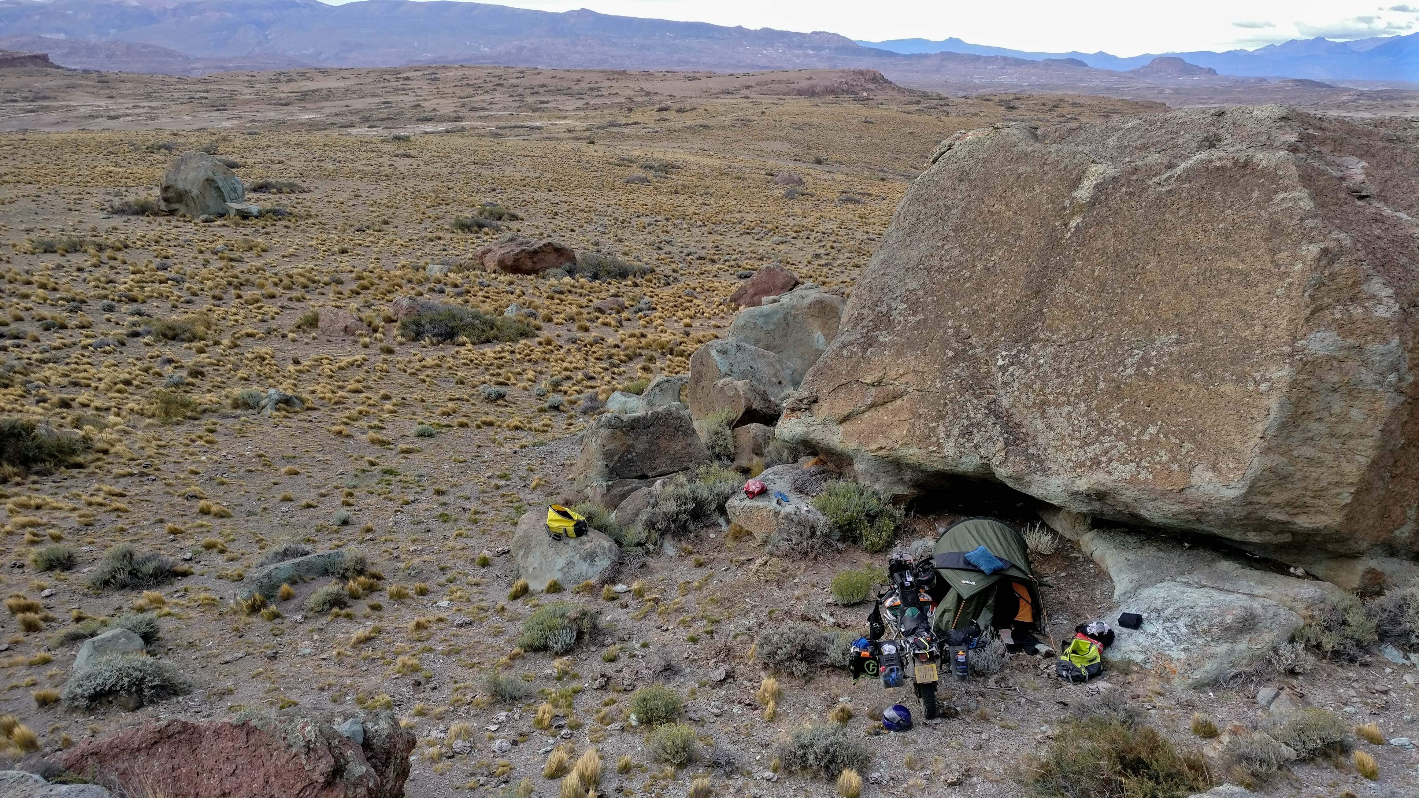
Wild Camping, Alero Charcamata, Santa Cruz Province, Argentina
Why is it an ‘Epic Ride’
Maybe ‘Epic’ is not the right word… This ride is more interesting because of the challenges and not so much on twisty roads and amazing scenery. But if you’re heading south, there aren’t many other roads to take 🙂
It’s a isolating crazy ride, full of wind, and barely any fuel stations.
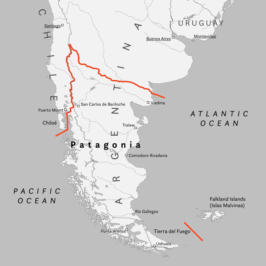
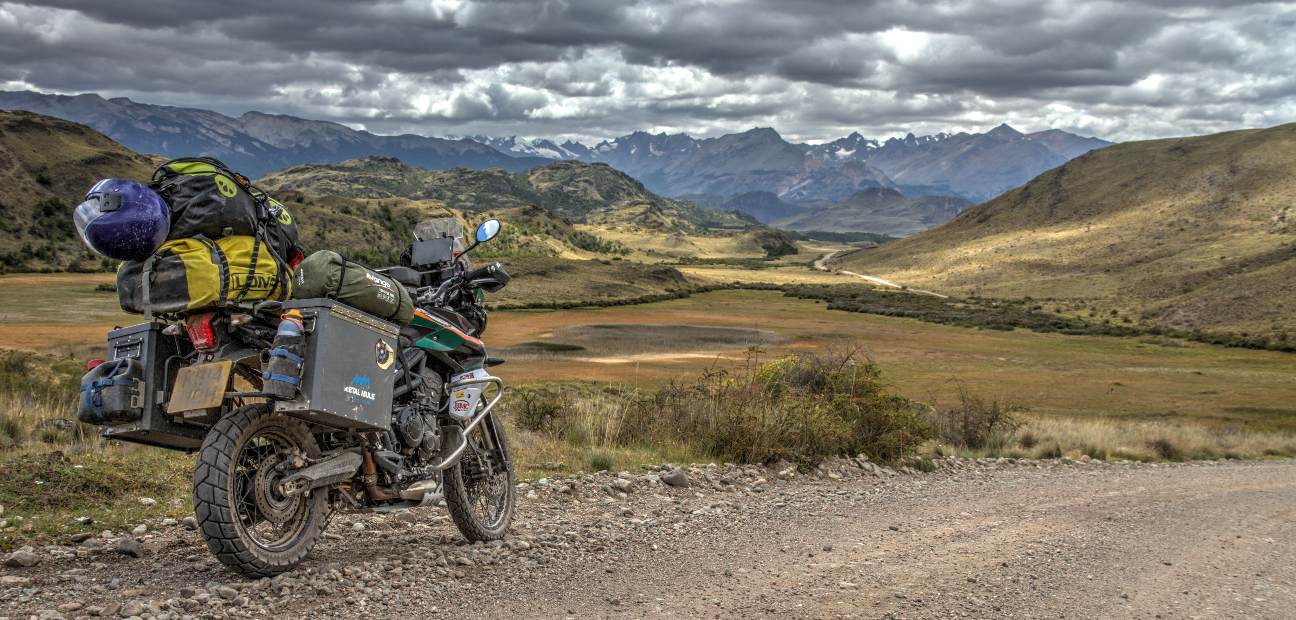
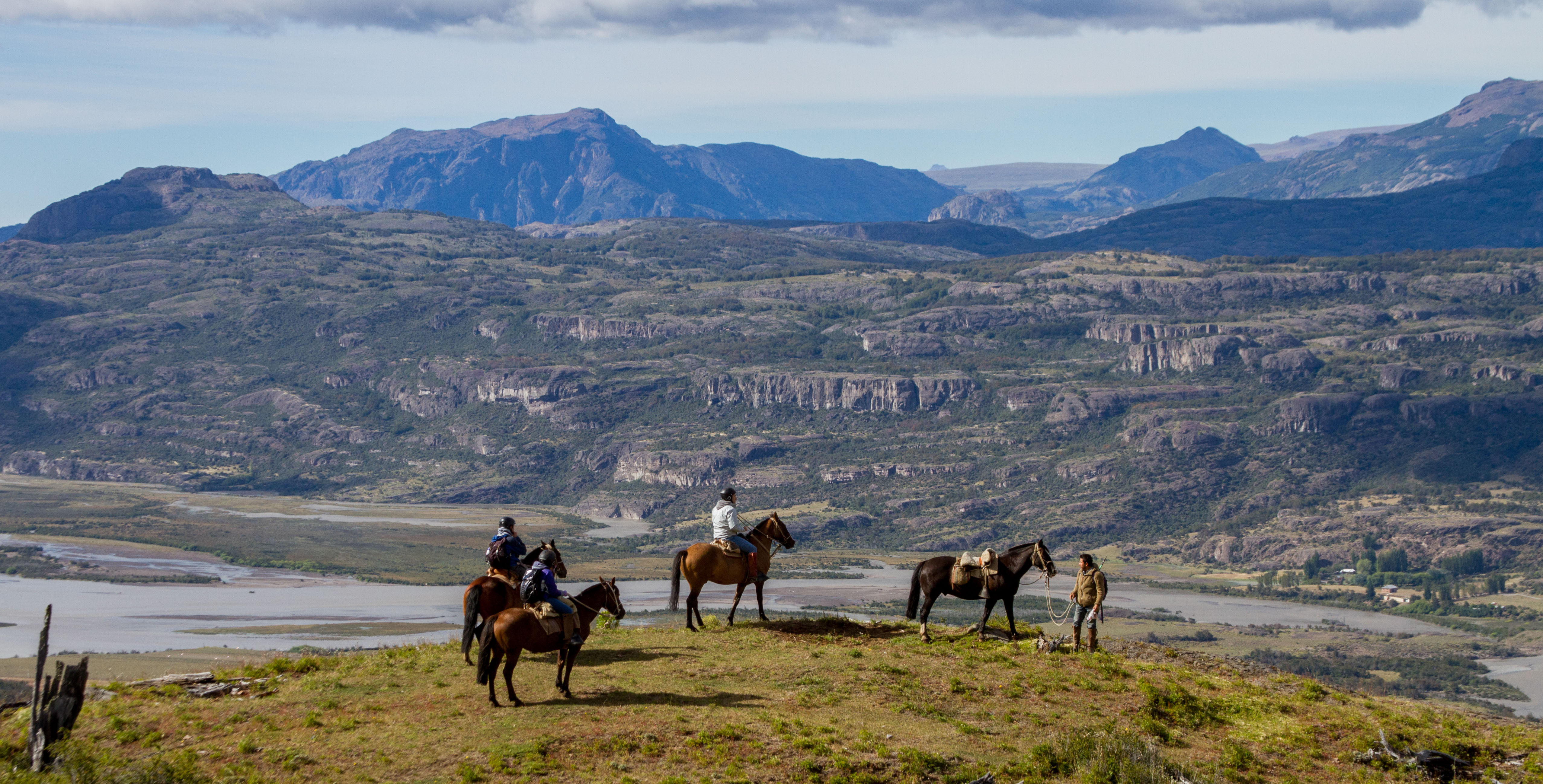
Patagonia is a sparsely populated region located at the southern end of South America, shared by Argentina and Chile. The region comprises the southern section of the Andes mountains as well as the deserts, pampas and grasslands east of this southern portion of the Andes. For overlanders, Patagonia has always been top of the ‘must-do’ on
Patagonia is a HUGE place that incorporates both Argentina and Chile. Highlights are many. You could stay for ages but you’ll be pushed north by the short summer period, longing to the day you return.
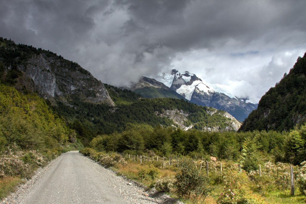
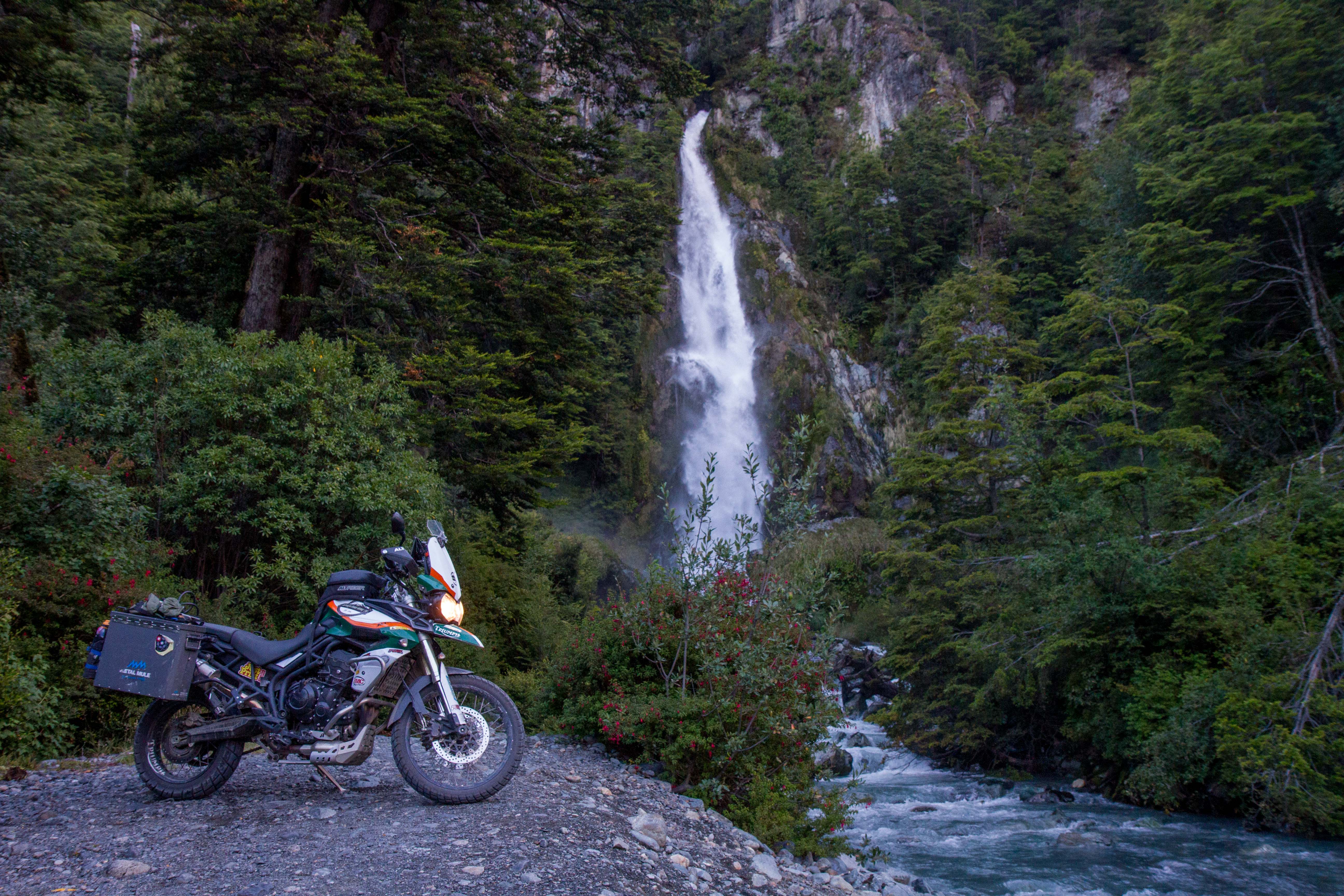
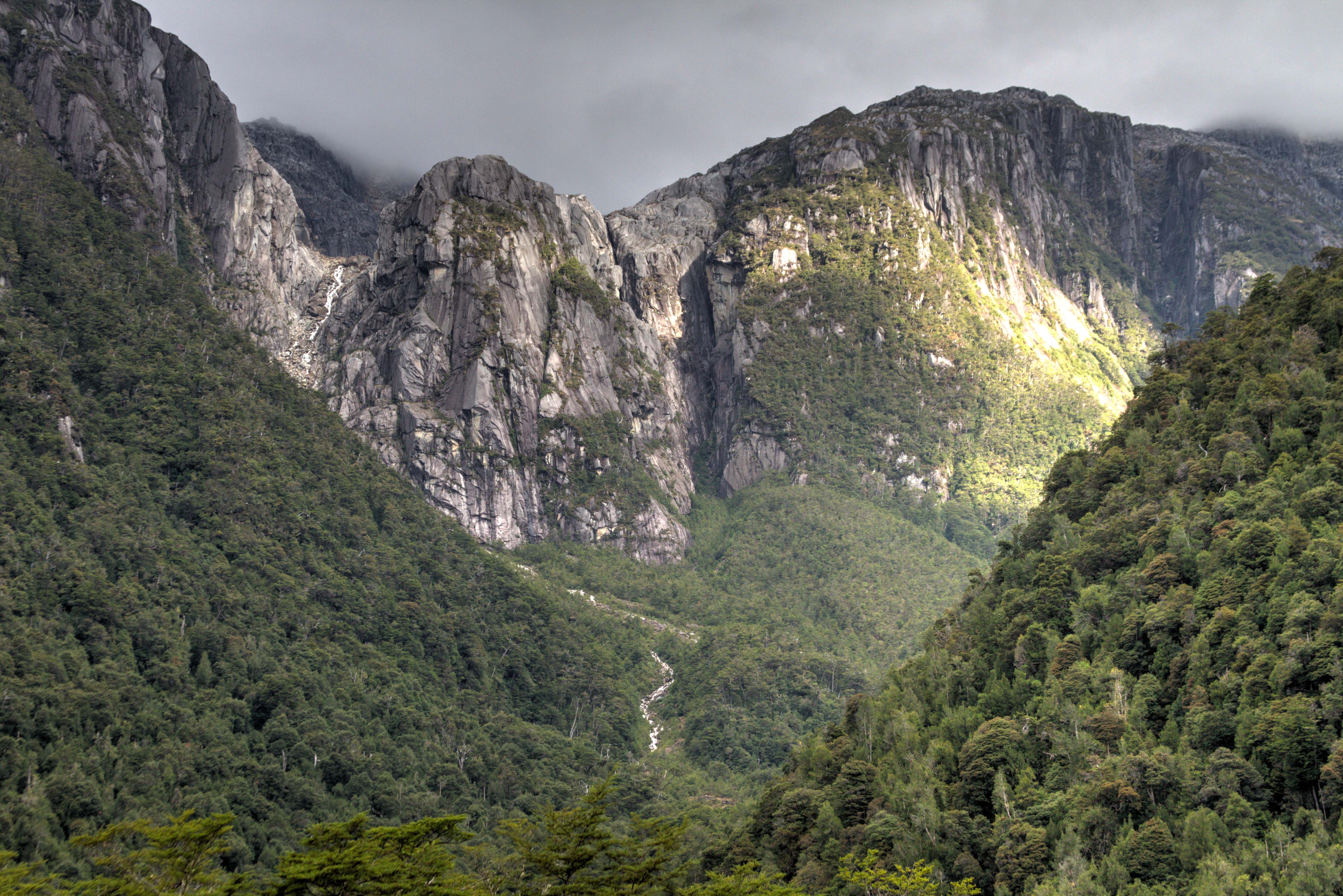
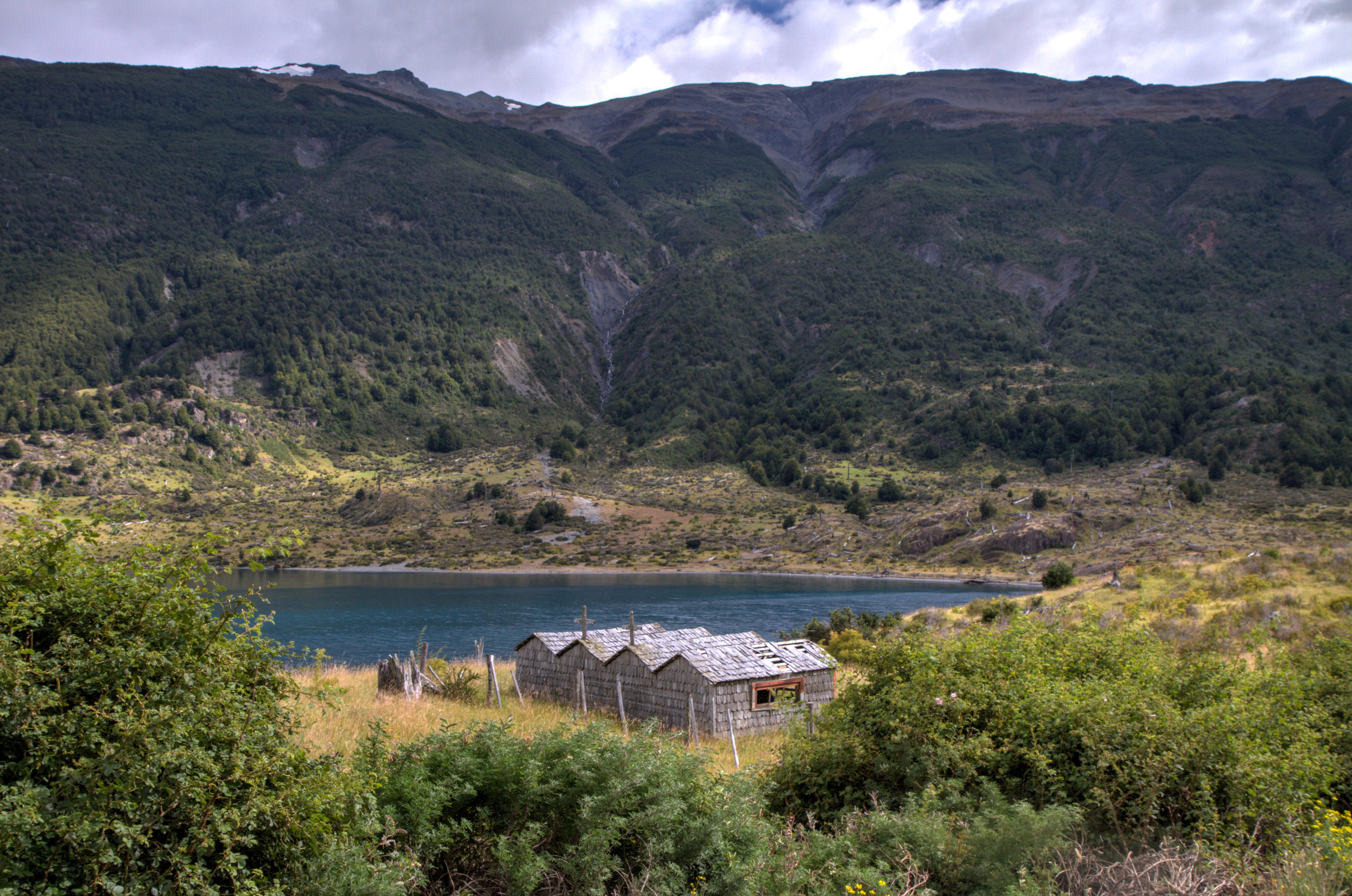
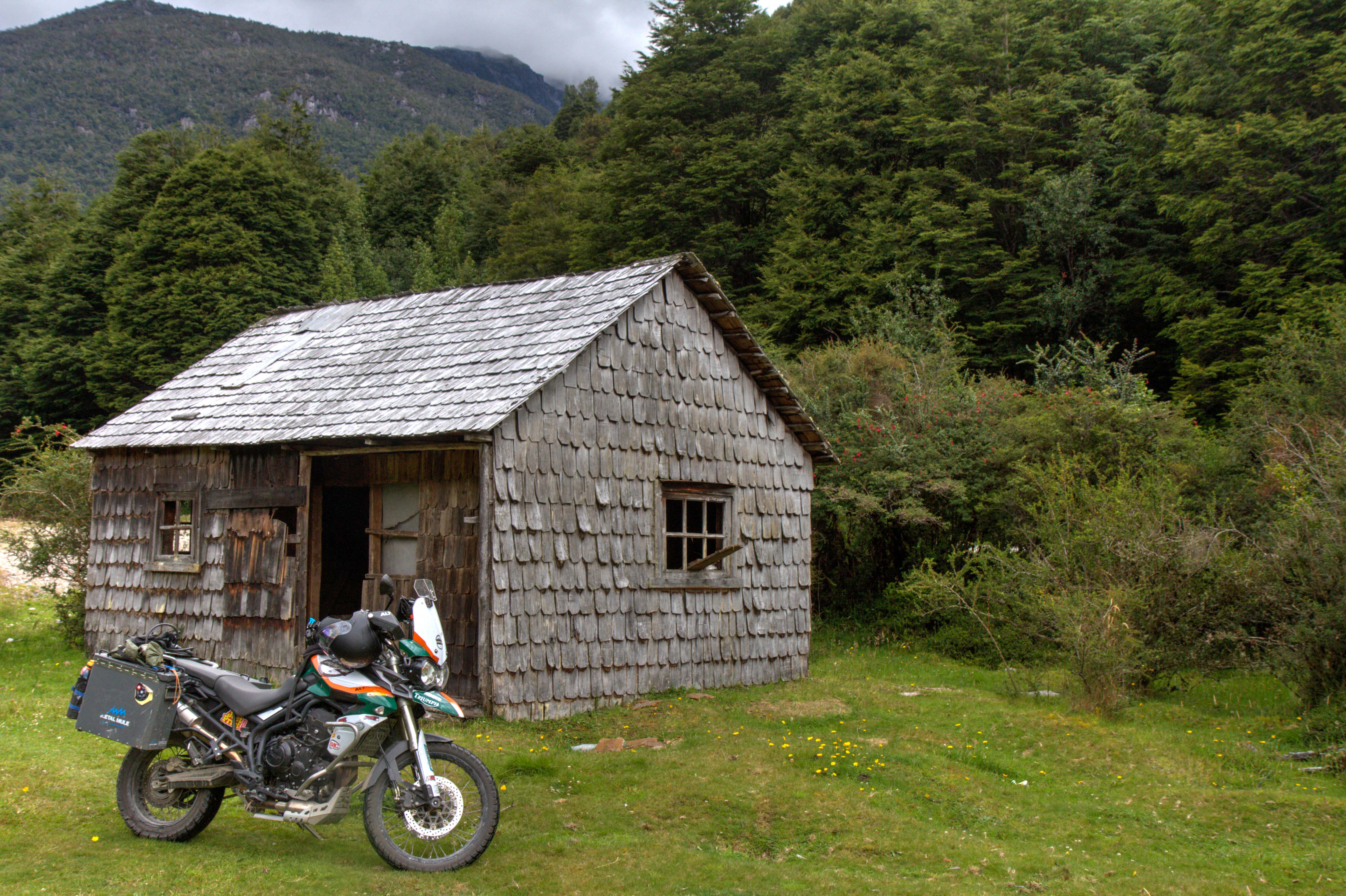
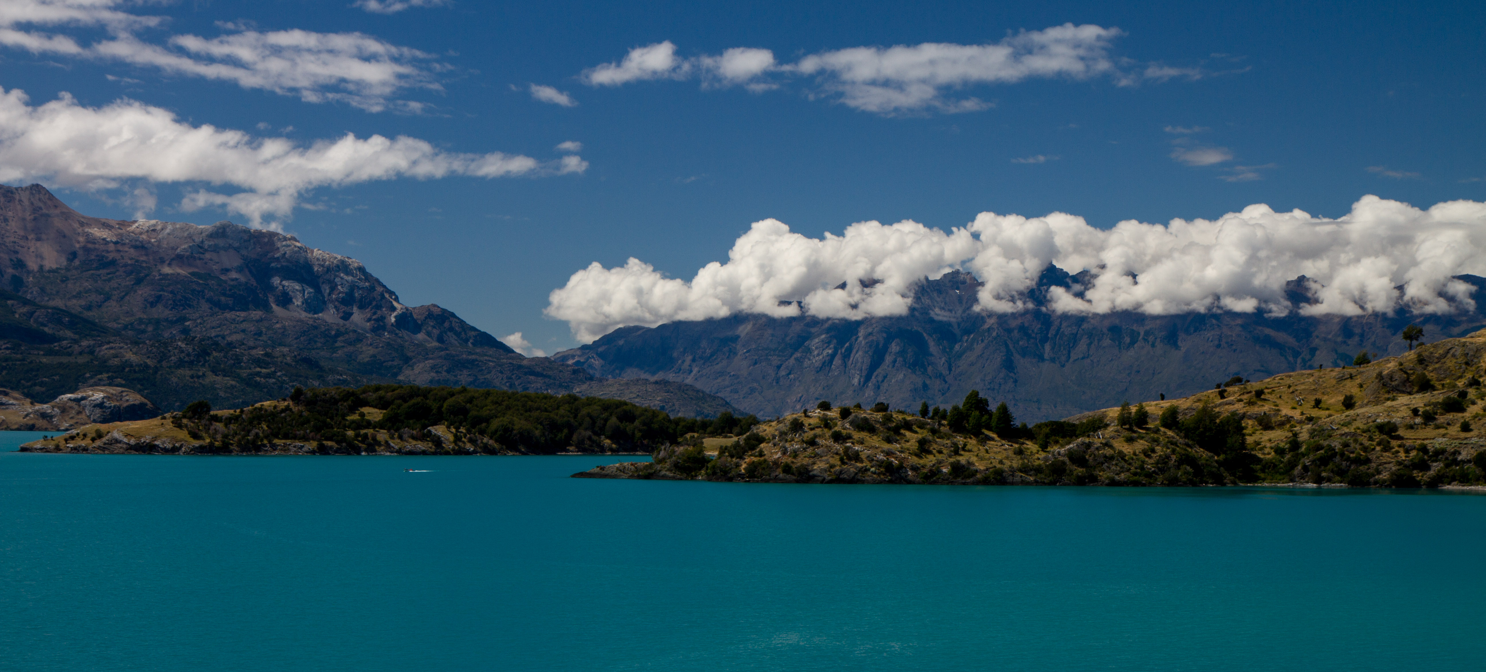
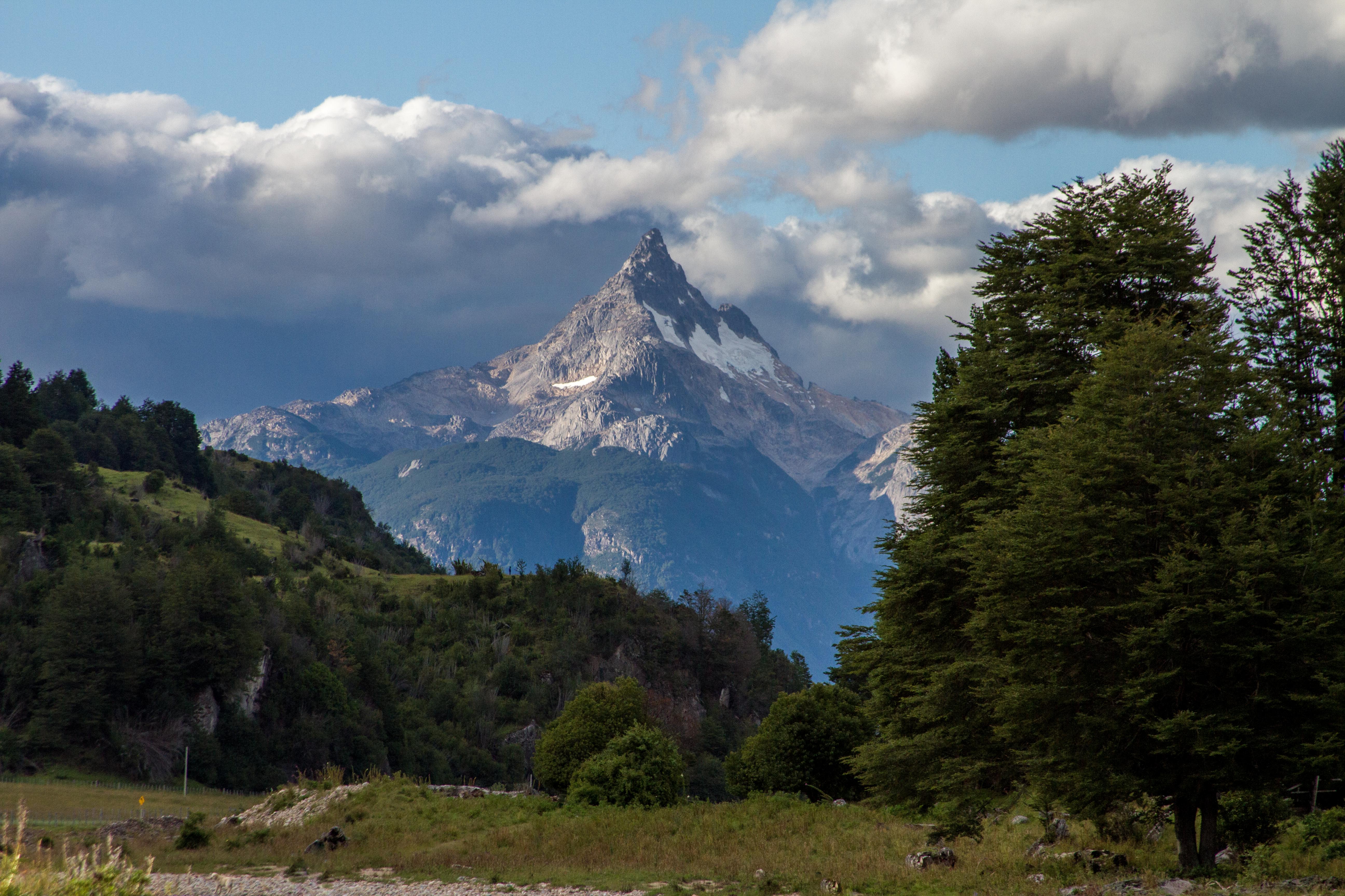
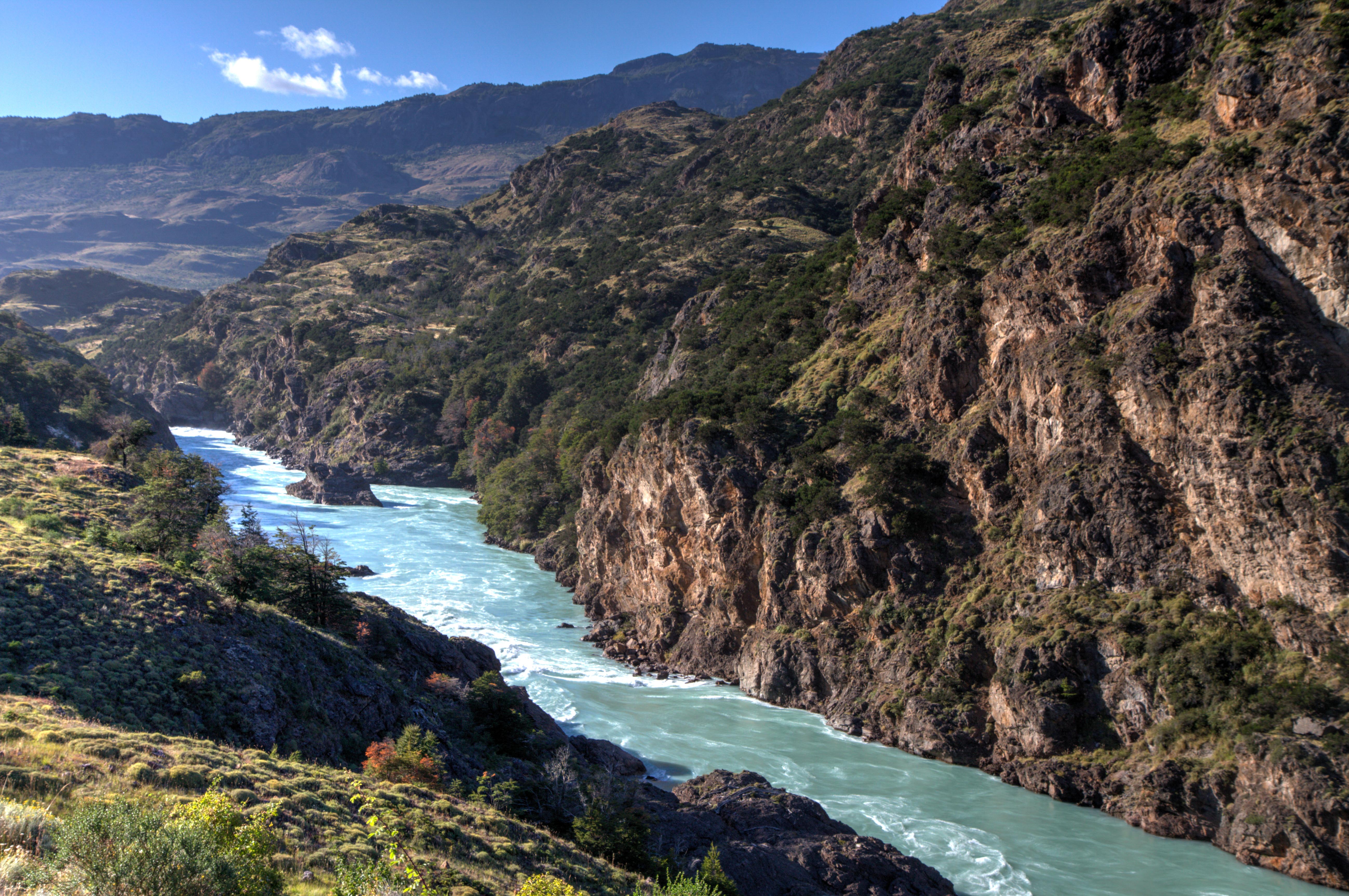
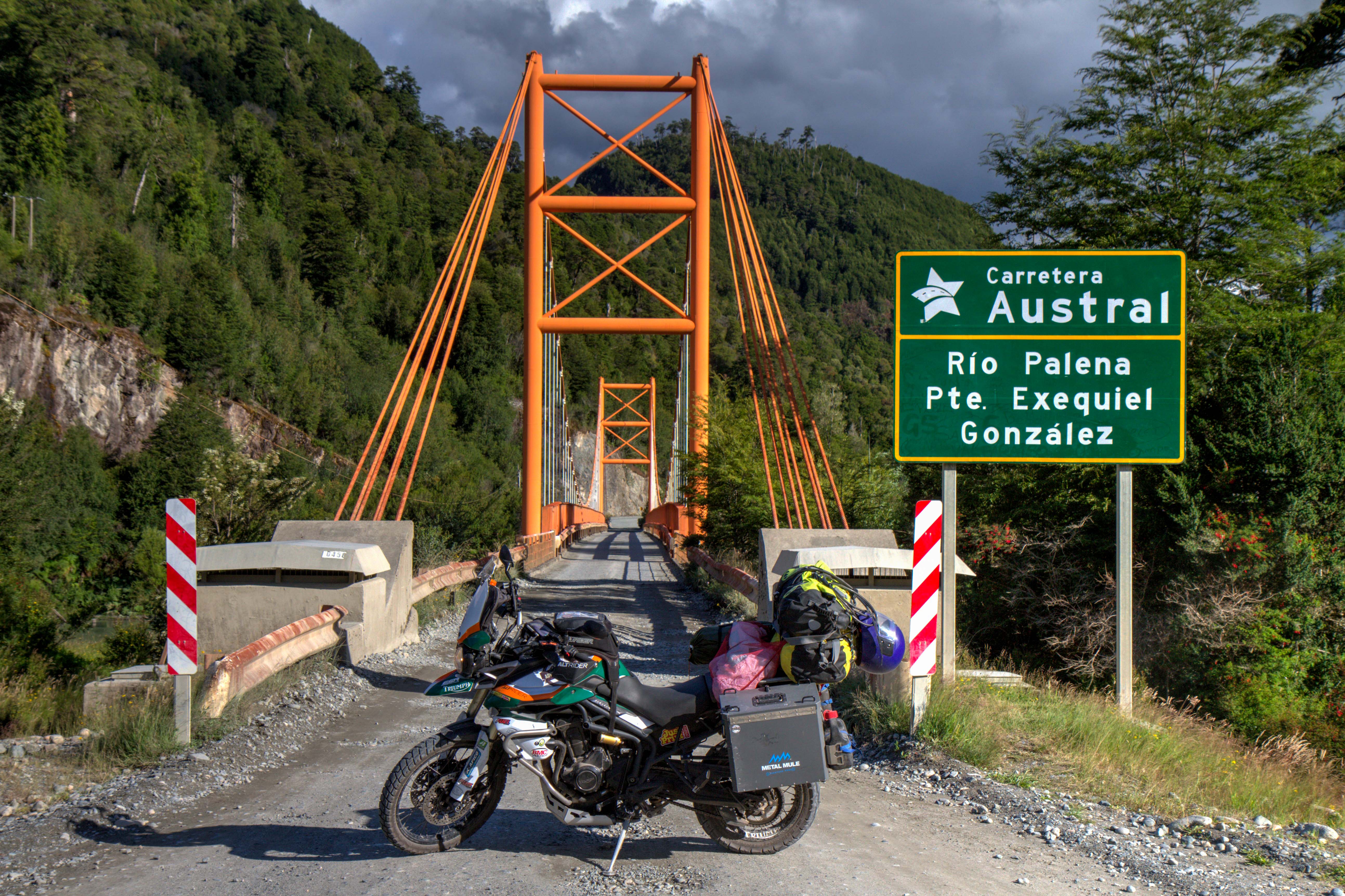
Carretera Austral
Carretera Austral is the legendary name given to the official Ruta (Route) 7 in Chile. The road runs from Puerto Montt to Villa O’Higgins. It exists entirely in the Patagonia section of Chile.
The construction of the road started in 1976 and was one of the biggest infrastructure projects at the time in Chile. Unlike Argentina, on the other side of the Andes Mountain range, constructing a road south into Chile was not easy. Argentina had the flat plains to run the road along when the mountain terrain became to difficult. This is seen in the famous Ruta 40 in Argentina, which mostly runs along the easier, flat lands away from the Andes. Chile dint have this luxury as the stunning terrain is full of steep mountains, fjords, forests, canals and glaciers. Apparently, 10,000 army personal were involved in the roads construction. When finished the road was completely dirt. Today work is underway to pave the entire length, a task that will take some time. Until then, enjoy the road before it becomes ‘too accessible’. Check out my post on the Carretera Austral.
Mirador Cerro Castillo, Aysén Region, Chile
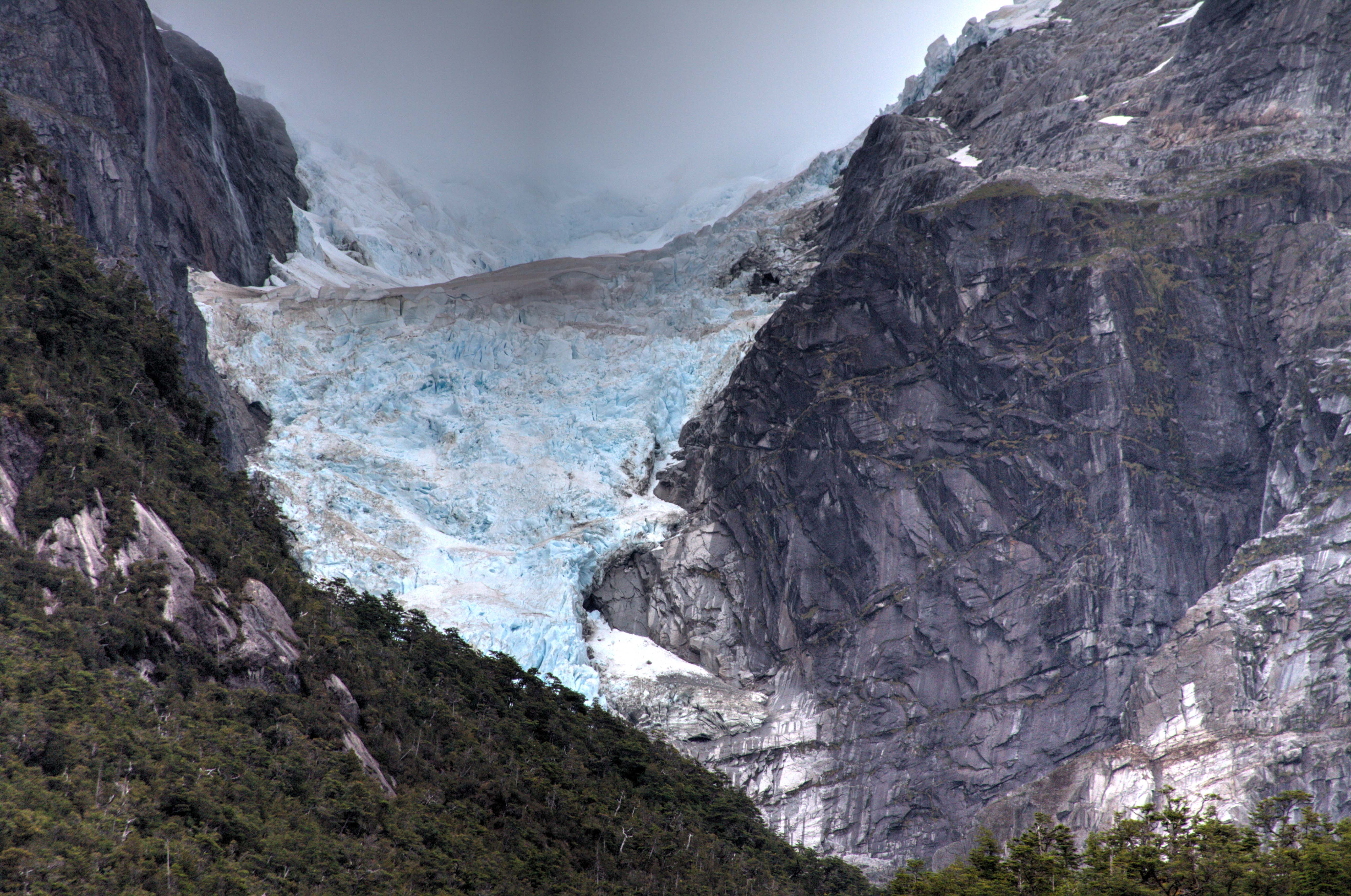
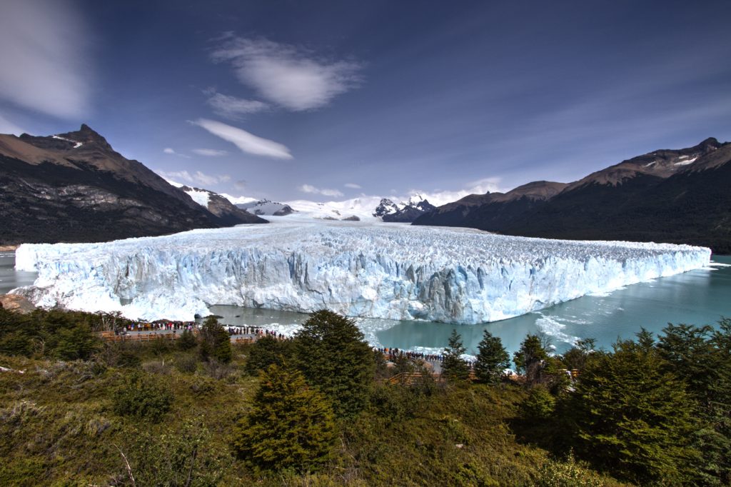
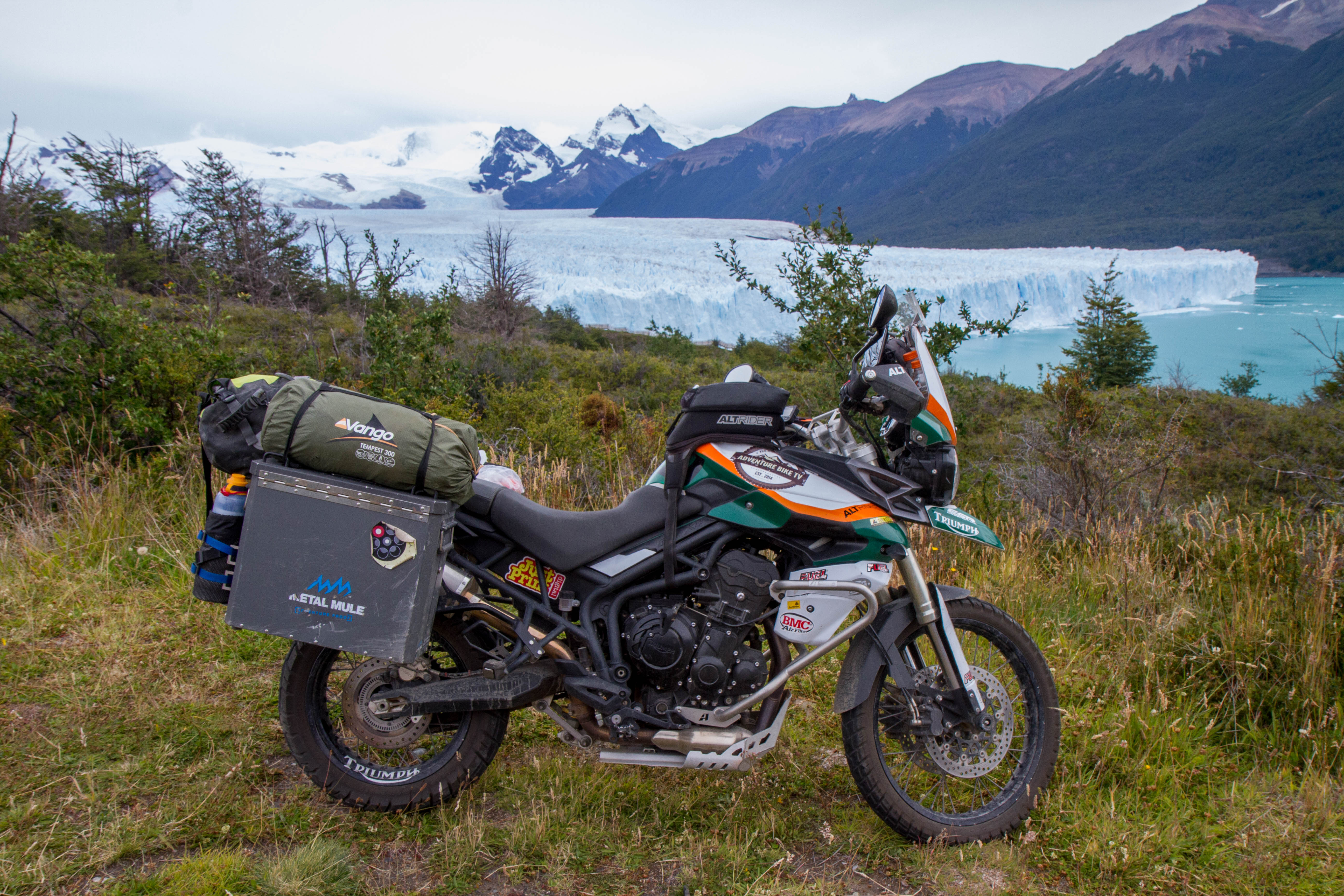
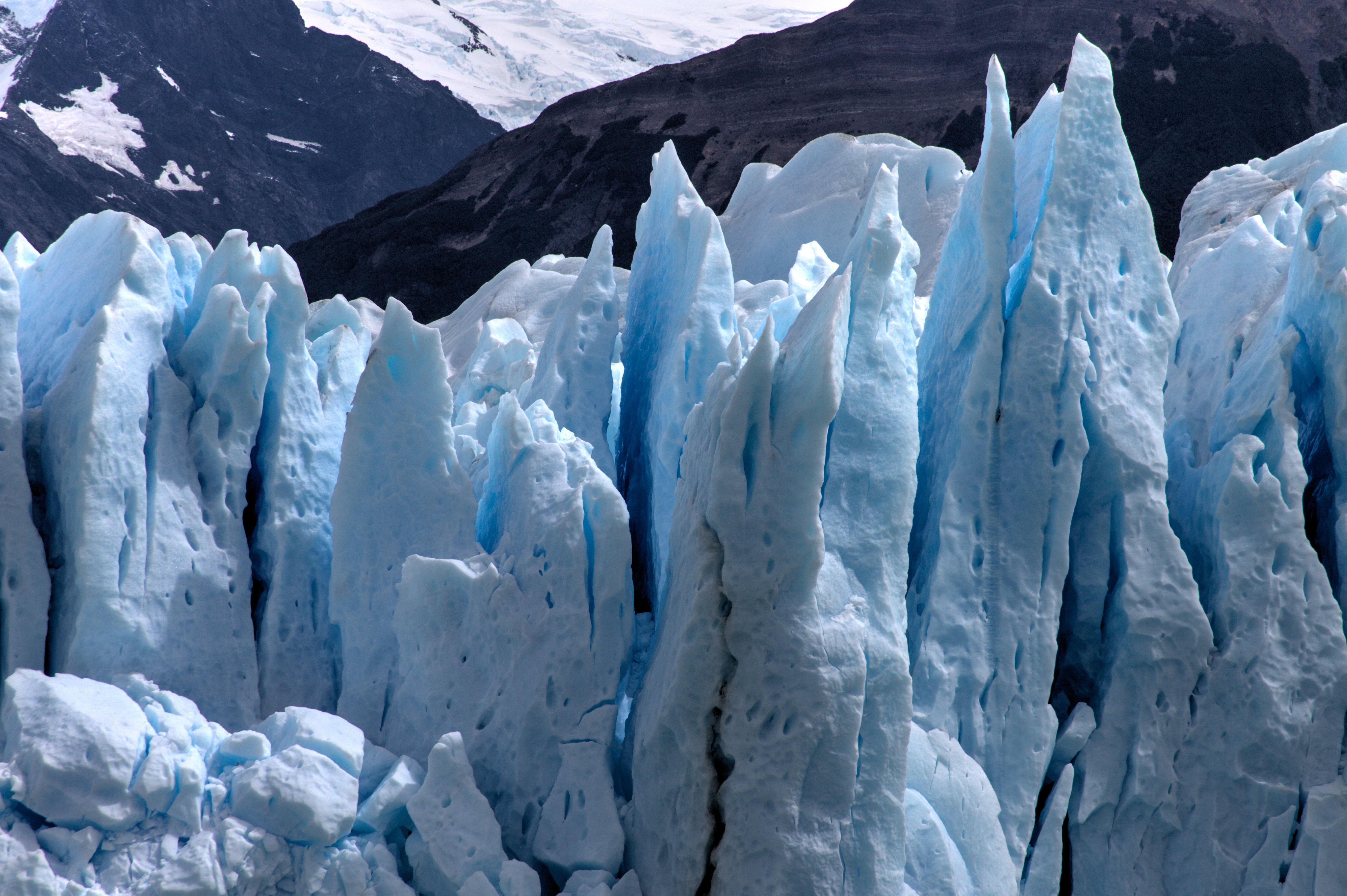
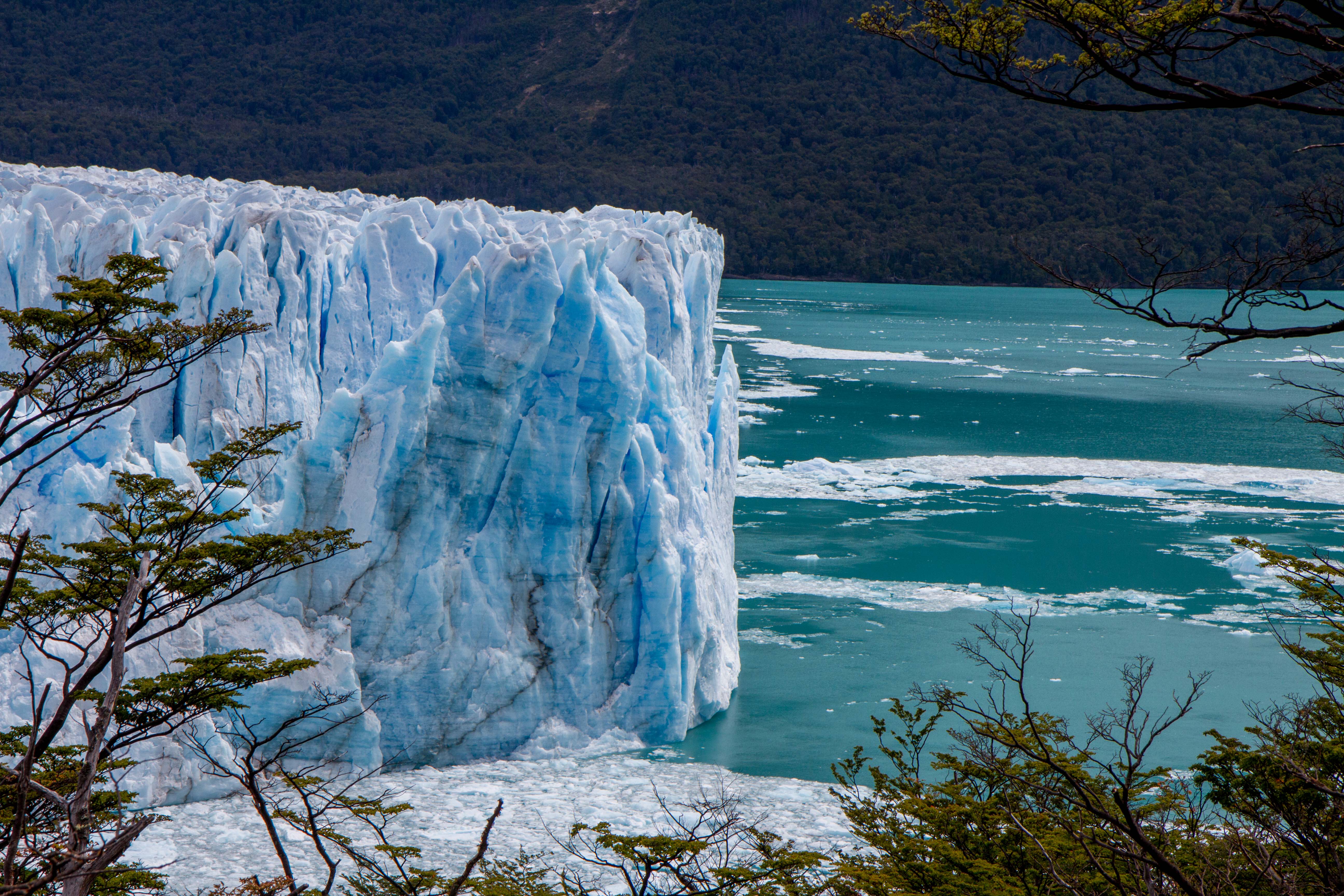
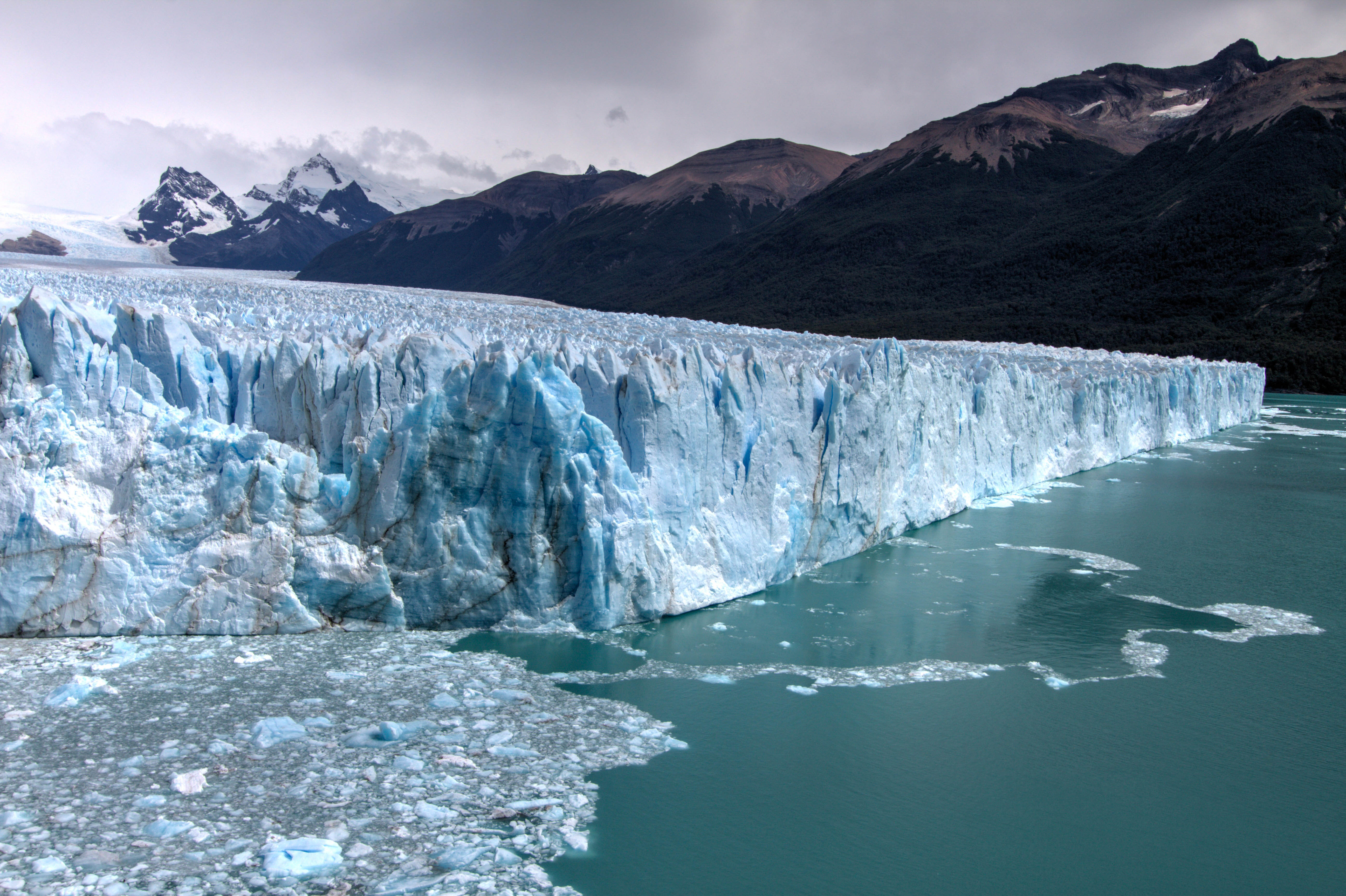
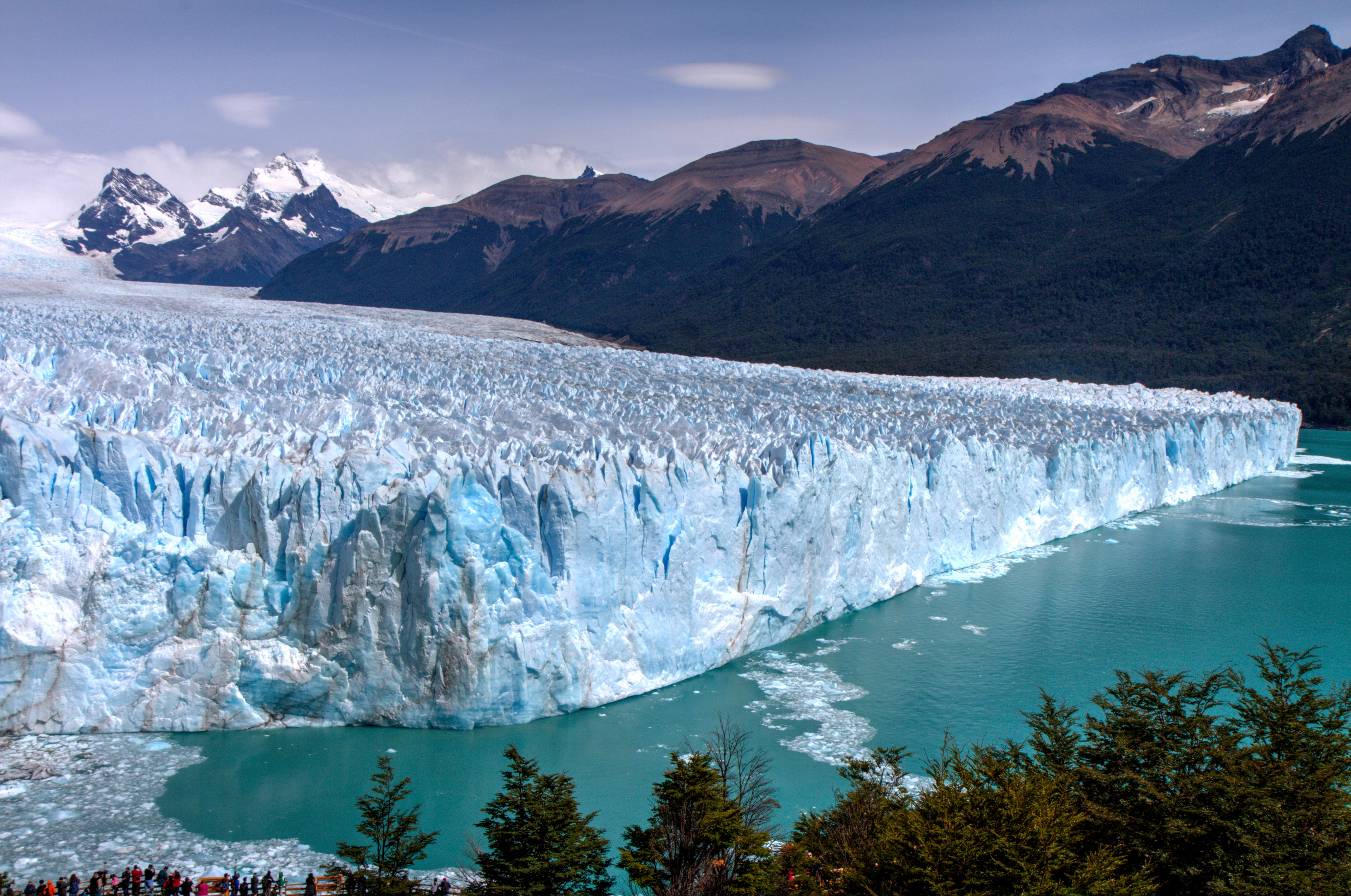
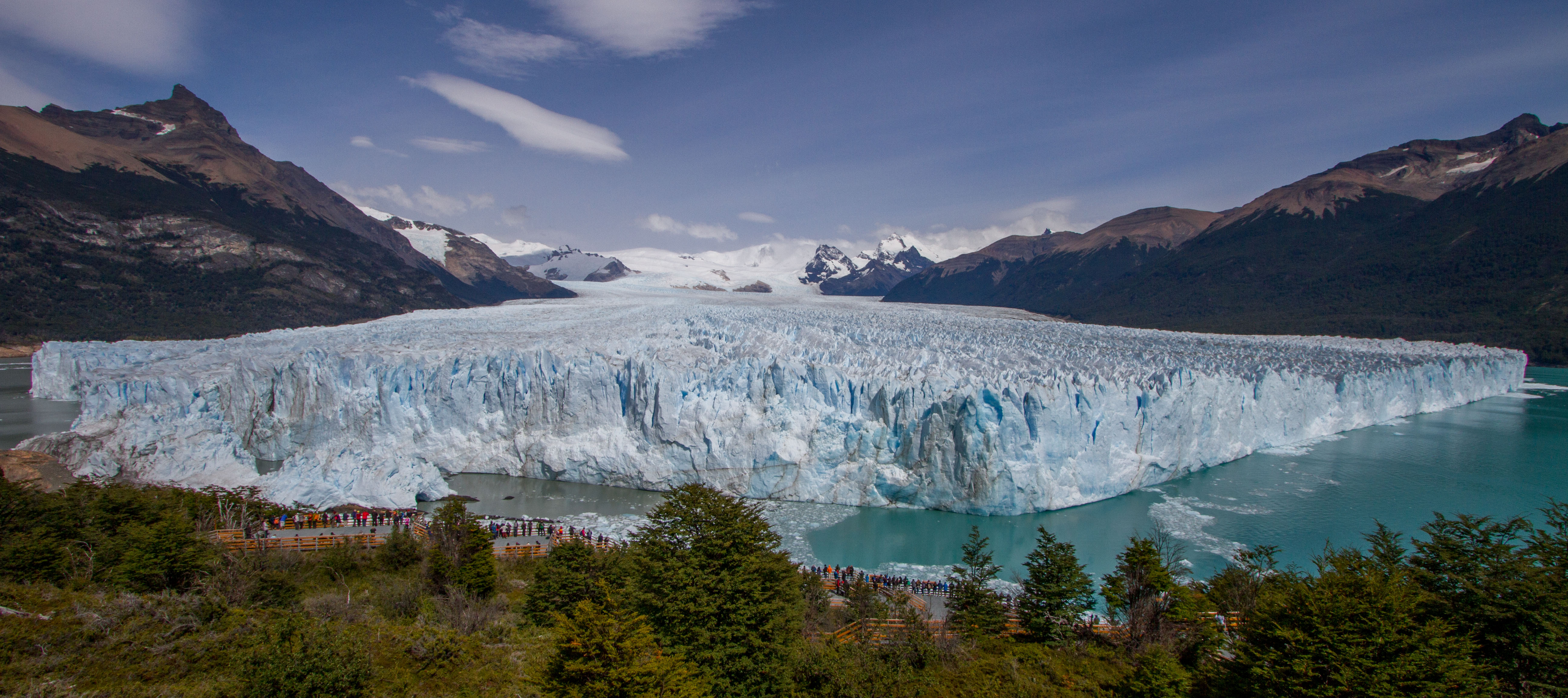
Perito Moreno Glacier
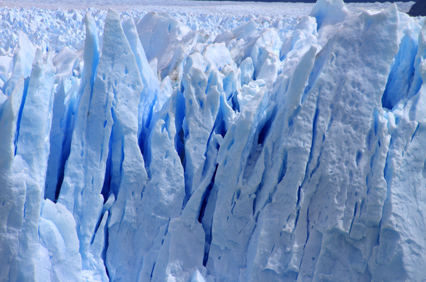
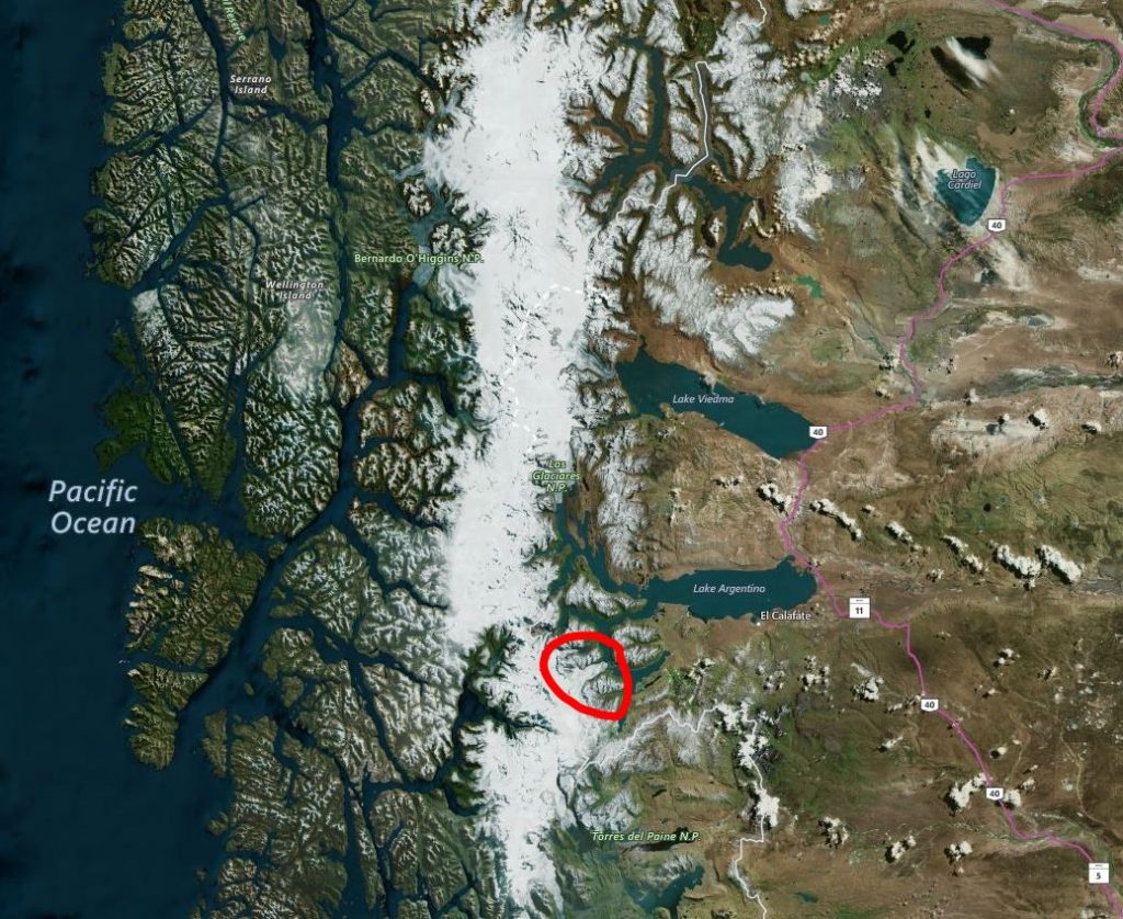
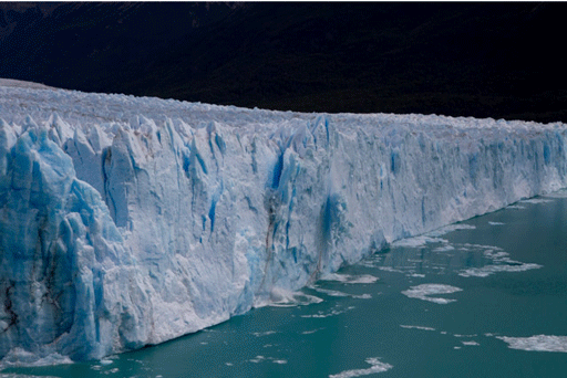
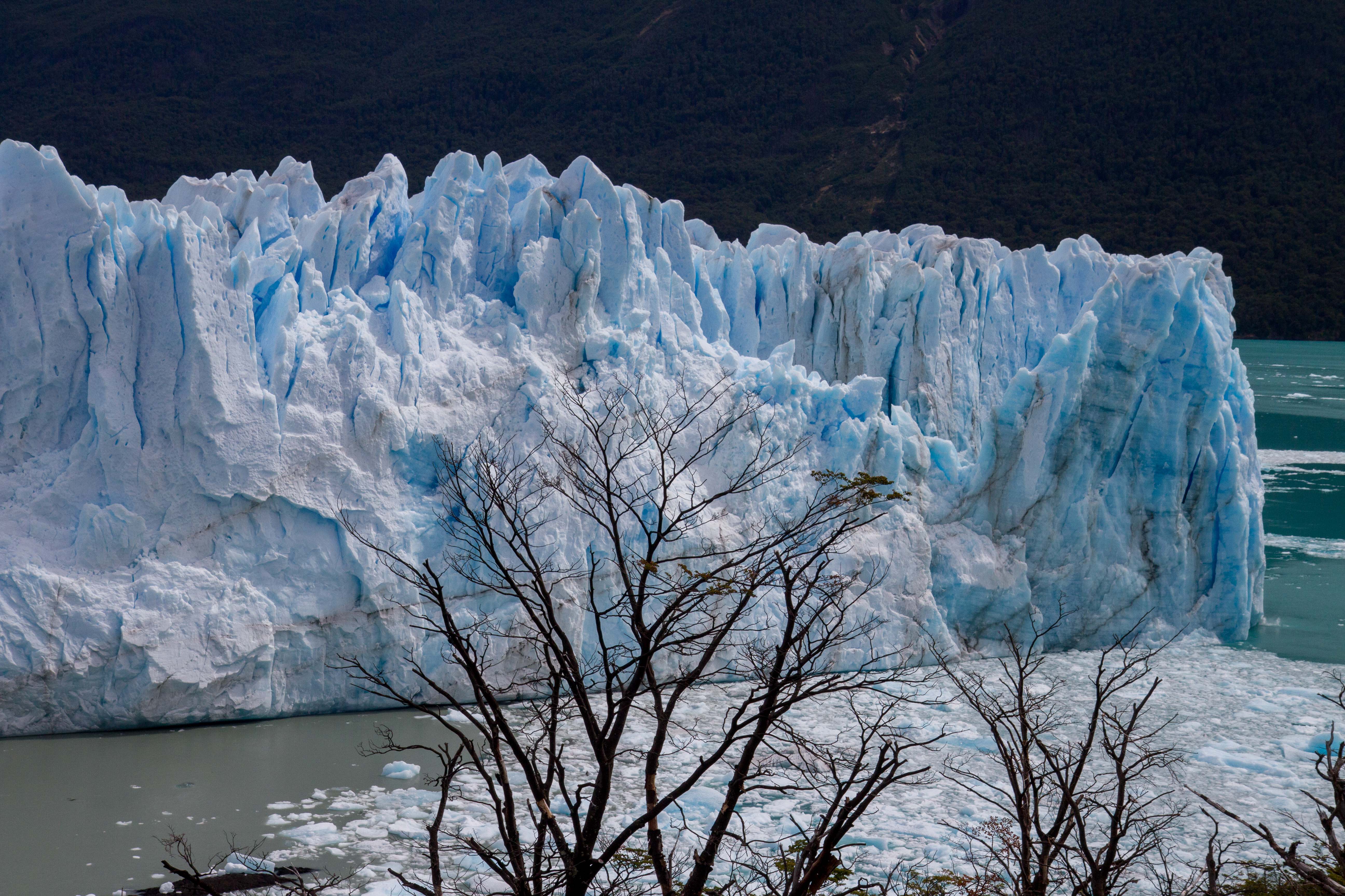
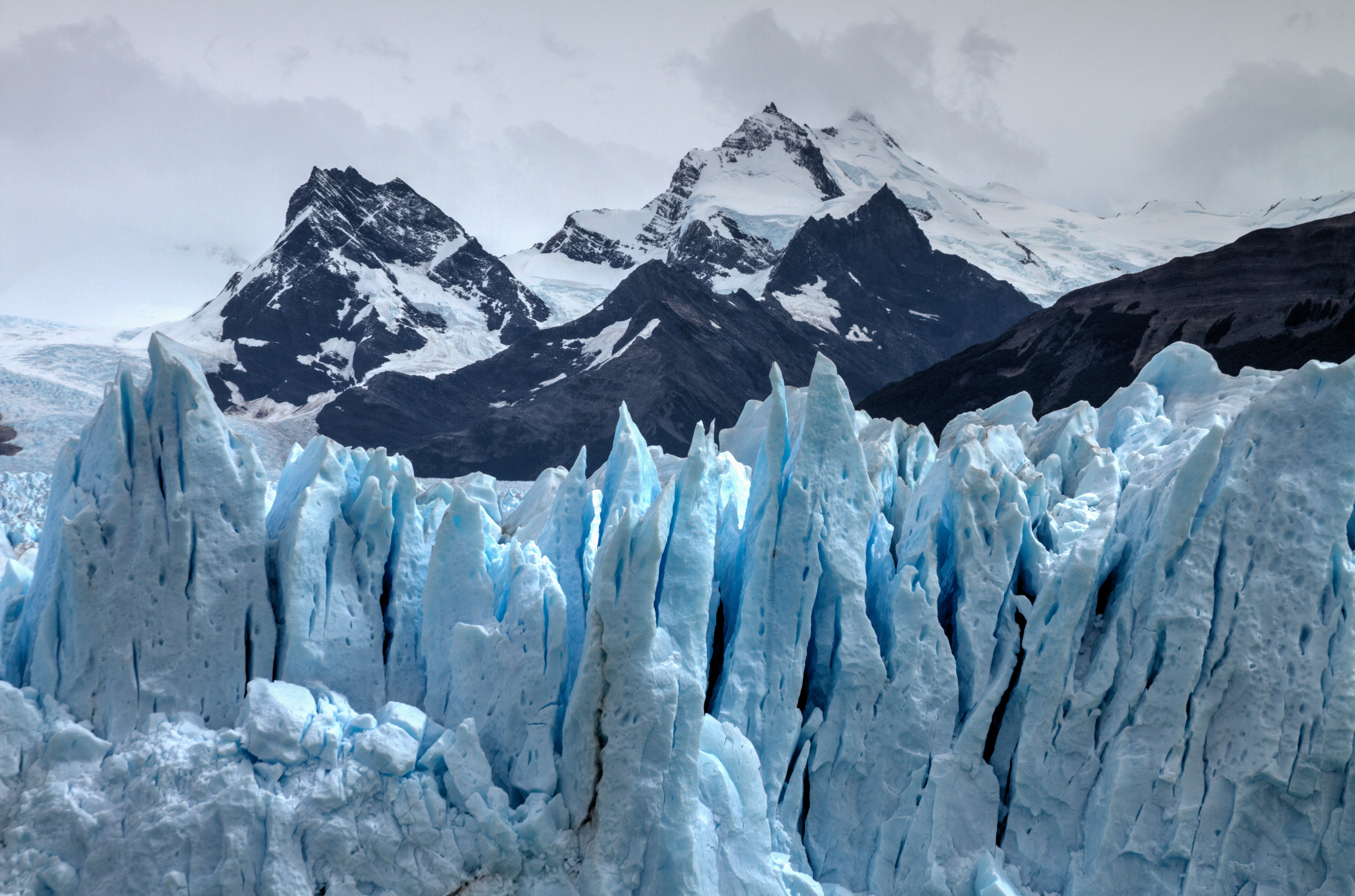
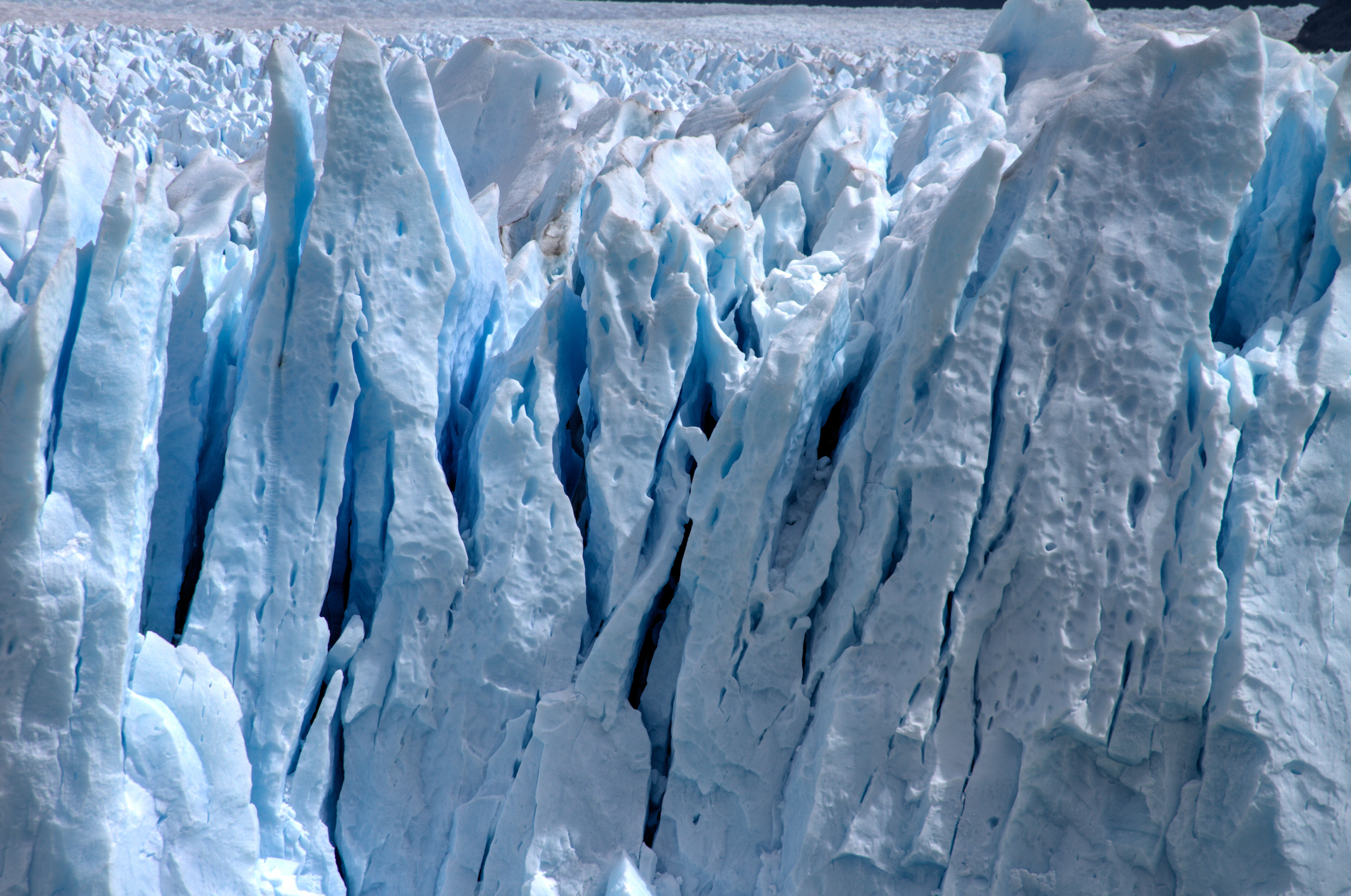
The Perito Moreno Glacier is classed as one of the ‘Must Sees’ of a trip to Patagonia, and with good cause. Its incredible! Firstly the size, the photo below show the width of the section that is view-able from the platform. incredibility this is 5kms wide!! More amazingly, it is part of the Southern Patagonian Ice Field which has an area of 12,363 km2. Check out my post on this amazing site.
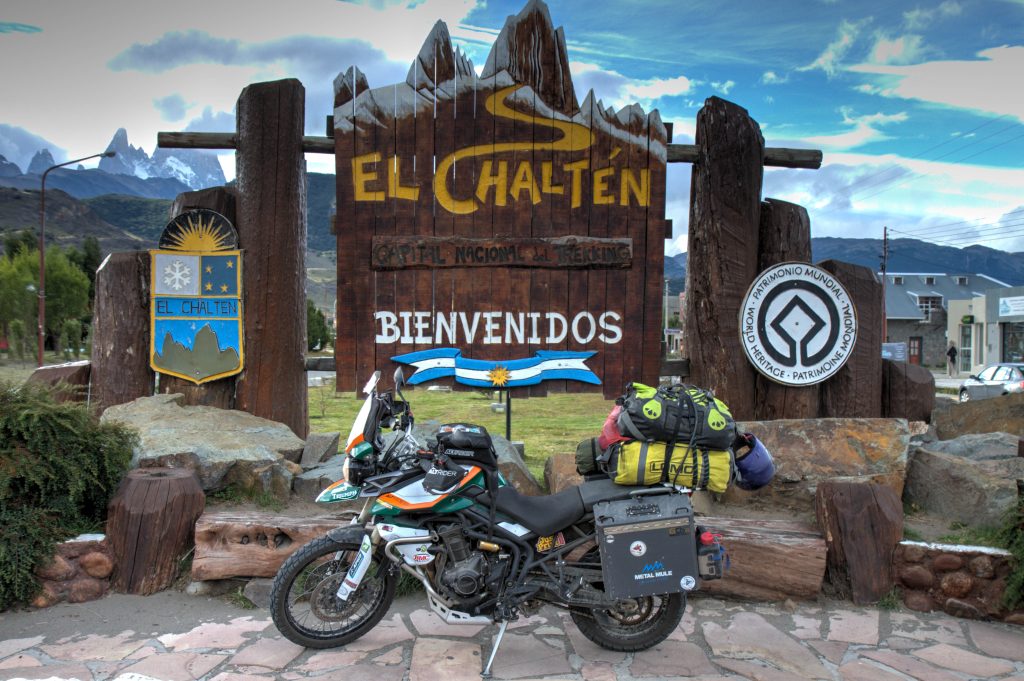
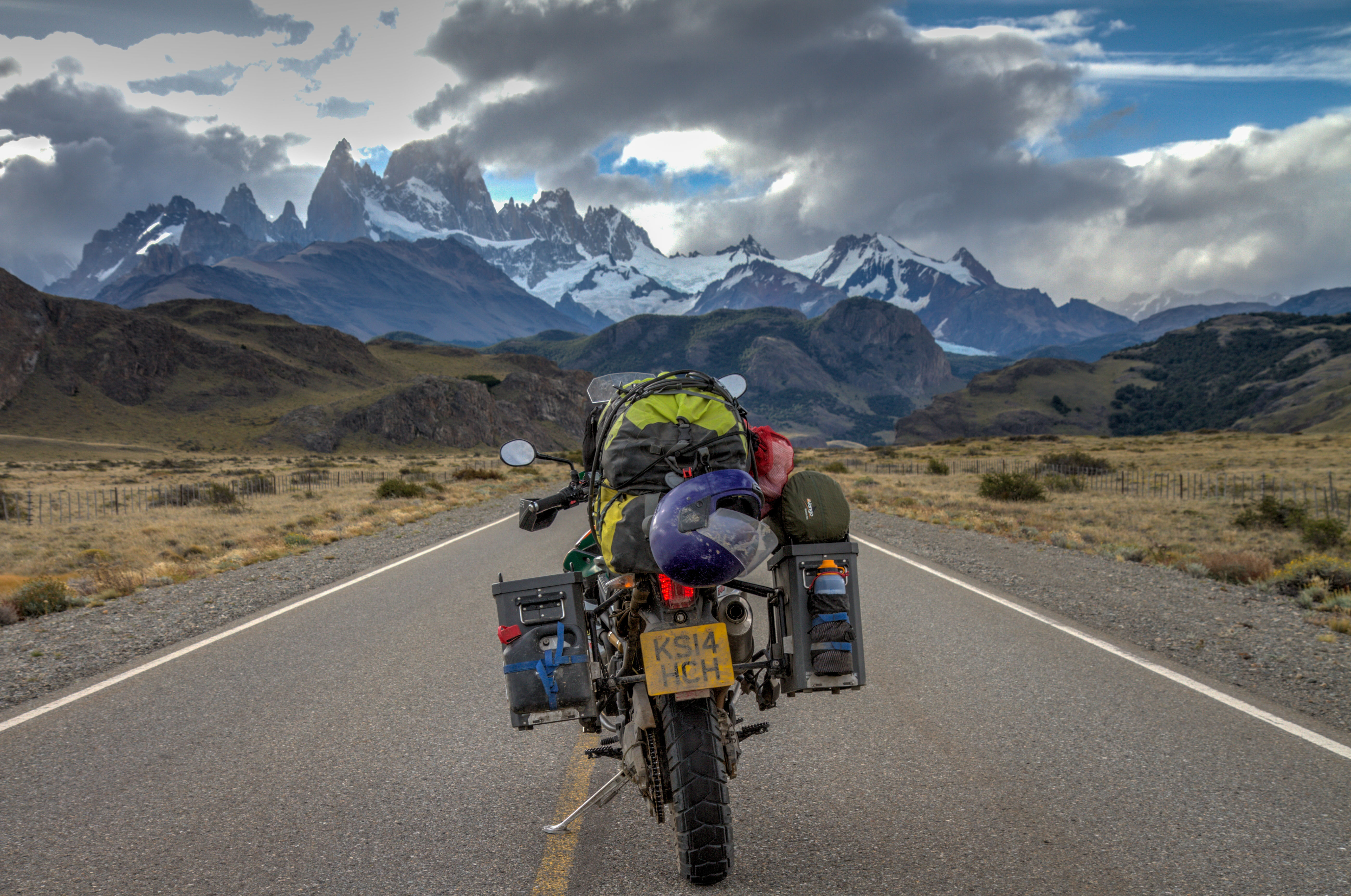
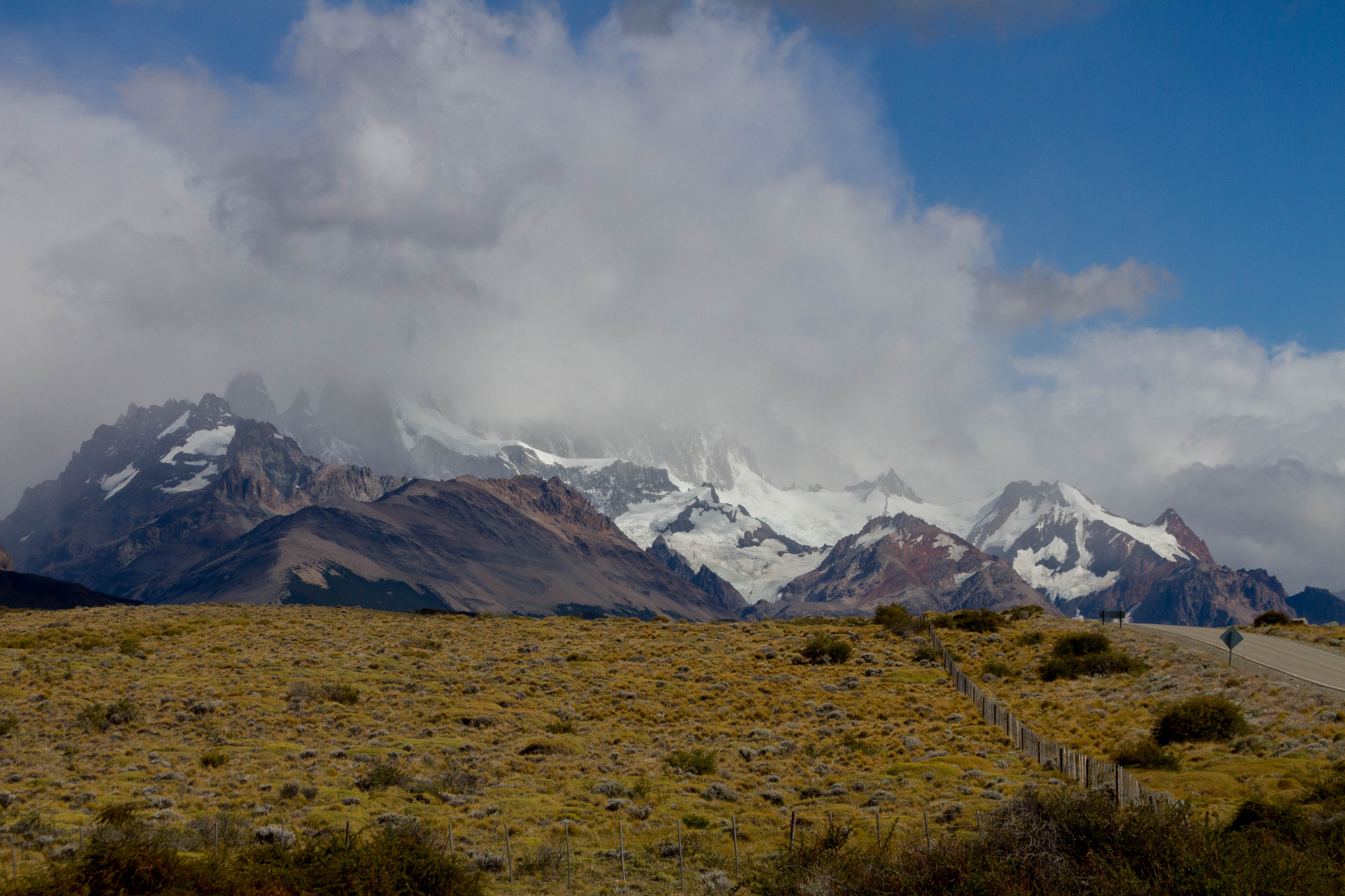
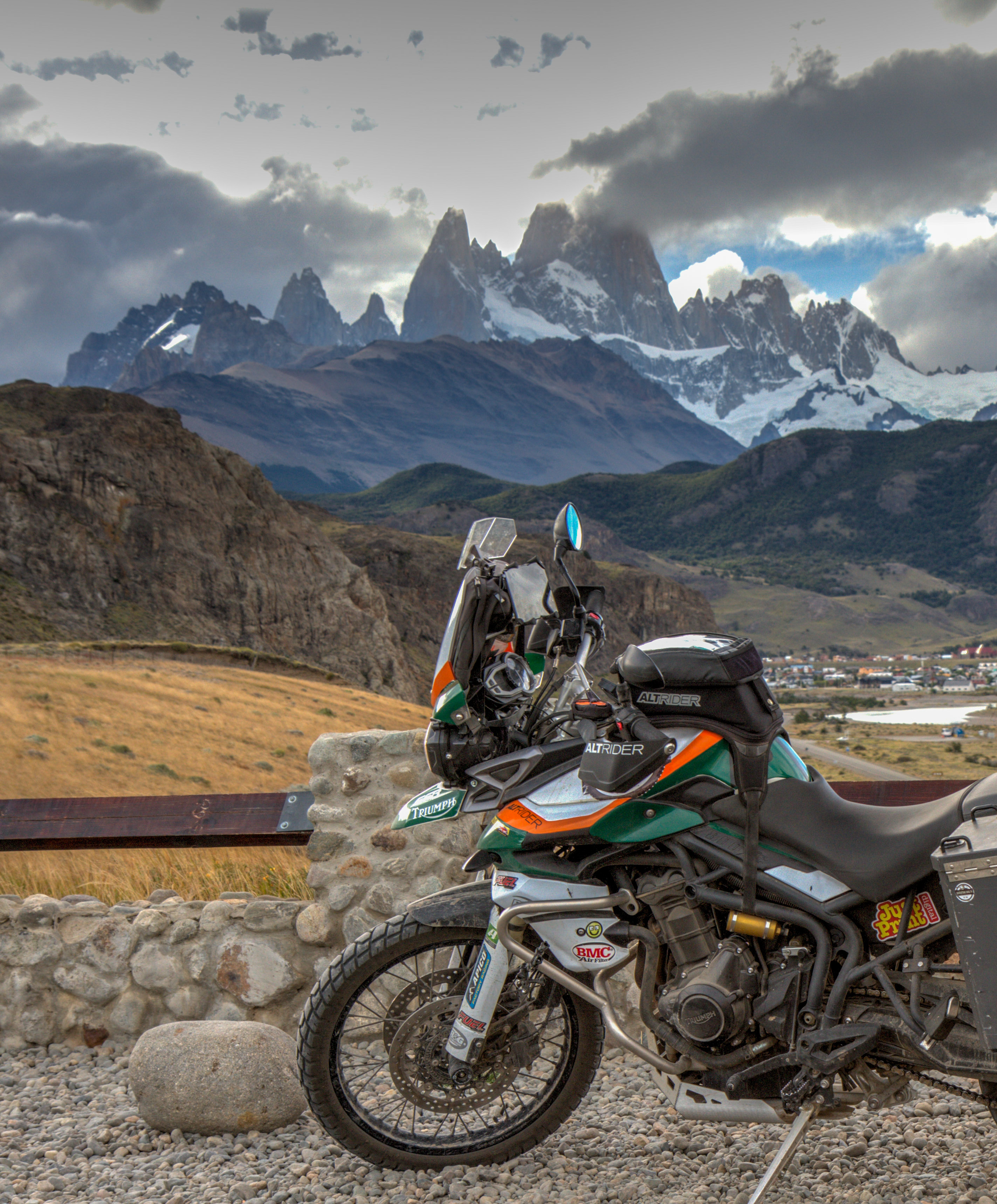
El Chaltén
El Chaltén is a small mountain village in Argentina. These days it is solely based on tourism and its the capital for hiking and all mountaineering activities in Argentina. It is located inside the Los Glaciares National Park, meaning the surrounding landscapes are sure to please. The most famous peak, Mount Fitz Roy is located near the town.
El Chalten, Argentina
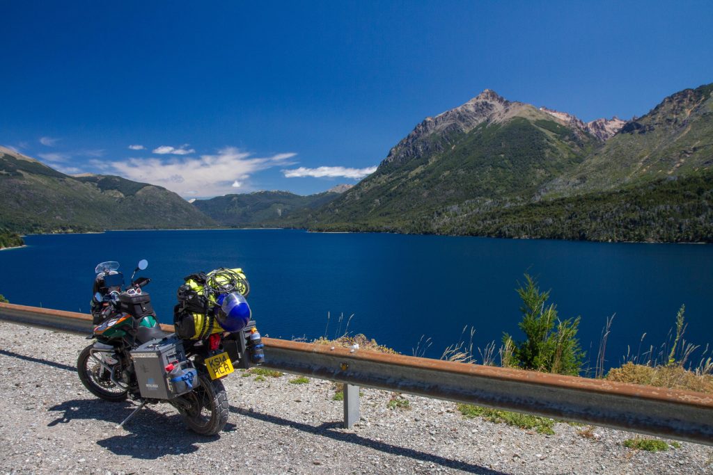
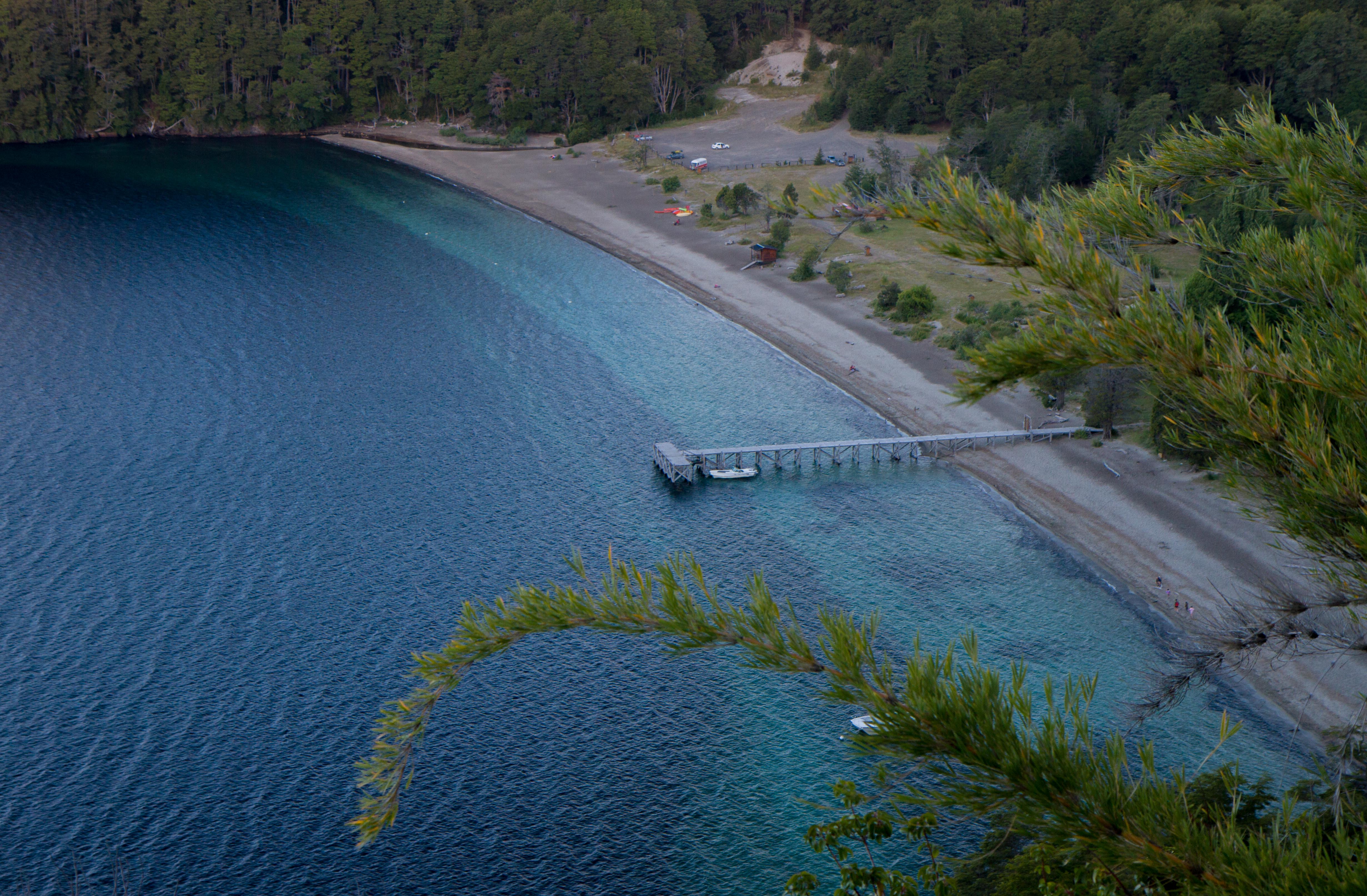
Seven Lakes (San Martin de Los Andes to Bariloche)
As the name implies, this 107km road goes through several lakes in the Patagonian area of Argentina. This area is also very close to the border of Chile and has some very accessible crossings. As a generalization, the roads running parallel to the Andes in Argentina are less spectacular than Chile. This is mostly due to the fact that Argentina was more flat lands (Pampas) then Chile. Therefore, it is much easy to run roads on flat land than mountain ranges. This section is the exception, the road zigzags around the lakes before moving back on the flat lands both north and south of this region. Because of this, if you are heading north or south of this area, I’d recommend jumping across to Chile. Check out my post on the Seven Lakes Road
Traful Lake, Nahuel Huapi National Park, Argentina
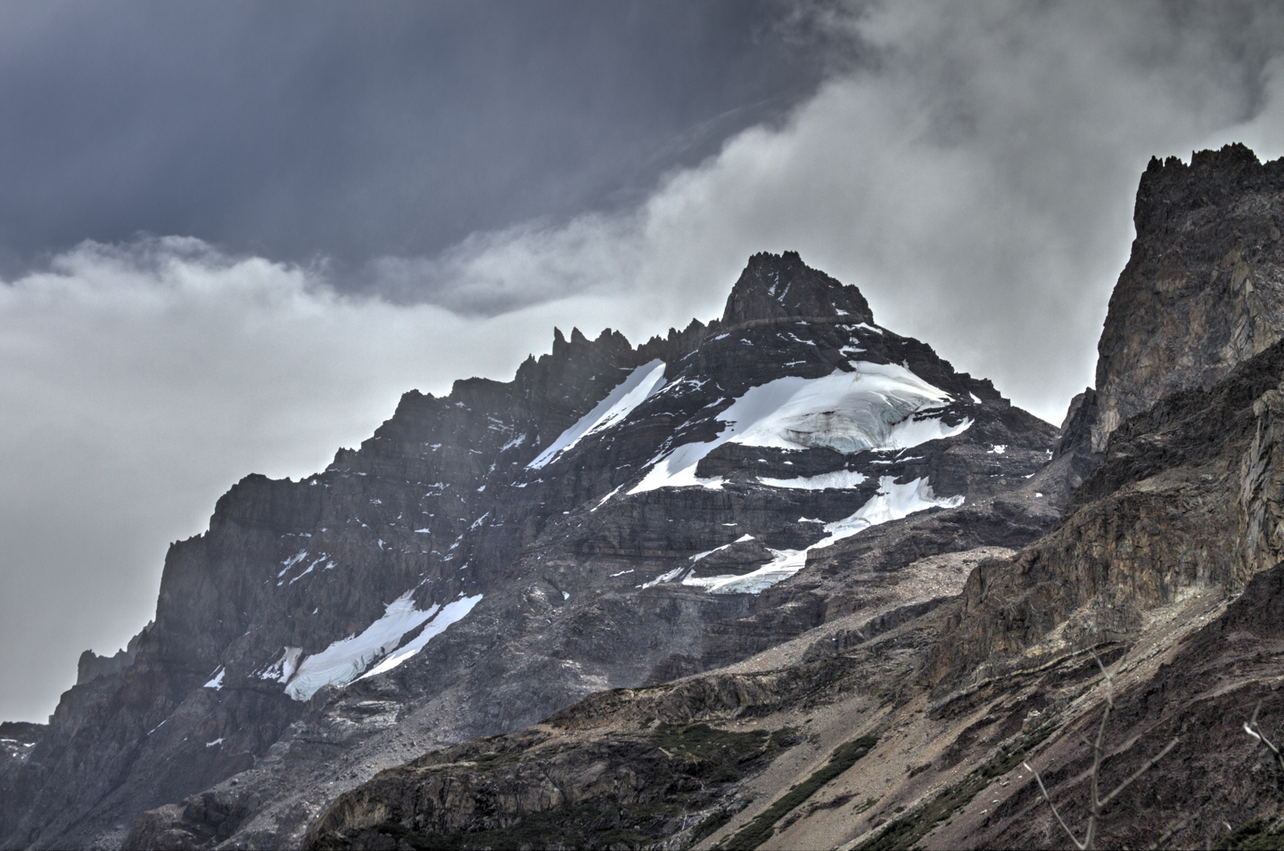
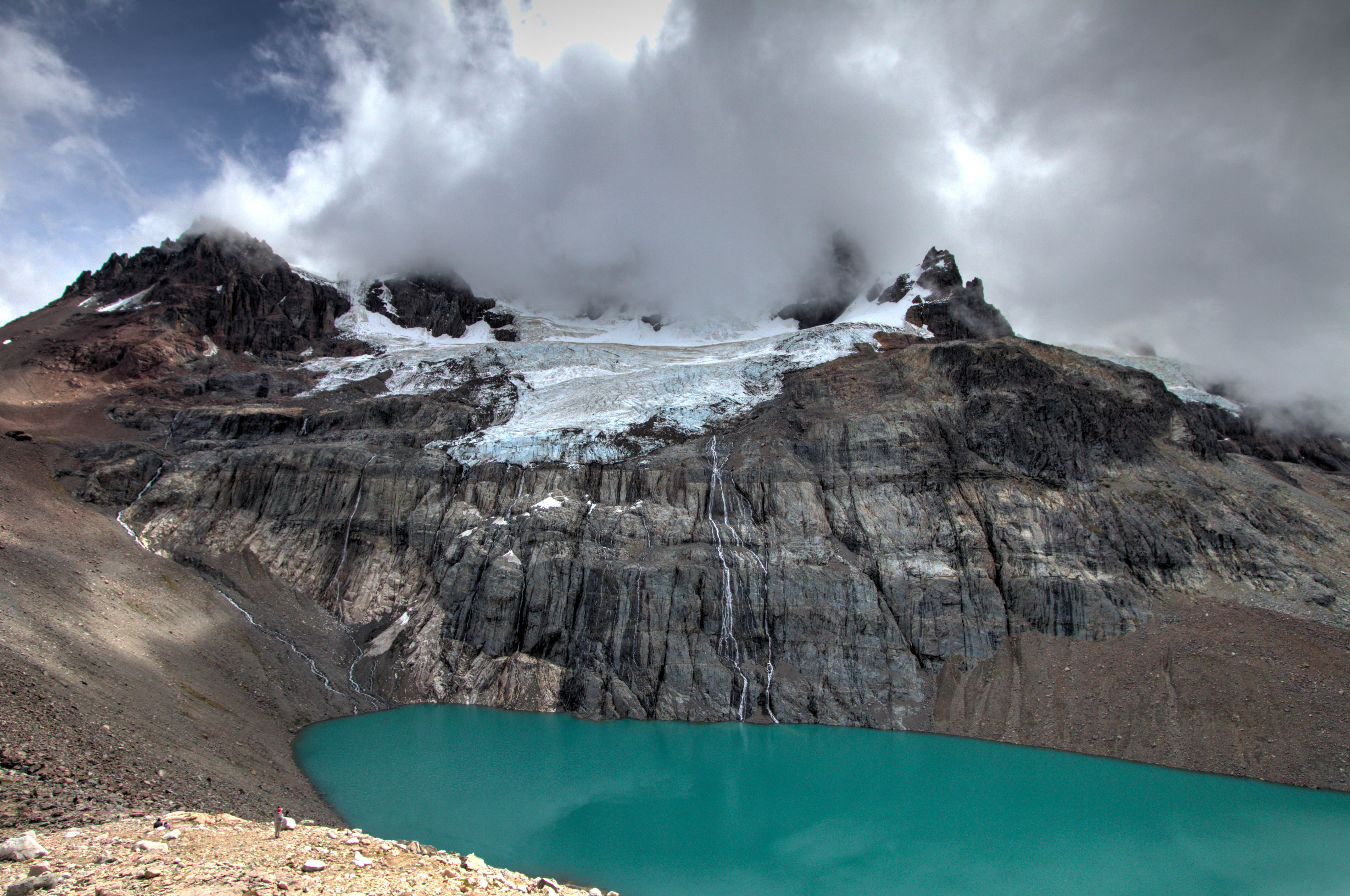
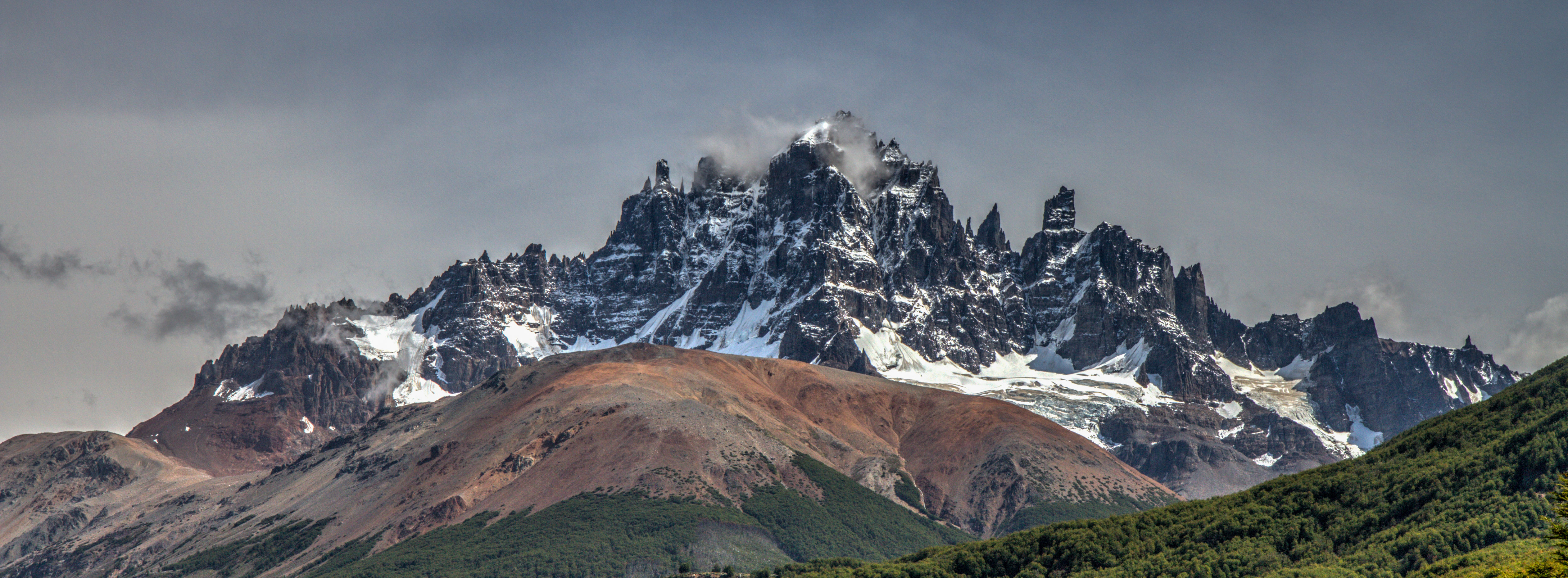
Cordillera Castillo
Cerro Castillo is a jagged rocky peak located on the Carretera Austral. At the bottom is the small town of Villa Cerro Castillo. There is a good day hike to a lake located half way up the mountain. Check out my post here.
Cordillera Castillo, Aysén, Chile
Marble Caves (Carrera Lake)
The Marble Caves (Cuevas de Mármol) are located on a peninsula of solid marble. Lake General Carrera sits at the base… 6000 yrs of the lakes waves have formed this unique cave… add the blue glacier water from the lake and you’ll find a very surreal mix of cathedral caves with ice blue reflections. Check out my separate post here
The Perito Moreno Glacier is classed as one of the ‘Must Sees’ of a trip to Patagonia, and with good cause. Its incredible! Firstly the size, the photo below show the width of the section that is view-able from the platform. incredibility this is 5kms wide!! More amazingly, it is part of the Southern Patagonian Ice Field which has an area of 12,363 km2 . (The section in red is the section that is 5kms wide!!)
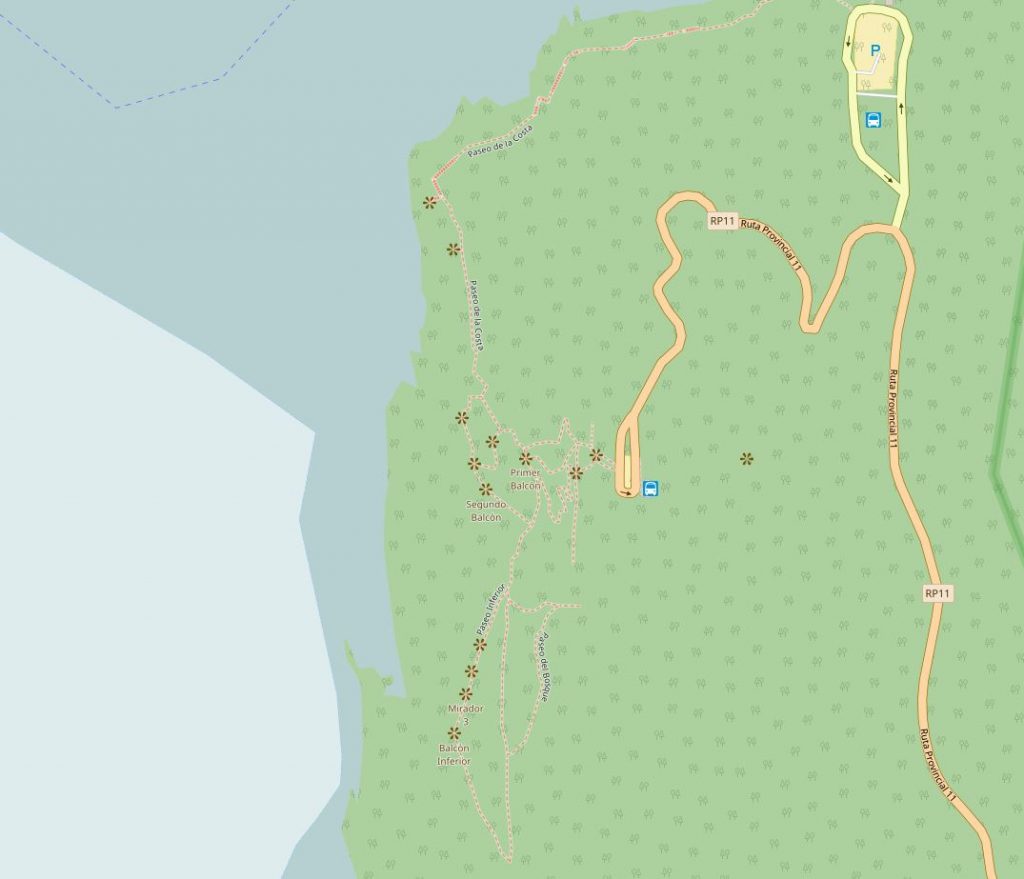
Accessing the glacier is simple. It is located 78km east of the town ‘El Calafate’. There is a series of raised platforms for accessing several viewpoints.
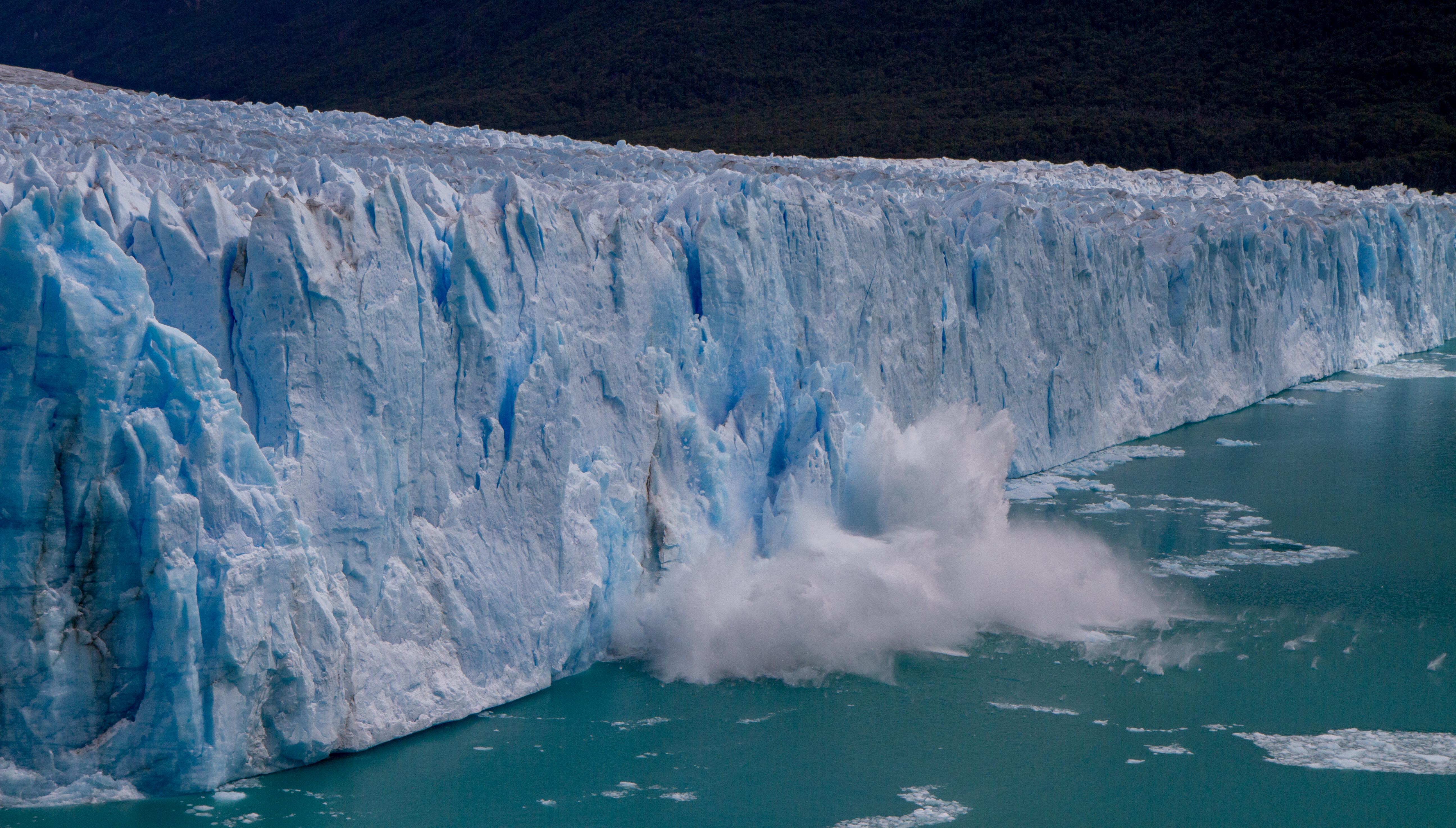
If you’re lucky you can even experience a section of ice break away and lunge into the waiting lake. The ice moves 2m per day so hang around and get the camera ready 🙂