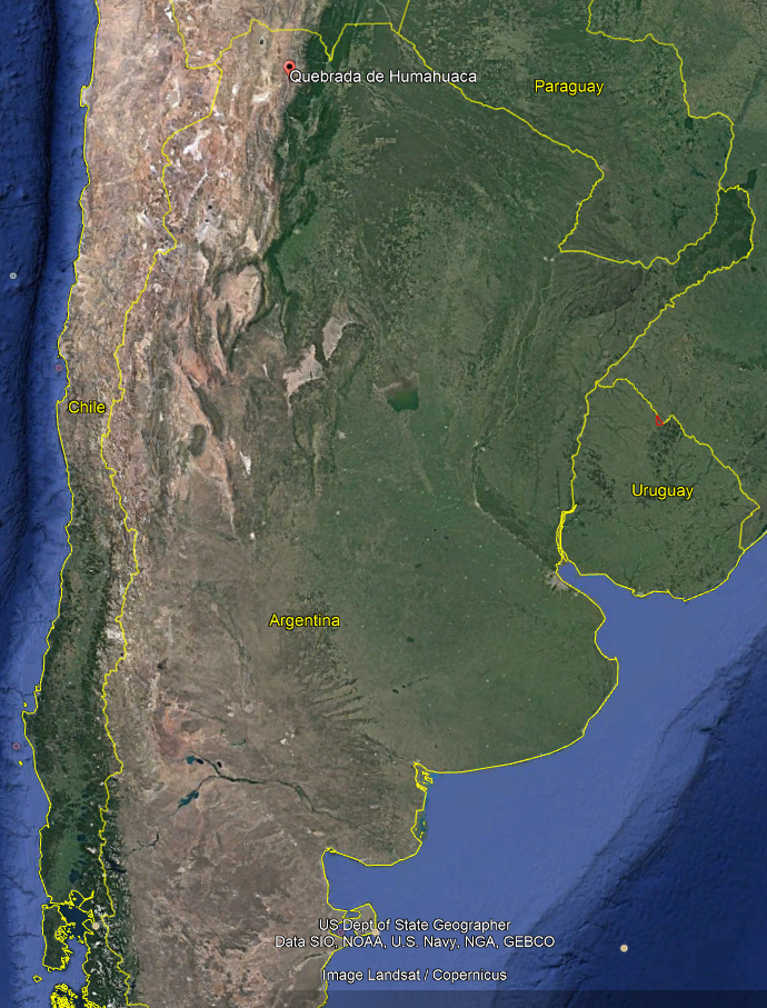
Quebrada de Humahuaca (Humahuaca Valley), is located in the Jujuy province of Argentina. It is narrow mountain valley that contains many villages in which are the oldest settlements in Argentina. The valley runs north to south and can be easily accessed when travelling to/from Bolivia or Chile.
There are many highlights along the valley, these are my favorites (Some are just outside the valley)
Purmamarca
Purmamarca actually is located off the main road in the valley. It is on the road towards Attacama desert in chile via the amazing Paso de Jama. This makes it a great stop on the way to and from Chile. The town is very small and was the most ‘touristy’ town in the area. Best for a day trip, check out the main square which is full of markets stalls. Another site is the Cerro de los Siete Colores (The hill of seven colours). It has a unique color range that is the product of a complex geological history including marine sediments, lake and river movements elevated with the movement of the tectonic plates.
Purmamarca, Jujuy, Argentina
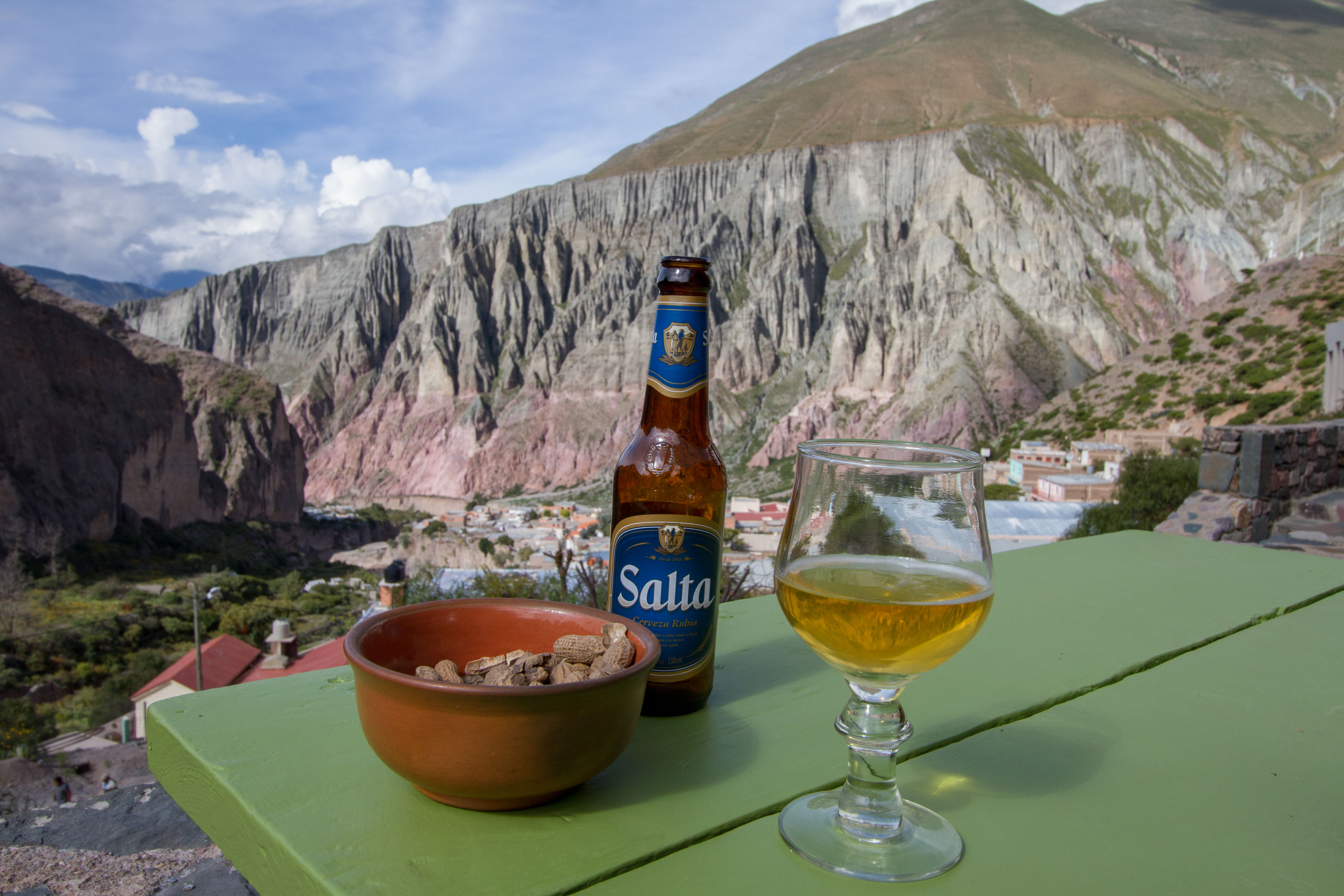
Tilcara
I found Tilcara to be the best place to stay as it has alot of hostel options and great restaurants (more than the other towns). Traces of human habitation in the area date back more than 10,000 years, making it one of the oldest continuously inhabited settlements of Argentina. There is also an amazing day hike to ‘Devils Throat’, that has great views of the area, waterfalls, and a water aqua-duct.
Jujuy, Argentina
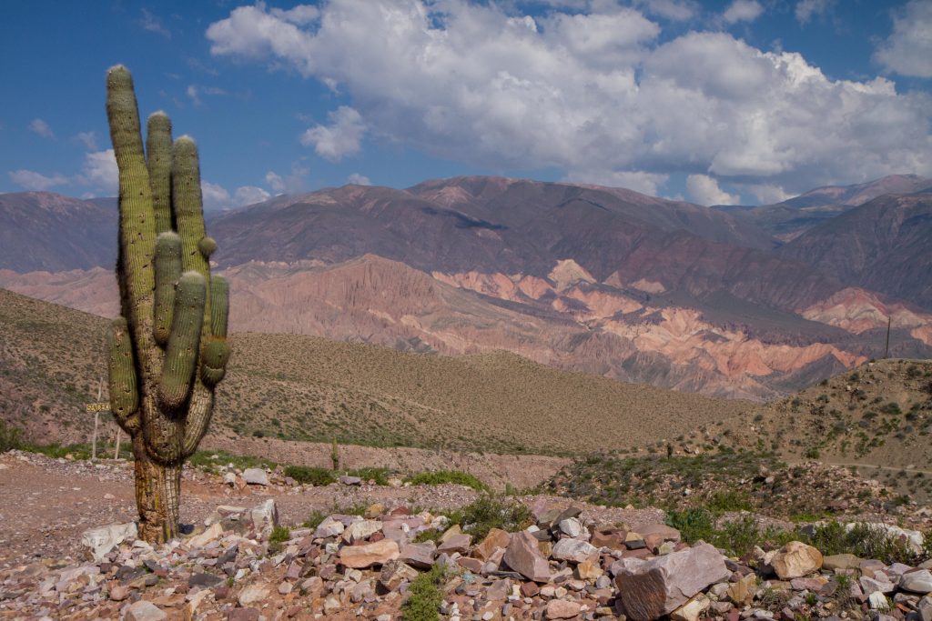
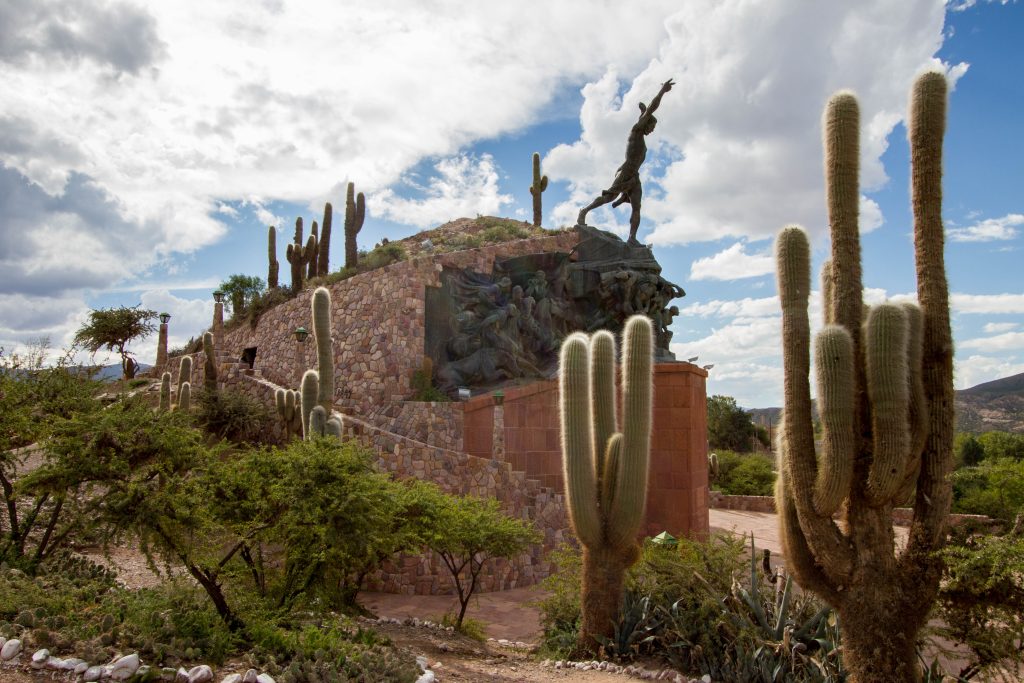
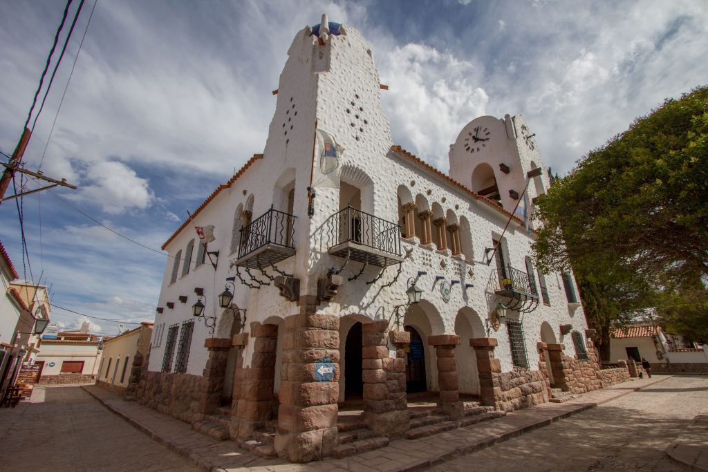
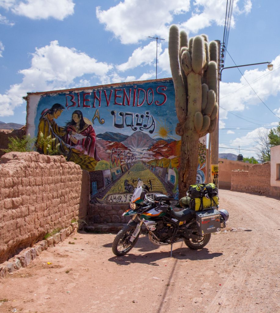
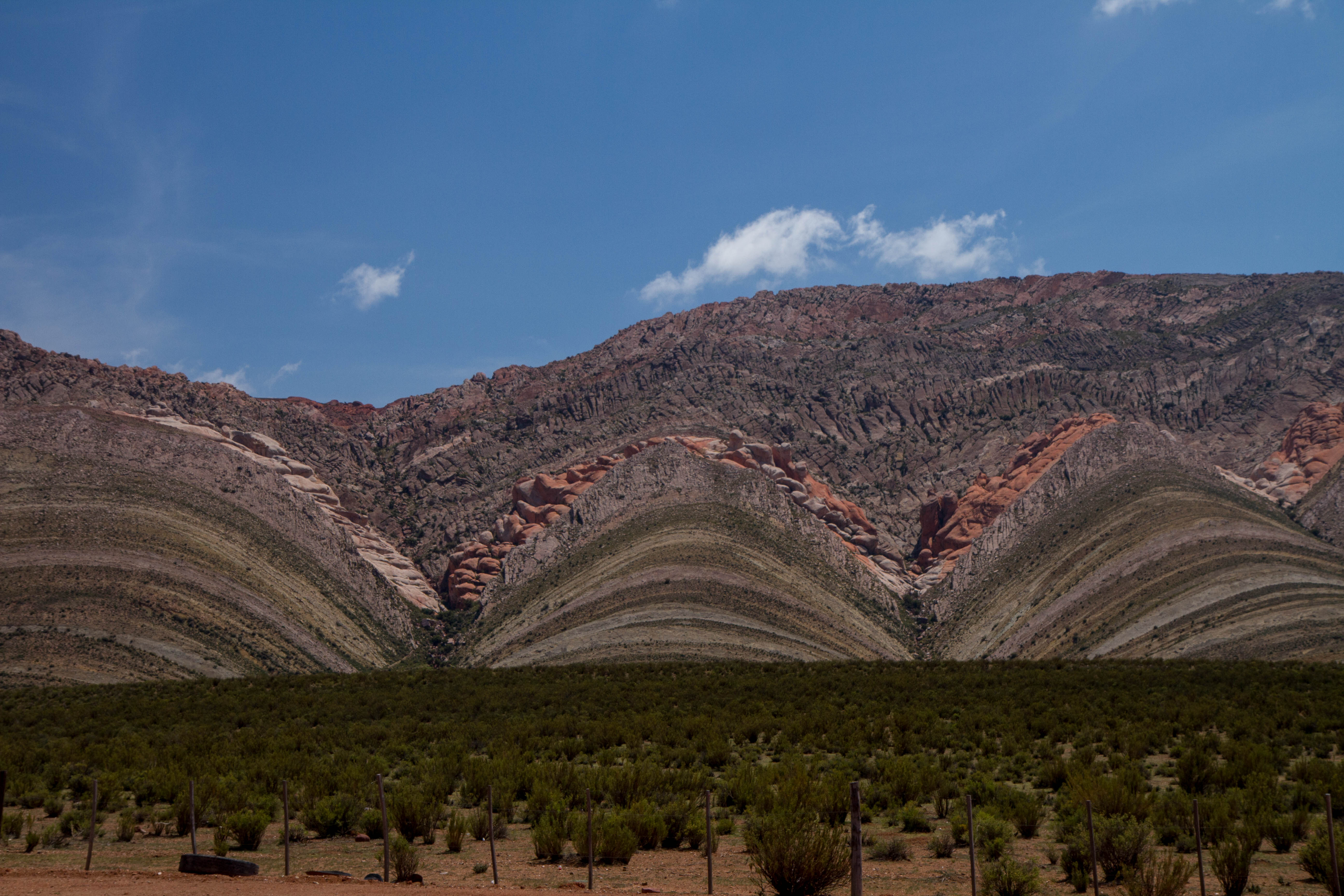
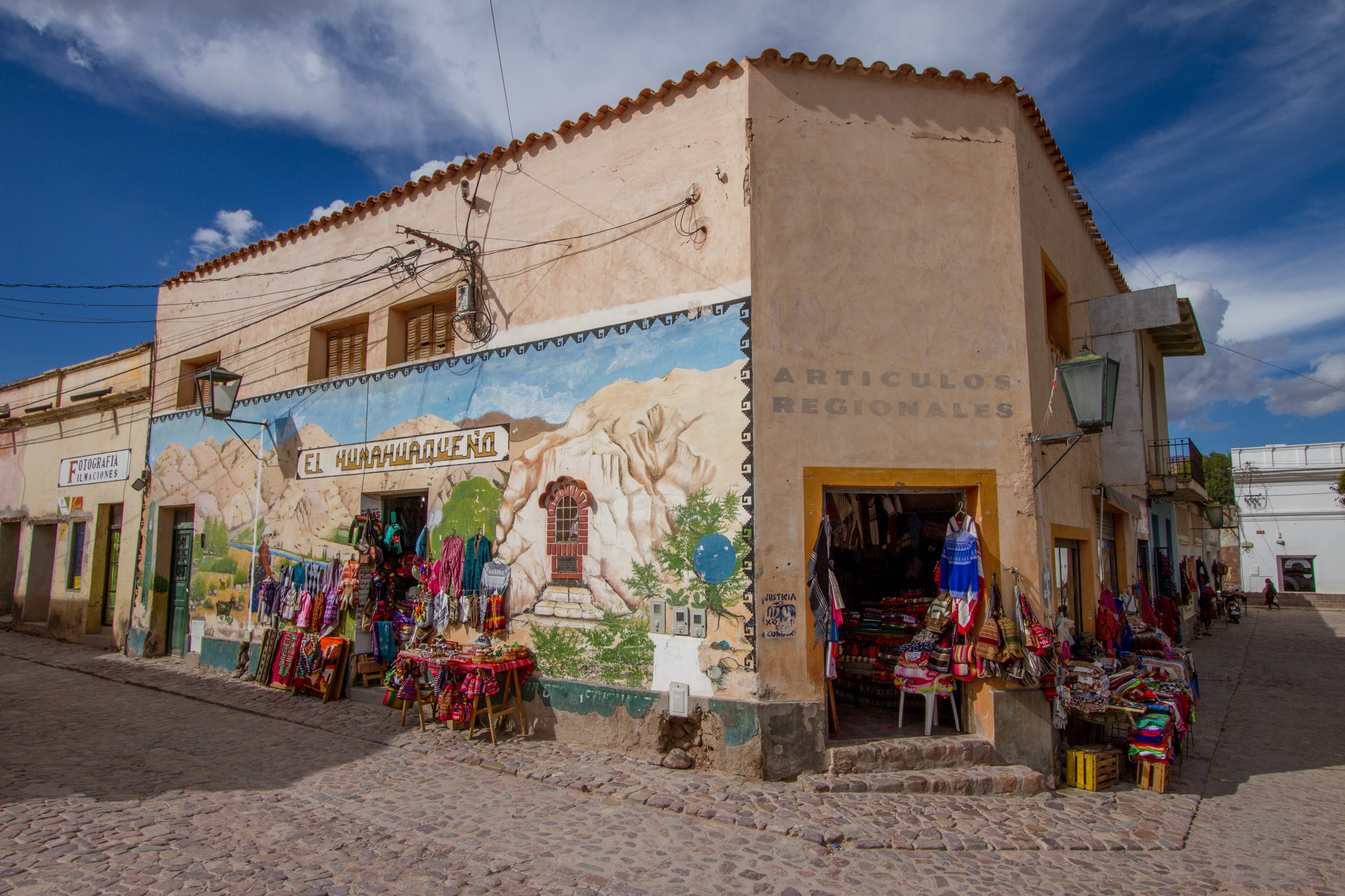
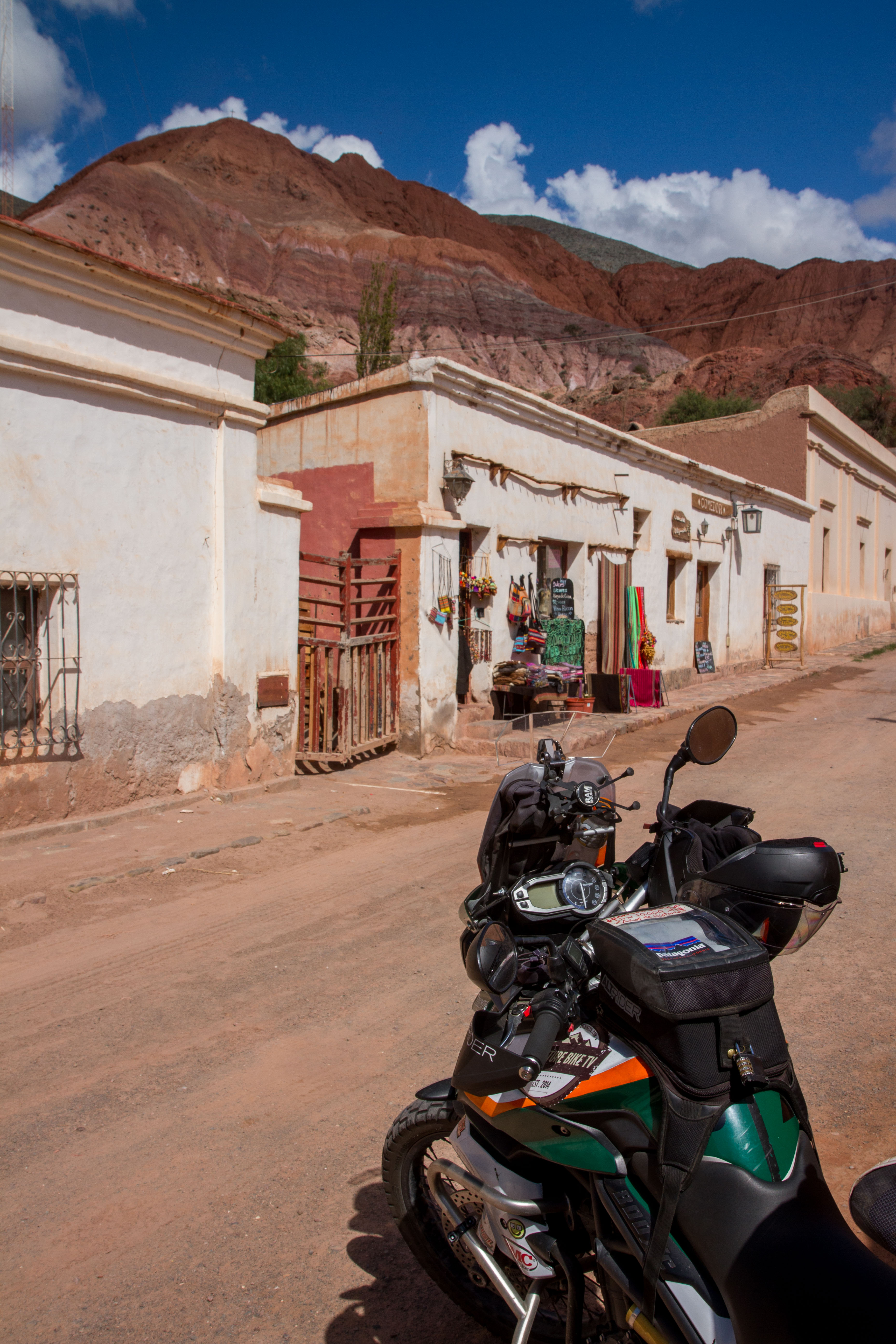
Humahuaca
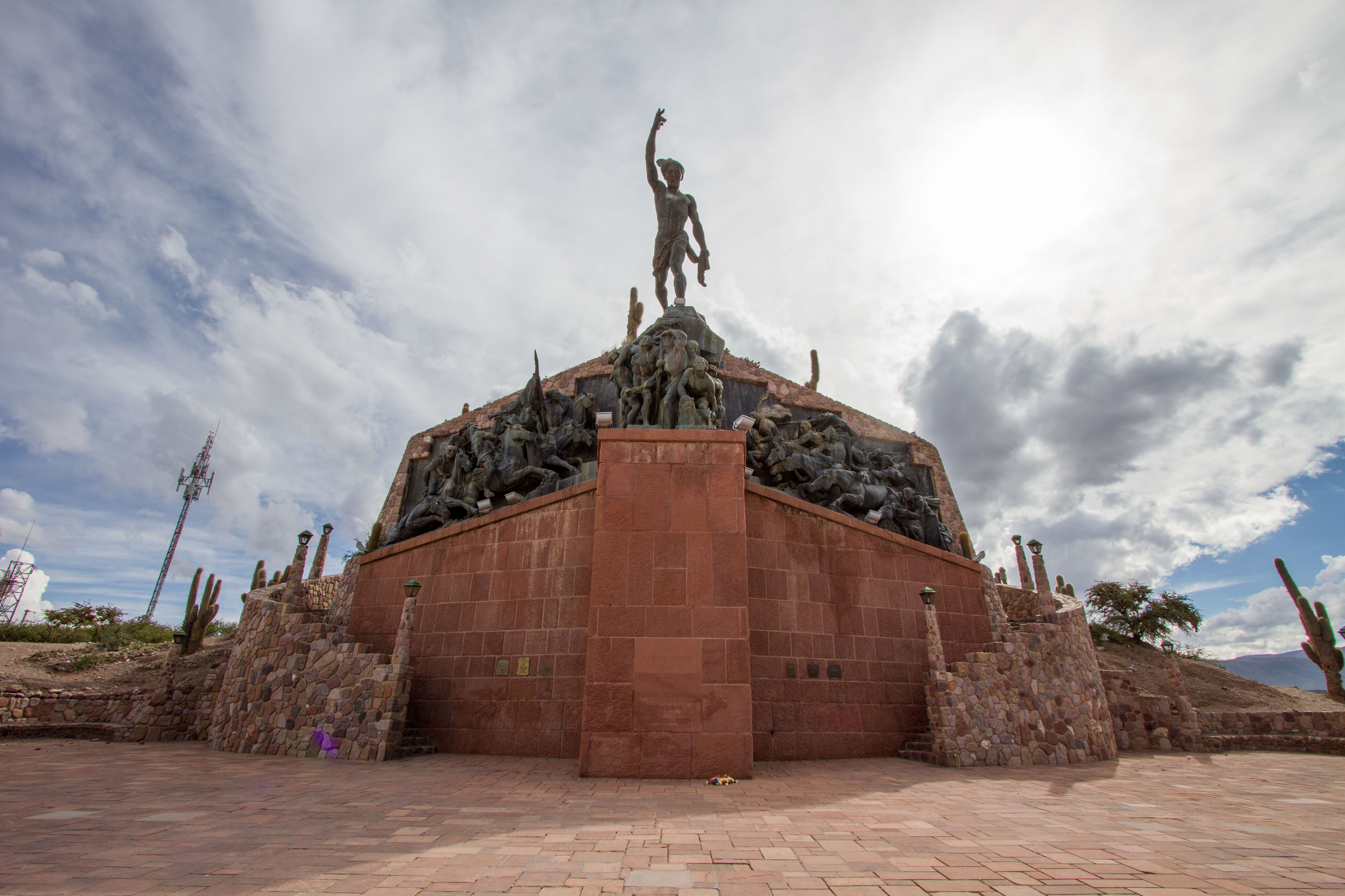
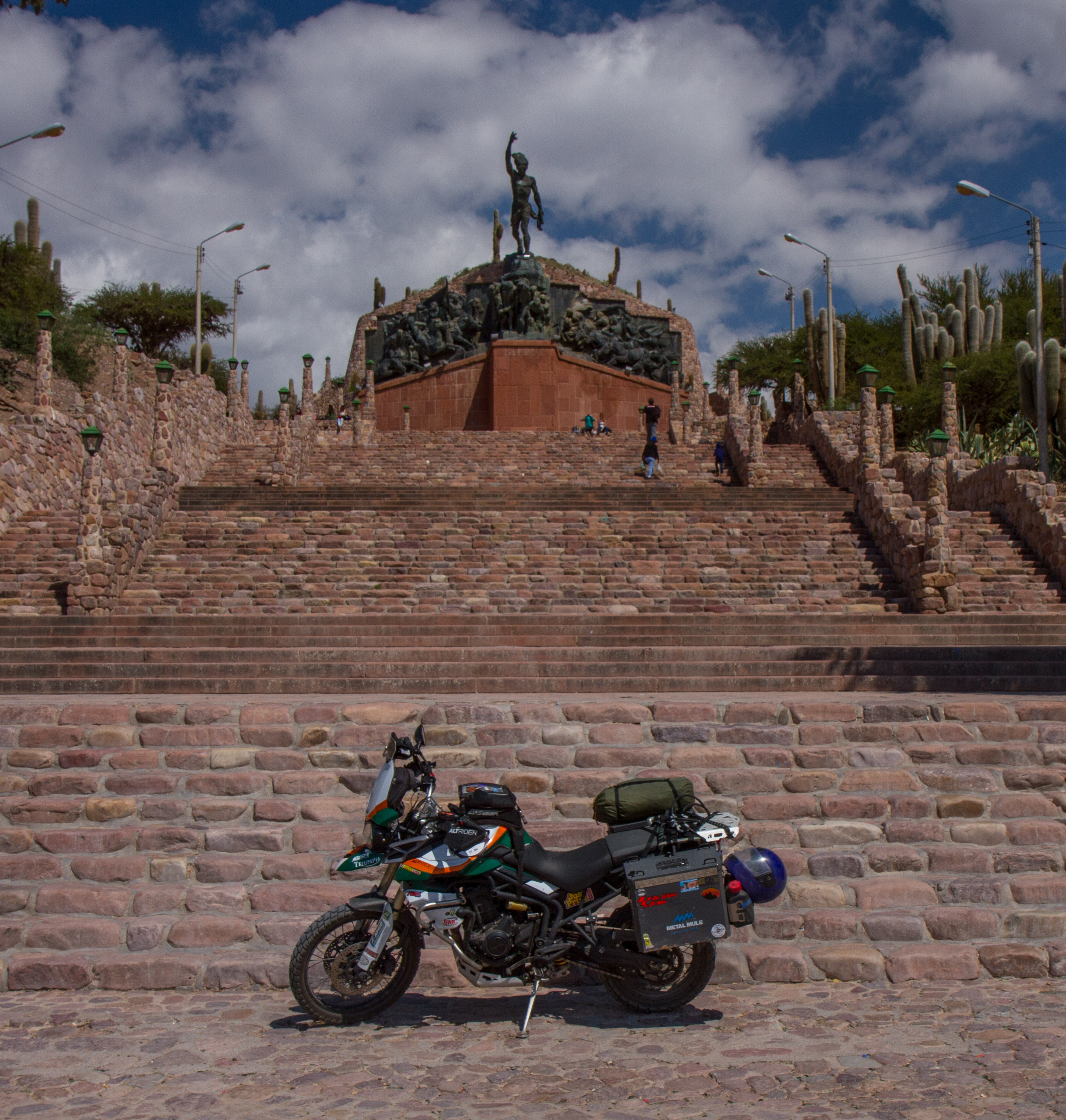
Humahuaca is widely known for its location at the Quebrada de Humahuaca, a long valley east of the central Andean Altiplano. It is the main town in the valley, located north of Tilcara and Purmamarca. The centre of the town has a lovely square which leads up some amazing stairs to a monument to the heroes of the Independence. (Monumento a los Héroes de la Independencia)
Humahuaca, Jujuy, Argentina
Humahuaca, Jujuy, Argentina
Humahuaca, Jujuy, Argentina
Humahuaca, Jujuy, Argentina
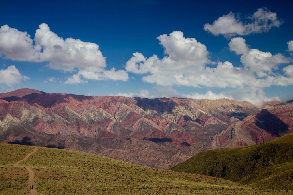
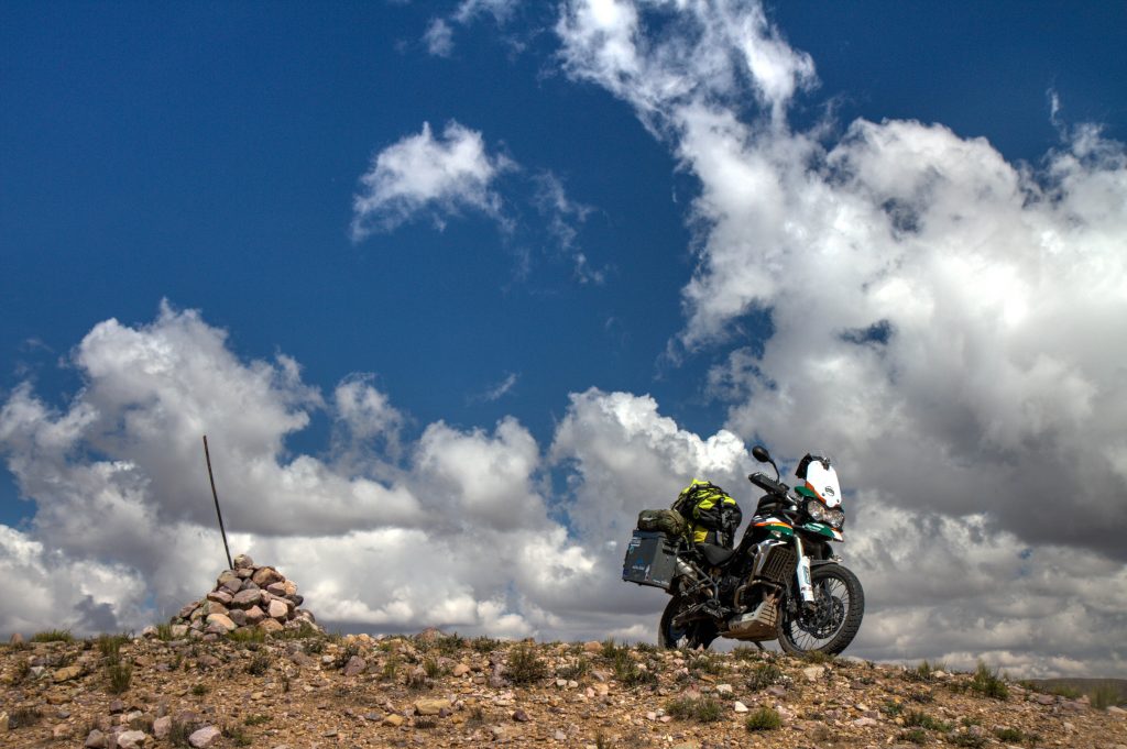
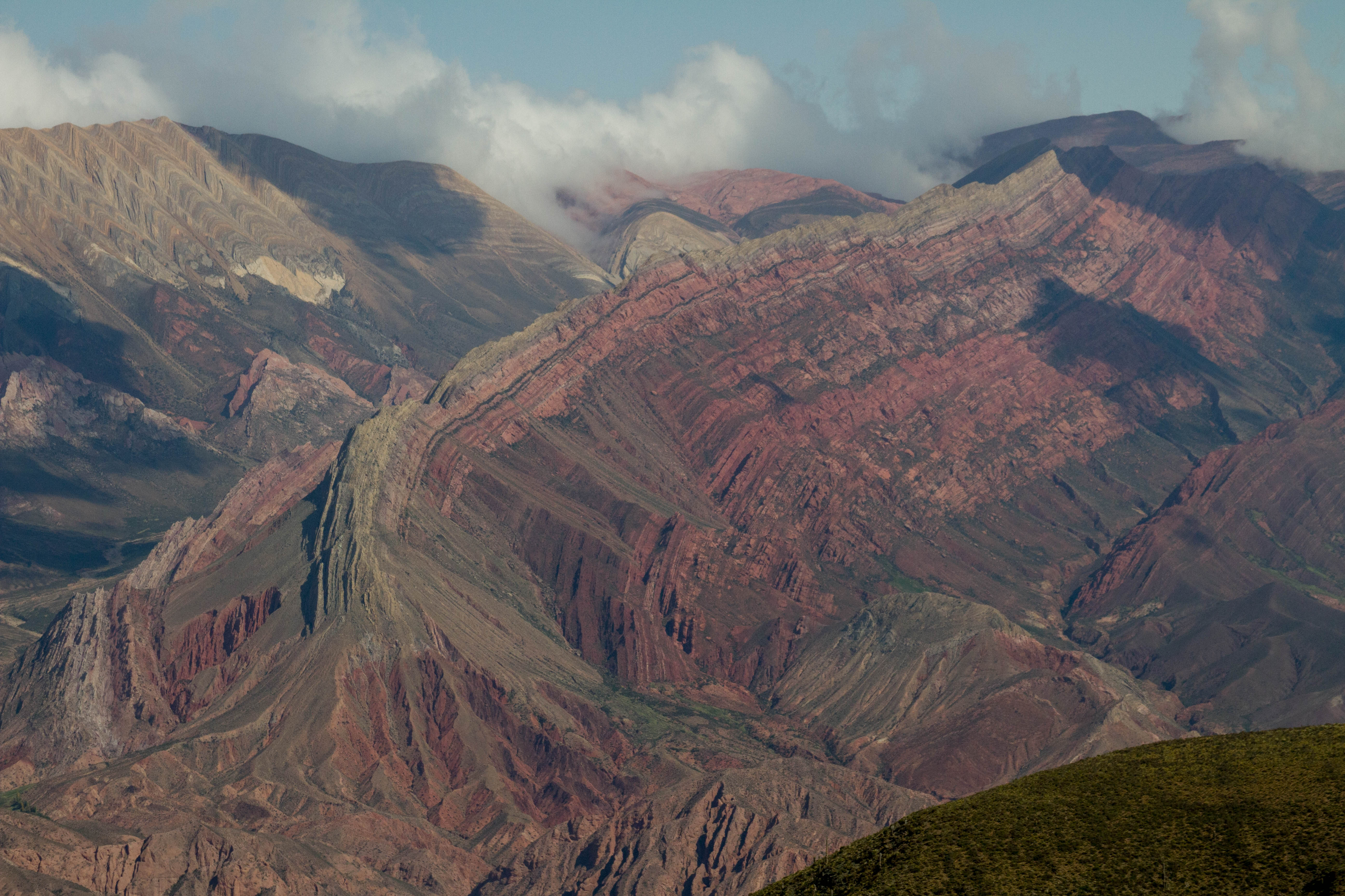
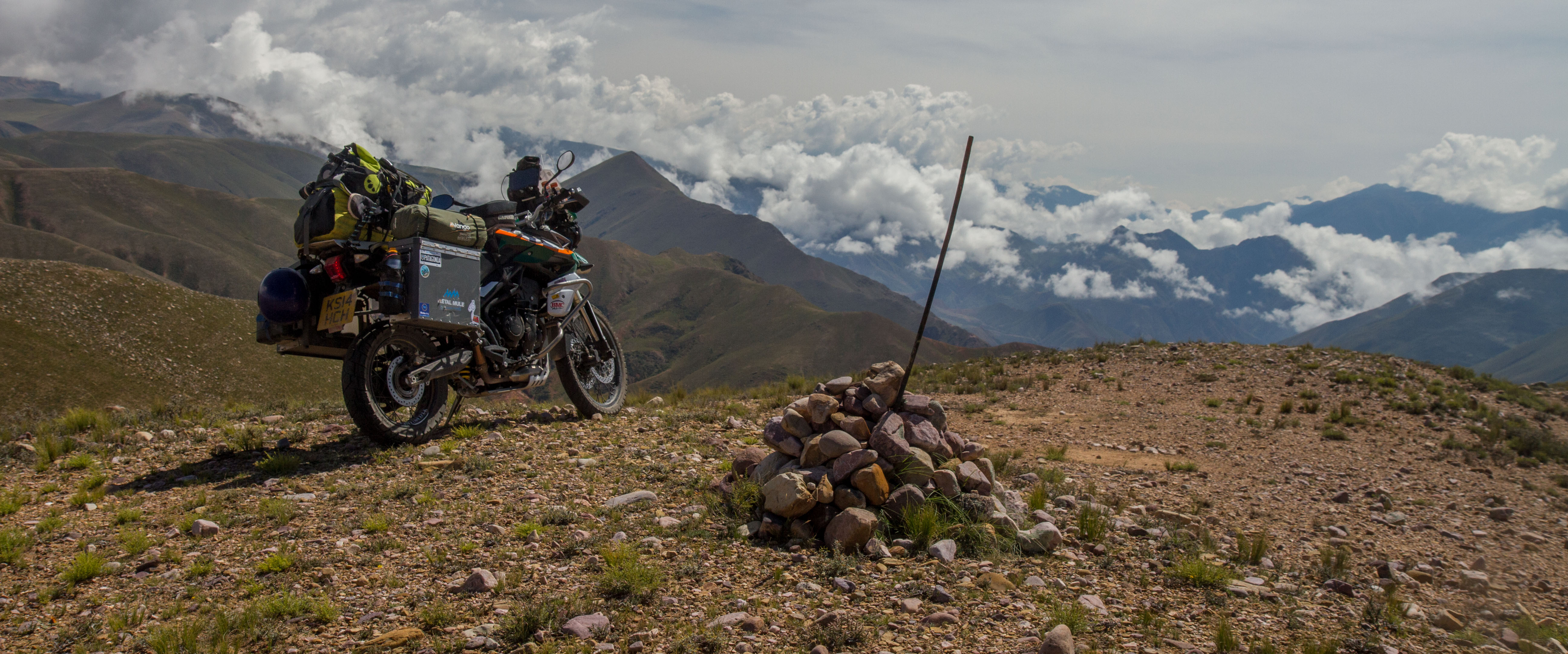
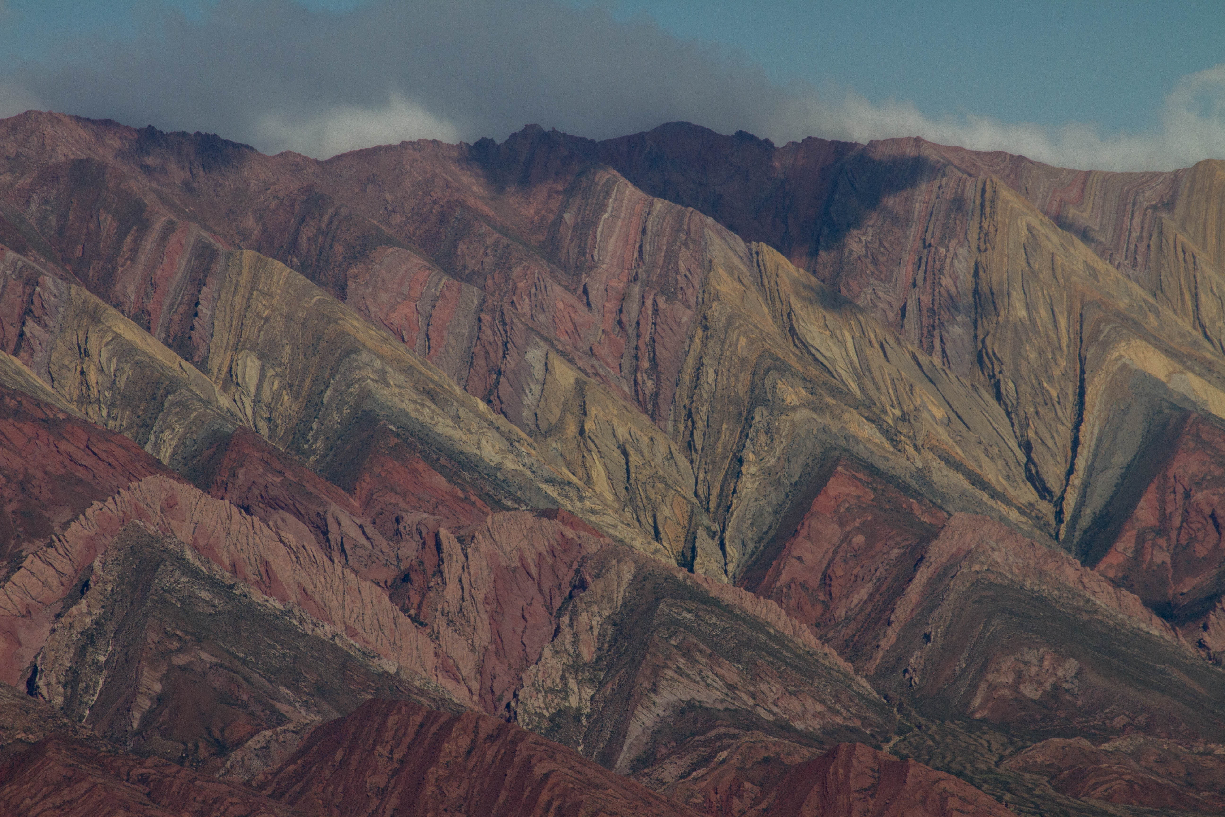
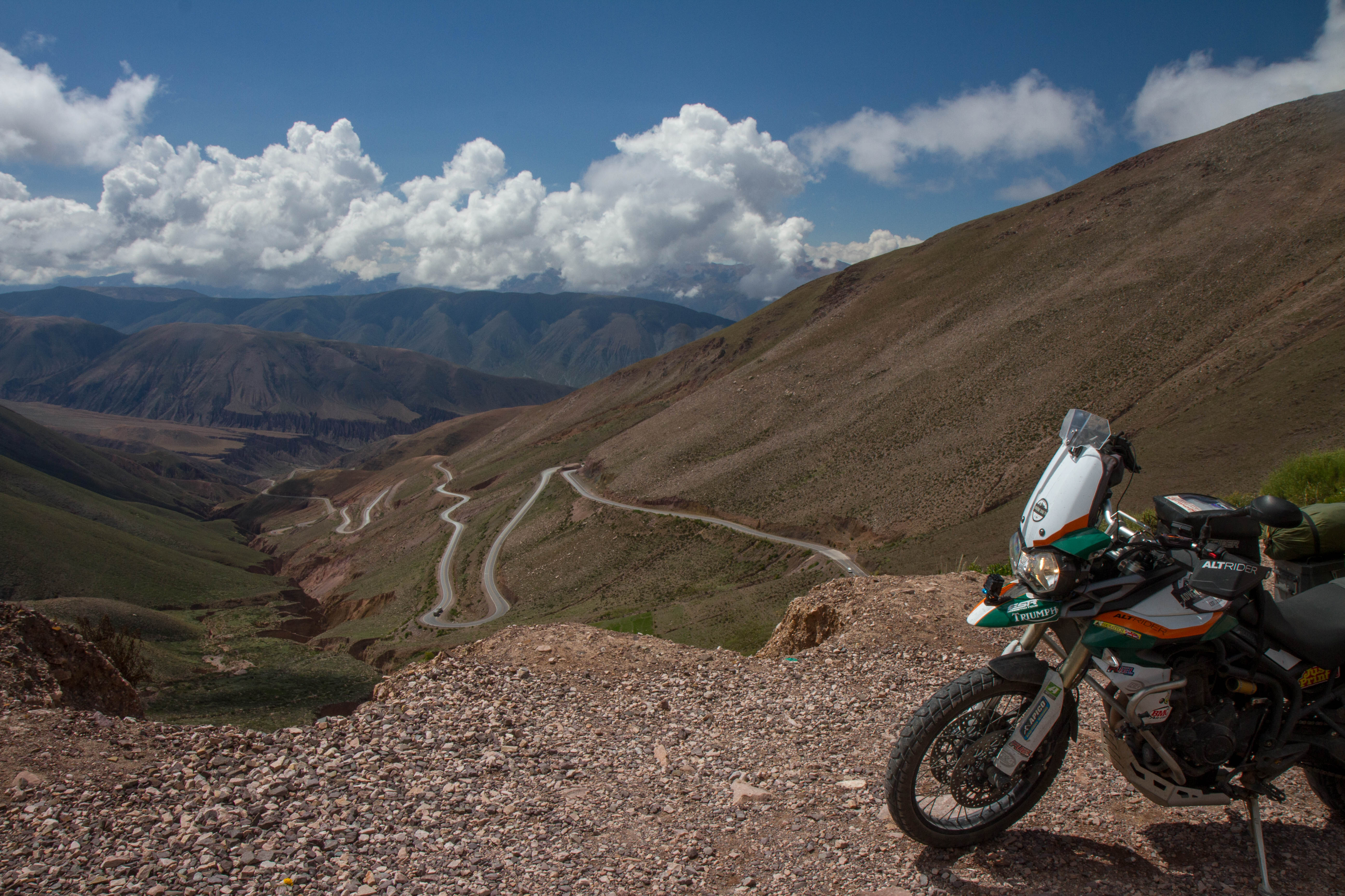
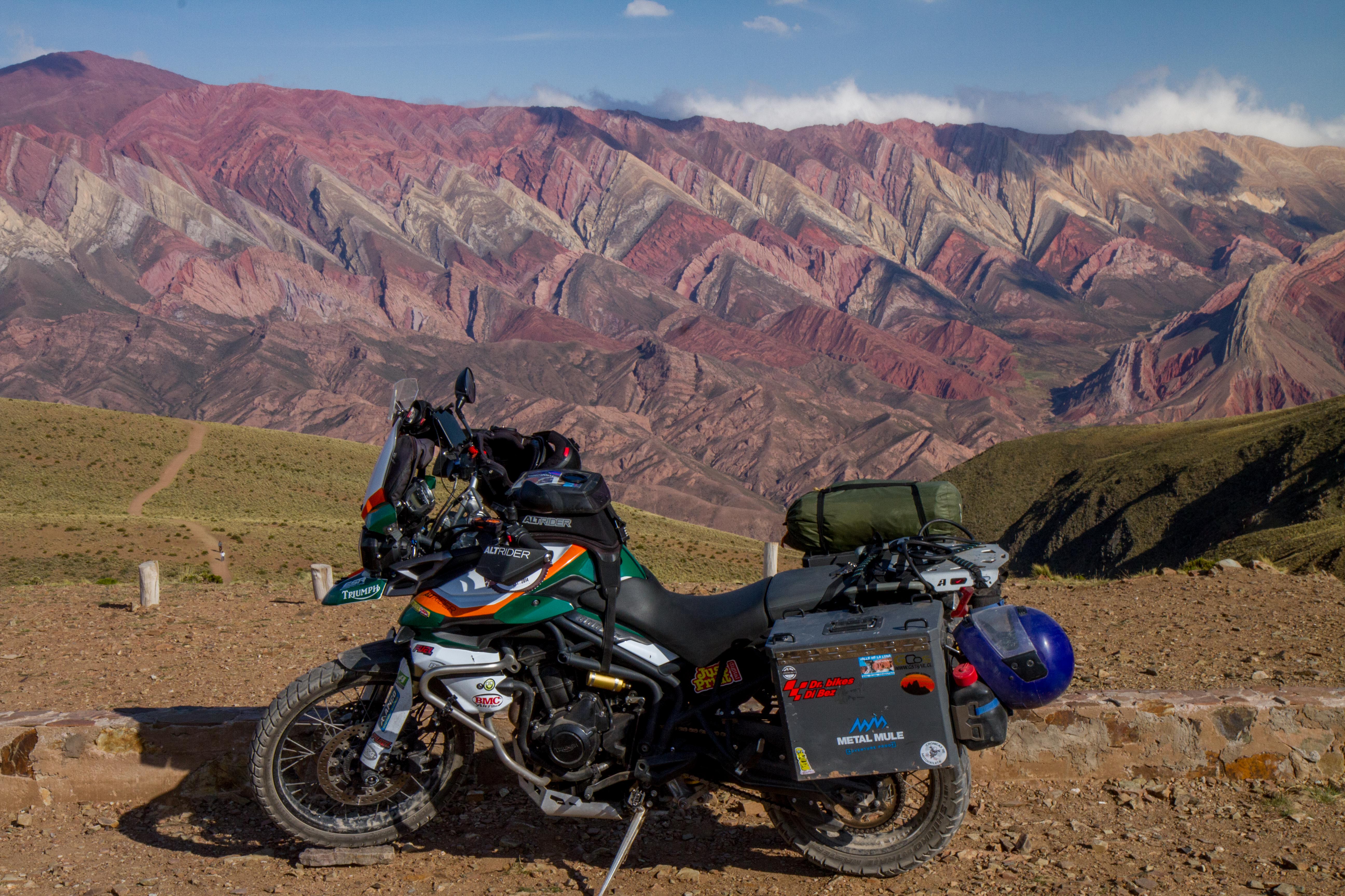
Serranía de Hornocal
The Serranía de Hornocal are a range of mountains located 25 kilometers from the city of Humahuaca in the Argentine province of Jujuy. Exposed in the range is the limestone formation called Yacoraite that extends from Salta, Argentina, through the Argentine Quebrada de Humahuaca and then through the Bolivian Altiplano to Peru. When you finally reach the colored mountains, you’ll be at 4761 meters above sea level.
Cerro de los 14 colores, Jujuy, Argentina
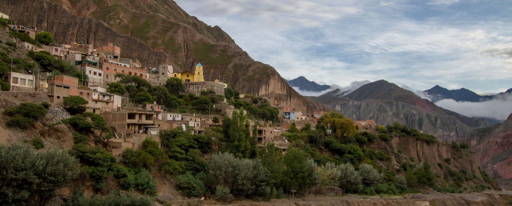
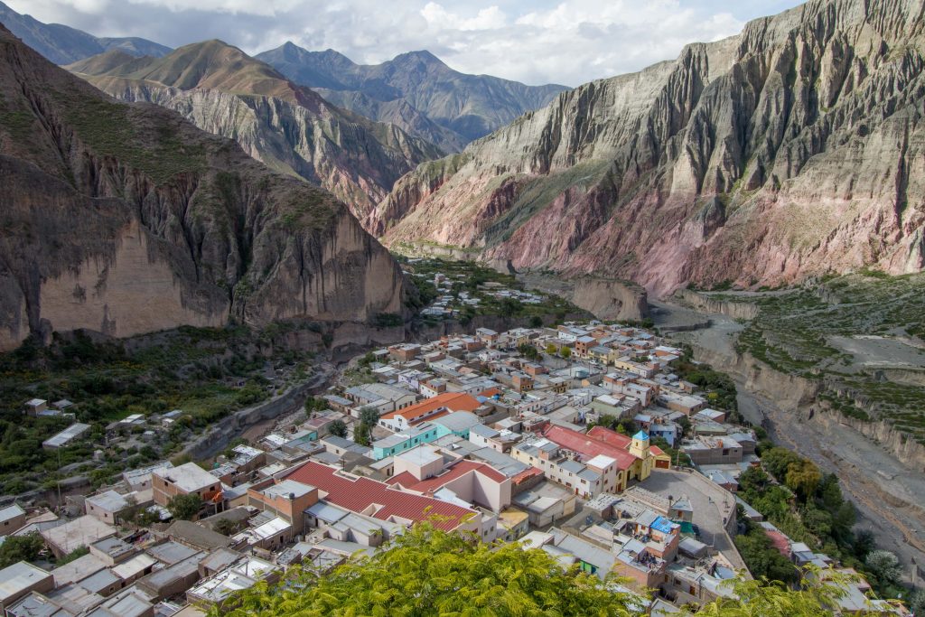
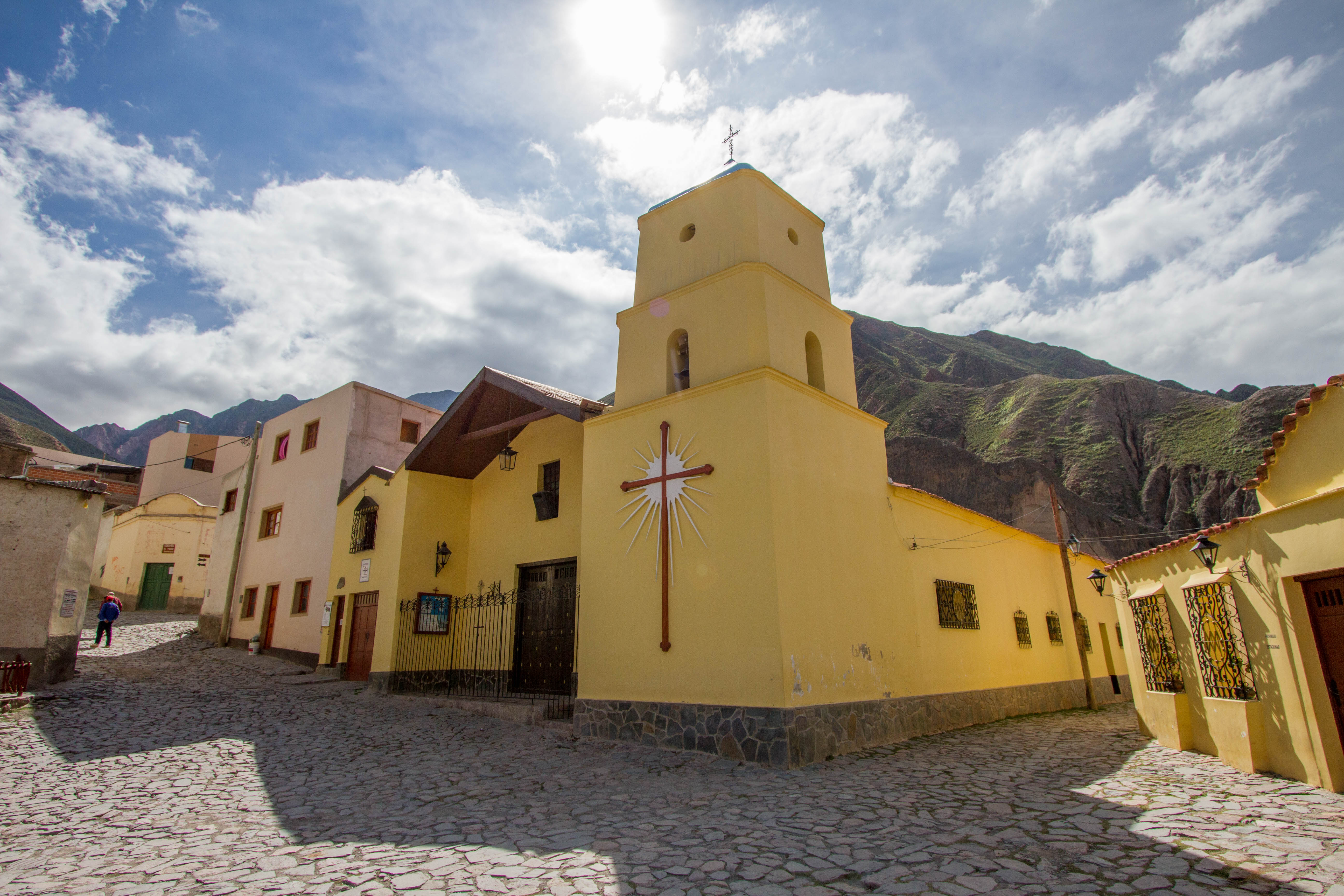
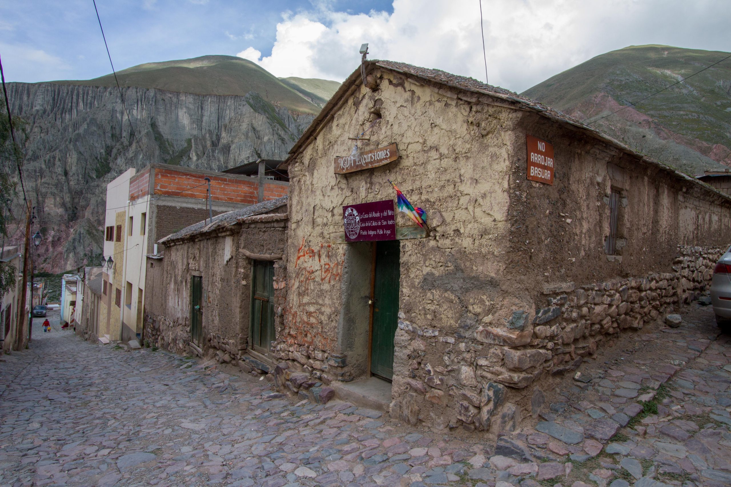
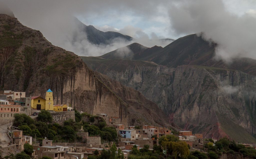
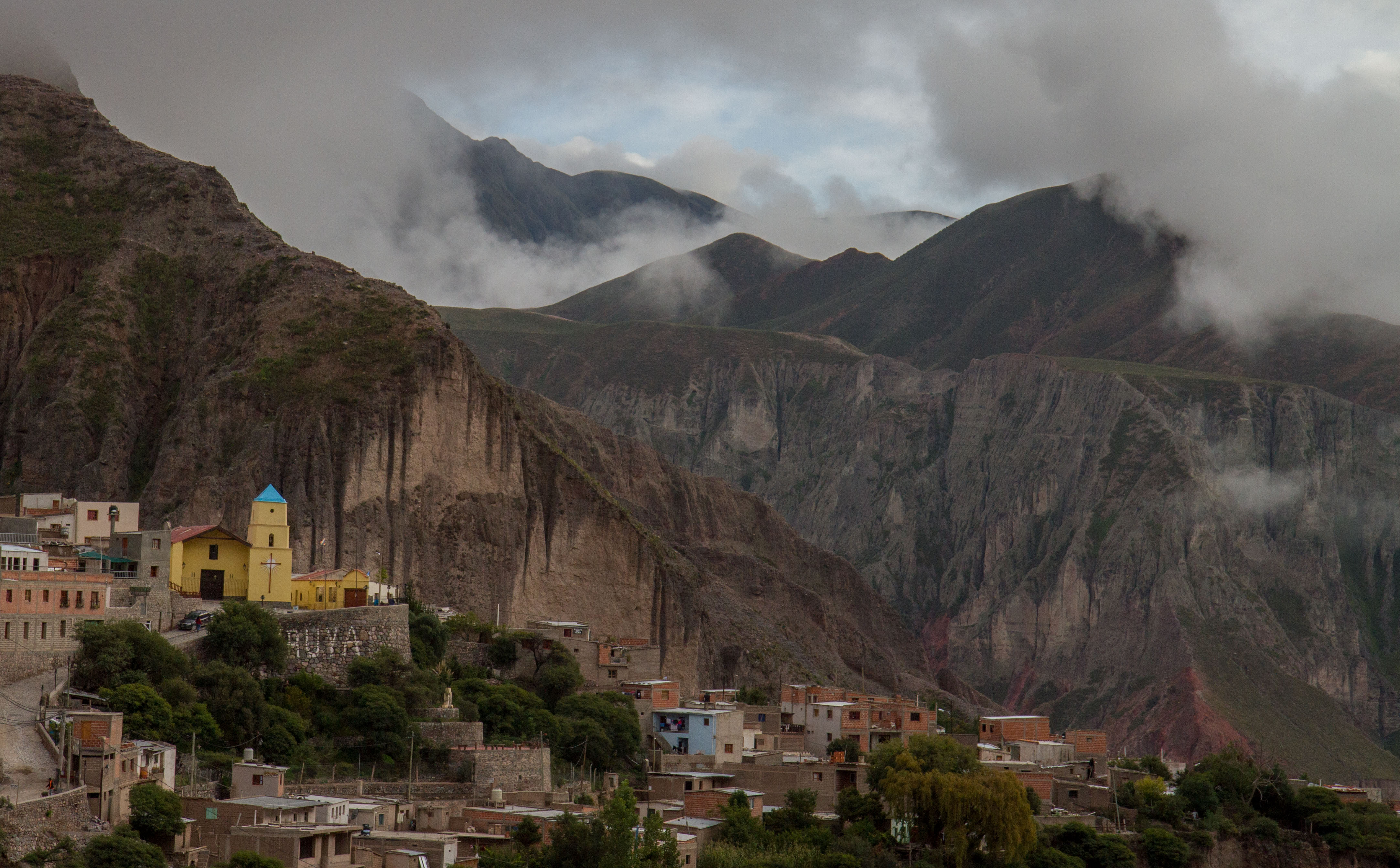
Iruya
Iruya is small mountain town located in the Salta region of North West Argentina. The town is accessed by a gravel road from Quebrada de Humahuaca (Humahuaca Valley). So technically it is outside the Quebrada de Humahuaca, but it was my favorite place in Argentina, because of its remoteness. I have a dedicated post on Iruya
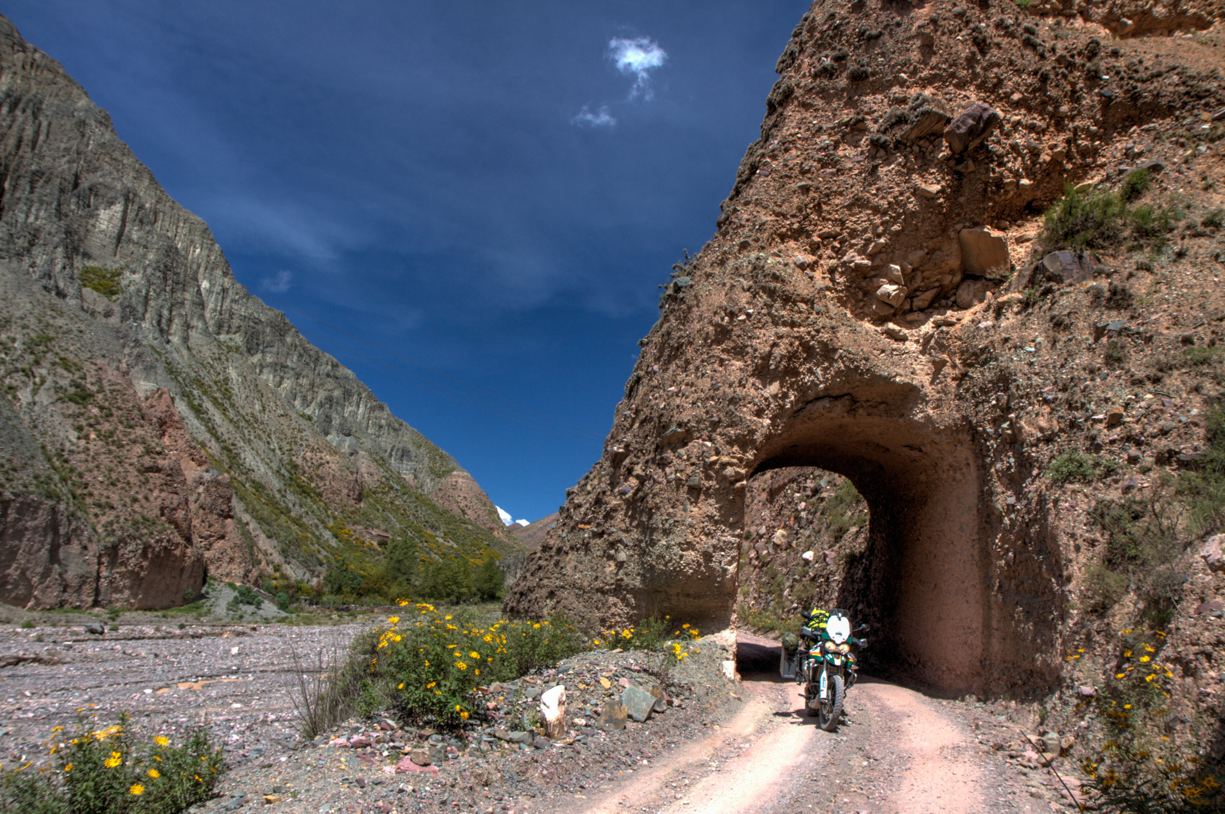
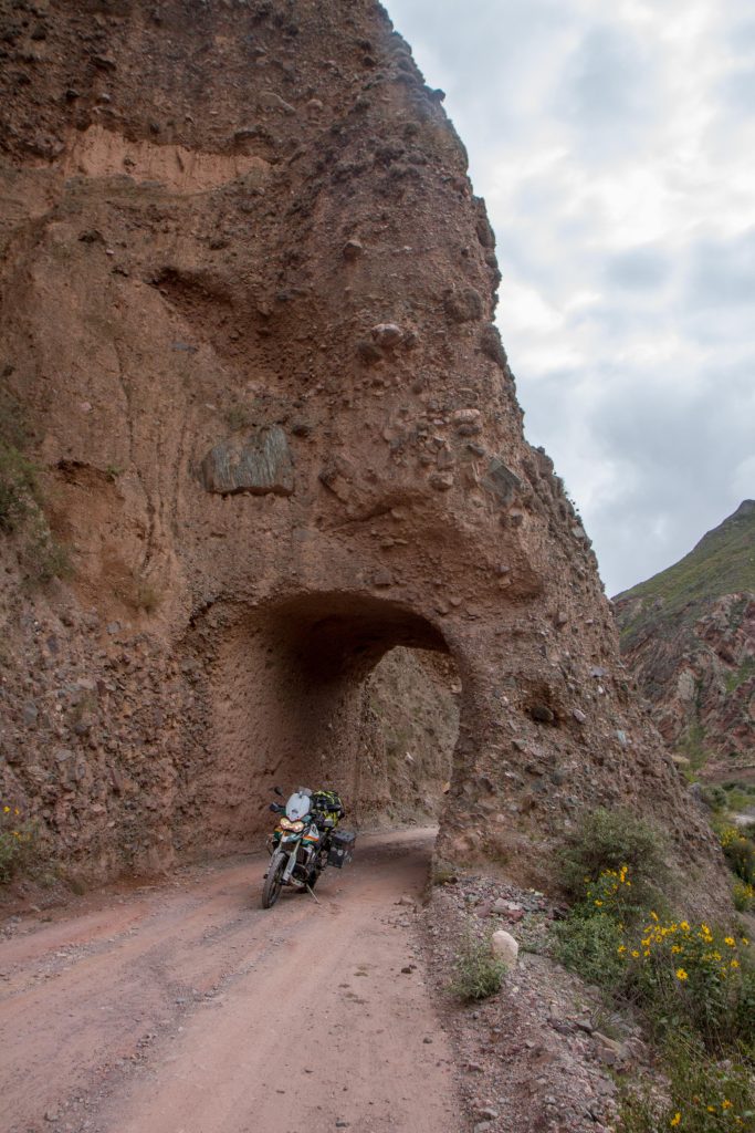
Iruya is small mountain town located in the Salta region of North West Argentina. The town is accessed by a gravel road from Quebrada de Humahuaca (Humahuaca Valley). The road climbs to 4000m before descending to 2600m where Iruya is located.
You’ll see the entrance tunnel to the town once you start to ride along the Iruya River. This ride is stunning, with dramatic landscape and twisty bends.
Iruya, Salta Province, Argentina
Once in the town, the hightlights are the church (built in 1609), the friendly people and many condors you can see from the ‘Mirador de los condor’
Iruya, Salta Province, ArgentinaIruya, Salta Province, Argentina
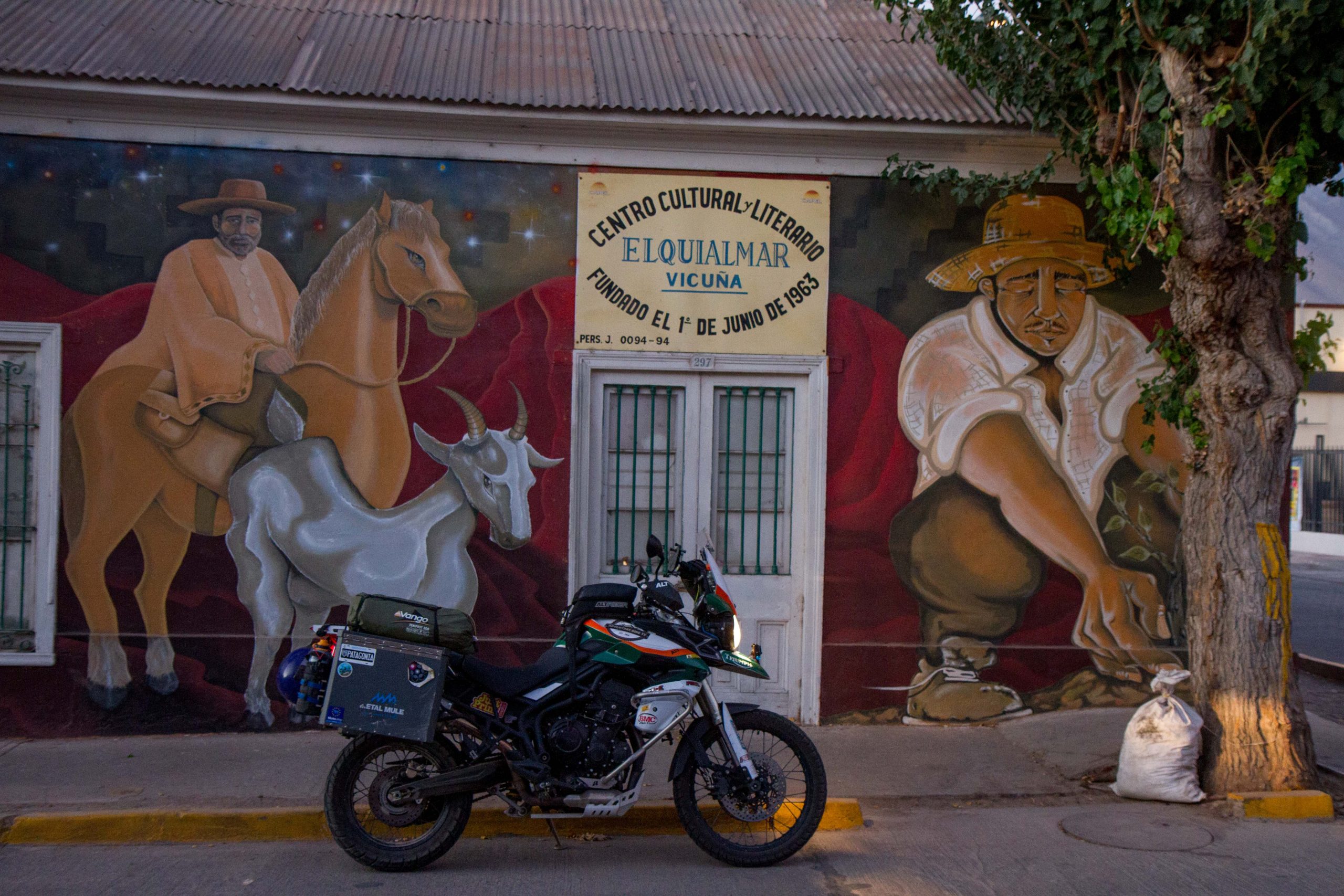
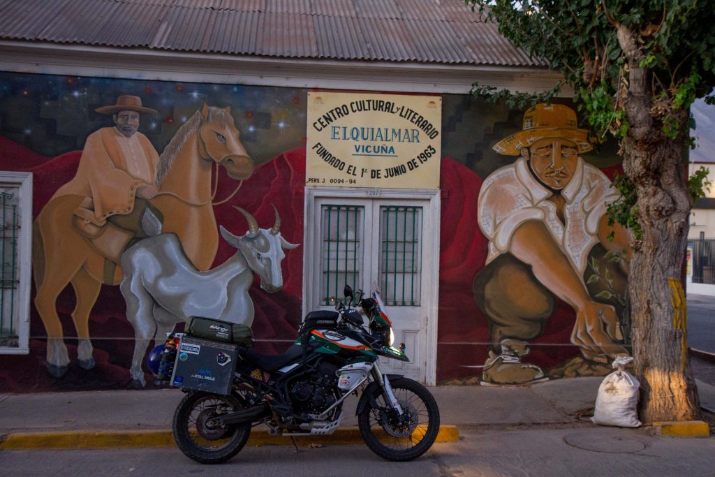
Elqui Valley is almost hidden away in an area that isn’t on the international tourist trail. Most people will travel up the coast near La Serena (Where the beaches in Chile slowly start becoming warm enough to swim it), but if they venture towards the Andes they will be rewarded by one of Chile’s most important valleys. This is Elqui Valley, famous for pisco-producing and stargazing.
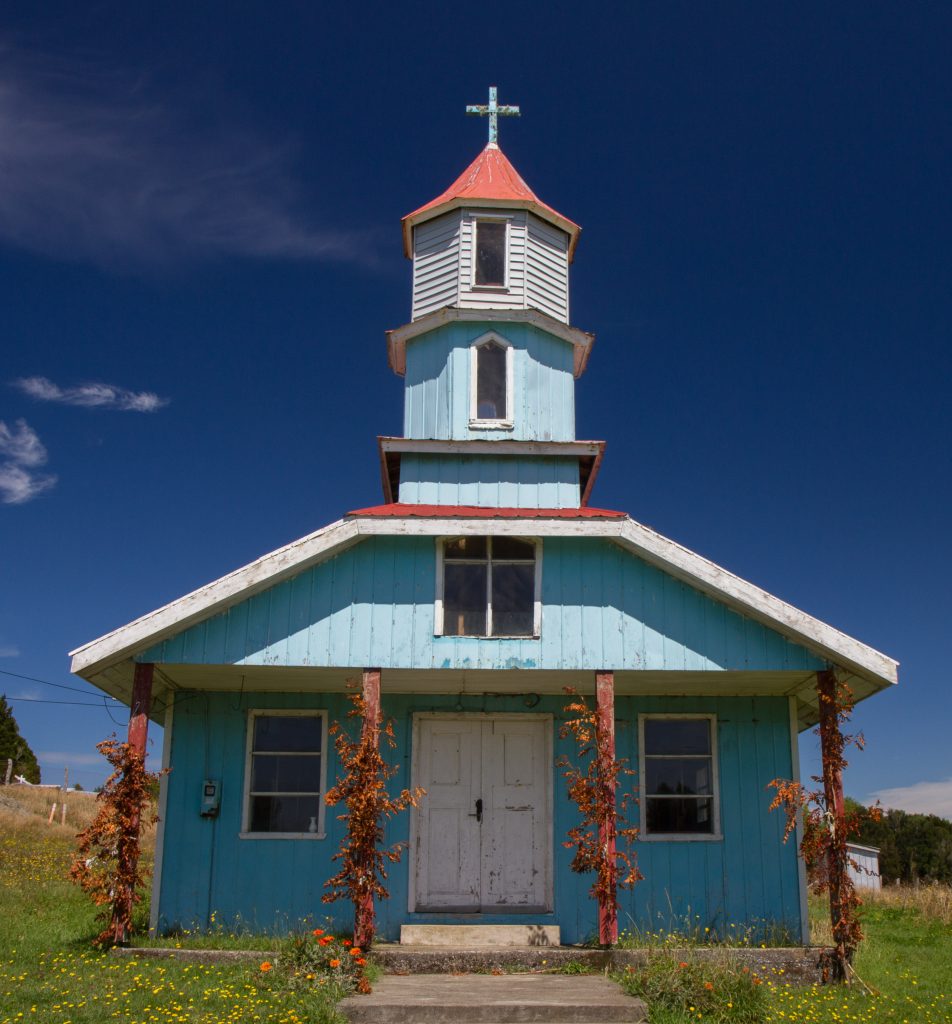
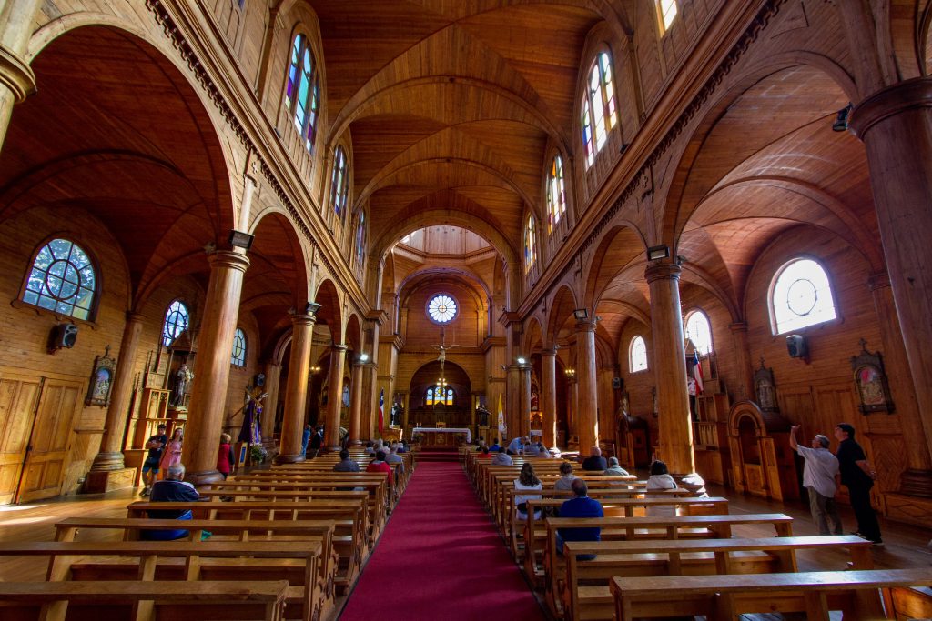
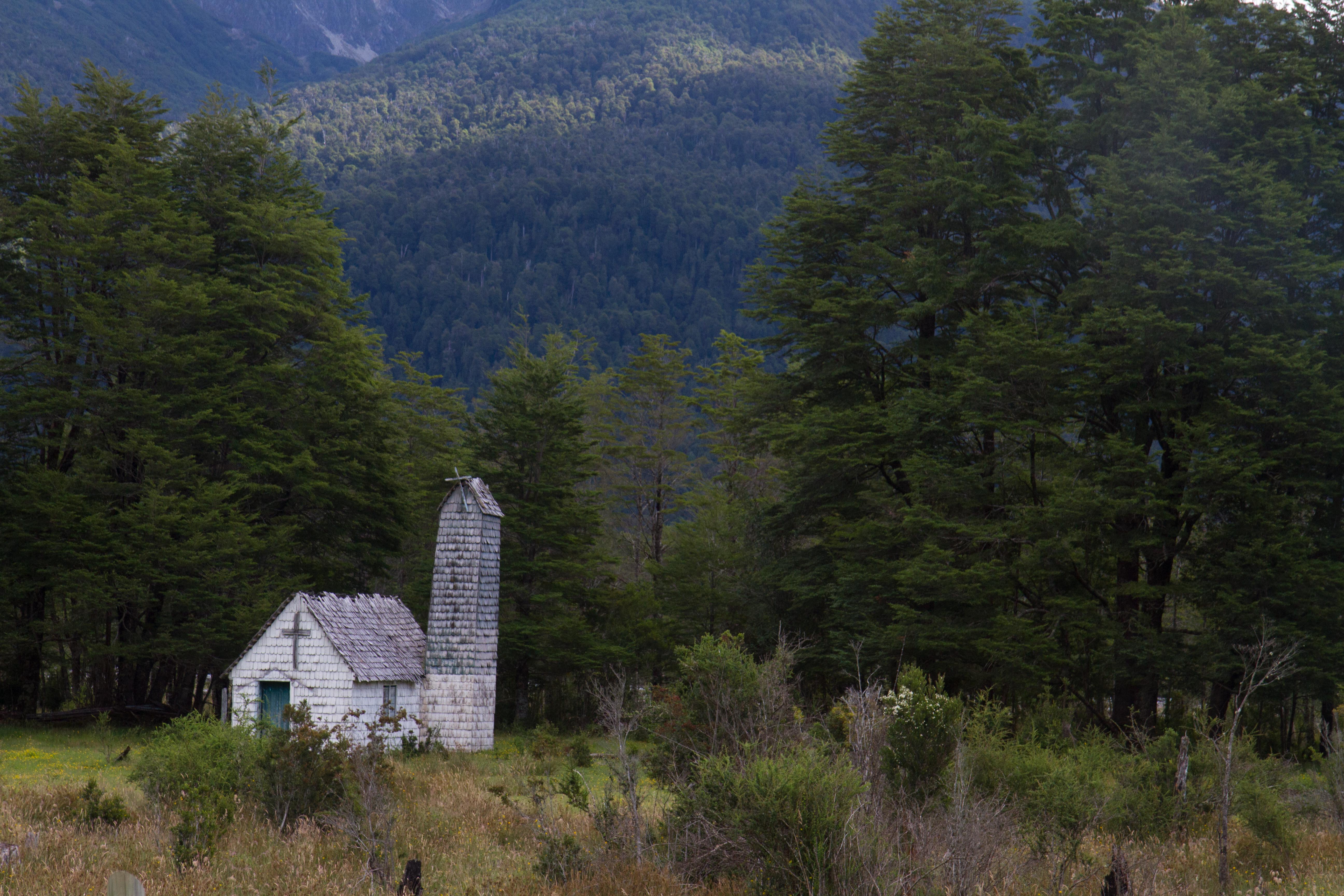
The wooden churches of Chiloe and a UNESCO World Heritage Site and are a unique architectural phenomenon in the Americas. Unlike classical Spanish colonial architecture, the churches of Chiloé are made entirely in native timber with extensive use of wood shingles. The churches were built from materials to resist the Chiloé Archipelago’s humid and rainy oceanic climate.
Wooden Churches of Chiloé, Chile
Wooden Churches of Chiloé, Chile
Wooden Churches of Chiloé, Chile
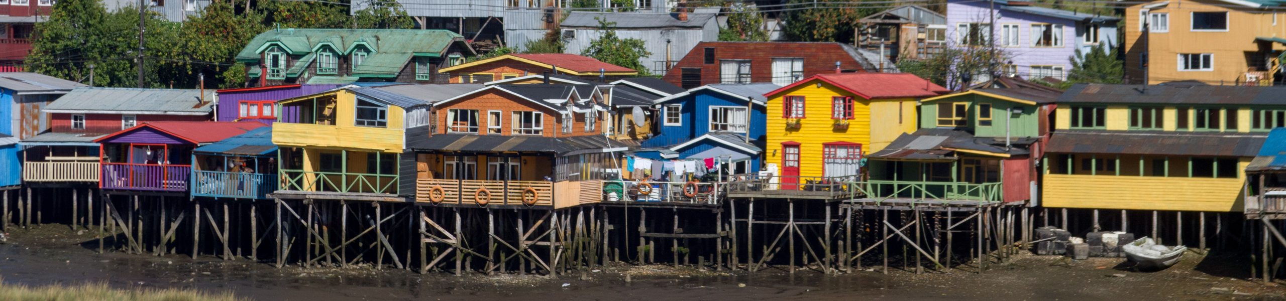
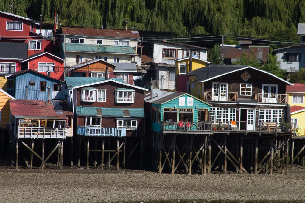
Castro, Chile
Castro is famous for its palafitos, traditional wooden stilt houses which were common in many places in Chiloé. Some of them are preserved in the town district Gamboa in the west of the town in a bay called Fiordo de Castro.
Castro, Chile
Castro, Chile
Sunsets
Sunset Explosion over the beaches in Chiloe Island
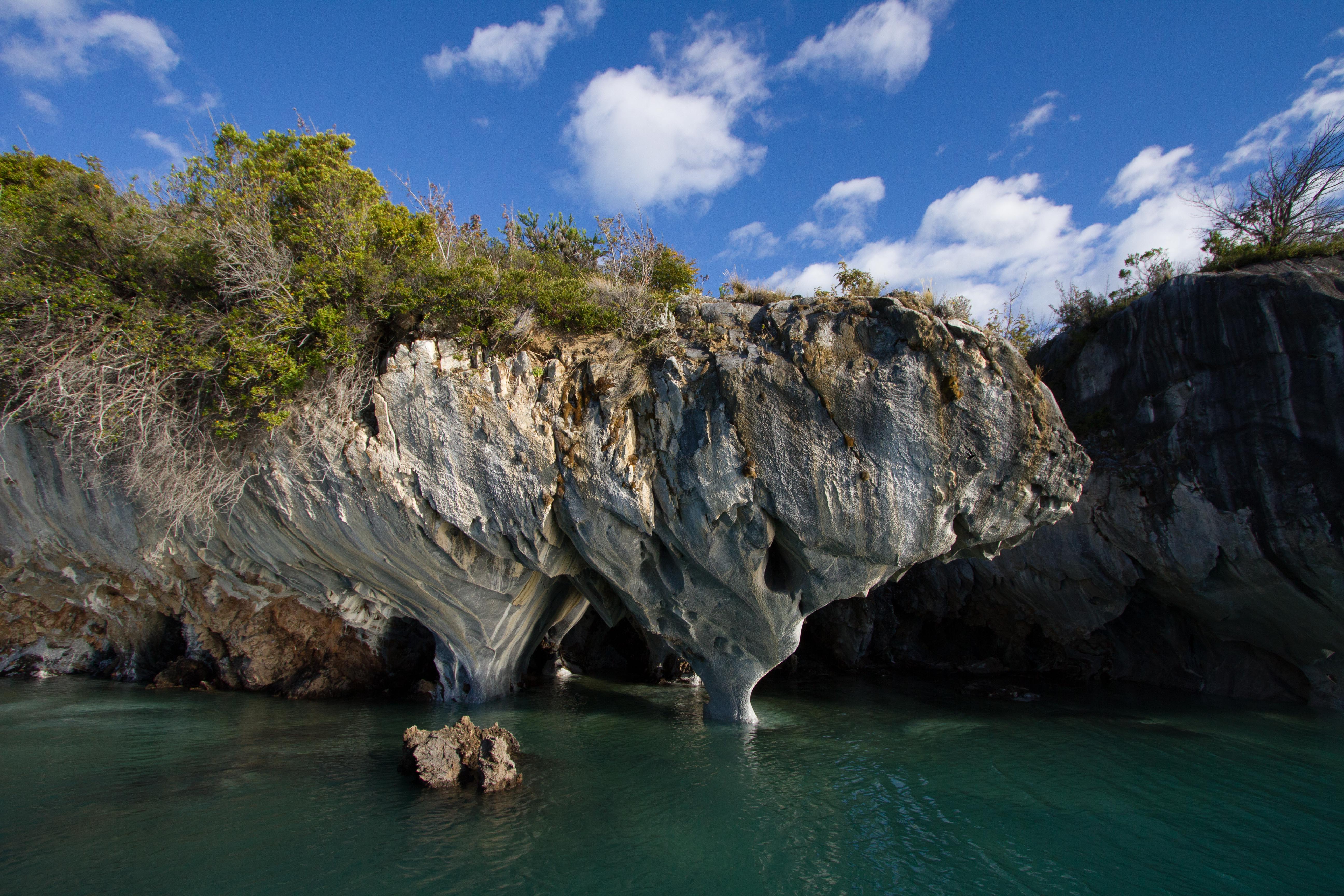
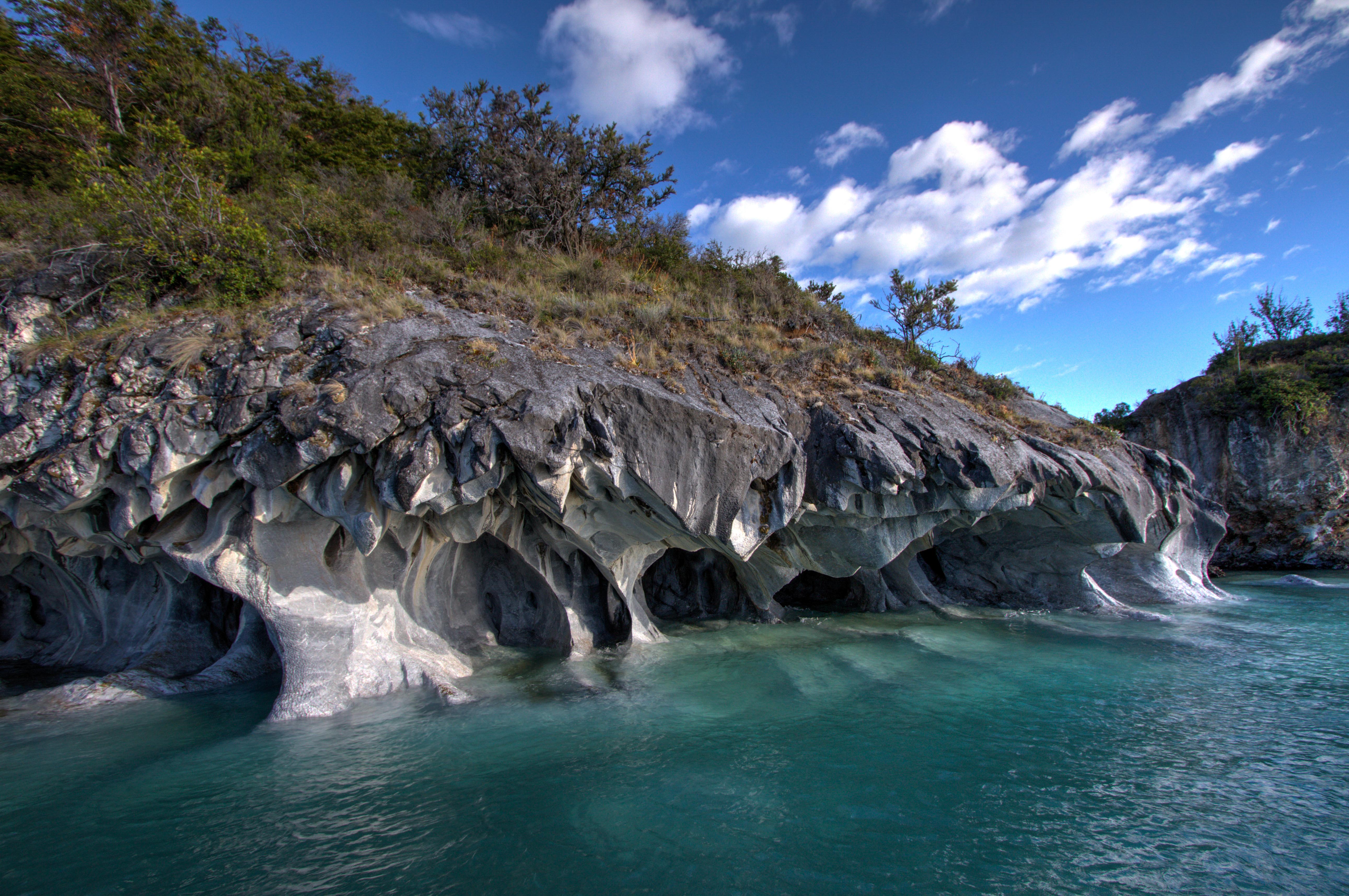
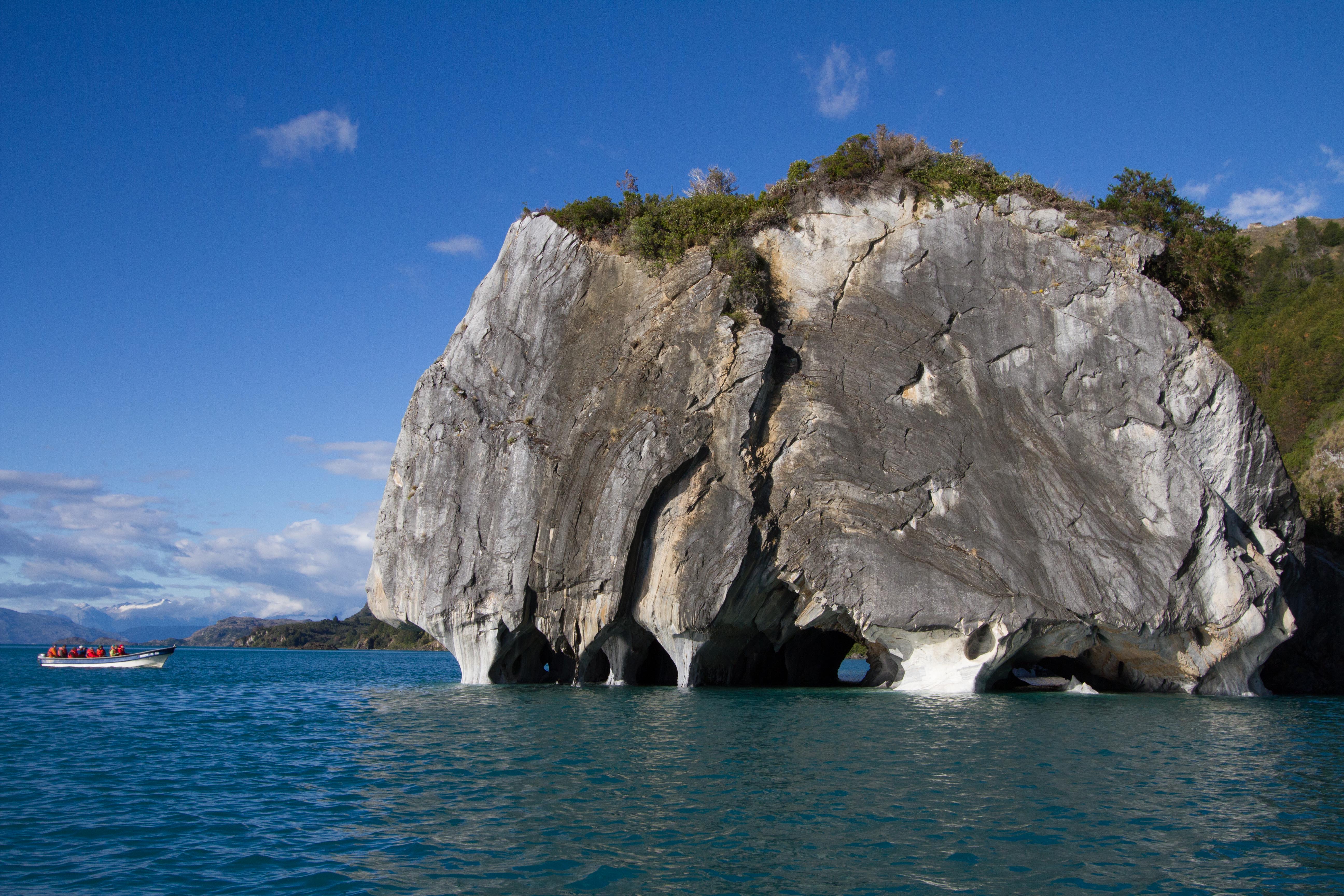
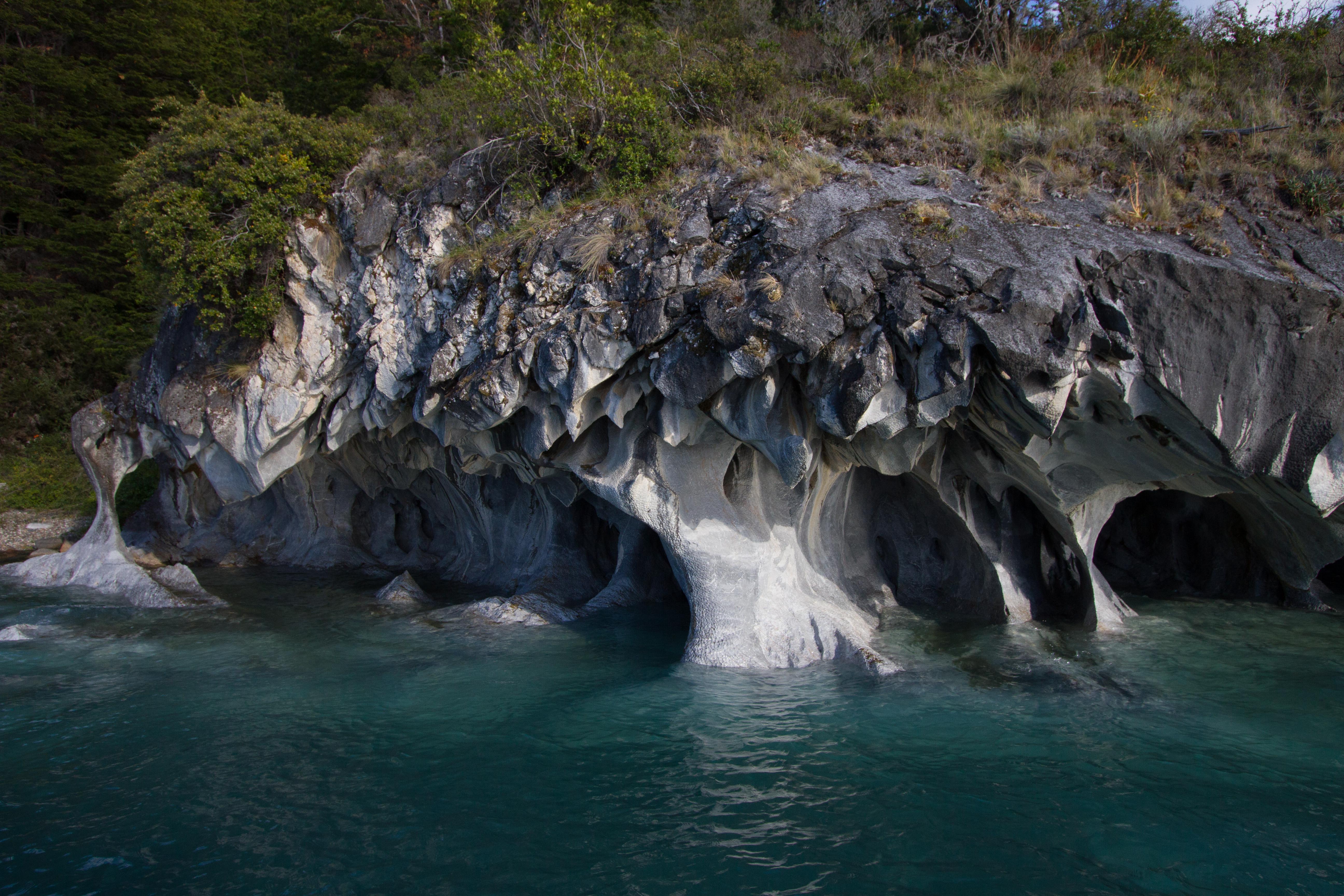
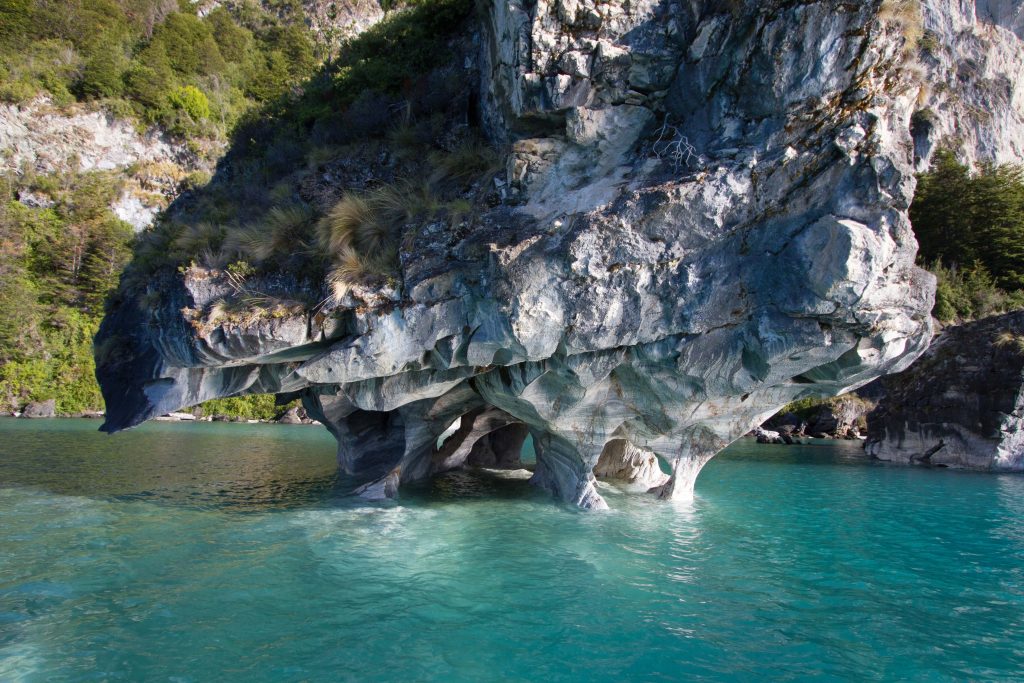
The Marble Caves (Cuevas de Mármol) are located on a peninsula of solid marble. Lake General Carrera sits at the base… 6000 yrs of the lakes waves have formed this unique cave…. add the blue glacier water from the lake and you’ll find a very surreal mix of cathedral caves with ice blue reflections.
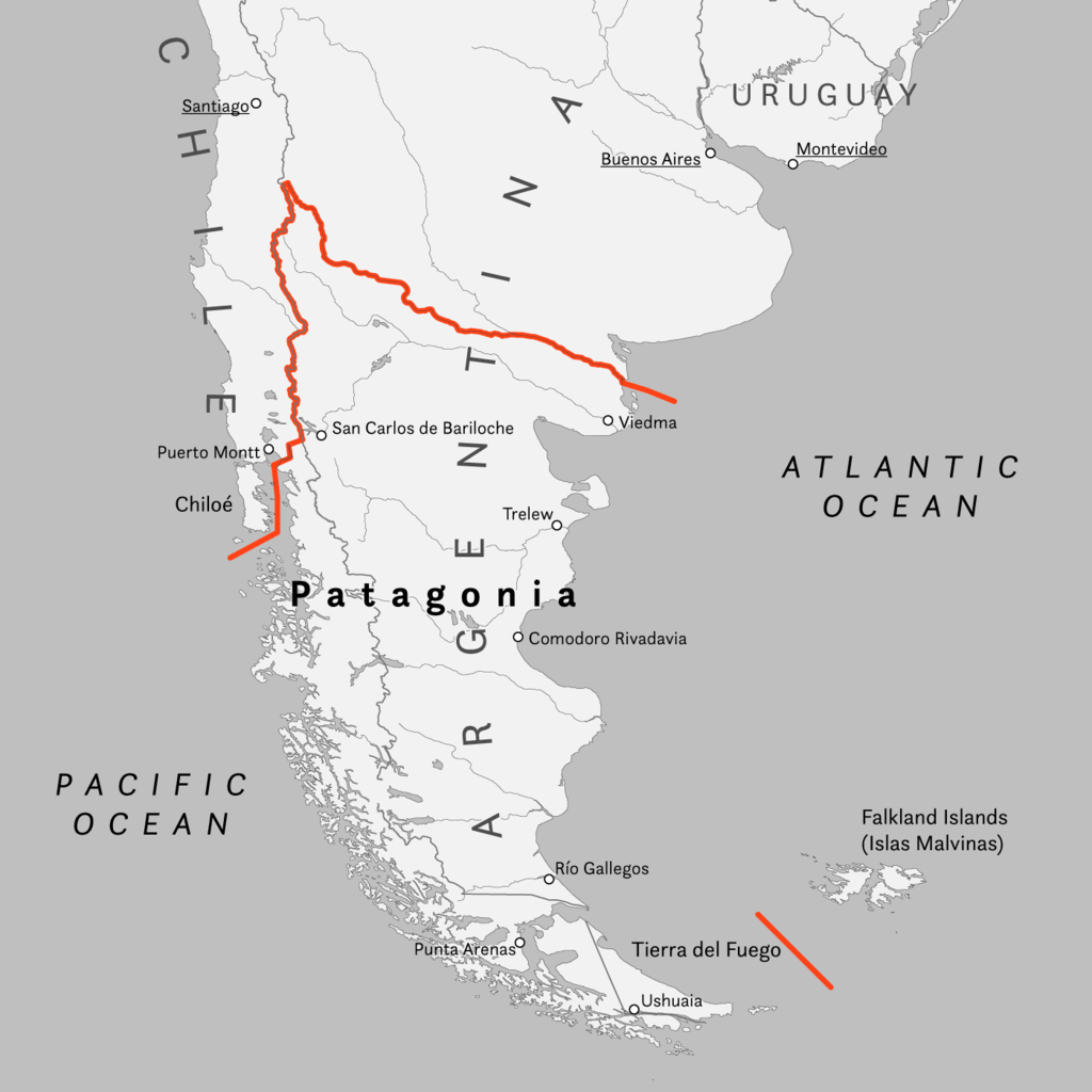
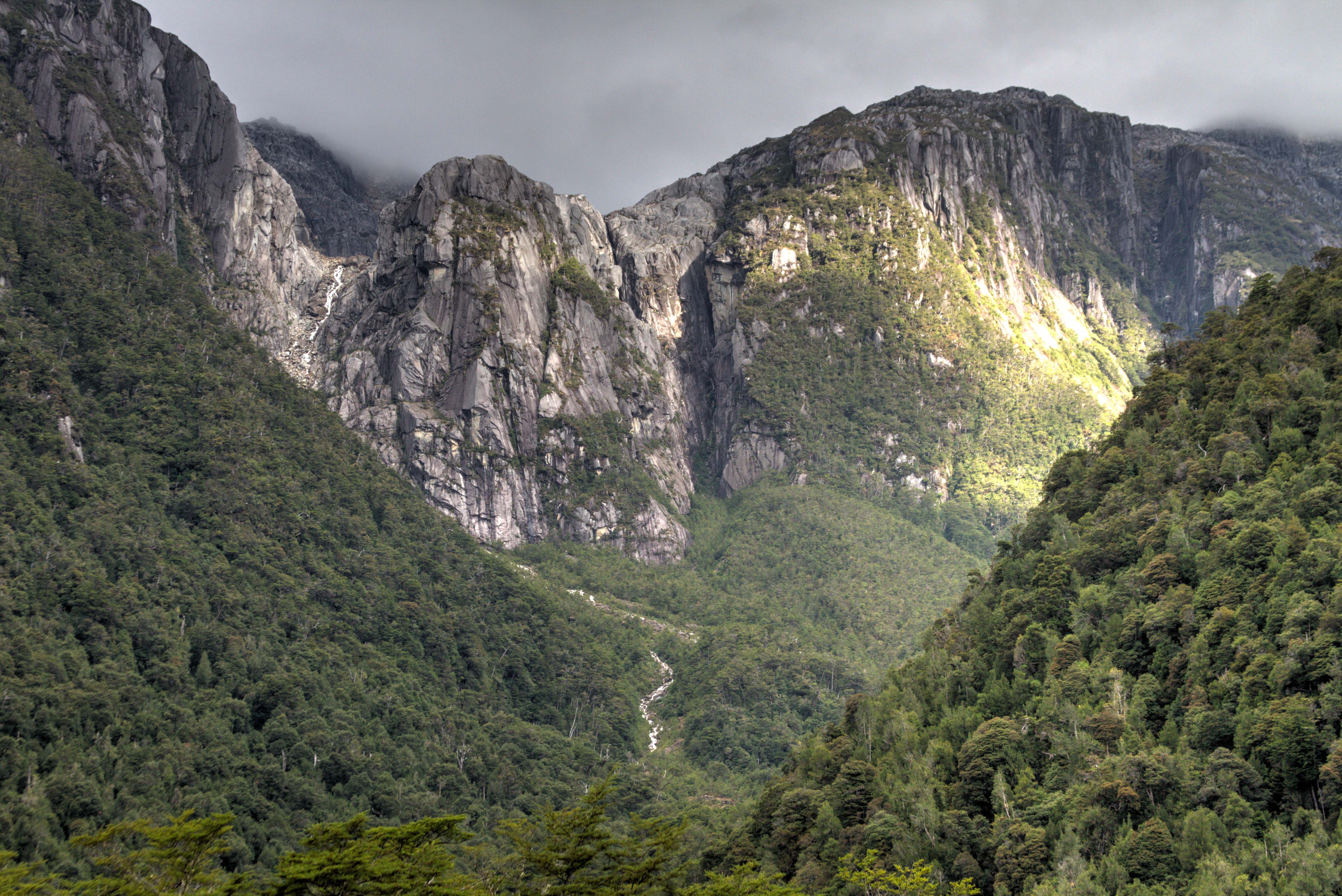
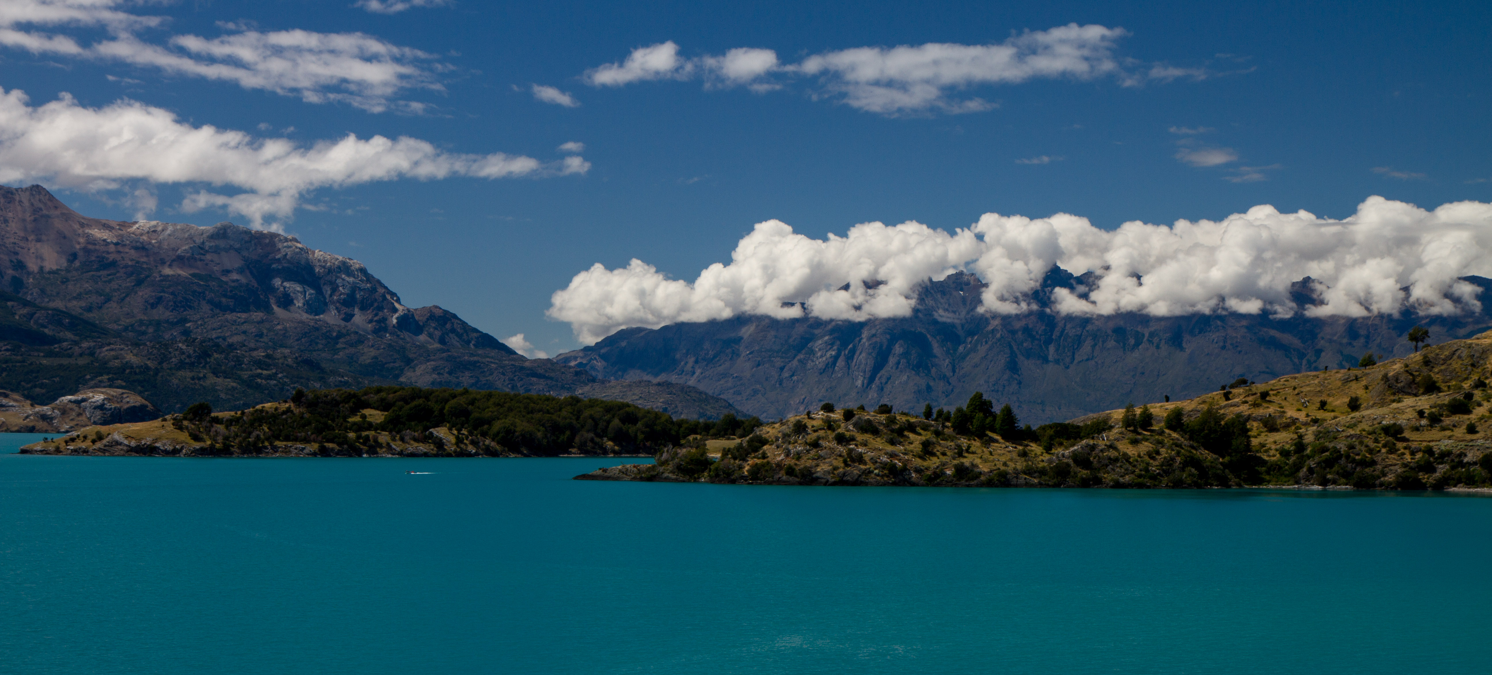
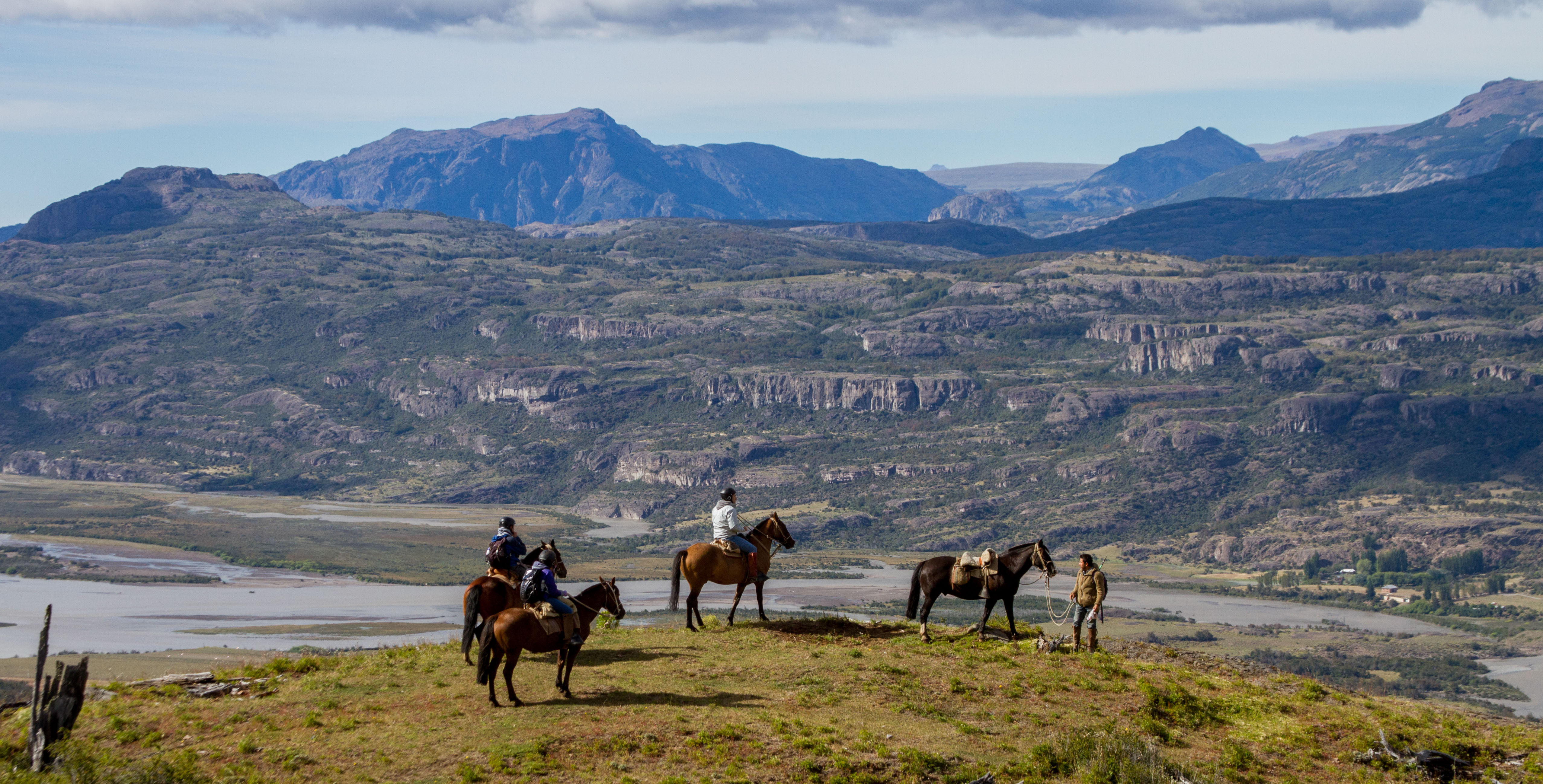
Patagonia is a sparsely populated region located at the southern end of South America, shared by Argentina and Chile. The region comprises the southern section of the Andes mountains as well as the deserts, pampas and grasslands east of this southern portion of the Andes. For overlanders, Patagonia has always been top of the ‘must-do’ on
Patagonia is a HUGE place that incorporates both Argentina and Chile. Highlights are many. You could stay for ages but you’ll be pushed north by the short summer period, longing to the day you return.
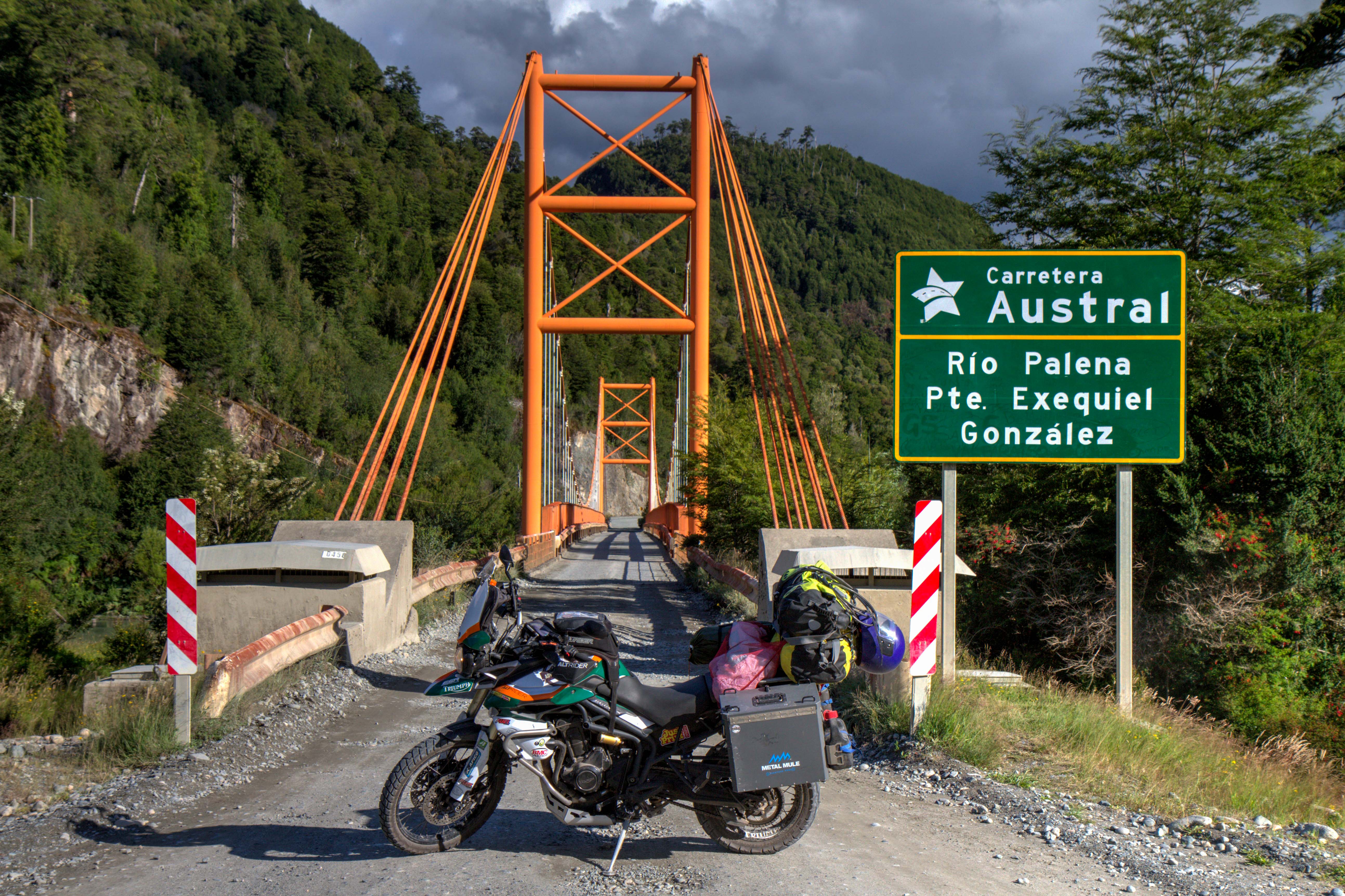
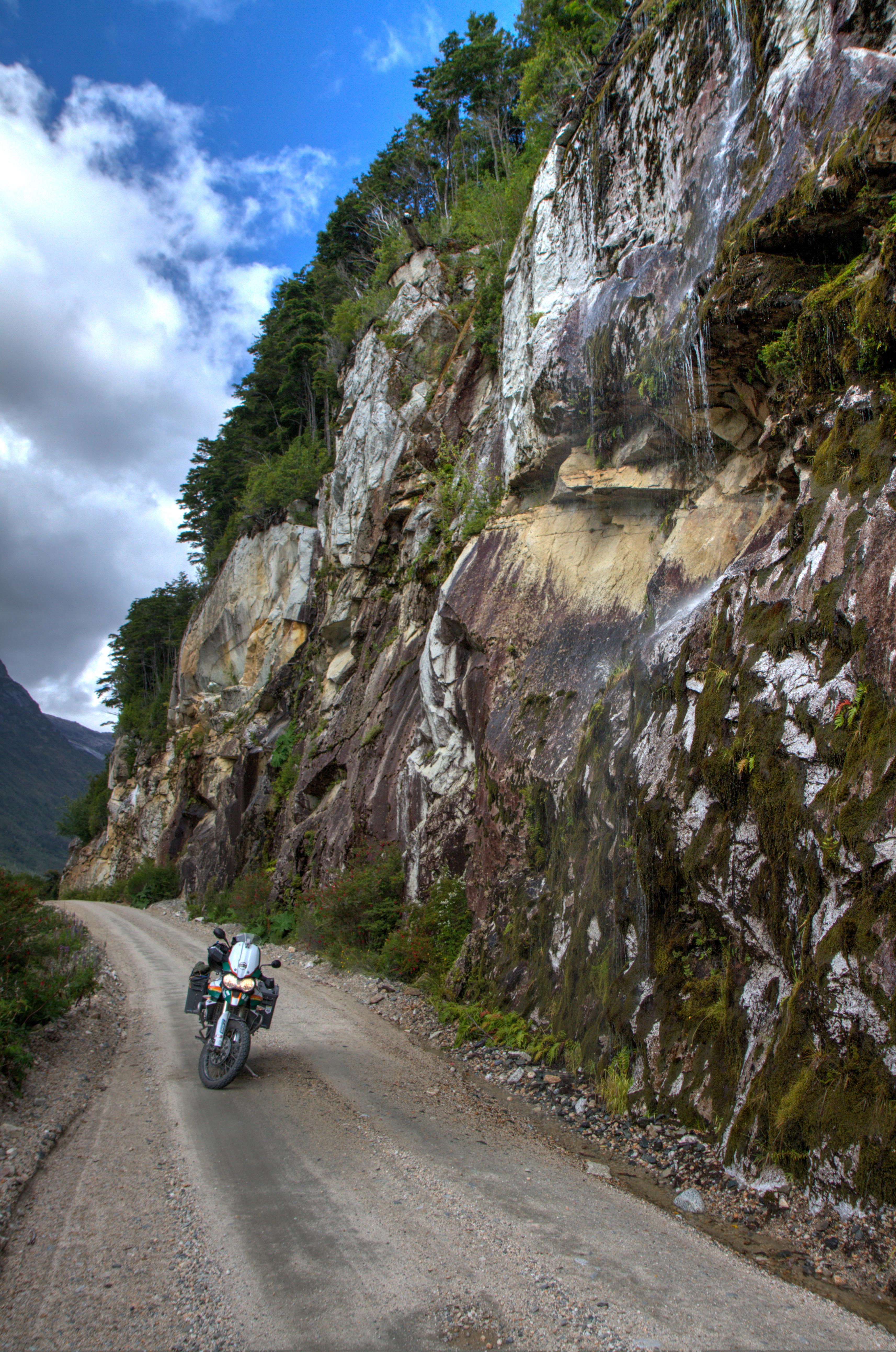
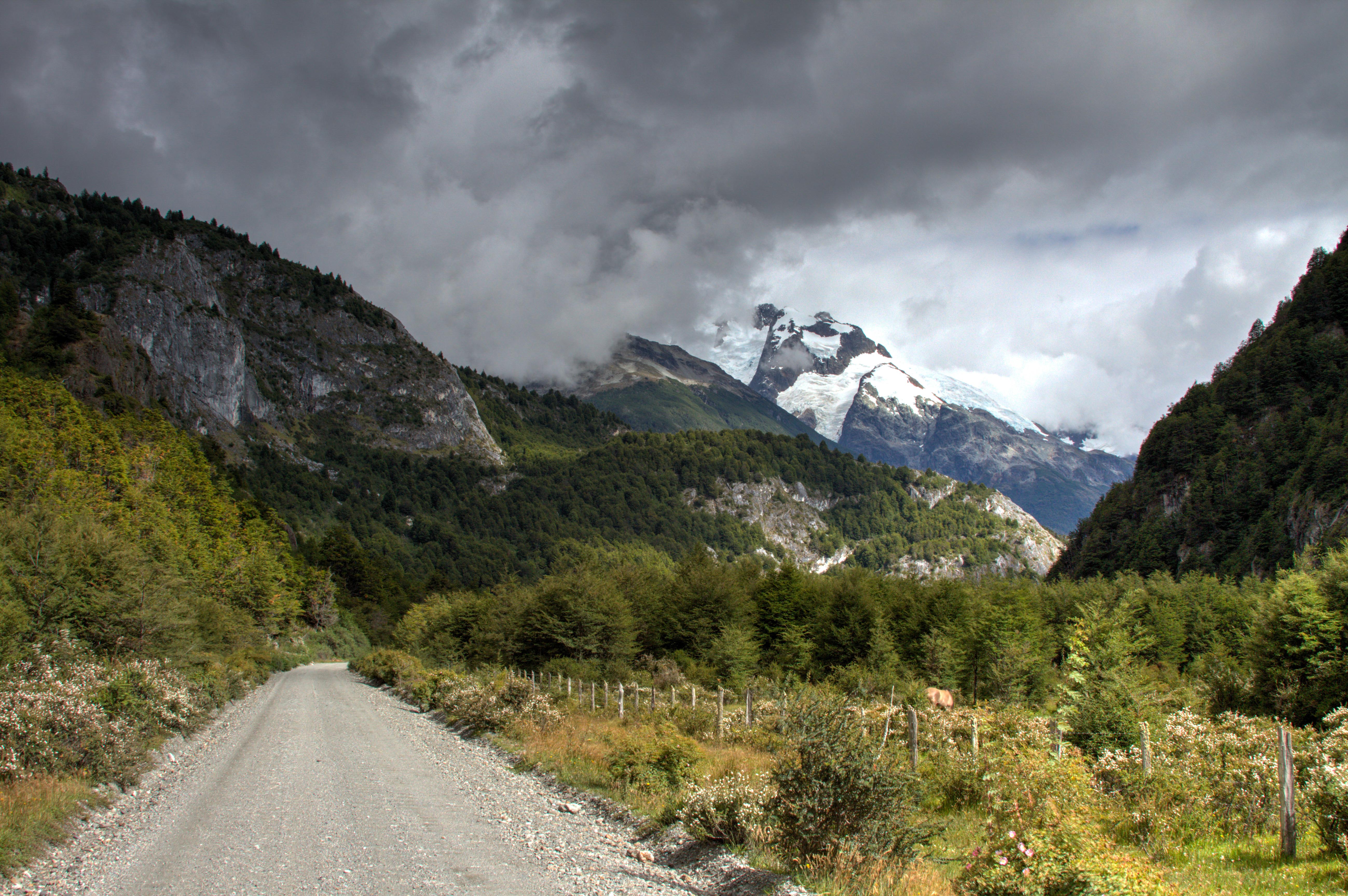
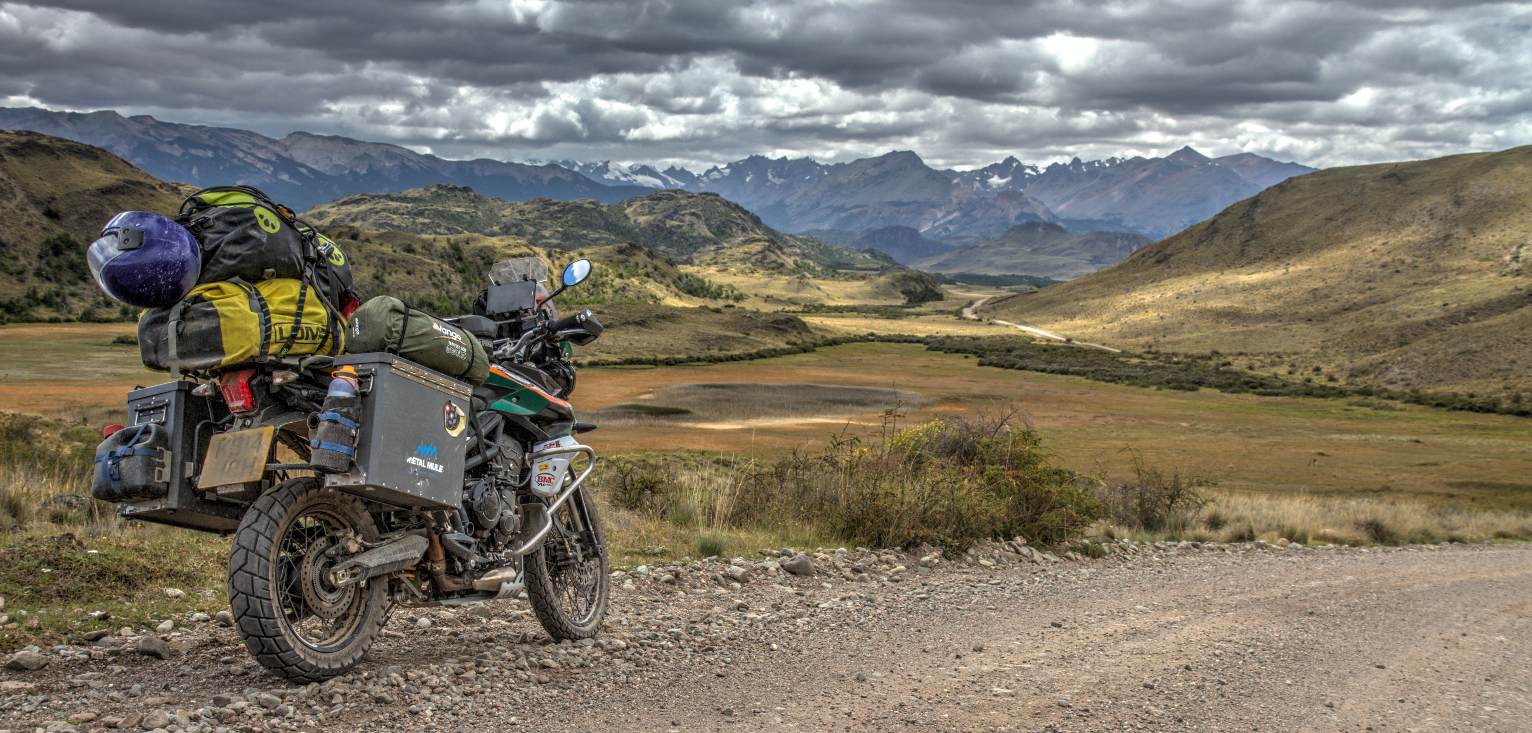
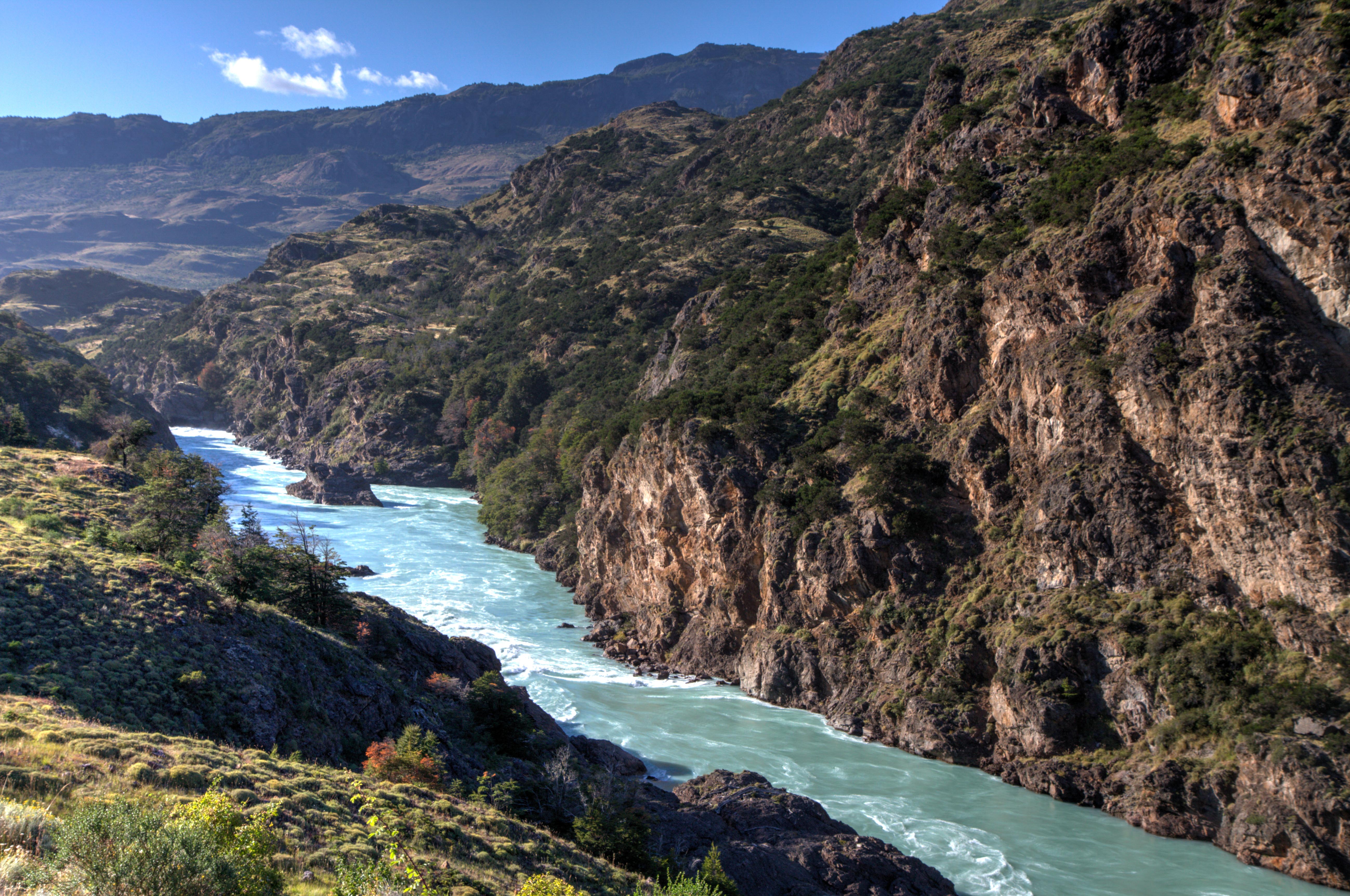
Carretera Austral
Carretera Austral is the legendary name given to the official Ruta (Route) 7 in Chile. The road runs from Puerto Montt to Villa O’Higgins. It exists entirely in the Patagonia section of Chile.
The construction of the road started in 1976 and was one of the biggest infrastructure projects at the time in Chile. Unlike Argentina, on the other side of the Andes Mountain range, constructing a road south into Chile was not easy. Argentina had the flat plains to run the road along when the mountain terrain became to difficult. This is seen in the famous Ruta 40 in Argentina, which mostly runs along the easier, flat lands away from the Andes. Chile dint have this luxury as the stunning terrain is full of steep mountains, fjords, forests, canals and glaciers. Apparently, 10,000 army personal were involved in the roads construction. When finished the road was completely dirt. Today work is underway to pave the entire length, a task that will take some time. Until then, enjoy the road before it becomes ‘too accessible’. Check out my post on the Carretera Austral.
Mirador Cerro Castillo, Aysén Region, Chile
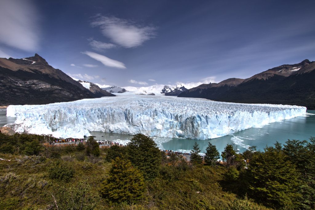
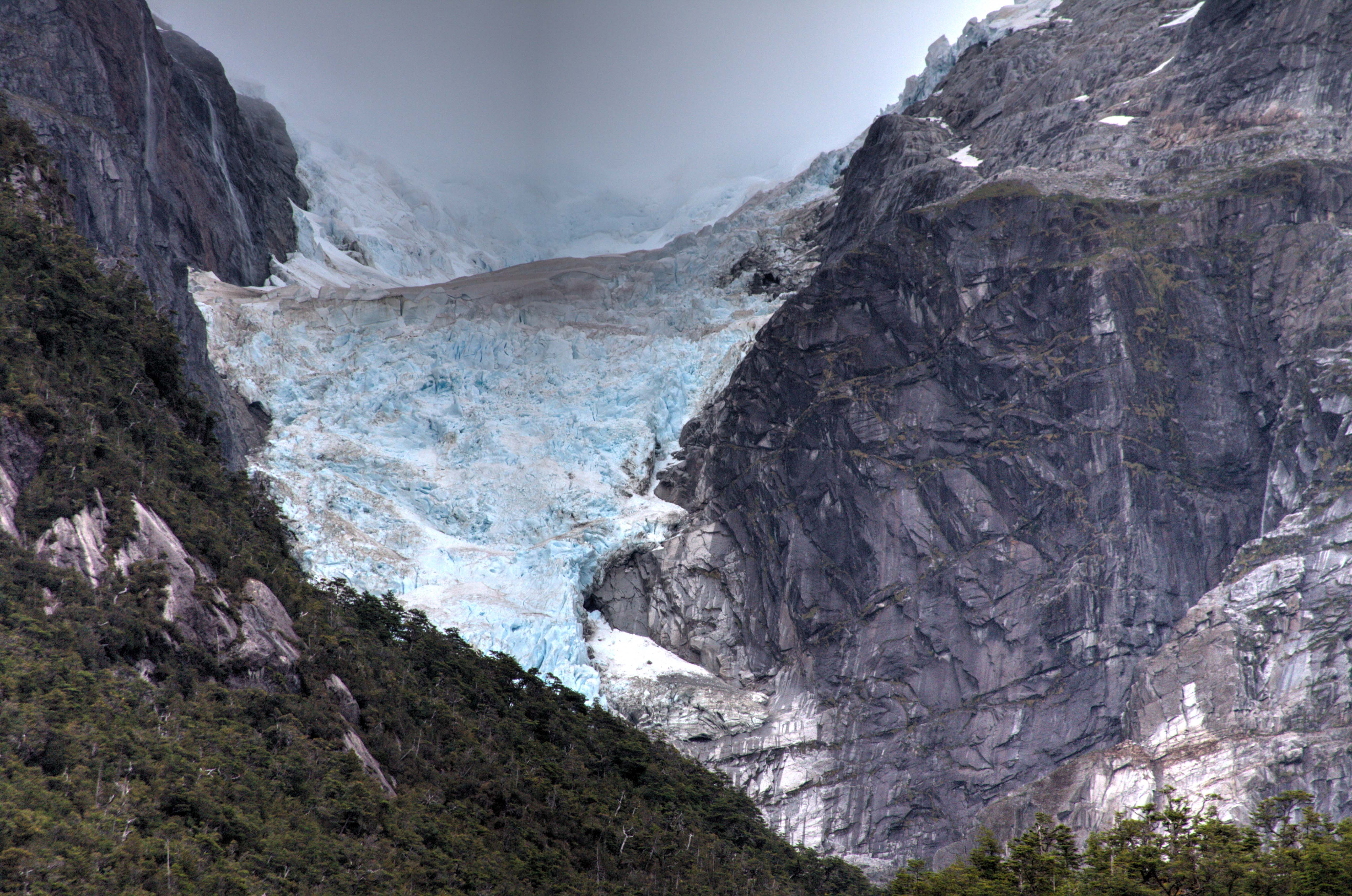
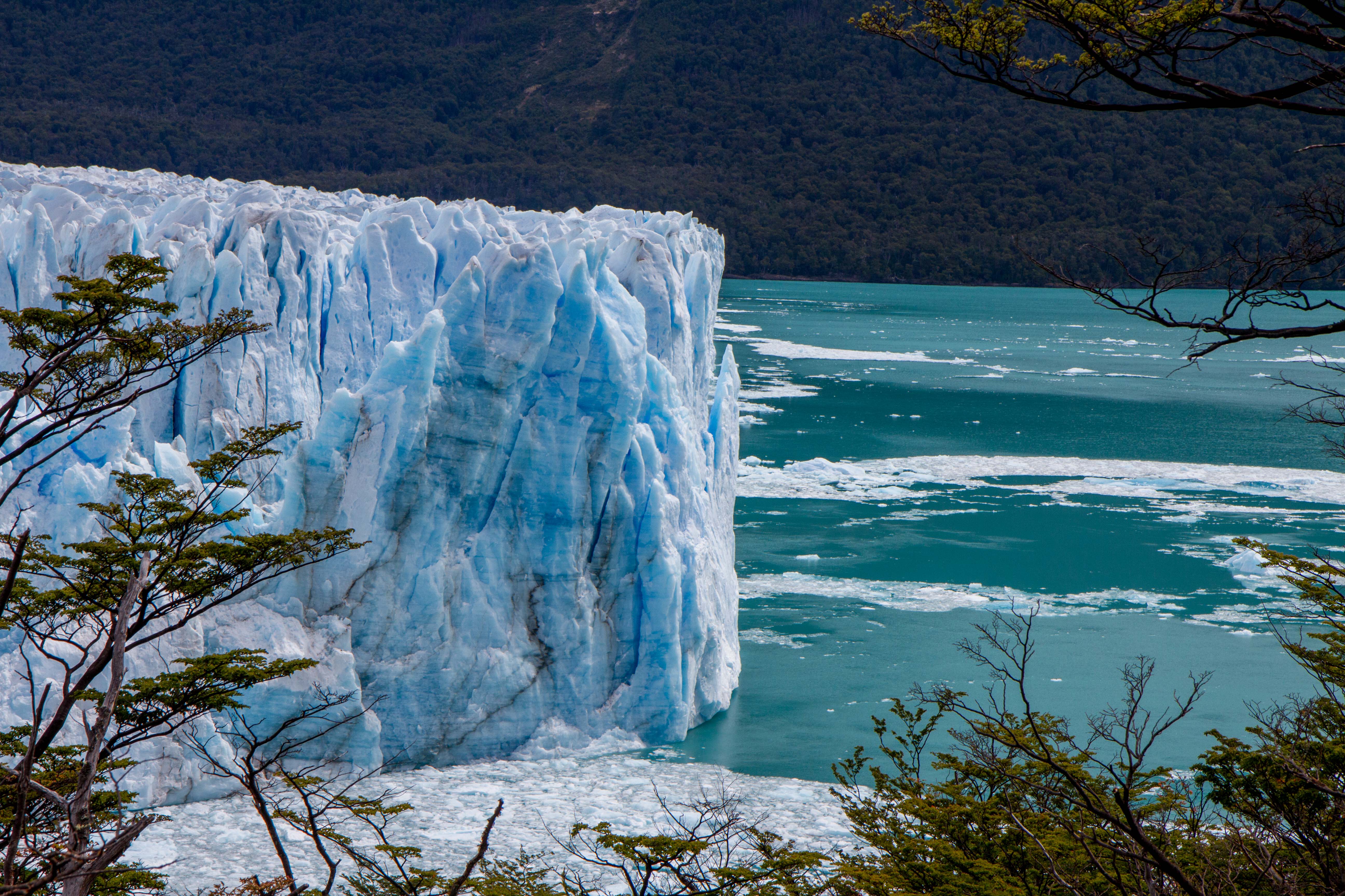
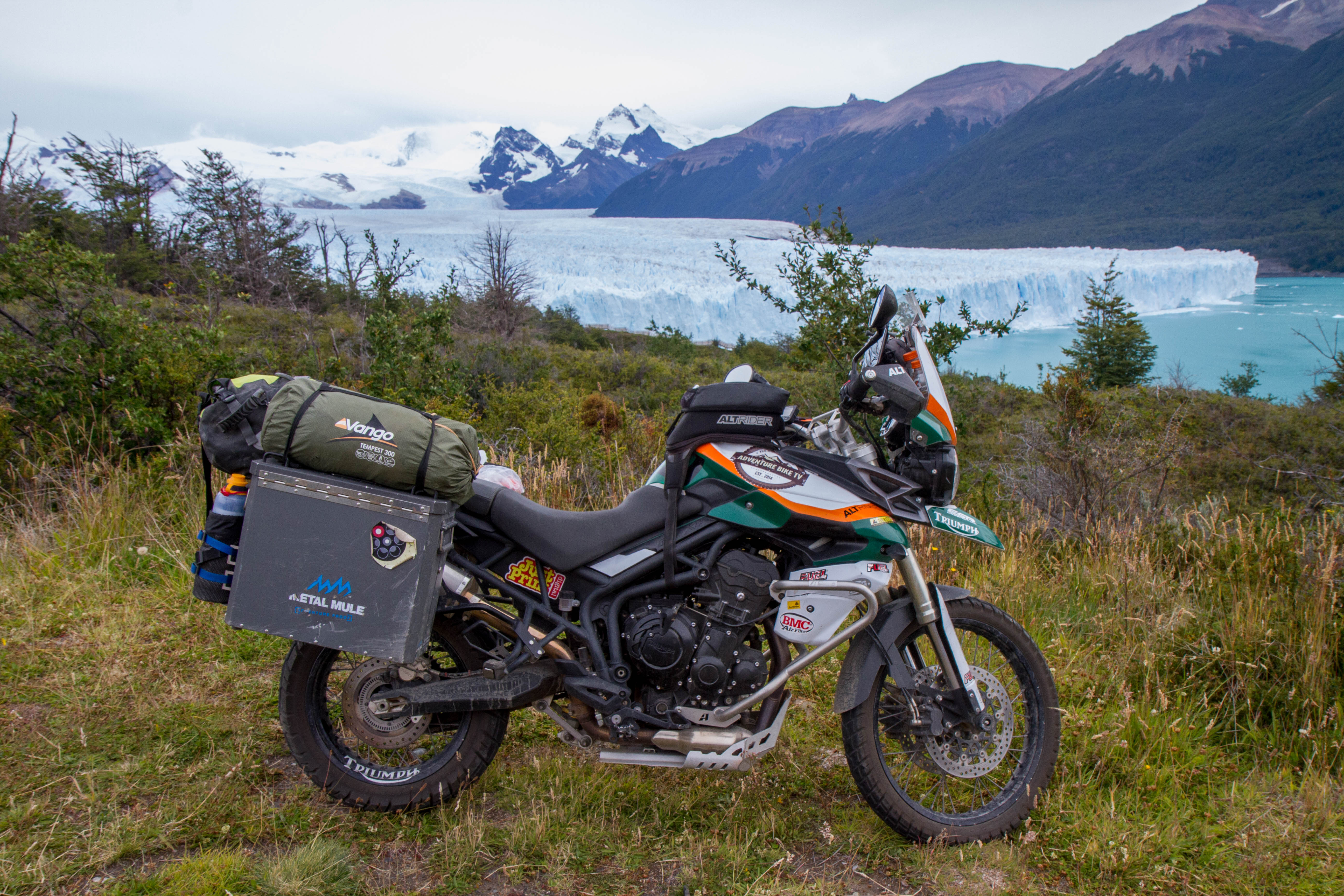
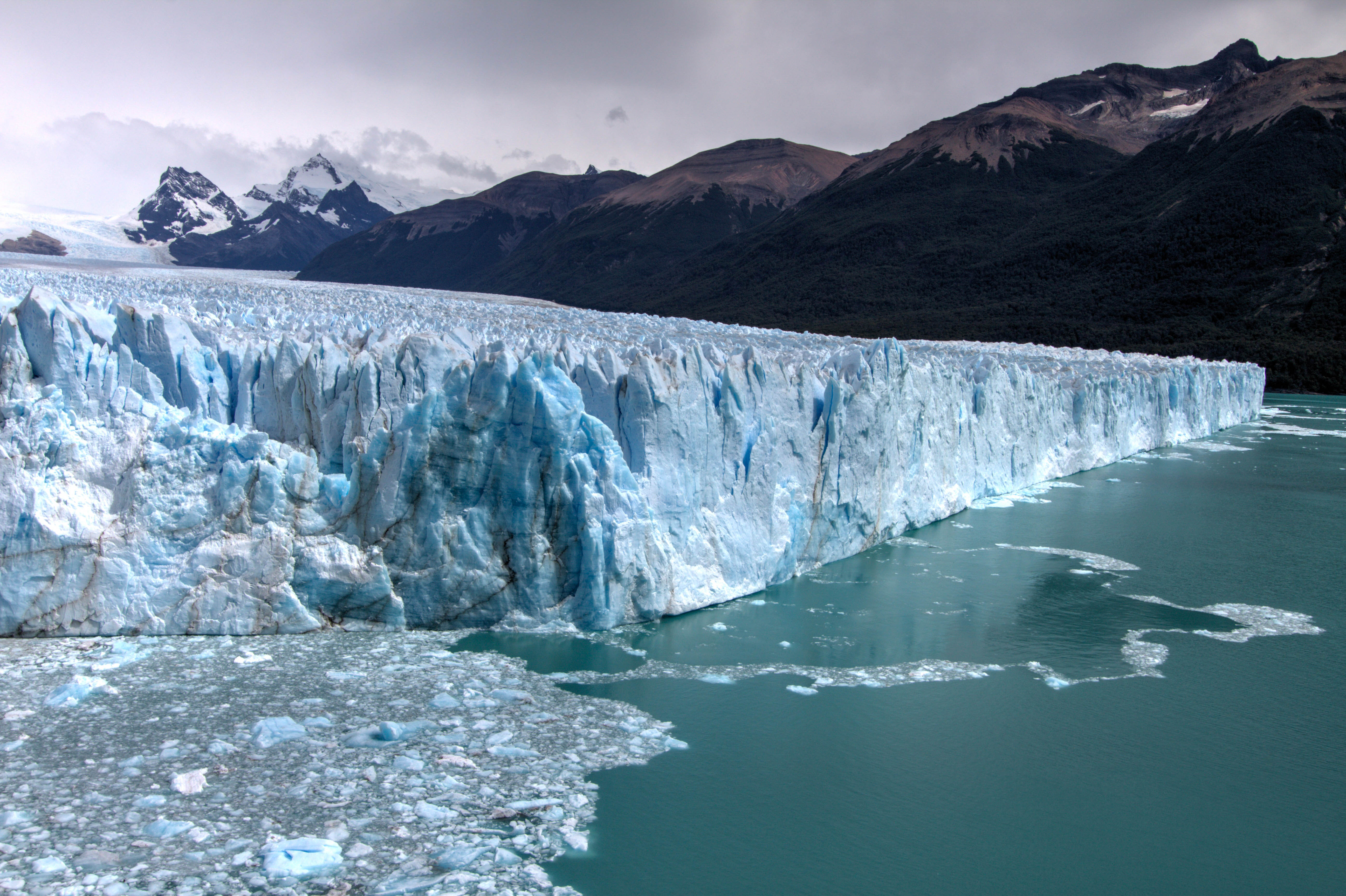
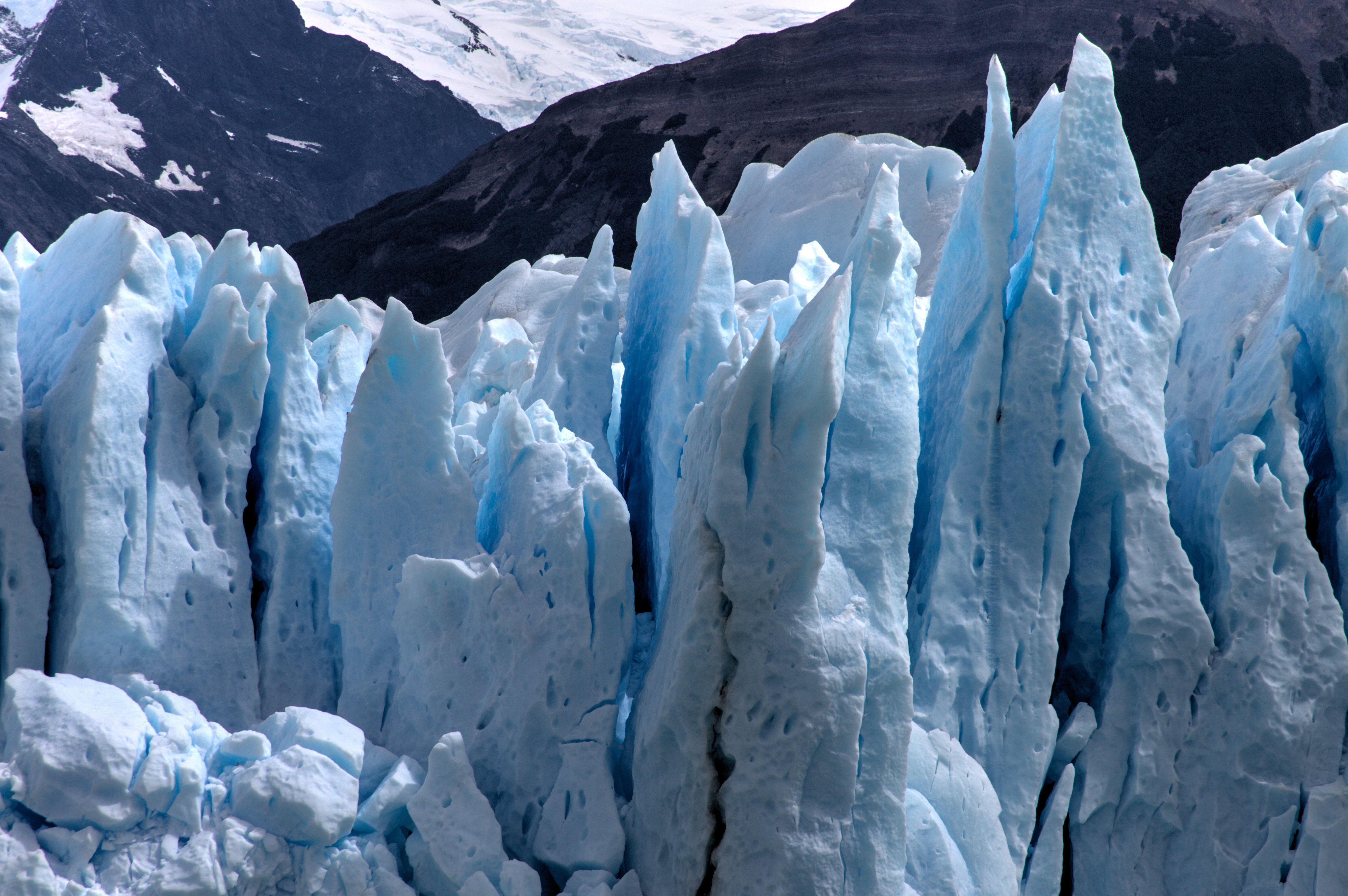
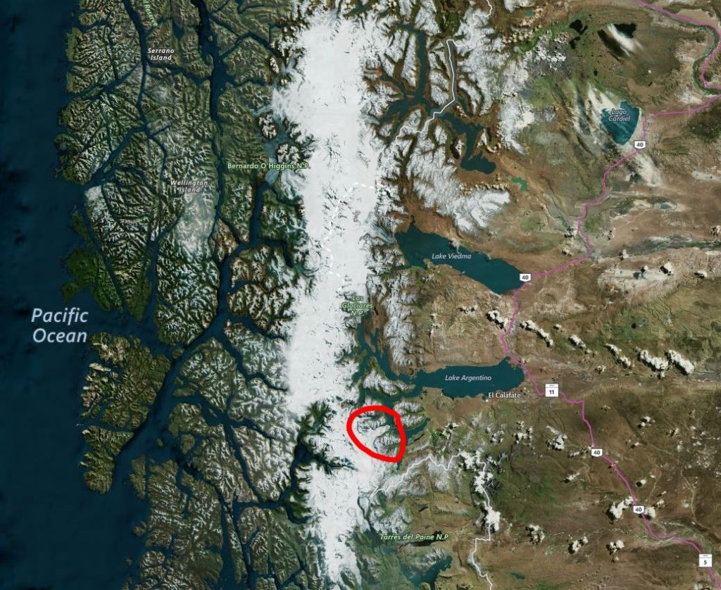
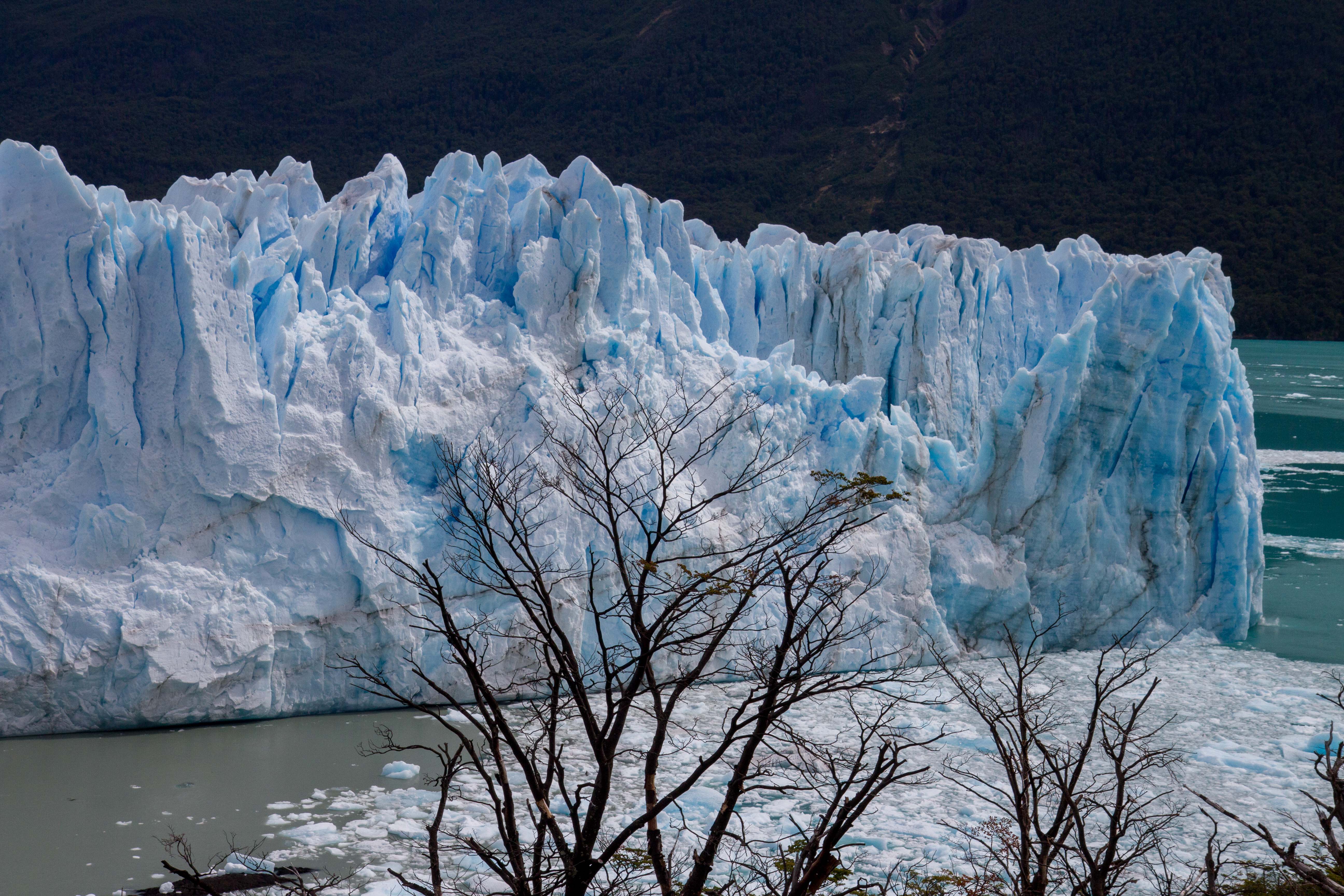
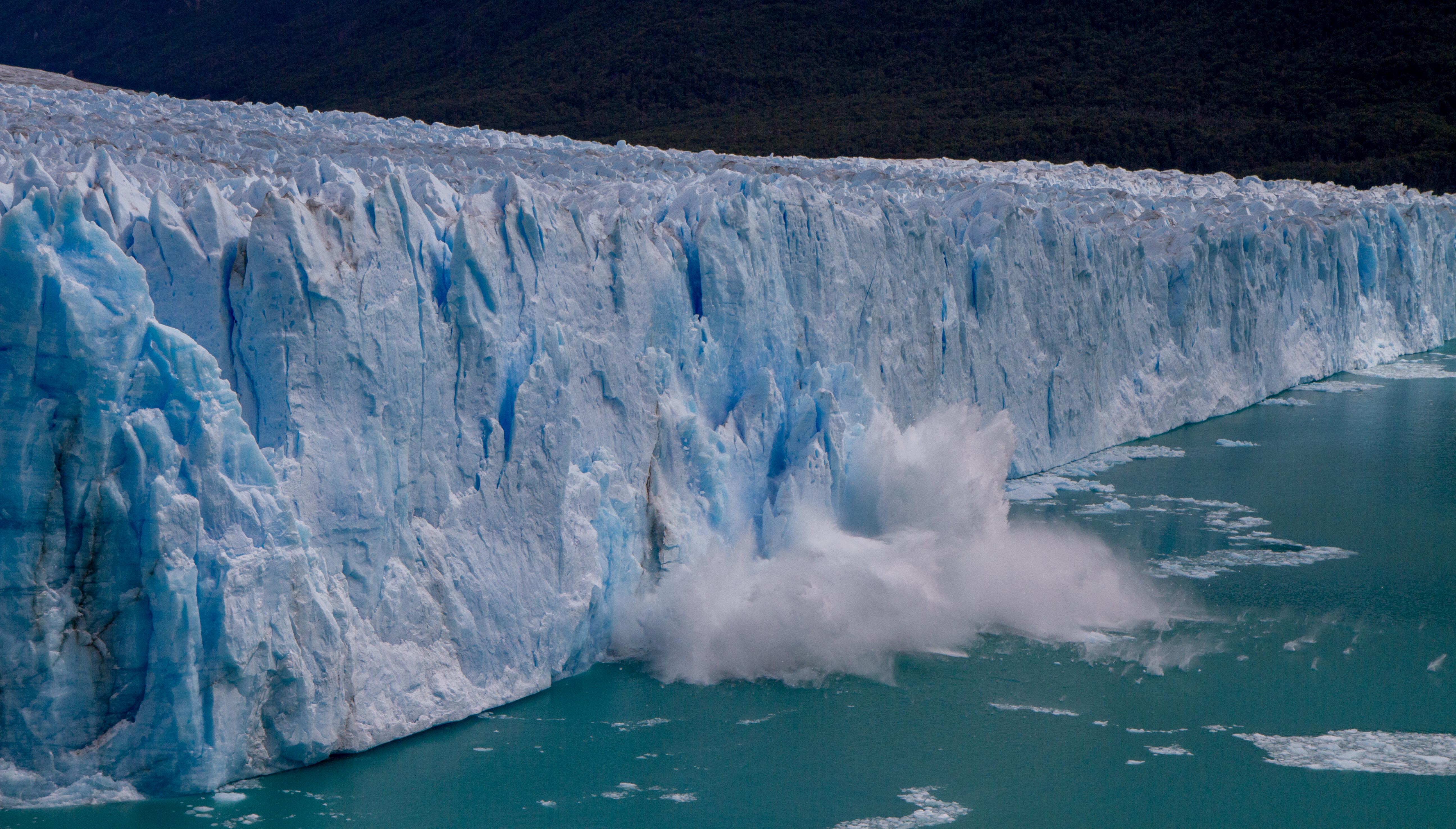
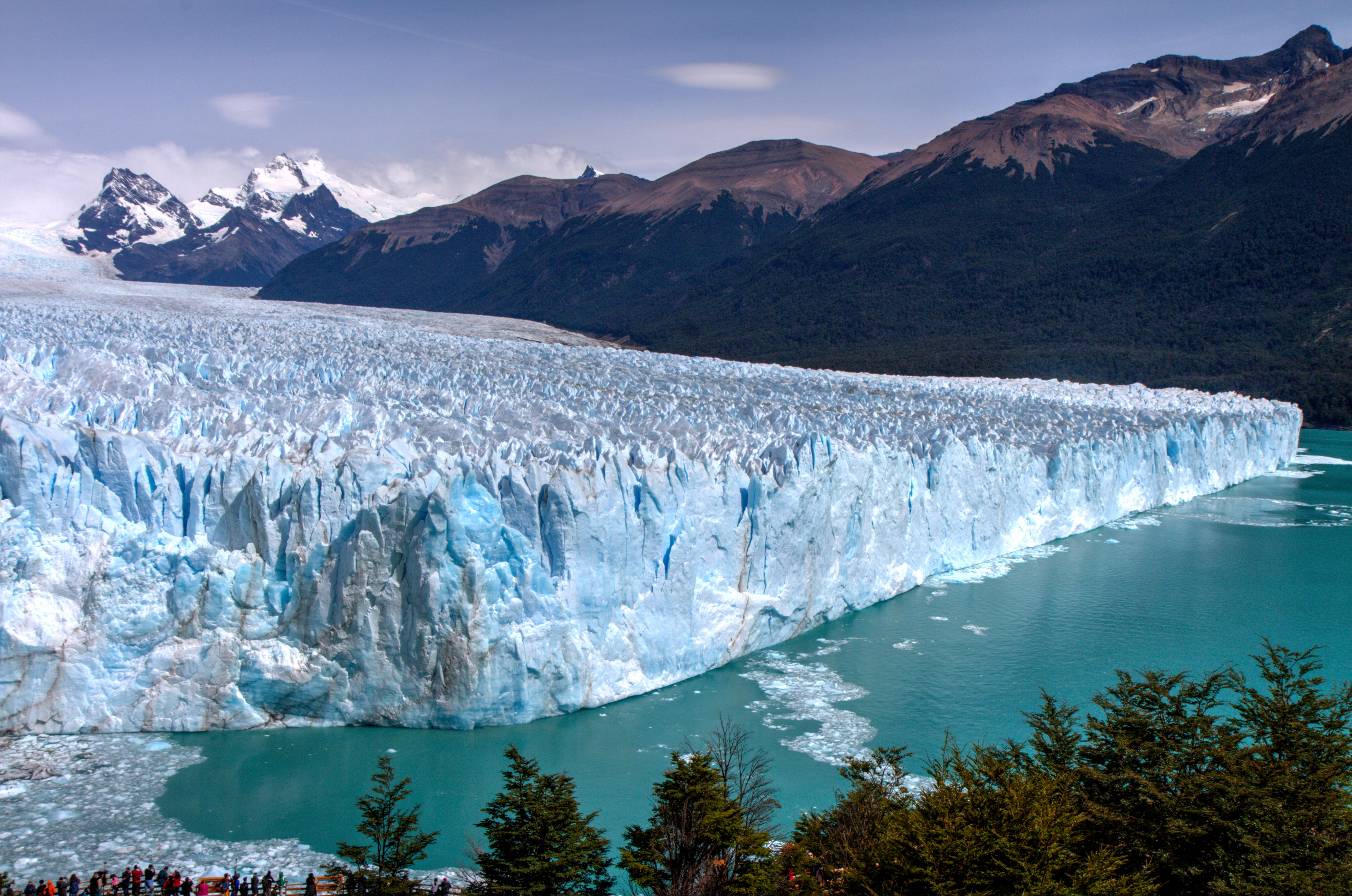
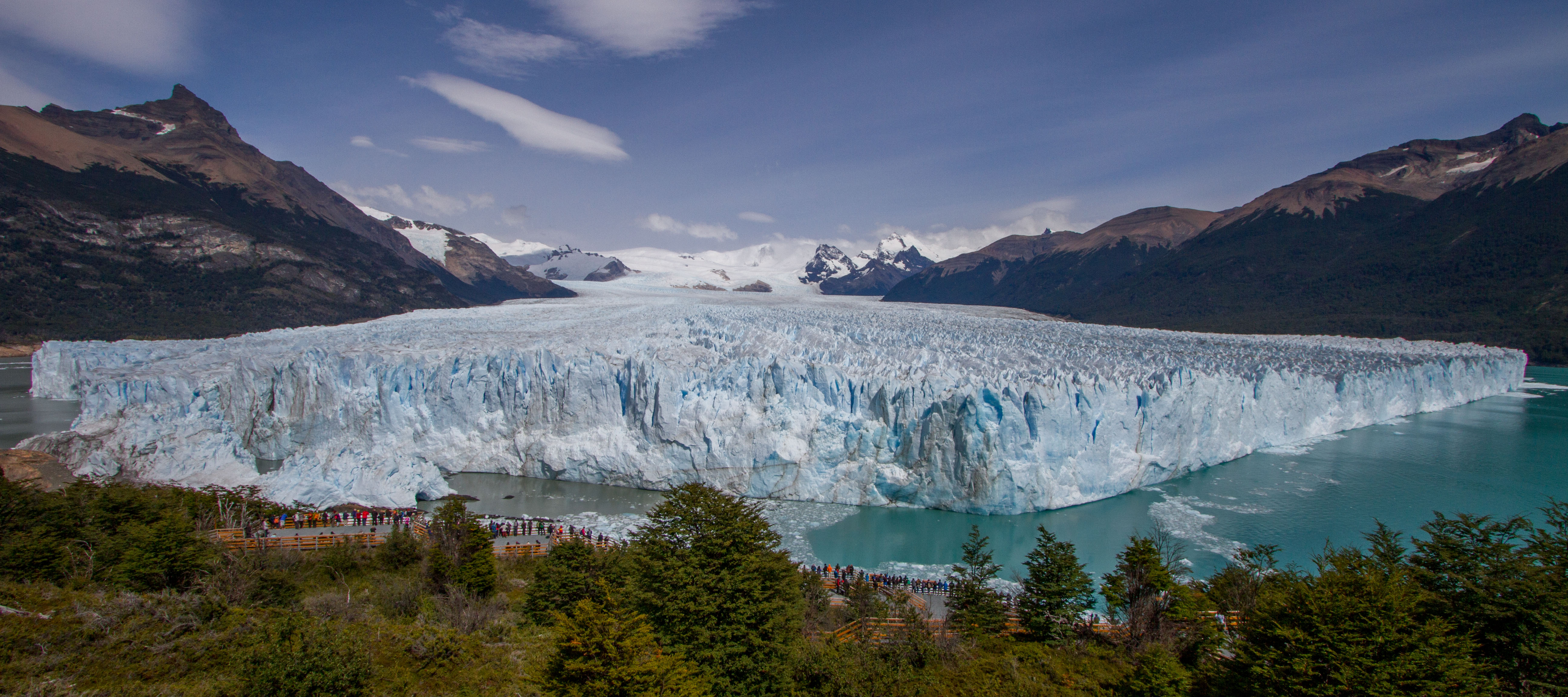
Perito Moreno Glacier
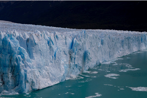
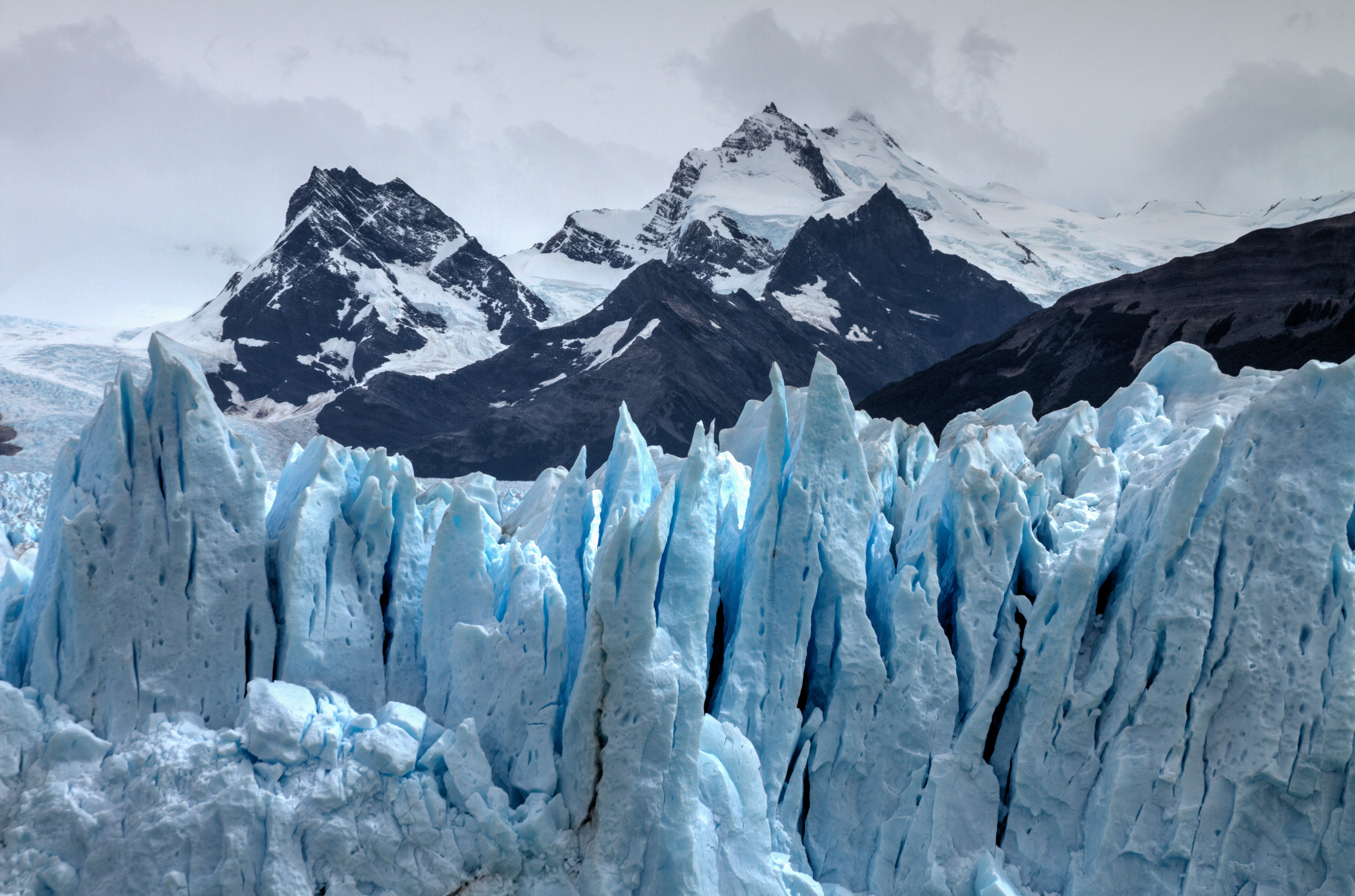
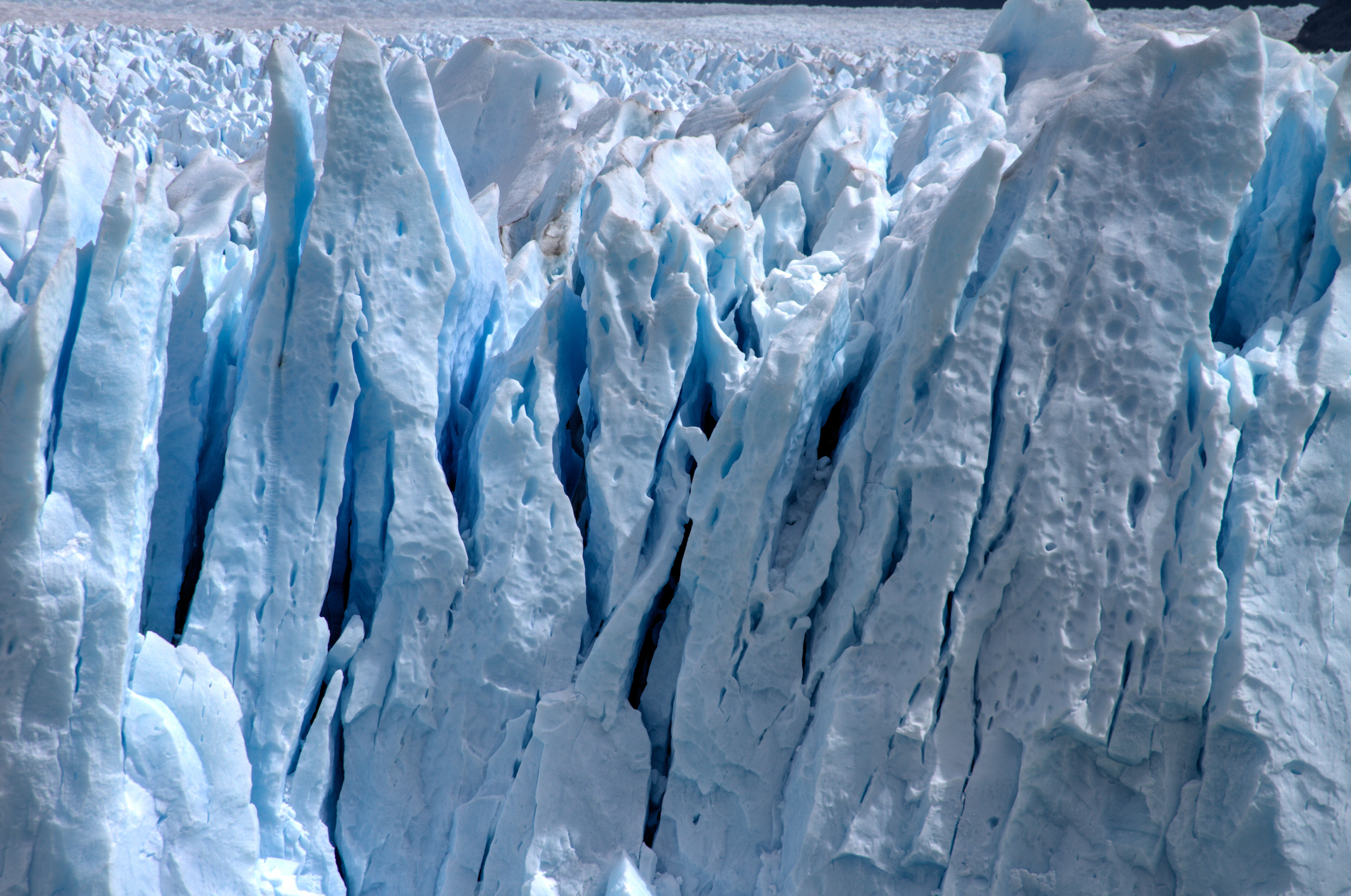
The Perito Moreno Glacier is classed as one of the ‘Must Sees’ of a trip to Patagonia, and with good cause. Its incredible! Firstly the size, the photo below show the width of the section that is view-able from the platform. incredibility this is 5kms wide!! More amazingly, it is part of the Southern Patagonian Ice Field which has an area of 12,363 km2. Check out my post on this amazing site.
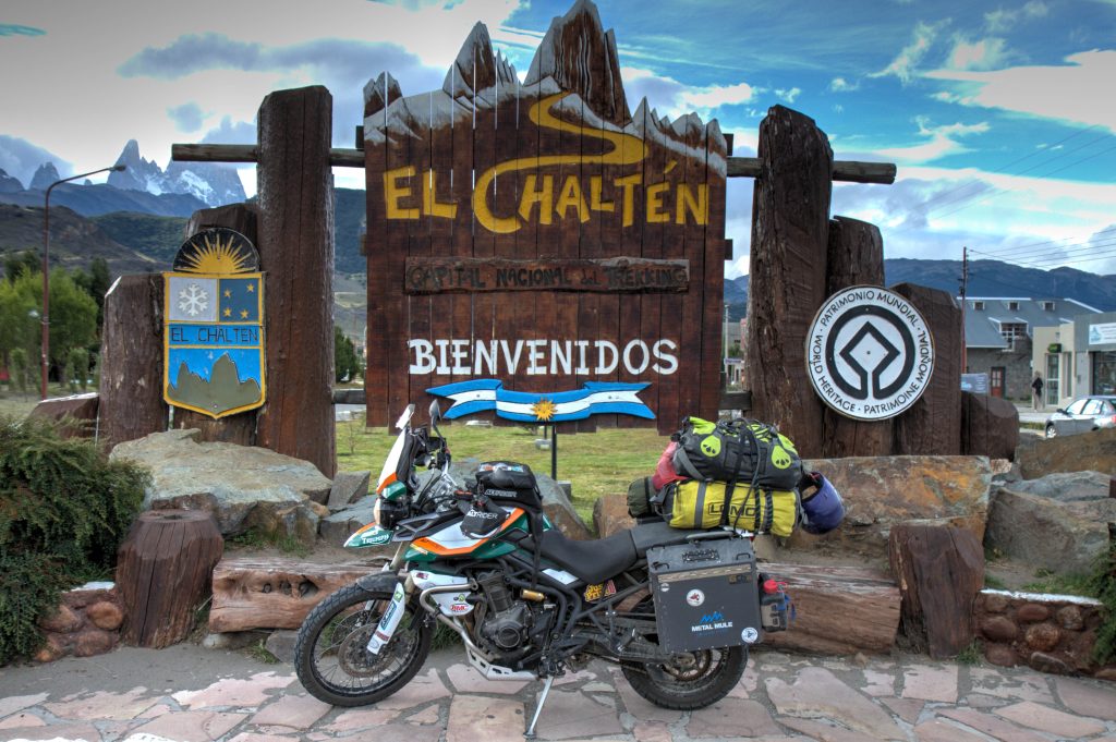
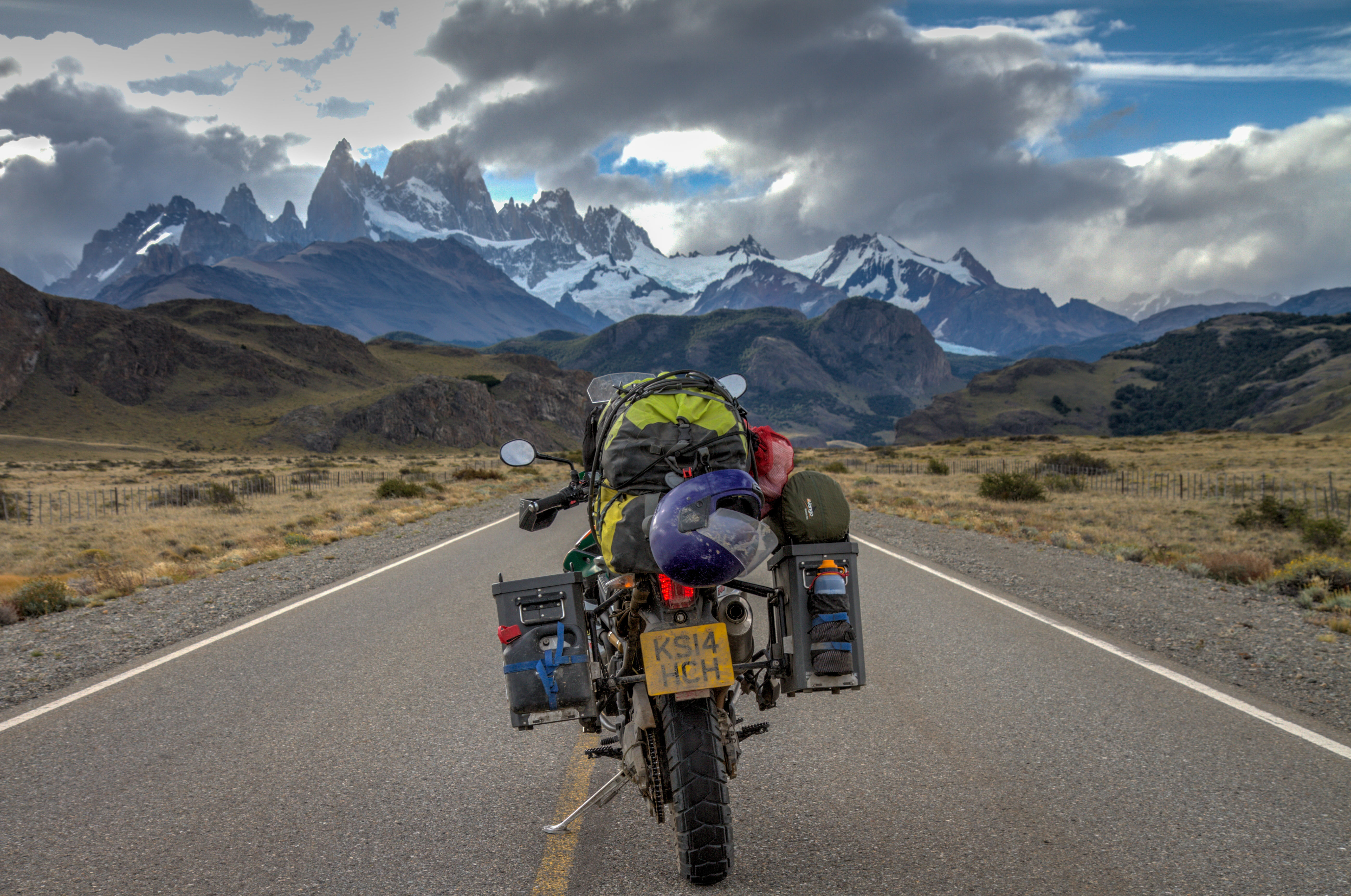
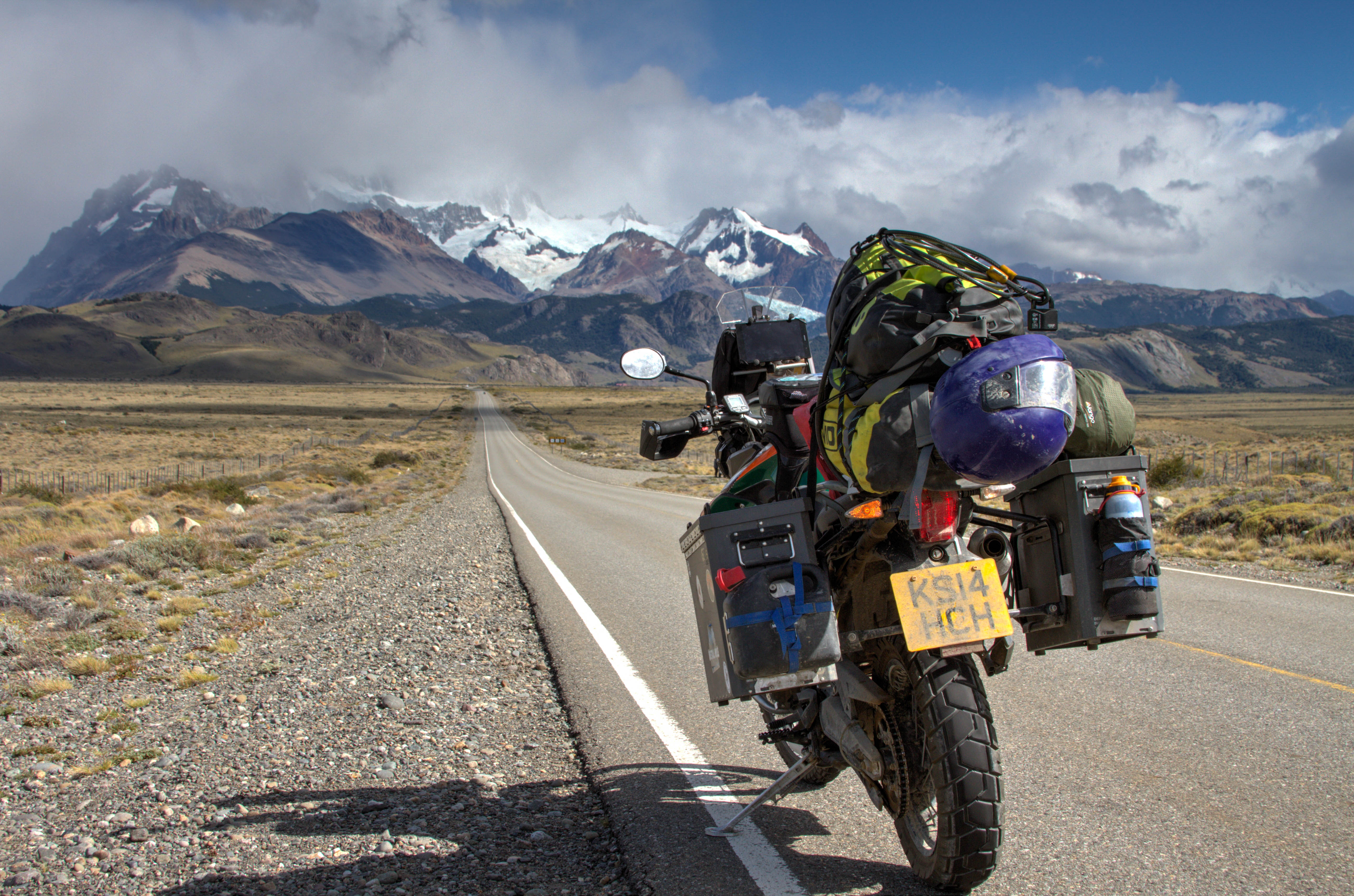
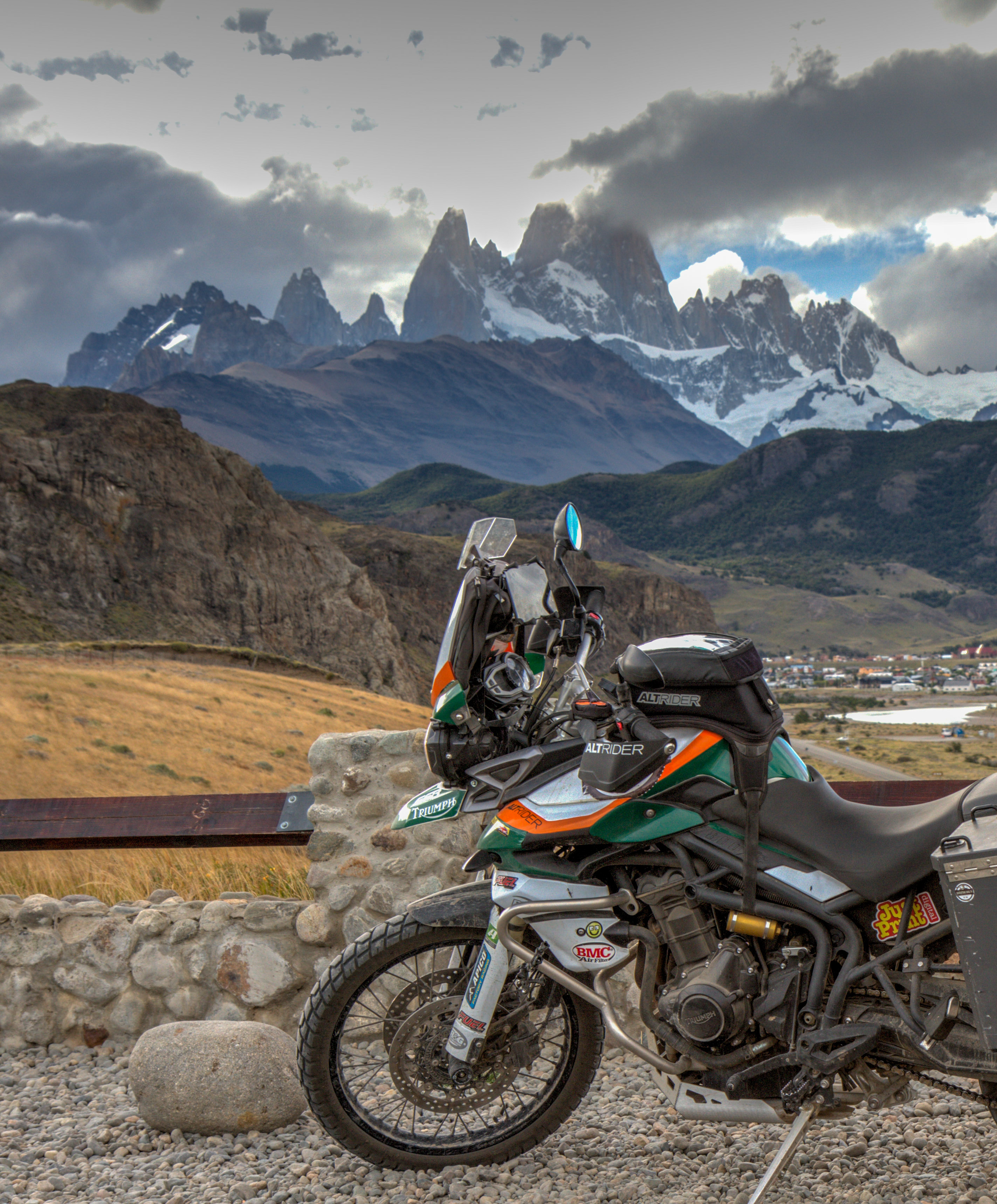
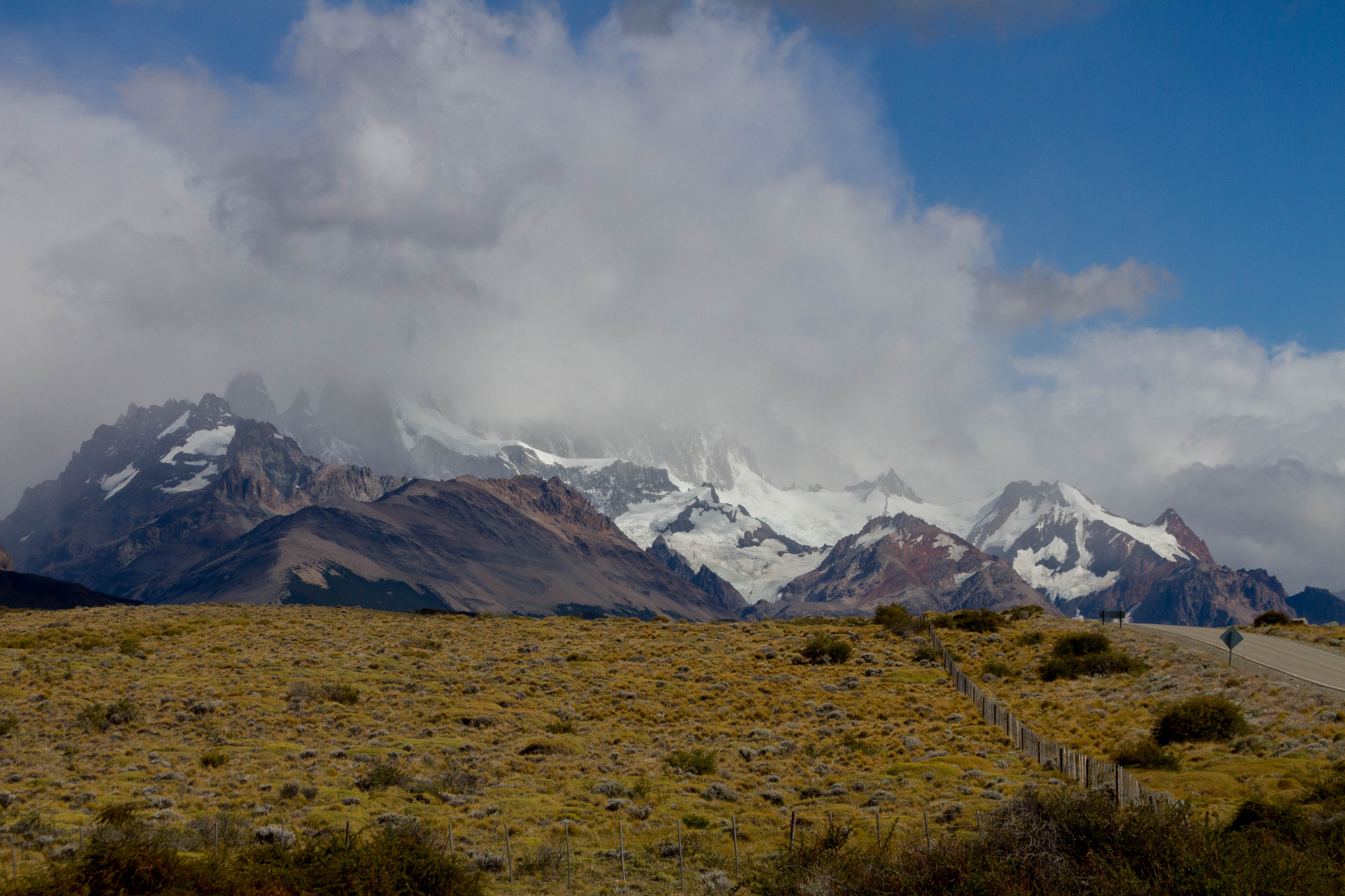
El Chaltén
El Chaltén is a small mountain village in Argentina. These days it is solely based on tourism and its the capital for hiking and all mountaineering activities in Argentina. It is located inside the Los Glaciares National Park, meaning the surrounding landscapes are sure to please. The most famous peak, Mount Fitz Roy is located near the town.
El Chalten, Argentina
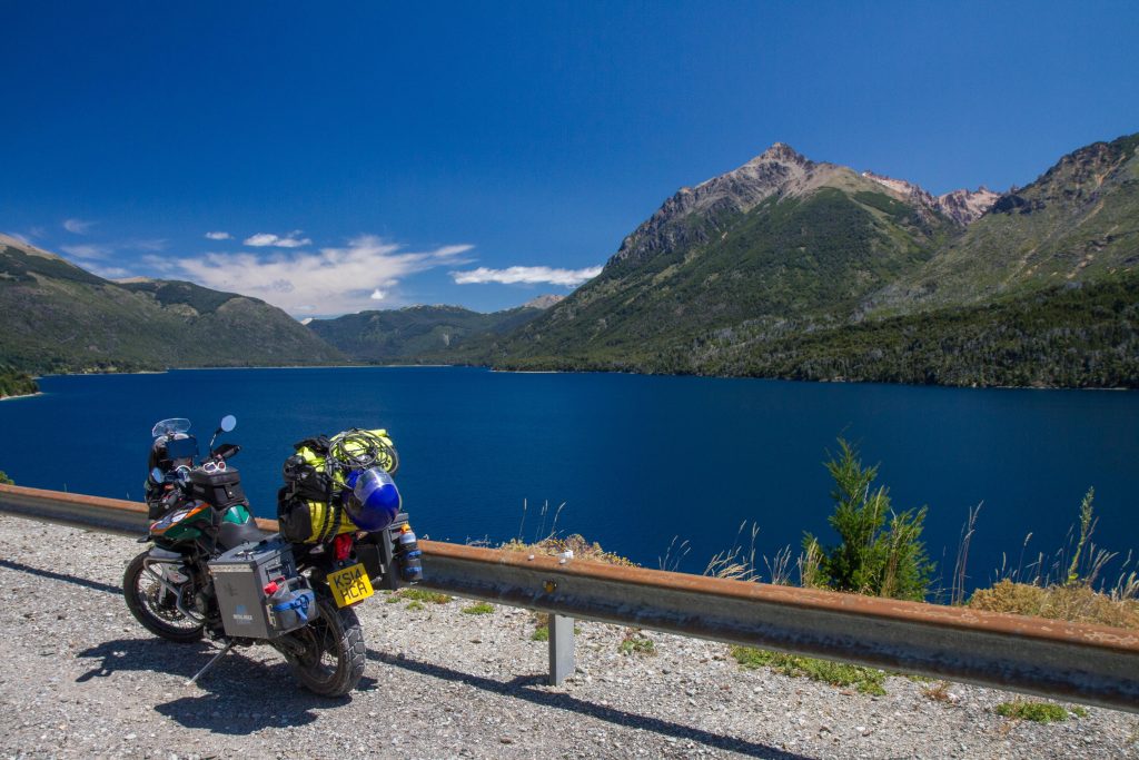
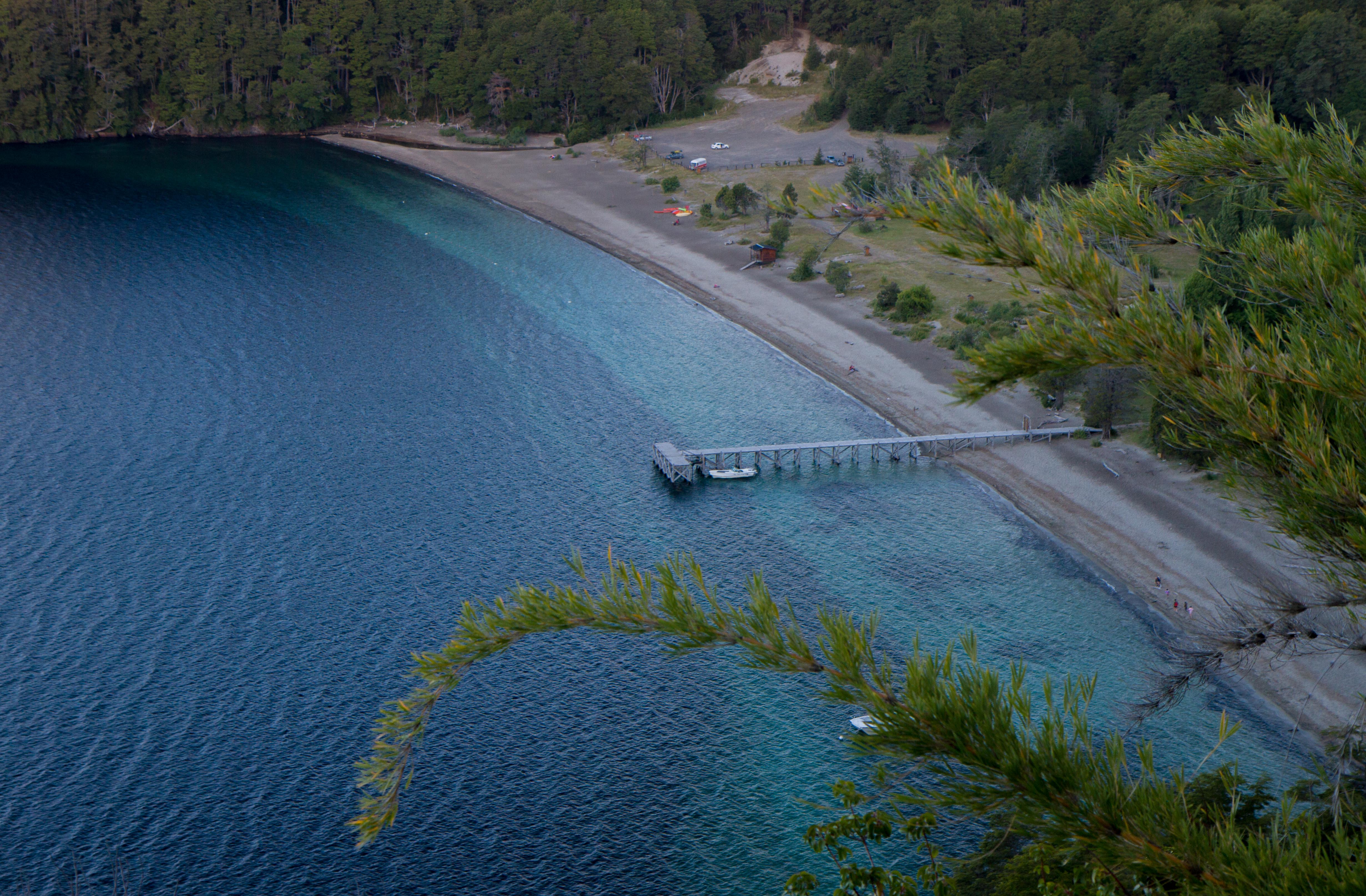
Seven Lakes (San Martin de Los Andes to Bariloche)
As the name implies, this 107km road goes through several lakes in the Patagonian area of Argentina. This area is also very close to the border of Chile and has some very accessible crossings. As a generalization, the roads running parallel to the Andes in Argentina are less spectacular than Chile. This is mostly due to the fact that Argentina was more flat lands (Pampas) then Chile. Therefore, it is much easy to run roads on flat land than mountain ranges. This section is the exception, the road zigzags around the lakes before moving back on the flat lands both north and south of this region. Because of this, if you are heading north or south of this area, I’d recommend jumping across to Chile. Check out my post on the Seven Lakes Road
Traful Lake, Nahuel Huapi National Park, Argentina
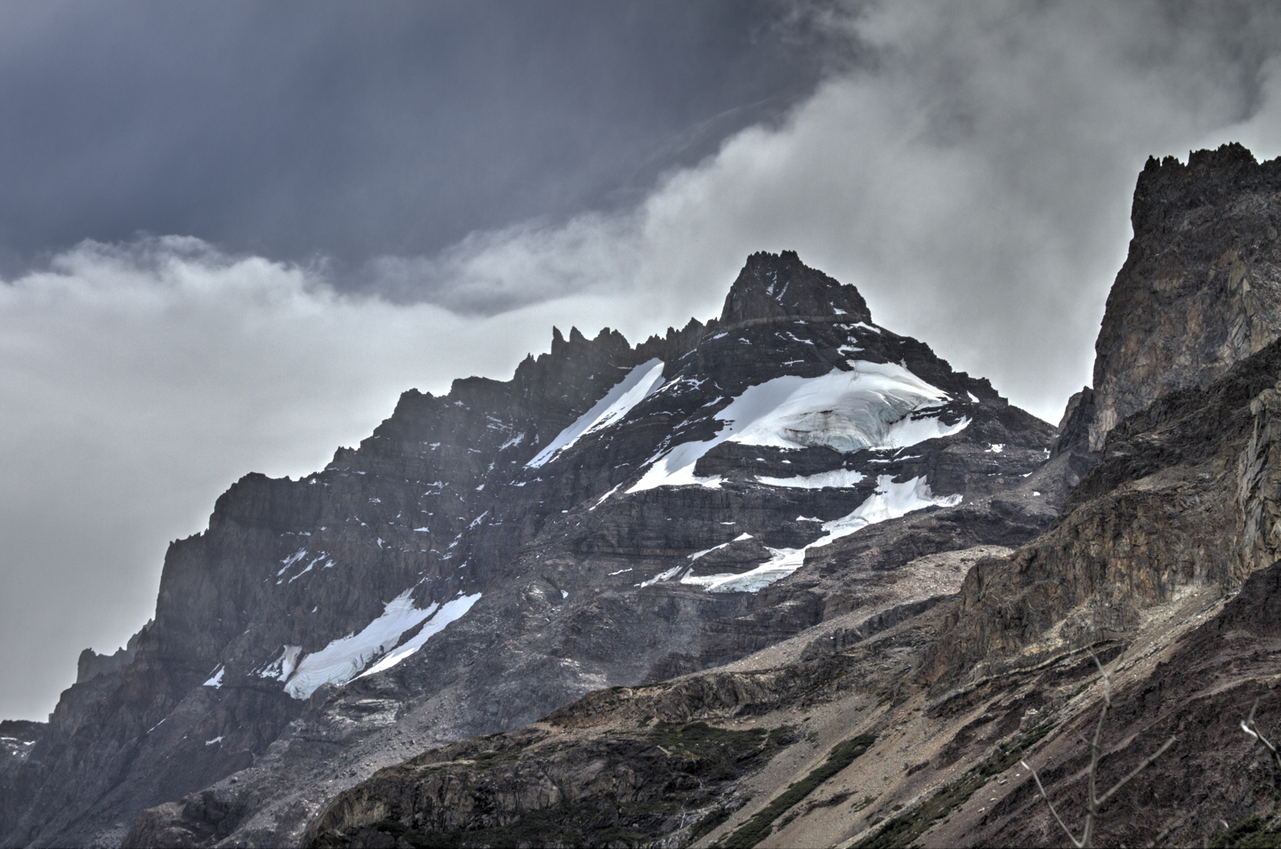
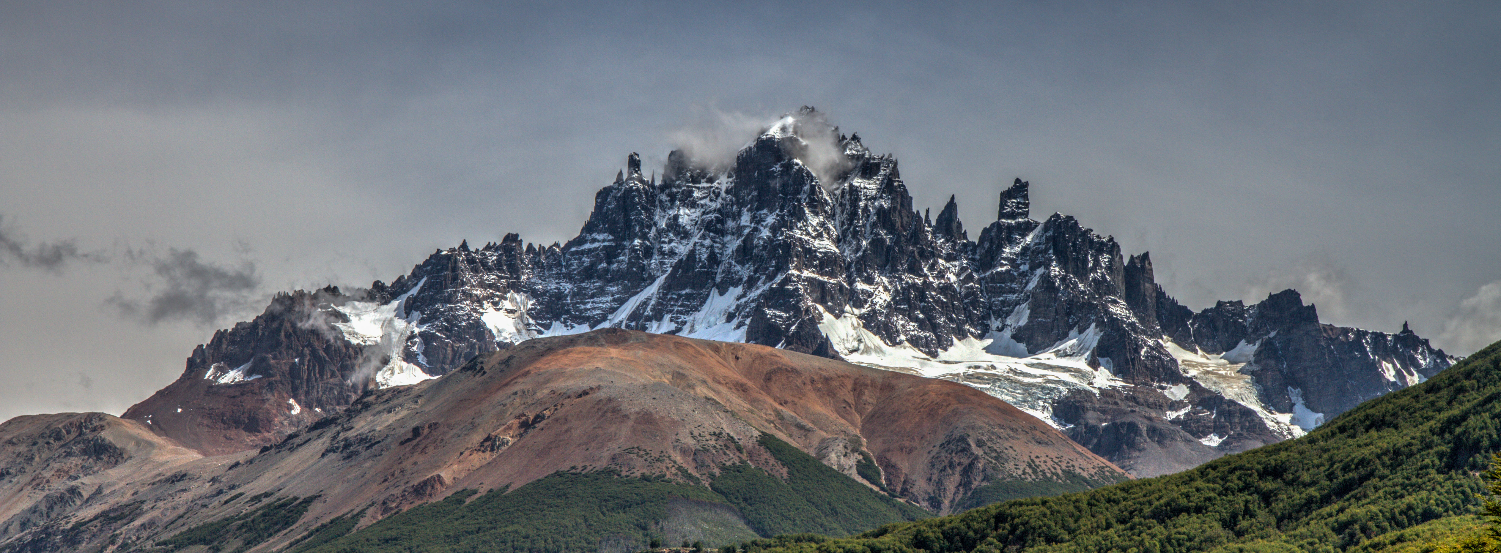
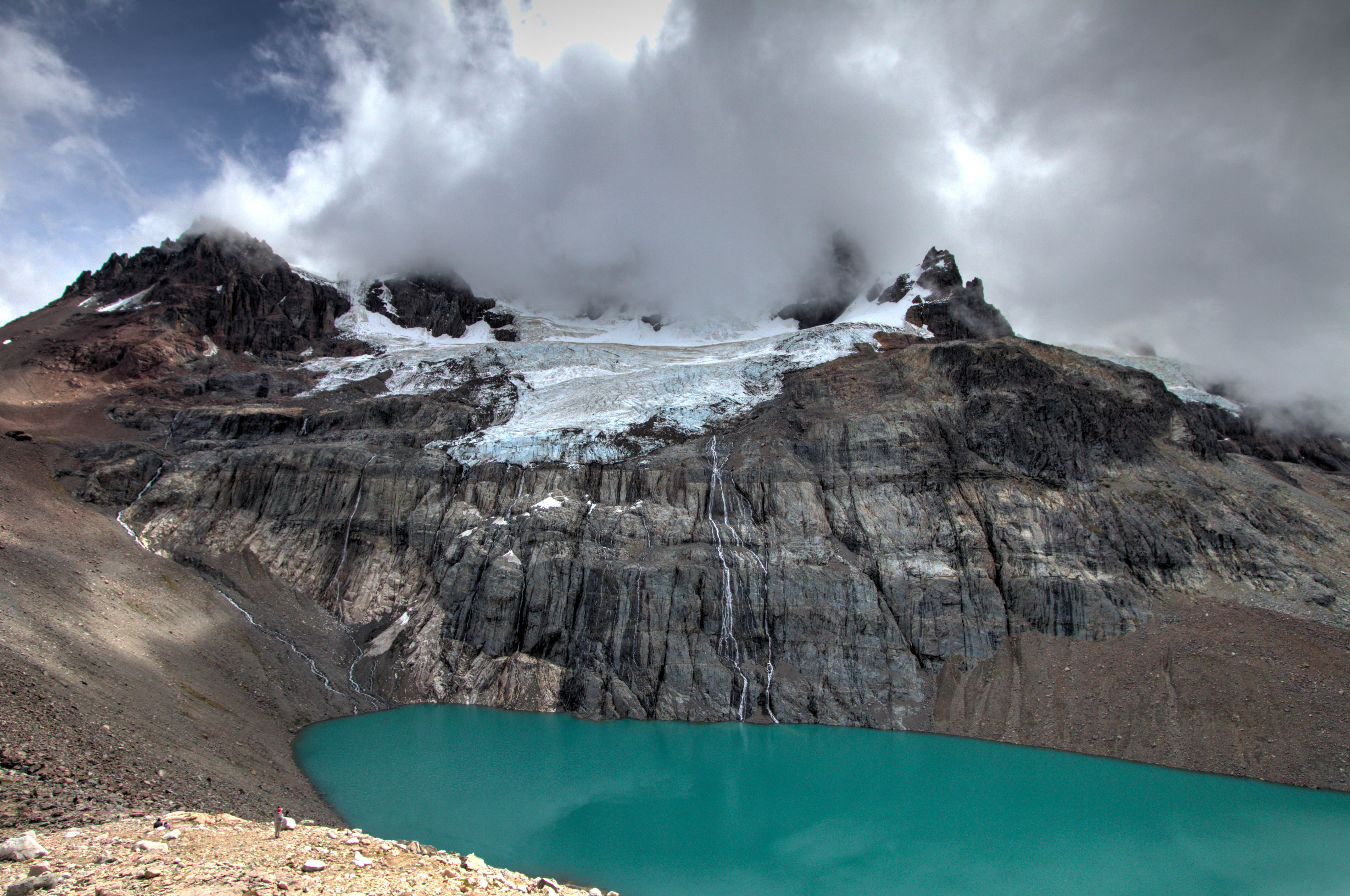
Cordillera Castillo
Cerro Castillo is a jagged rocky peak located on the Carretera Austral. At the bottom is the small town of Villa Cerro Castillo. There is a good day hike to a lake located half way up the mountain. Check out my post here.
Cordillera Castillo, Aysén, Chile
Marble Caves (Carrera Lake)
The Marble Caves (Cuevas de Mármol) are located on a peninsula of solid marble. Lake General Carrera sits at the base… 6000 yrs of the lakes waves have formed this unique cave… add the blue glacier water from the lake and you’ll find a very surreal mix of cathedral caves with ice blue reflections. Check out my separate post here
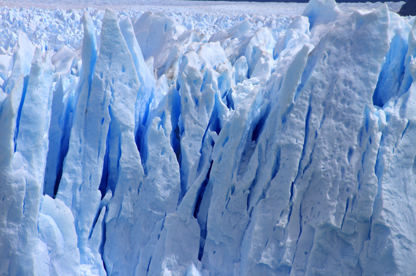
The Perito Moreno Glacier is classed as one of the ‘Must Sees’ of a trip to Patagonia, and with good cause. Its incredible! Firstly the size, the photo below show the width of the section that is view-able from the platform. incredibility this is 5kms wide!! More amazingly, it is part of the Southern Patagonian Ice Field which has an area of 12,363 km2 . (The section in red is the section that is 5kms wide!!)
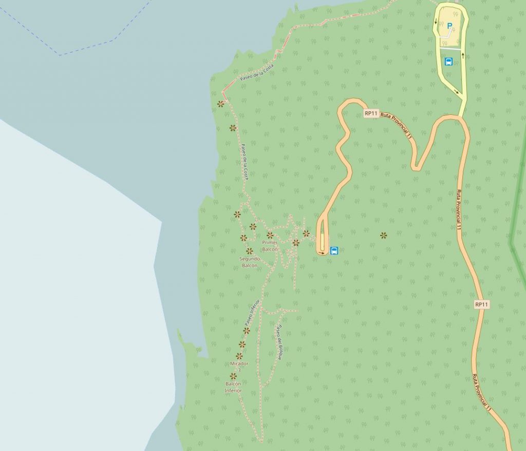
Accessing the glacier is simple. It is located 78km east of the town ‘El Calafate’. There is a series of raised platforms for accessing several viewpoints.
If you’re lucky you can even experience a section of ice break away and lunge into the waiting lake. The ice moves 2m per day so hang around and get the camera ready 🙂